Author: Dan Johnson

  • Violence At Vienna

    Violence At Vienna

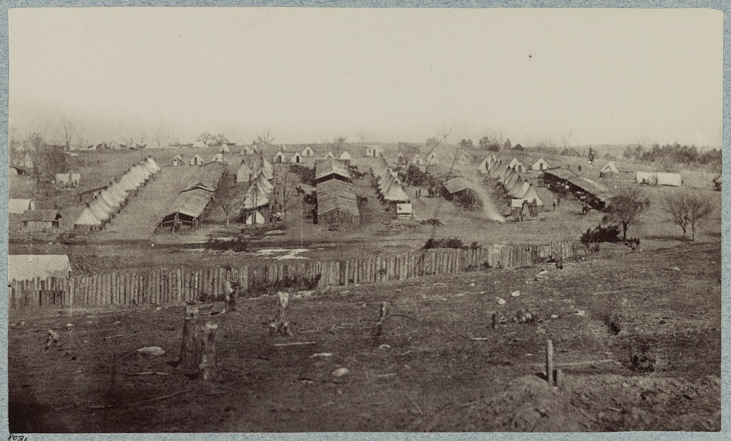
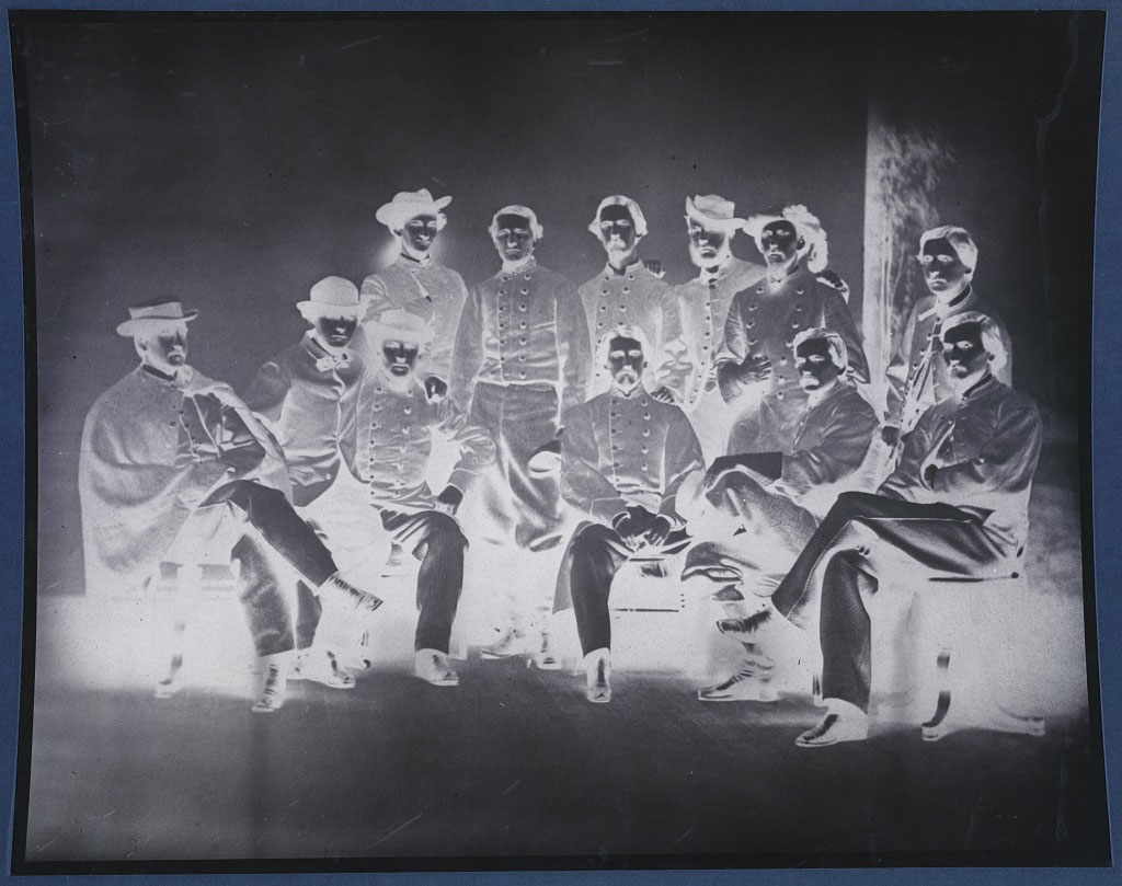
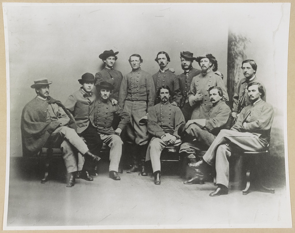
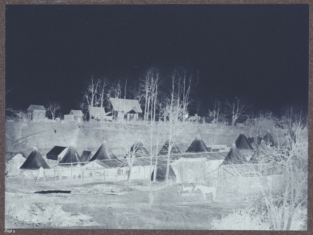
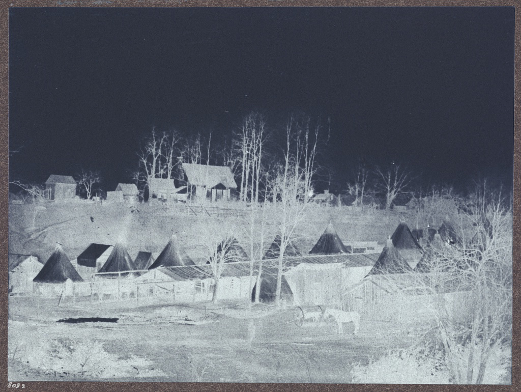
    (Negative image of Lowell’s Cavalry Camp at Vienna. Courtesy of LoC.)

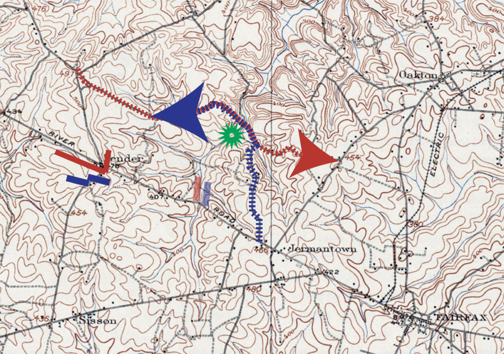
    On March 7, 1865, twenty-two Yankees from the 16th New York Cavalry left their camp at Vienna on a routine patrol to Fairfax Court House five miles to the south. Not far from Flint Hill (modern Oakton) thirty rebel guerrillas emerged from the woods to the west and mauled the Union cavalrymen. Two New Yorkers were killed and three more captured. The Rebels suffered no losses.[1]

    It was a small, but astonishing event. The Confederacy was, after all, weeks away from its demise. More importantly, this lopsided ambush took place less than fifteen miles west of the White House in nearby Washington, D.C.

    Unannounced ambushes plagued Federal troops left to guard the capitol’s western periphery. Brief and gory episodes were de rigeur in Fairfax County, where no degree of due diligence nor surge of manpower could stymie Confederate guerrillas.

    Mosby was to blame. The hyper-effective partisan leader whose notoriety was hard won in cunning pistol fights on this same line inspired a perception not unlike that bestowed upon the Vietcong. Though Mosby himself was not always present and the men who marauded through Fairfax County were not always under his command, “Mosby” became like “Charlie”: a catch-all for the pervasive fear inspired by effective guerrillas who congealed from and melted away into the forests.

    The number fifty thousand has been bandied about to quantify the amount of Federal troops that Mosby’s efforts in Northern Virginia necessitated in order to ensure Washington, D.C.’s safety. On a sixty mile arc from Front Royal to Bailey’s Crossroads, Yankees that could otherwise have bolstered the Army of the Potomac were held close at hand to address potent guerrilla raids.

    How is it that Confederate guerrillas were able to effectively sever a Union main supply route deep in Fairfax County a month before Lee’s surrender one hundred and thirty three miles to the southwest?

    In their regimental history of Mosby’s Battalion, Hugh Keen and Horace Mewborn attach a simple methodology to the prolific guerrilla chieftan. “The command,” they write, “used back roads and little known paths.”[2] Simply, superior place knowledge and the flexibility to work with landform empowered Confederate guerrillas in Northern Virginia.

    Some background worth pondering:

    These opportunities enabled Mosby and his men to occupy friendly ground that brought them within a stone’s throw of the Yankee camps at Centreville, Fairfax Court House, and Jermantown.

    The most lethal edge of this guerrilla geography was its eastern limit along Hunter Mill Road where a nest of Mosby families hosted a killing spree in the woods adjacent to the Union camp at Vienna.

    ADVERSITY & OPPORTUNITY

    John Mosby inherited an ideal laboratory for asymmetric warfare. His arrival in early 1863 slotted behind two years of intermittent violence on the line of the Chain Bridge Road between Fairfax Court House and Vienna and the Hunter Mill Road which jutted out from the Chain Bridge Road at Flint Hill.

     A rugged, undeveloped atmosphere predominated. The roads were poor and remained poor after the war. The Chain Bridge Road between Fairfax and Vienna retained its unruly, mud-drenched quality well into the 20th century. In 1915, weary locals belonging to the Fairfax County Improvement League mounted a campaign to have that stretch of history road marked with signs that read “Fairfax Folly.”[3]

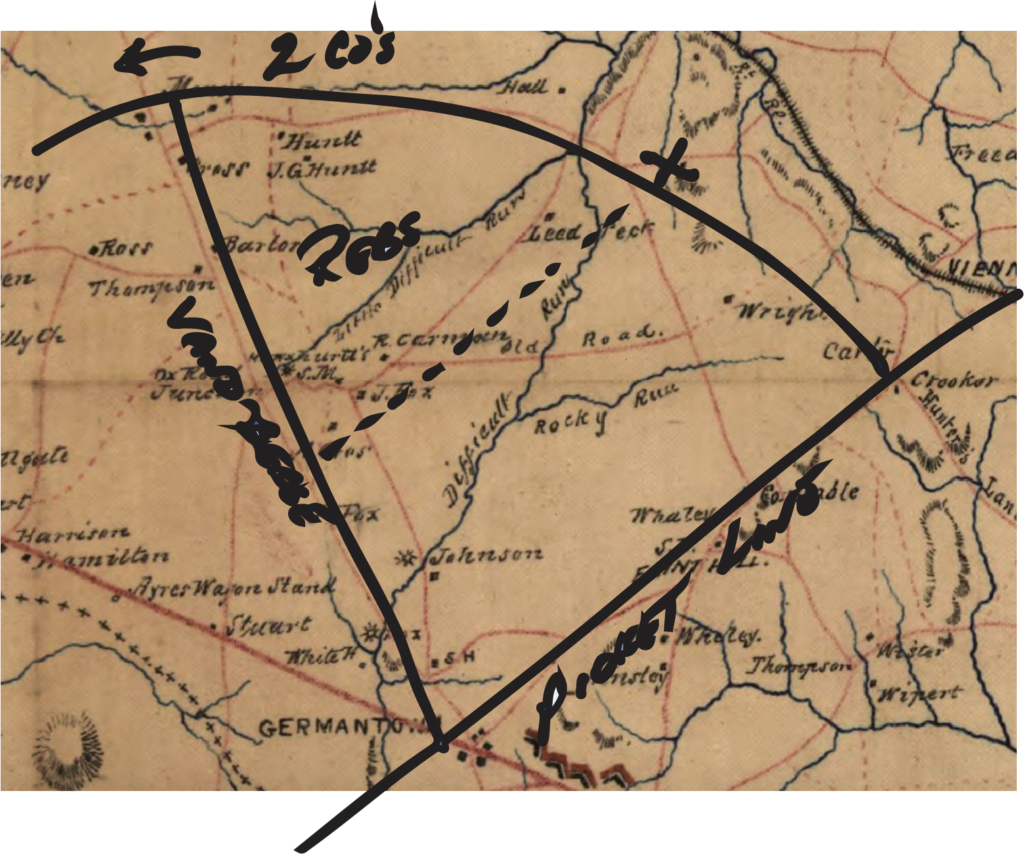
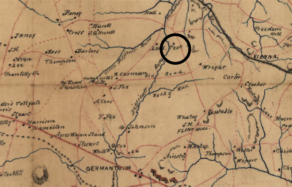
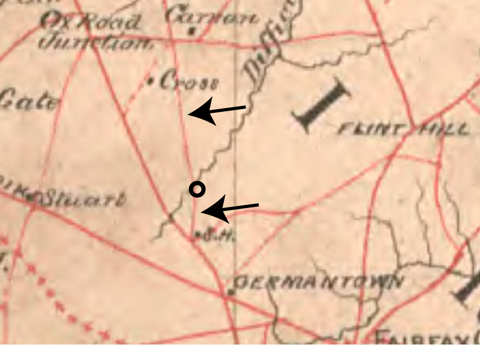
    One Federal map sketched after “A Rapid Reconnaissance” in October of 1861 described the Chain Bridge Road north of Fairfax as “hilly, uneven, sunk at places from 6 to 8 feet below the adjoining ground and badly drained.”
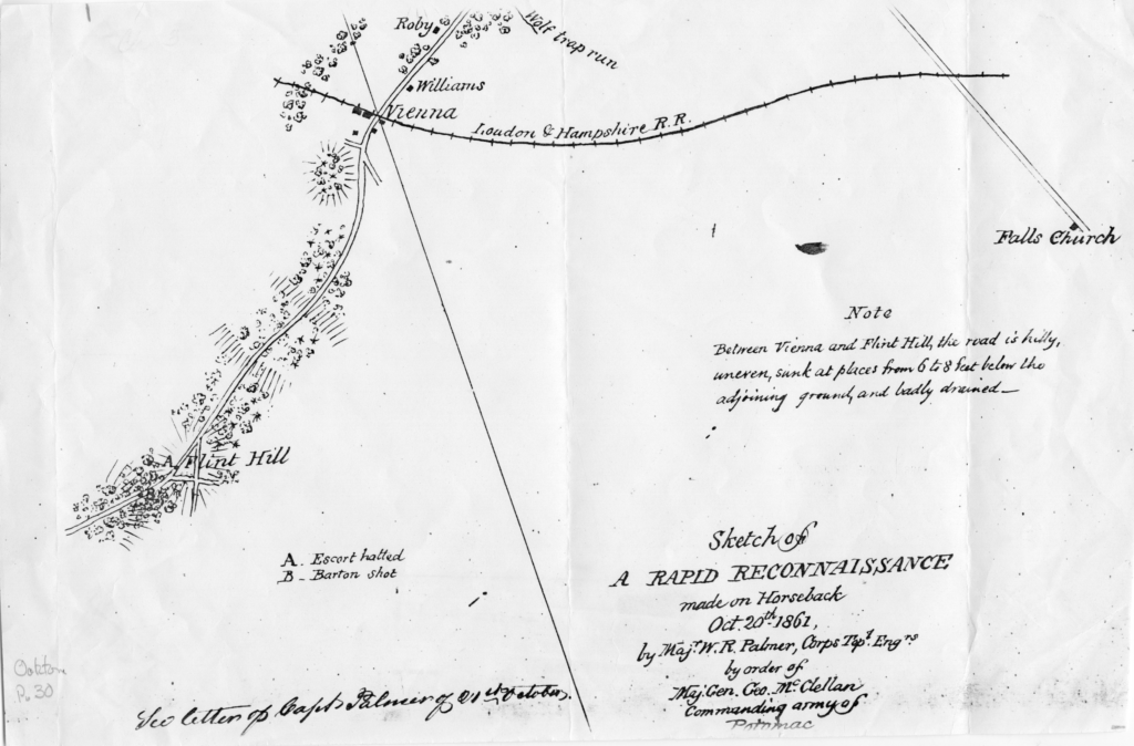
    An October 1861 Federal map depicting foliage and reporting conditions along the Chain Bridge Road just west of Difficult Run. Courtesy of Chris Barbuschak at the Virginia Room at the City of Fairfax Regional Library.

    The mud alone was not the only issue. As a Federal cavalry commander who survived an ambush in the thickets near Difficult Run in 1861 phrased it, panic set in amongst his command as Confederates fired into their ranks while riding on a “very narrow” road “hemmed in on both sides with trees.”[4]  

    The abundant foliage bounded up the poor roads to create kill zones where marching columns would bunch up and lose both their ability to maneuver and their visibility. So ripe were the conditions for guerrilla warfare that conventionally trained soldiers reverted to bushwhack tactics near Hunter’s Mill as early as 1861. West Point graduate and old army cavalry veteran Robert Ransom, Jr. orchestrated the very same forest ambush previously described as a panic.

    In an after action report eerily prescient of John Mosby’s later accounts of guerrilla warfare along Difficult Run, Ransom described guiding one hundred and sixty picked men of the First North Carolina Cavalry “by a small path through thick pines and oak woods.”

    Ransom and his men assembled a half mile away from Hawxhurst’s Mill and then stalked the woods around Hunter’s Mill where they established another pattern that would become a cornerstone of Mosby’s operations.
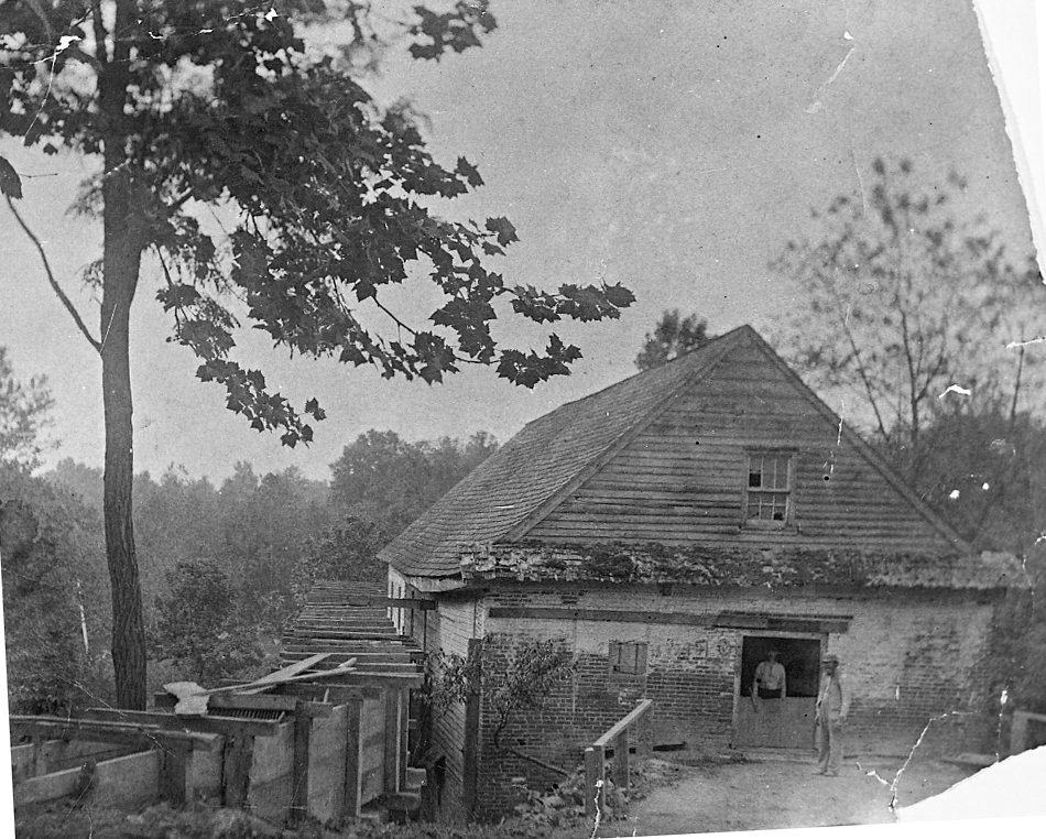
    A late-19th/early-20th century image of Hunter’s Mill. Courtesy of Chris Barbuschak at the Virginia Room at the City of Fairfax Regional Library.

    One of many staunchly Confederate locals, Edward Johnson, relayed valuable information about a company of Federal cavalry that had passed not long before. Ransom followed and attacked this unit from the rear as is funneled through a deep cut in Lawyers Road.[5]

    The Federals were routed that day and a key characteristic of Confederate cavalry tactics west of Vienna was set in stone. Friendly locals and thick vegetation incentivized Rebel horsemen to break up their columns and thread across the landscape, choosing either to pass through unseen or spring an ugly ambush on unsuspecting Federals.

    Rebel forces continued to prey upon their Yankee counterparts through the Winter of 1861-1862. In February, the 5th Pennsylvania Cavalry had enough. A patrol rode into Flint Hill and torched a barn where Confederate pickets were known to roost. Then they proceeded to the Peck House located on Hunter Mill Road where today’s Hunter Valley road intersects above Vale. A firefight ensued with muzzle flashes emanating from the house itself as well as “the neighboring hills and woods.”[6]
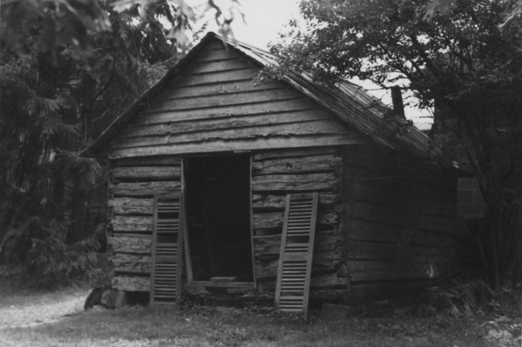
    An example of 19th-century vernacular architecture in Difficult Run, this chinked log cabin structure with rough-hewn lap siding on the upper gable survived well into the 20th century near the intersection of Hunter Mill and Vale Roads. Courtesy of Chris Barbuschak at the Virginia Room at the City of Fairfax Regional Library.

    Another predictable outcome occurred in September of 1862. A Federal cavalry patrol probing northwards towards Vienna came to grief in the woods near Flint Hill. Colonel Beardsley of the Ninth New York described the action, “we got into a thick wood at the cross-roads this side of Vienna, when they gave us a volley and retired, killing several and wounding about 20.”[7]

    Fitz John Porter astutely diagnosed the situation at Vienna on September 2, 1862 when he reported that “the country beyond our picket lines affords every facility for such surprises.” Much maligned Fitz John Porter had some further sage words for Federal authorities. “The commanding general must expect them (attacks) to be frequent so long as the enemy continues in large force in our front and wishes to divert attention from other movements.”[8]

    Over the next two years, this reality transformed Vienna, Virginia into an armed camp. Writing in February of 1864, Herman Melville described the place in language couched on twin pillars of ecological clear cutting and dread.

    “The cavalry-camp lies on the slope

    Of what was late a vernal hill,

    But now like a pavement bare—

    An outpost in the perilous wilds

    Which ever are lone and still;

    But Mosby’s men are there—

    Of Mosby best beware.”
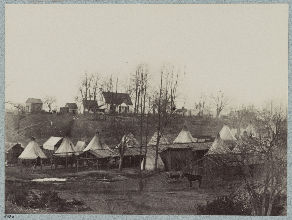
    Lowell’s Brigade Headquarters at Vienna circa February, 1864. What was once well-forested has been gradually denuded of foliage. Courtesy of the LoC.

    STRATEGIC REALITIES

    The Federal disposition at Vienna was problematic for the entirety of the war. From 1861 until March of 1865, Yankee cavalry was subject to period ambushes at points all along their line. Guerrilla units routinely penetrated their pickets, and infiltrated deep into the rear where they destabilized a Union force ten times their size.

    Very early in the war, this paradigm produced a practical calculus. When Confederates withdrew from Fairfax Court House in March of 1862, Federal presence became a permanent, if tenuous, fixture of western Fairfax County. The position at Vienna was a crucial piece of the local tactical schema.

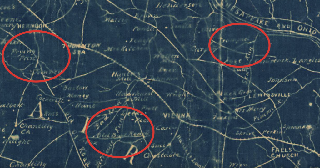
    The Difficult Run Basin from which Mosby frequently emerged to wreak havoc was centrally located between important north/south ridge roads. Three hugely important east/west highways—the Warrenton, Little River, and Leesburg Turnpikes—cut through the watershed. The camp at Vienna sat astride the most important of these ridge roads, the Chain Bridge Road, and covered its intersection with the equally important Leesburg Turnpike at Tyson’s Corner.
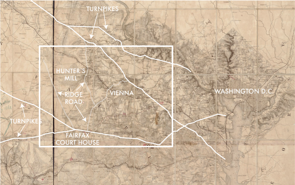
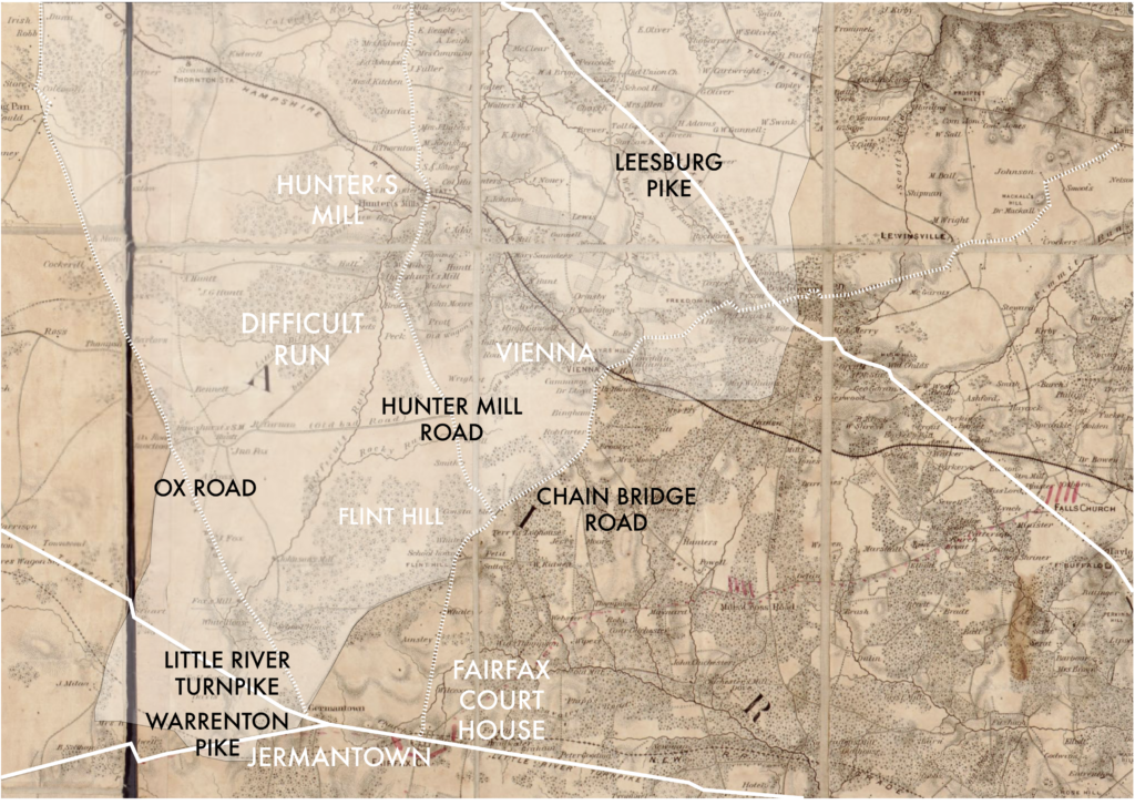
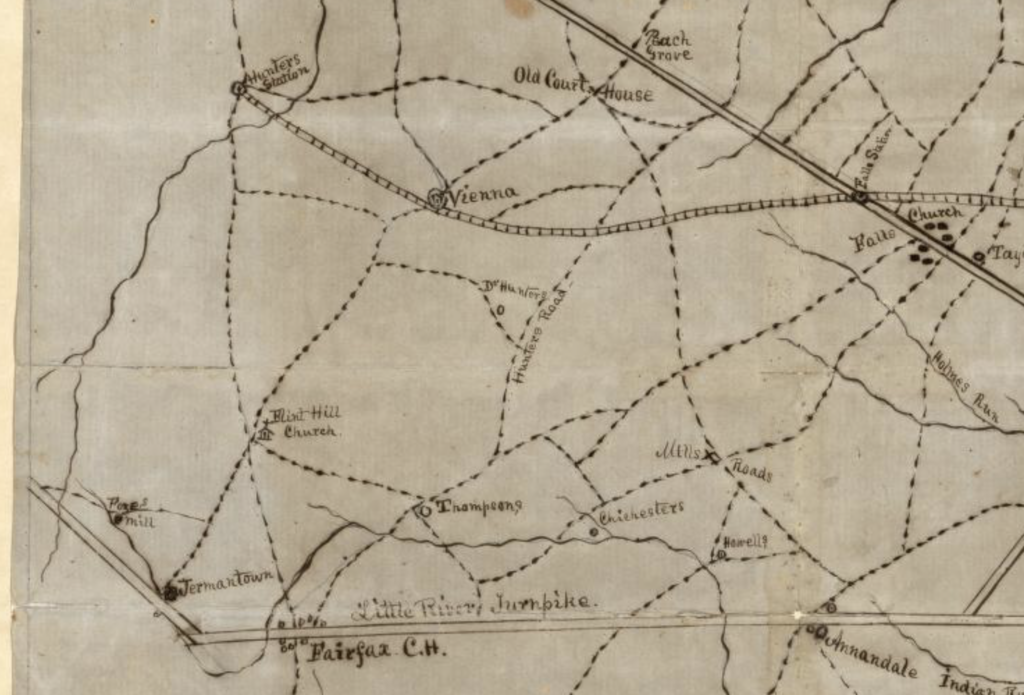
    (McDowell Map base courtesy of LoC.)

    If Federal cavalry quit Vienna, they would sacrifice their advanced pickets on the Hunter Mill line and would inhibit their ability to patrol and project on a wide arc from Herndon to Frying Pan and Chantilly. Diminished Yankee presence along the Chain Bridge Road would invite increased Mosby marauding into Maryland that would jeopardize the Baltimore & Ohio Railroad, which was an important lifeline to Federal armies moving up the Shenandoah Valley.

    Worse still, Vienna was the only position covering the broad Accotink watershed, which was already a favorite Mosby haunt despite the fact that it was miles behind nominal Yankee lines. If Mosby established himself in Accotink, Fairfax Court House would be in jeopardy and, more important, so would the vital Orange & Alexandria Rail link, which supplied Federal campaigns in Central Virginia.

    Simply, Vienna had to hold to maintain both local tactical and theatre-wide strategic initiative.

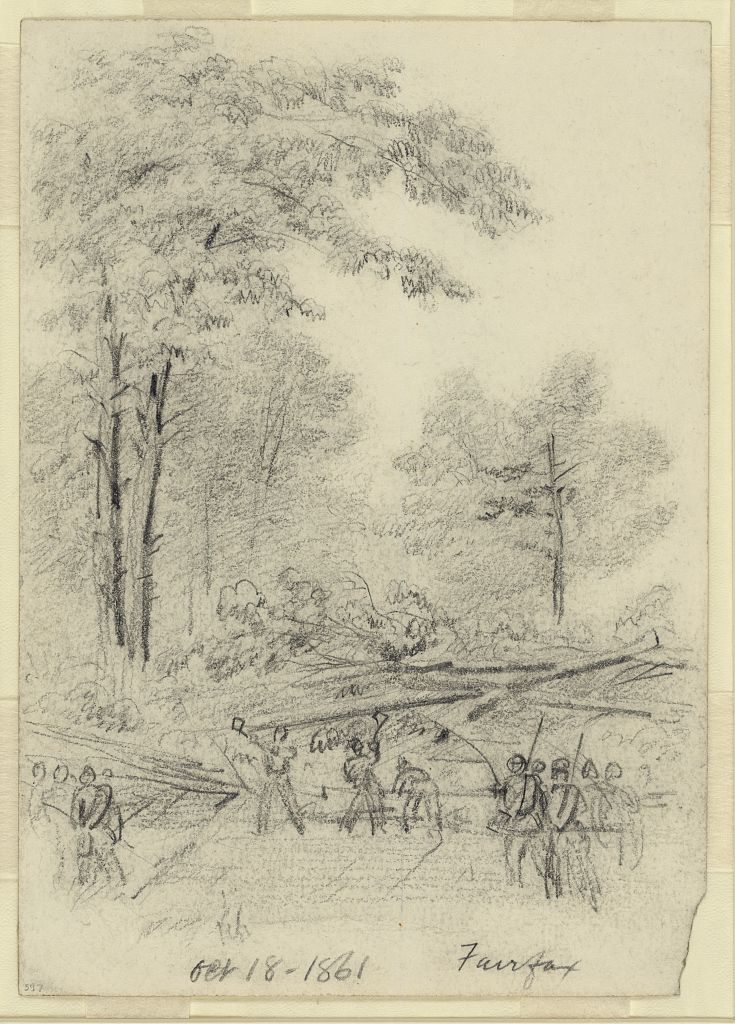
    The chief obstacle in maintaining this position was ecological. Abundant foliage made observation and pursuit a difficult proposition for Union forces. So too, the wealth of trees that made the Vienna line so lethal were a critical aspect of the Union war effort.

    By 1862, Vienna was the terminus of the once proud Alexandria, Loudoun & Hampshire Railroad. The tracks west from there had been destroyed so that trains coming from the capitol could go no farther than Vienna.

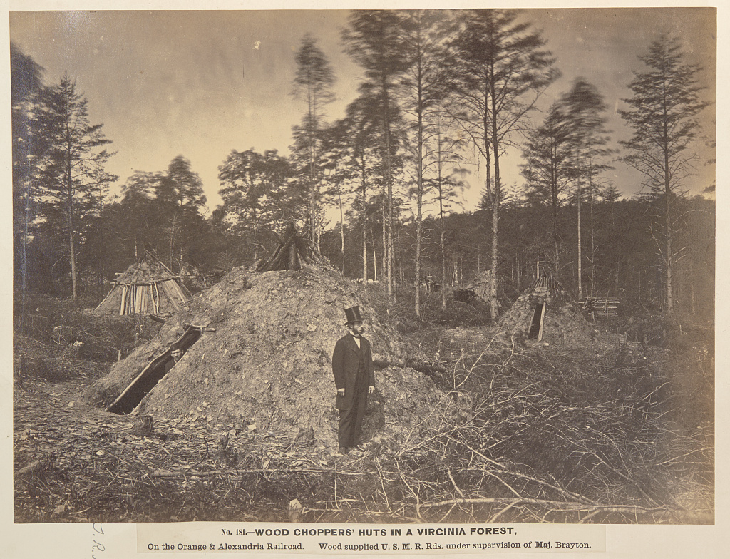
    Deeper context sprouts from antebellum history when the stretch of track immediately west of Vienna on the AL&H railroad was developed to serve a growing lumbering hub nearby. Huge stands of old growth hardwood on either side of the tracks became fodder for an emerging trade in timber exports to England.[9] On the eve of the war, the two rail stations west of Vienna—Hunter’s Mill and Thornton’s Station—were integrated into the railroad chiefly to handle bulk timber coming out of the valley.
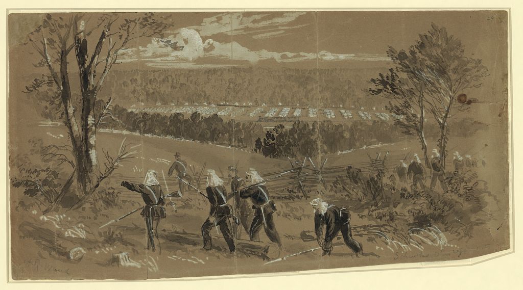
    (An early war drawing from Alfred Waud hints at the scope of the forest near Vienna. On reverse, it’s captioned, “The Ohio Corps near Vienna, in a valley through which runs the railroad, on which the skirmish took place, a beautiful and romantic spot, but hardly a safe position against surprise…” Courtesy of the LoC.)

    The presence of this important timber belt and the infrastructure that facilitated its extraction did not escape the attention of Federal authorities. As early as 1862, Vienna was serving as a transportation hub for Yankee axe-men who were felling trees in Difficult Run to feed the war effort in Washington, D.C. and at large.

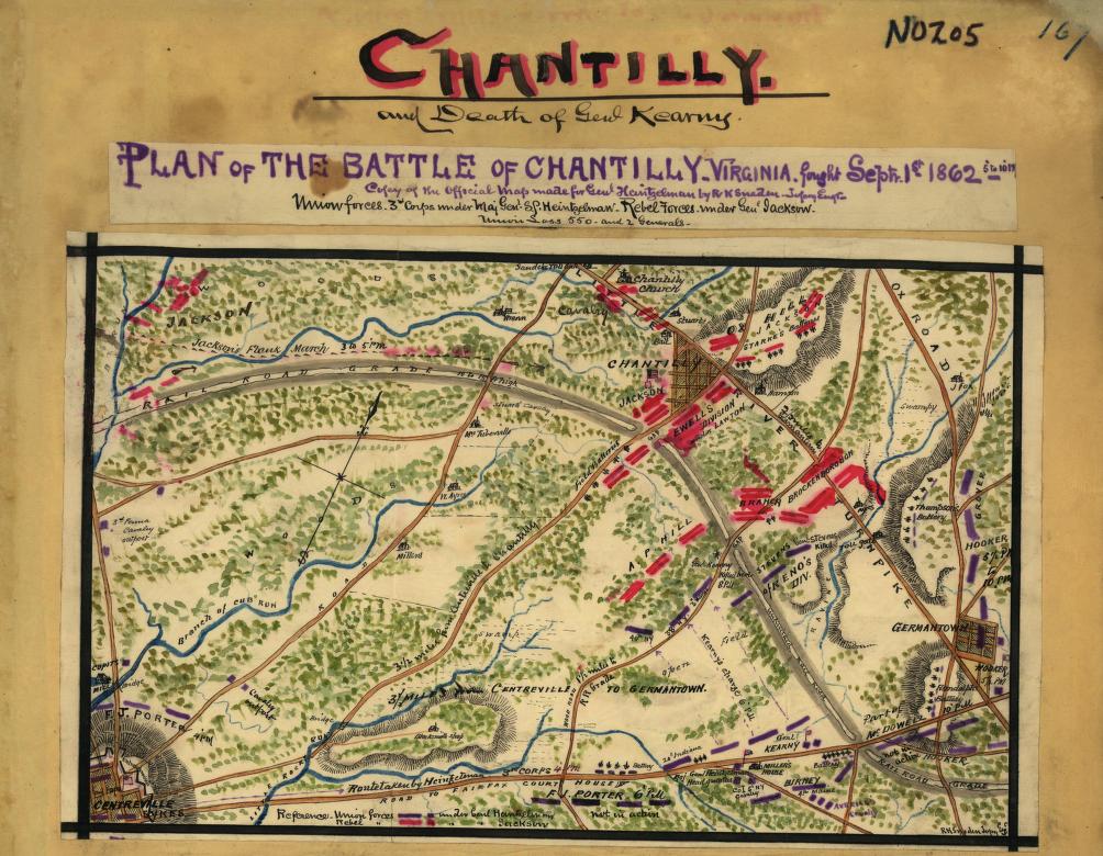
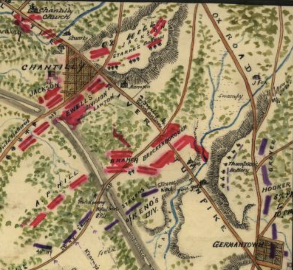
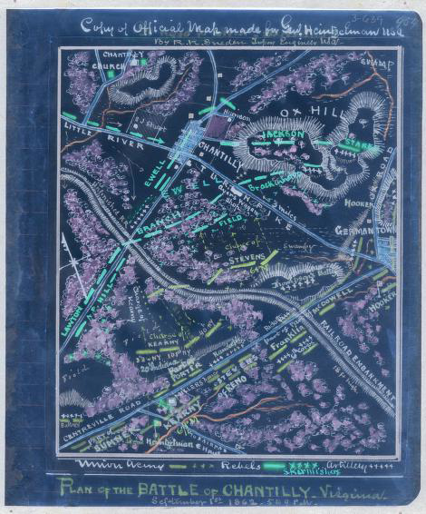
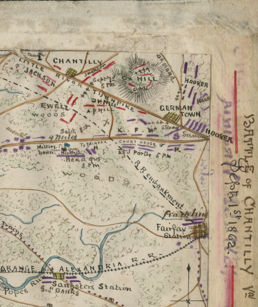
    After the Yankee retreat from Second Manassas and the panic-inducing thrust of Stonewall Jackson towards Jermantown that culminated in the Battle of Ox Hill on September 1, 1862, General John Pope did a head count of Federal forces in Fairfax County to make sure everyone had tucked in behind the line of forts protecting Washington. The last unit to enter Federal lines was “the tree corps on the Vienna and Chain Bridge Road.”[10]

    A May 1863 report detailing Union force dispositions in Northern Virginia describes one key function of General Abercrombie’s “moving division” of 8,600 men as “guarding the quartermaster’s woodcutters near Vienna.”[11] This pattern continued throughout the war. Just after Appomattox, a post-mortem material survey of Federal assets near Washington included a section on the Alexandria, Loudoun and Hampshire Railroad. “The road is in complete running order to Vienna Station,” the reporting officer wrote, and “a large number of wood trains were run to transport the wood cut by Quartermaster’s Department.”
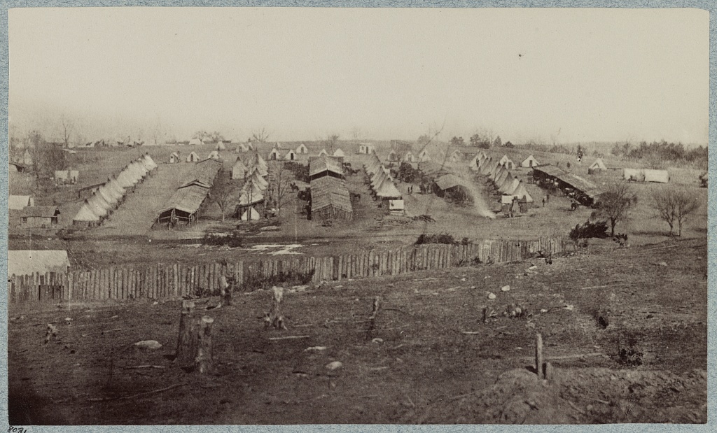
    (Camp of the 2nd Massachusetts Cavalry at Vienna circa February, 1864. No image captures the extent of deforestation quite like this one. Courtesy of the LoC.)

    The scale of the harvest was immense. One report from Vienna dated June 20, 1863, indicates that 13,000 cords of wood were cut, stacked, and ready for transport at Vienna.[12] Assuming the timbered trees in question had a diameter at breast height of 22 inches, this figure indicates that at least 13,000 trees had already been hauled from the Vienna forests by mid-1863.[13]

    Not only were the trees important aspects of the ecology, they were also economic assets. Timber was considered chattel, a very liquid instrument that could be readily brought to market. As an 1843 real estate advertisement phrased it in the pages of the Alexandria Gazette, “timber will always find a ready sale at the Court House.”[14] The loss of these trees was more than a passing concern for locals. Post-war prosperity was premised on retaining this wealth.

    Equally important was the composition of the tree corps doing the actual logging.

    In late December of 1863, Confederate cavalry chief JEB Stuart led a raid into Fairfax County. After looting the railhub at Fairfax Station, Stuart led his men (including his finest scout, John Mosby) north through Fairfax Court House to Vienna where they cut across Hunter’s Mill to bivouac at Frying Pan. As the Gazette put it, these Confederates captured “a large number of ‘contrabands’ engaged in felling timber in the neighborhood of Vienna.”[15]

    It was the confluence of anxieties. Secession motivators in Fairfax County tapped into deep-seated fears by which economic subjugation of white southerners went hand in hand with the elevation of African-Americans. In late 1862, contrabands—freed slaves—were actively separating locals from their assets while armed Federals guarded them. This could be interpreted as proof positive of the worst fears harbored by Secessionists.

    Not coincidentally, the discovery and capture of freed slaves felling hardwood near Vienna preceded the creation of John Mosby’s independent command by only a few hours. Regimental historians Hugh Keen and Horace Mewborn point to the account of John Scott who described the scene at the Ratcliffe House a few miles west of Vienna later that evening.

    “Stuart…announced that he intended to comply with Mosby’s request to leave a few men behind to protect the loyal Southerners of northern Virginia,” wrote Scott.[16]

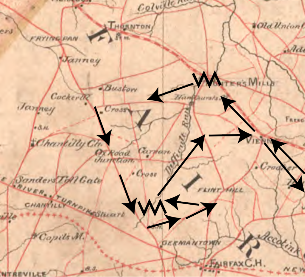
    Over the next two months, the Hunter Mill/Vienna corridor went from contested no man’s land to an axis and venue for hyper effective Rebel guerrilla warfare. So successful were Mosby’s early raids on Frying Pan and the Ox Road that Federal cavalry commanders petitioned to withdraw the main picket line east of Difficult Run, to a position out front of the Chain Bridge Road at Flint Hill, Hunter’s Mill, and Vienna.[17]
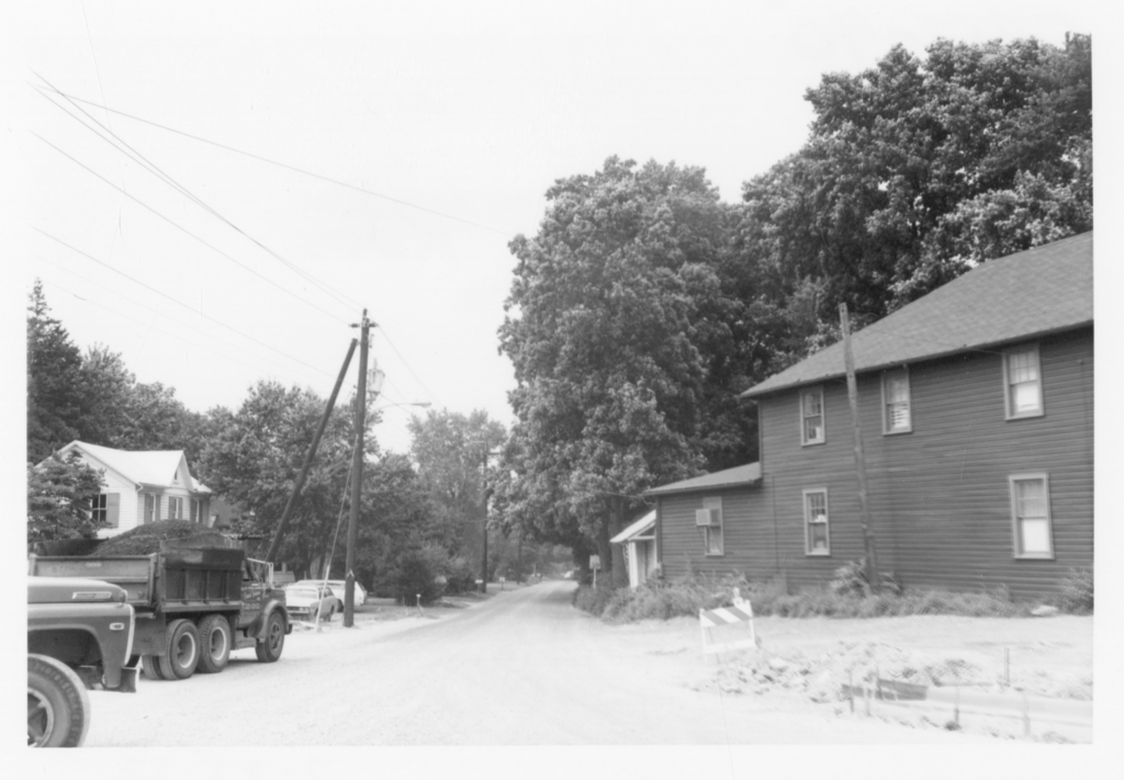
    (A 1973 picture looking north down Hunter Mill Road from its intersection with the Chain Bridge Road. Wilder and woolier than its well-groomed contemporary iteration, this Hunter Mill Road is more illustrative of the limited horizons and claustrophobic dimensions of that thoroughfare during the war. Courtesy of Chris Barbuschak at the Virginia Room at the City of Fairfax Regional Library.)

    By early June of 1863, quick scouts and sharp sniping in the woods west of Vienna transitioned into full scale fire fights. One of Mosby’s most trusted and knowledgeable scouts—a woodsman who had married into the Trammell family that had been a fixture of Hunter’s Mill for generations—orchestrated a designed ambush of the 5th and 6th Michigan on Lawyers Road.

    Once drawn into a chase, the Federals unwittingly entered the box. Mosby and his main element of seventy-five men crashed through the Federal column with pistols blazing. Though encircled and outnumbered, Mosby escaped with only modest casualties.[18]

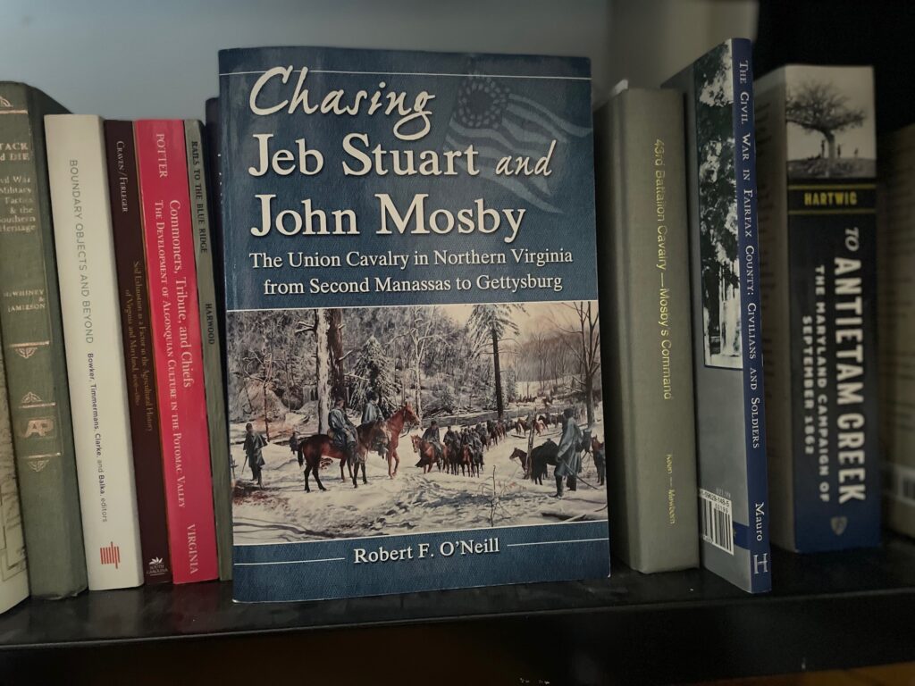
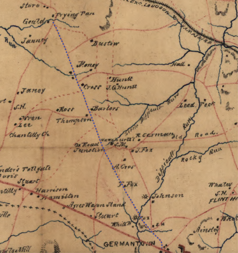
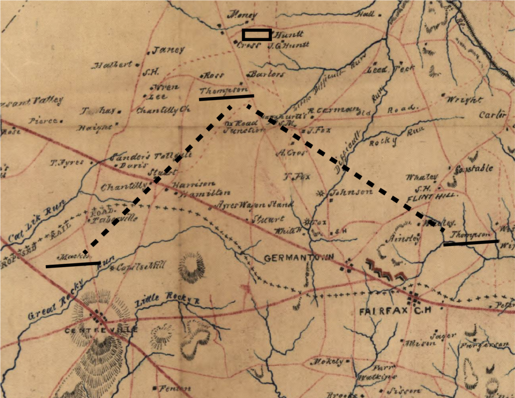
    Bob O’Neill, author of Chasing Jeb Stuart and John Mosby and Small But Important Riots, pulled the correspondence of Lieutenant Colonel Allyn Litchfield of the 7th Michigan, who described the Mosby ambush in a letter to his wife on the following day. Not content to spell out the various Yankee forces that were patrolling on the Ox Road (today’s Waples Mill Road) and Lawyers Road, Litchfield drew a map, which O’Neill copied and has graciously allowed me to use here.

    When overlaid with an 1864-vintage Confederate map, the dotted path of the rebels and the X-marked ambush site on the Lawyers Road corroborate Confederate presence along Difficult Run and violence near Hawxhurst’s and Hunter’s Mill.[19]
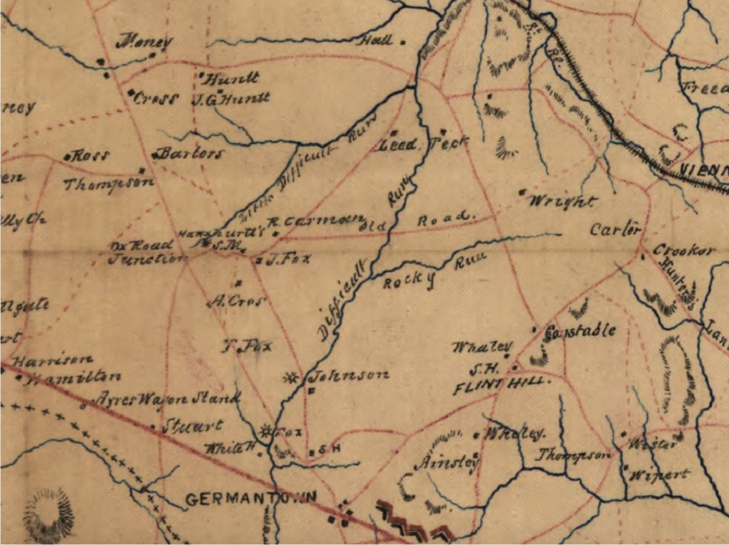
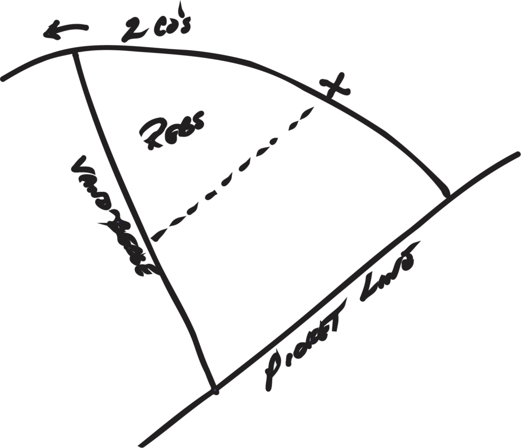
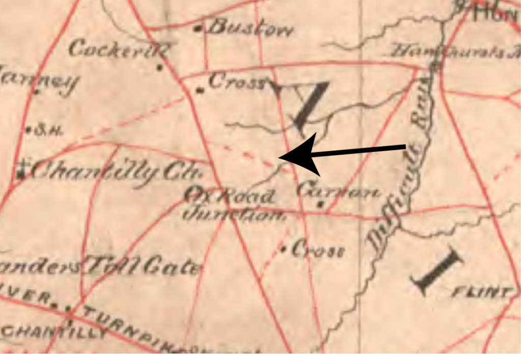
    Subsection of the 1864 Confederate Hoffman/Brown map featuring Difficult Run from Vienna to Ox Junction.
    Used Courtesy of Robert F. O’Neill, this map can be found in the University of Michigan’s French Papers in the Clements Library. Included as part of a letter sent by LTC Allyne Litchfield of the 7th Michigan Cavalry to his wife, the lines depict movements along the Ox Road to the left and the Lawyers Road to the right.
    When married together, the Litchfield sketch and the Hoffman/Brown map overlay in an interesting way that corroborates an account of John Underwood initiating the fight with a designed ambush near Hunter’s Mill (not far from the X marked above).

    Further evidence of privileged Confederate place knowledge and a sense of impunity with which Mosby men regarded their affairs in the woods west of Vienna came in the late-20th century when Mosby scholar Tom Evans and his son found the famed Hidden Valley camp.

    The story of the site’s rediscovery is best told in Don Hakenson and Chuck Mauro’s A Tour Guide and History of Col. John S. Mosby’s Combat Operations. The father/son duo uncovered a makeshift anvil made from wrecked train rail and a number of discarded horseshoes, which corroborated oral legend that Mosby maintained a reshoeing station along Difficult Run where recently captured Yankee horses could be shod before being led back into Confederate lines.[20]

    This secluded micro-valley was the venue for a notorious pre-war grog shop, which served African-American clientele. In 1860, Fairfax County brought charges against its owner, Charles Adams, a local brigand who happened to be first cousin once removed to two Mosby Rangers, Ira and John Follin.[21]

    A quarter mile northeast of this hidey-hole, Adams’ property (which abutted that of his wife) bordered Difficult Run, across which could be found extensive property owned by three Gunnell siblings. One of whom, Martha Gunnell, was married to Richard Dorsey Warfield, Sergeant of Mosby’s Company B. On the night of October 18, 1864, a deep raid into Falls Church culminated at the border of these properties when a Mosby Ranger brought civilian school teacher John D. Read to his knees on the ruined railroad bed and executed him.[22]

    The killing was audacious. Not just because the victim was a civilian or that powder burns to his forehead left no doubt as to the scenario of his demise, but because the murder occurred less than two miles from the cavalry camp at Vienna. More embarrassing still was the fact that Read had been snatched from his brother’s farm three miles east of that same cavalry camp. Rebel partisans had threaded their way past Yankee patrols to a place that was mere minutes away from multiple Union regiments. The butternut rangers fired two shots and disappeared into the night. 

    As with the presence of the hidden valley reshoeing camp, this murder could only take place in a location where Mosby men felt safe. These moments and their geographic particulars represent the culmination of a deliberate tactical methodology. Mosby men dominated the area west of Vienna because they were from that area, had family in the area. Like locals anywhere, they had a unique understanding of nearby places and shortcuts between them. Their entire pre-war lives—the chores, errands, church trips, family visits that comprised their existences—were now military intelligence.

    The cumulative weight of these experiences would have been a potent asset, especially considering that the Union cavalry base was literally surrounded and at intervals directly bordered by properties of Mosby men and their families.

    John Underwood married into the Trammell family that owned land on either side of Hunter Mill Road, weaving scout Bush Underwood with Rangers George West Gunnell and LB Trammell. John F Saunders and Thomas Clarke were boyhood friends who grew up and fought with Mosby together in the same woods. William E. Moore, a particularly effective scout that Federals identified as being essential to Mosby’s operations near Vienna, descended from Baptist preacher Jeremiah Moore, whose bloodline (and, hence, Moore’s cousins) spread out throughout the creek valley and up into Flint Hill. LB Hunt and Richard Dorsey Warfield lived a stone’s throw away.

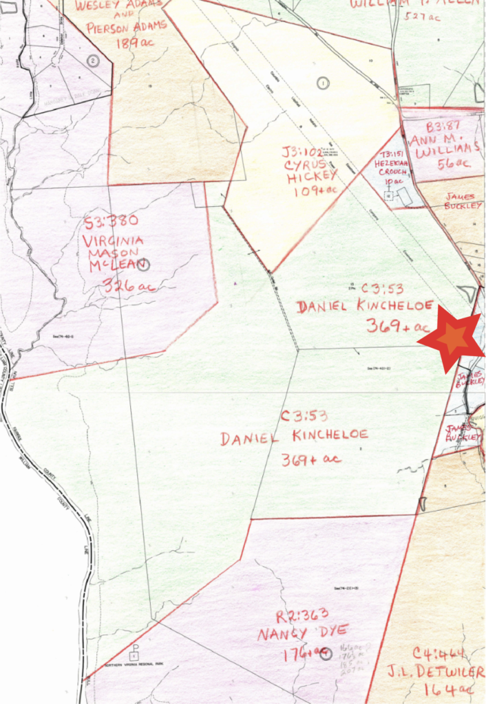
    East of the cavalry camp, John and Ira Follin grew up on a property abutting the future Yankee camp. Their grandmother owned 338 acres of prime land immediately adjacent to a 422 acre spread owned by Hampton Williams, father of Company B’s Lieutenant Frank Williams. Just to the west of them, the Ferris family that ranger Minor Thompson married into just before the war owned 58 acres that almost touched the 109 acre plot of William Moore’s mother, Mary.

    The Hunters of Hunter Mill fame were also cousins to William E. Moore. Their sprawling properties along Difficult Run and near today’s Route 66 in eastern Vienna would have been known to Moore and their other cousins, Rangers Gus and Richard Farr Broadwater.

    AJI

    Capture, encirclement, maneuverability, life and death are concepts central to the game of Go. Unlike chess, Go is played on vertices where lines intersect. Individual pieces are less important than the local and broadscale “shape” achieved by positioning many pieces together in certain configurations.

    Two Go terms are helpful for understanding Vienna. Moyo, or framework, hints at an individual game’s development, in which islands of occupation grow and shift as the game grows older. The initial framework is created as first pieces carve out corners and relationships with other pieces. In these groups and the pockets that develop between and around them, aji, or potential, emerges.

    Depending on the player and the moyo they have built, aji can either be good or bad.

    It’s not enough to say that Mosby dominated the woods near Vienna, Virginia during the Civil War. This simplifies and detracts from the greater truth: a labyrinth of formally designed and informally deigned infrastructure created a warren of potentials. In the space between Difficult Run and Vienna, an ambush could emerge from any angle and dissolve just as easily into one of many corridors or lanes that channeled guerrillas to safety.

    This aji and its kinetic expression had a terrifying aspect for any Yankees unlucky enough to experience its potency. Upon leaving Federal lines in any direction from the camp at Vienna, Union soldiers could rightfully expect to be set upon from any quarter, including and especially the rear.

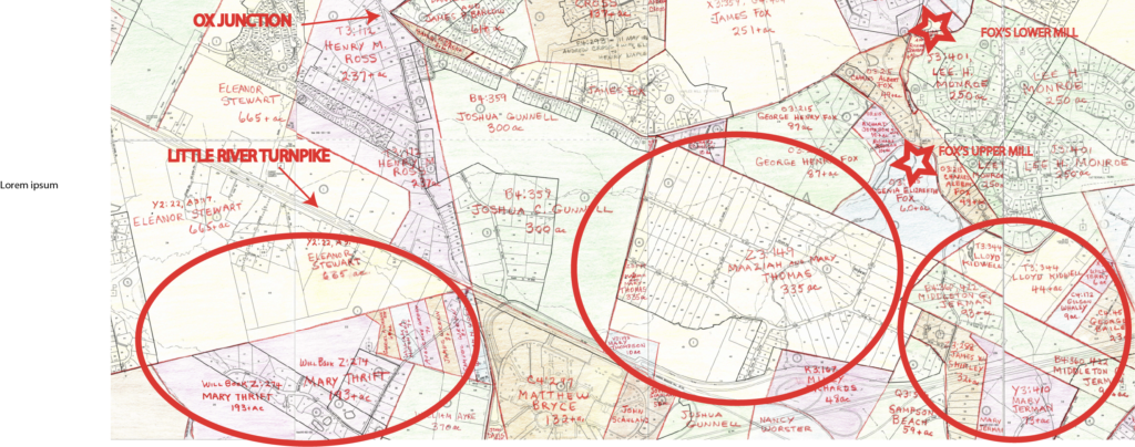
    Like the Ox Road and its tributaries to the south, the Lawyers Road and Hunter Mill Road intersection west of Vienna was a complex infrastructural palimpsest. Centuries—potentially millennia–of human travel carved the desires of successive populations into axial thoroughfares that shifted and settled to suit each generation until they were paved over in the 20th century.

    Hunter Mill Road, like the Chain Bridge Road that ran from Vienna to Fairfax Court House, was regarded as an indigenous ridge road—a pre-cut trace lacing from high point to high point on a line that invariably connected the rich resource belts of Difficult Run to the popular pre-historic Potomac trading interface.[23]

    As modern drivers can attest, the Hunter Mill Road north of Difficult Run bobs and weaves as it did through the 20th century, the Civil War, the early republic, colonial days, and the indigenous period. This road eventually connects with the Leesburg Pike, where both Lewinsville and Dranesville and their respective road hub networks were readily accessible. Frequented by Federal cavalry during the war, the Turnpike was an unsavory option for rebel raiders. However, modern Seneca, Springvale, and Beach Mill Roads would have offered potent escape potentials across the Potomac for knowledgeable Confederates who followed the Hunter Mill Road northwards.[24]

    Running crossways to this early north/south corridor was the Lawyers Road or, more appropriately, the Lawyers Roads plural. Jim Lewis, Jr., historian emeritus of the area around Hunter’s Mill, charts the development of the Lawyers Road back to Col. Broadwater’s 1740s-vintage mill.[25]
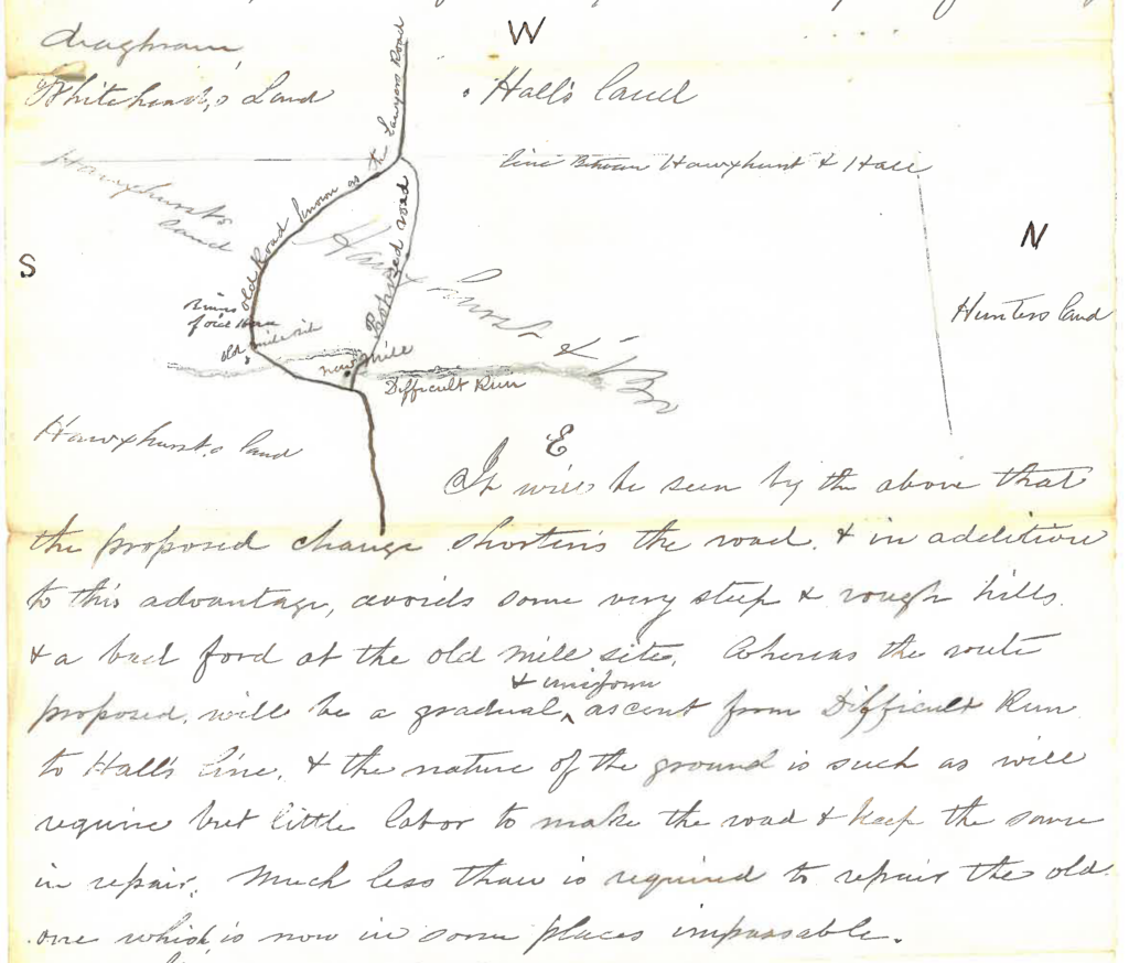
    (In January of 1867, Job and John Hawxhurst petitioned Fairfax County to improve Lawyers Road at the site of their burned out mill just west of Hunter Mill Road. The illustration is valuable, but the words are priceless in understanding Lawyers Road at its wartime intersection with Difficult Run. “It will be seen by the above that the proposed change shortens the road and in addition to this advantage avoids some very steep and rough hills and a bad ford at the old mill site…the nature of the ground is such as will require but little labor to make the road and keep the same in repair. Much less than is required to repair the old one which is now in some places impassable.” RP-053. Courtesy of the Honorable Christopher J. Falcon, Clerk of Court, Fairfax County.)

    The Lawyers Road was purpose built and precisely named. Fairfax County’s first courthouse was located in modern Tyson’s Corner. In the 1740s, a road built from potentially pre-existing parts was pieced together. It sprouted southwest from the courthouse towards the western leg of the Ox Road and then across field and forest until it reached the Braddock Road and the colonial road to Williams Gap.[26]

    Today’s Lawyers Road reflects a 19th century modification of the original road. Another route to Vienna, Old Courthouse Road, follows parts of the original Lawyers Road, which would have connected Ayr Hill, as Vienna was known, to the Hunter Mill Road. Both of these thoroughfares—one in formal use and the other as an informal road remnant—were writ large on the local landscape during the Civil War.

    It’s worth noting that the Old Courthouse Road intersected the Chain Bridge Road and then partially paralleled it on an alternative path to Fairfax Court House that approaches the county seat from the northeast on a line consistent with modern Nutley, Regents Drive, and Blenheim Boulevard. This potentially valuable road cut across much of the Moore and Hunter family properties, to which Mosby Rangers William E. Moore, Richard Farr Broadwater, and Guy Broadwater were related.
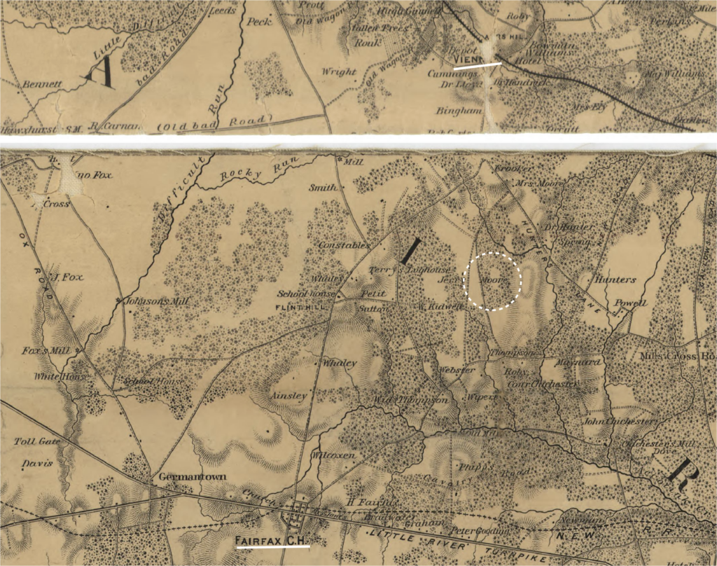
    (The McDowell Map shows a warren of side roads lacing through Mosby-friendly farms east of the Chain Bridge Road on lines that connect Fairfax Court House and Vienna. Courtesy of the LoC.)

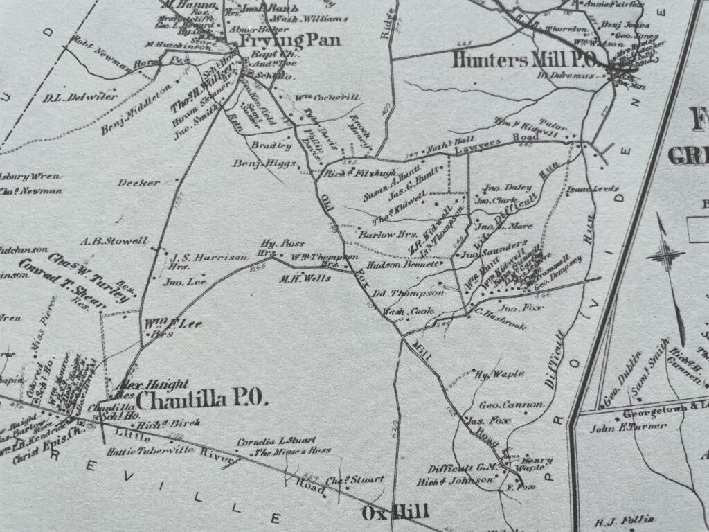
    An examination of the 1862 McDowell Map reveals a still richer web of farm roads connecting these greater thoroughfares with local enclaves. Most prominent are the two “Old Wagon Roads” that cut between Hunter’s Mill and Lawyers. Many other dotted lanes track off main roads towards homesteads and bands of noted forest.

    As Greg Weaver of Vienna Virginia History and Jim Lewis, Jr. of the Hunter Mill Defense League have rigorously documented, a road at Clarke’s Crossing of Piney Branch afforded locals the ability to cut across the run below Vienna.[27] The McDowell Map also indicates a similar ford road extending off one of the Old Wagon Roads.[28] This particular path goes on to dead-end at the Old Courthouse Road. On its western limit, this road charted across the land of many Mosby families before colliding with Hunter Mill Road on a line consistent with modern Vale Road.
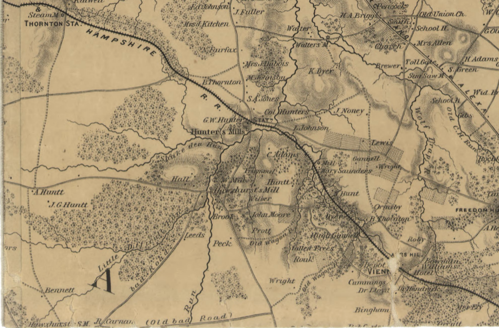
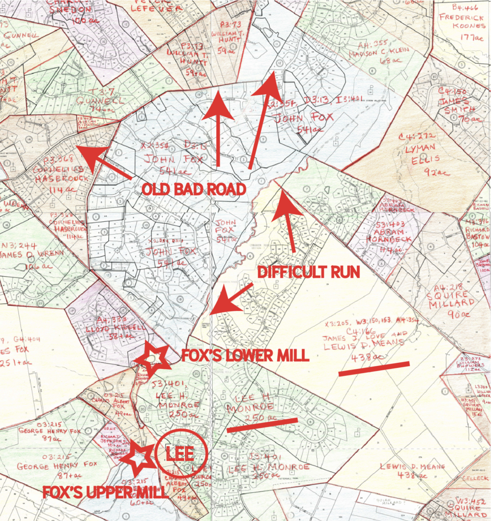
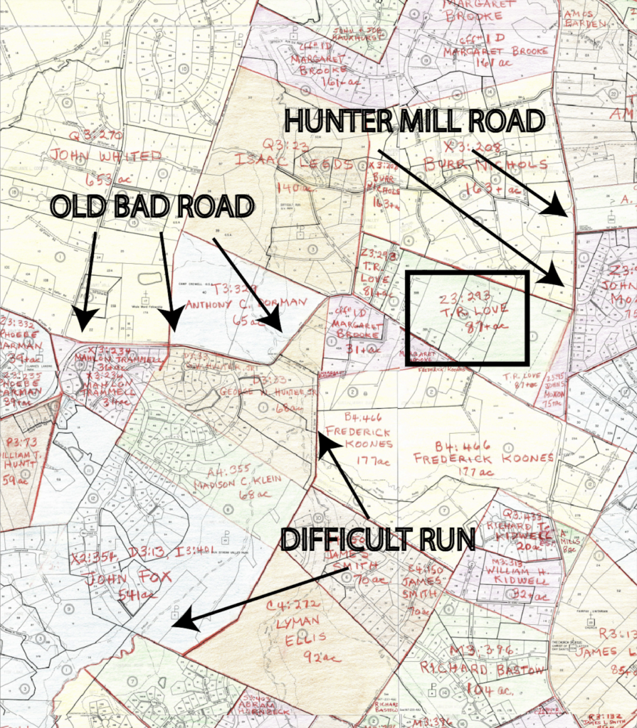
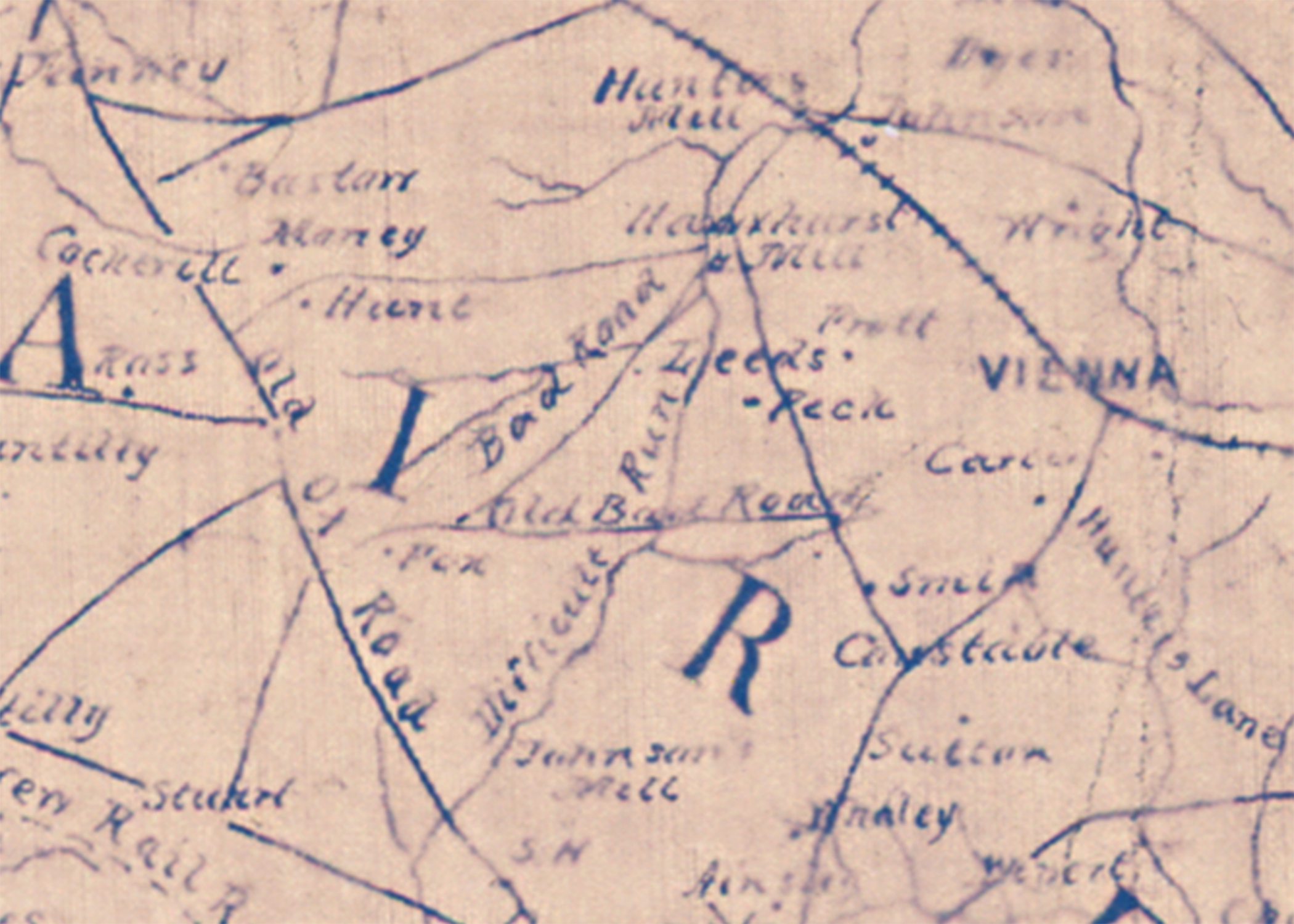
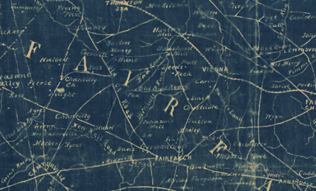
    (Segment of the 1862-vintage McDowell Map depicting “Old Bad Road” at bottom, “Bad Road” at bottom left, the Lawyers road going left to center mid-image, and the Old Wagon Roads west of Vienna cutting across Mosby-friendly territory. Courtesy of the LoC.)

    This route was an important gateway to “Old Bad Road.” Similarly, Lawyers Road at Hawxhurst’s Mill just west of the Hunter Mill Road fed directly into “Bad Road,” better known today as the eastern limit of Stuart Mill Road. Both of these routes were maligned on Federal maps because they crossed some of the worst sloughs in Upper Difficult Run and often paralleled the creek in geography that lent itself to superlative mud.

    However, both of these “bads” were perfectly situated to support a forward Confederate base of operations. Many friendly properties were located along both. Federals were unincentivized to use the roads at all because of their names. Best yet, with skilled use of these roads, Confederate partisans in deconstructed single file or loose group tactical configurations could pass across loyalist country and reach the Ox Road and the Little River Turnpike, from which they could readily access the belt of Mosby farms that dotted the western parts of Fairfax County.

    These roads are the ones we know about. The old tale told of John Underwood, Mosby scout and Vienna familiar, was that he “knew paths not even rabbits had found.”[29] This paradigm was probably most true in the 8200-acre timber forests north of Lawyers Road. Benjamin Thornton, Scottish hardwood magnate, ran a successful prewar lumbering operation here. Despite the volume of production therein—Thornton and company were said to be utilizing twenty seven perpendicular saws to process their trees—much of the land remained wooded going into the war.[30] Underwood, a “woodsman” by trade, who had moved from his native Middleburg to the vicinity of Frying Pan, a neighborhood just west of Thornton’s holdingslikely knew these timber fields intimately.[31]

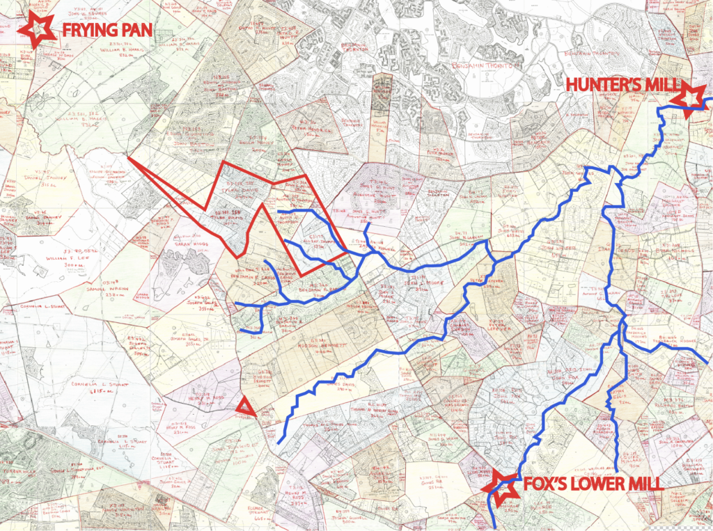
    Crucially underappreciated in this calculus is a whole other set of roads. Creeks were local minima—flat lands that connected citizens to the mills where they were known to gather, take their mail, process their agricultural output, and drink. Further, it can be safely surmised that the saw mills on Difficult Run were receiving local raw timber from both highland and lowland neighbors. Those living and felling trees in the valley itself would not have been calorically incentivized to drag this hardwood timber up to a ridge road when a muddy skid along the creek to a nearby mill would have sufficed.[32] 1930s-era aerial imagery of the basin reveals predictable paths paralleling the creek and splitting off in either direction to climb through draws towards high land.
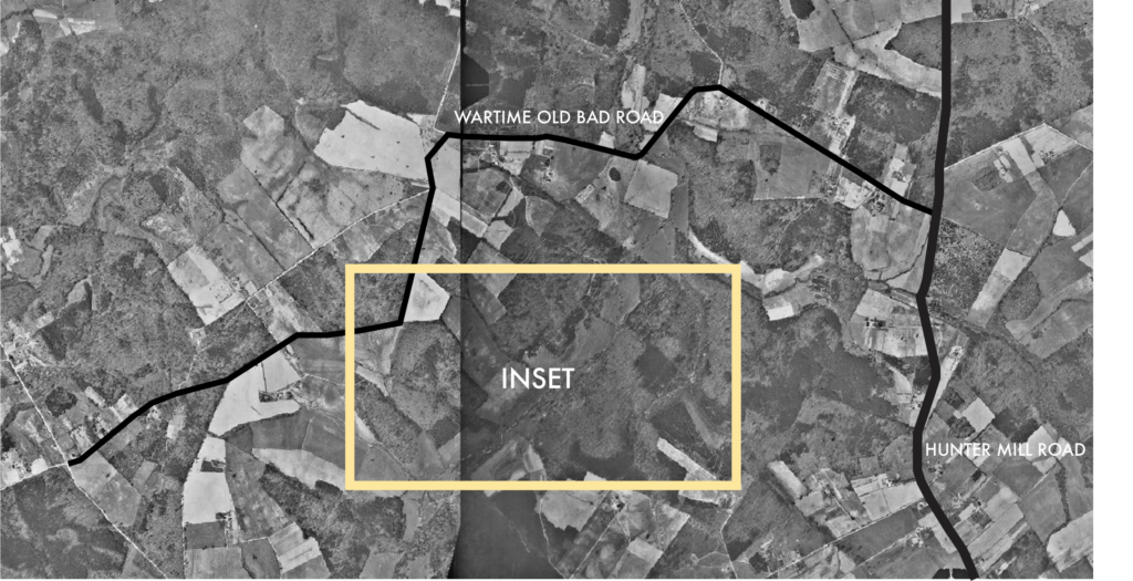
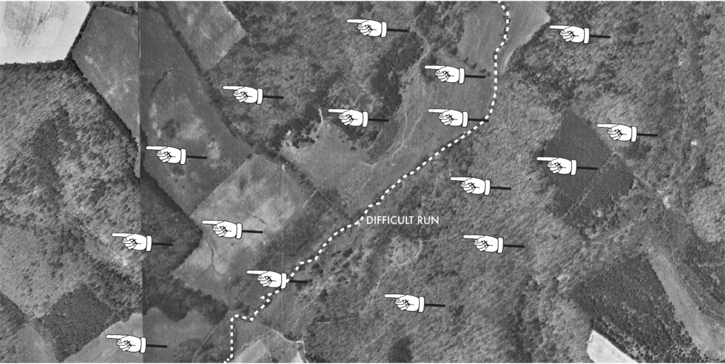
    (1937 aerial broad imagery)
    (1937 aerial north of Fox’s Lower Mill and south of Hawxhurst’s Mill along Difficult Run)

    These creek parallels were the epitome of local knowledge. Desire paths and cut betweens, these convenient avenues would have been well known to local Rangers. I say this as a child of Little Difficult Run who spent a chunk of his boyhood riding his bike between neighborhoods on the formal and informal trails that blossomed off the creek.
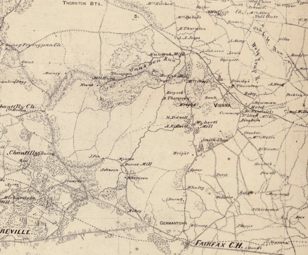
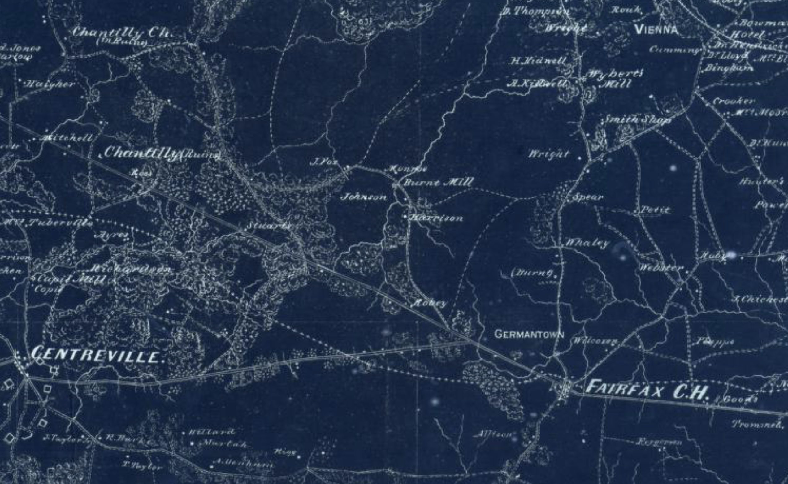
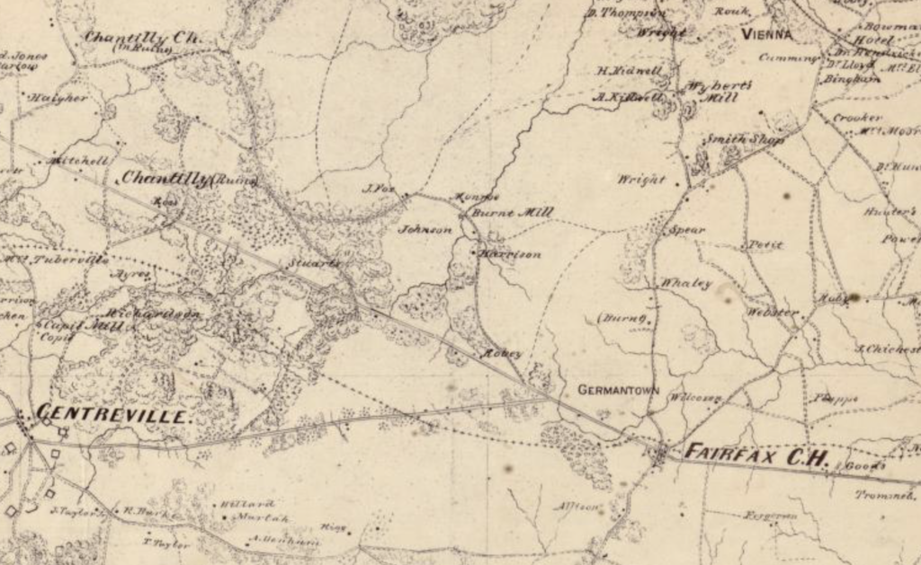
    (This segment of the 1864 Michler map renders the Upper Difficult Run Basin west of Fairfax Court House. Trees are only depicted where they were known to exist. Hence, the deeply forested valley’s barren appearance suggests non-access for cartographers, engineers, and scouts. So too, the relative roadlessness therein is probably a misnomer. The area between two “burnt mills,” Fox’s at bottom and Hawxhurst’s at top, was likely riven with informal paths connecting mills to farms and individual family units to kin nearby. Courtesy of the LoC.)

    To properly understand the available routes through the valley, a map of creeks and a map of Civil War period roadways should be overlaid. Add the torn up Alexandria, Loudoun & Hampshire railroad bed and you have a stunning map of potential movement that simultaneously demystifies that omnipotent Gray Ghost myth and adds subtly and nuance to the intelligence of John Mosby’s operations near Vienna.

    MURDER
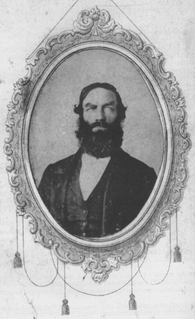
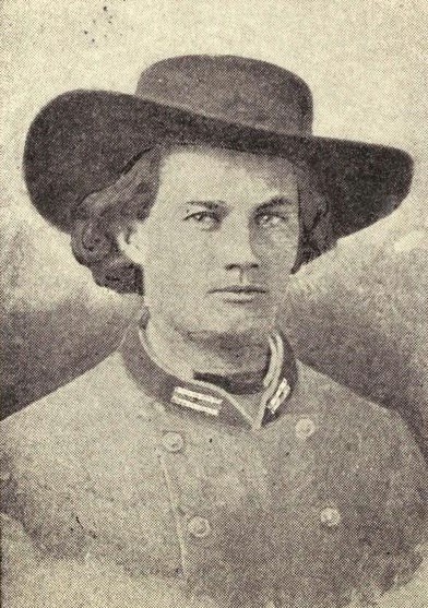
    (John D. Read in life)

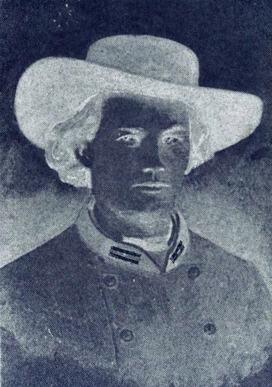
    The many threads of this story tie together and telegraph through the ages in the form of one particularly auspicious incident: the murder of John D. Read by an unknown Mosby Ranger (potentially Bush Underwood) on the AL&H railroad tracks two miles west of Vienna on the night of October 18, 1864.

    Read’s execution is a familiar piece of Mosby lore. Early on the 18th, a raiding party of rangers under Richard Montjoy infiltrated Accotink Creek by way of Centreville. Rebuffed by Federal guns at the Union stockade in Annandale, the seventy-five man detail turned northwards towards Falls Church. [33]

    Around 2 a.m. the Confederates struck near Falls Church. Read’s Brother, Hiram, owned a modest property just northwest of the modern intersection of Lee Highway and Route 7. In 1864, Hiram’s home was adjacent to that of Daniel Sines, whose barn Federal cavalry utilized as a stable for their horses.[34]

    With Bush Underwood serving as lead scout, Mosby Rangers were busy confiscating the Yankee horses in Sines’ barn when they heard a horn blow in the near distance. Montjoy and Company quickly realized that the noise was not a hunter flushing out game, but at attempt by a Connecticut-born local to summon local Federals. A firefight ensued, in which a free African-American named Frank Brooks was killed.

    Read and another freeman were captured and brought to the woods west of Vienna where they were summarily executed. Or so Mosby’s men thought. Read was dead as a doornail, but his compatriot survived to tell the tale. Today, a ‘Terror on the Tracks’ historical marker interpreting the event along the W&OD Trail is witnessed by a host of cyclists passing in third gear.

    Lost in this narrative is the salient question of how Confederate raiders were able to lace through a network of Yankee forts and patrols, before skirting a massive Federal camp, and arriving on the other side unseen where they felt comfortable enough to fire two pistol shots.

    By 1864, the Yankee line along Chain Bridge Road was reinforced with another phase line running from Lewinsville to Falls Church and down to Annandale. Finding this too to be inadequate, Colonel HM Lazelle of the 16th New York Cavalry implemented in 1864 a “secret picket-line” near Falls Church. The tactic was a sort of early LRRP methodology built on small squads of six to twelve who would take two days rations and set up concealed posts in unpredictable quadrants to surprise Rebels.[35]

    Given this defensive posture, it is stunning to think that Montjoy and his seventy-five man contingent would be so successful on that October night. The mystery—and with it the supernatural allure of John Mosby himself—fade somewhat as the spatial reality of friendly civilians between Vienna and Falls Church sheds new light on the incident.

    Just west of Hiram Read’s farm, the land sloped downwards into Tripps Run, a ready-made corridor for escape where silhouettes disappeared. Less than a mile north, that creek peters out into its headwaters along the AL&H railroad. From there, it would have been a quick three miles along the railbed until a party of raiders intersected Frank Williams’ family farm, where a prominent hill afforded them a view over Vienna. The Follin family owned the adjacent farm. Both properties sloped into the deepening basin of Wolf Trap Creek, which crossed Chain Bridge Road at a very opportune low point just east of the Federal cavalry base. From there, it was a few hundred yards before the run ducked into the Follin Brothers’ father’s farm, which extended all the way to Courthouse Road. Following that for less than half a mile, Mosby’s men would have found Clark’s Crossing Road. This trace was surrounded by properties of Mosby families not far from the murder site a half mile to the west.

    All in, this creek and railbed heavy route skirted every major Federal outpost in the area with just under nine miles of travel distance. The record of what occurred just after the murder of John D. Read seems to corroborate Wolf Trap Creek’s central role in the evening’s events. The party rode back towards Vienna from Difficult Run then captured the Federal cavalry picket at the intersection of the Leesburg Pike and the Lewinsville Road. That location was a mere one and a half miles directly downstream on Wolf Trap Creek from the place on the Follin Farm where the Old Courthouse Road forded that run.[36]

    The spatial relationships that enabled and motivated the killing of John D. Read went even deeper. Fifteen months prior to his death, John D. Read offered Federal authorities knowledge of Mosby’s “Headquarters,” which he claimed was “only about 5 miles from Falls Church.”[37] It was five miles as the crow flew between Vienna and the home from which Read was snatched.

    More intriguing still, another Federal informer, Charlie Binns, was potentially the procuring cause for southern partisans to be lurking in the woods near Falls Church. Binns had been an enthusiastic 1863 enlistee in Mosby’s guerrilla experiment before drunkenness and a supposed plot to re-enslave local freed women caused Binns to flee the command or face arrest.[38] He then did an about face and offered his considerable intelligence to Union cavalrymen. Subsequently, a price was put on Charlie Binns head and a rumor has trickled through oral history suggesting that Mosby would give a lieutenancy to anyone who brought Charlie Binns back for justice.[39]

    Binns was married to Mary E. Gantt Rose, who owned a farm in Falls Church less than a mile to the west of Hiram Read’s house. John D. Read may have blown the horn that alerted Rebels to his presence, but the raid that cost him his life was potentially an extra-curricular effort to see if Charlie Binns was home. [40]

    A BASE IN THE WOODS

    The spatial coincidences presented above are proven facts. The idea that they interconnected in specific, meaningful, routed ways are theories. These particular theories are difficult to prove. Absent the discovery of a mid-19th century era teleportation device, these ideas represent one of the most plausible explanations of the geography that enabled the murder of John D. Read.

    More facts facilitate still more theories. Indisputable is the fact that spaces mattered and the social, infrastructural, and topographic sinews that governed the inter-relation of these spaces mattered more than all. The configuration of these resources and their masterful manipulation by a Confederate guerrilla created a palpable sense of fear in Vienna.

    This reality goes beyond the rhapsodic verse of Herman Melville. People—to wit, Federals and loyal civilians—who had to venture into the woods near Vienna from 1863 to 1865 were rightfully terrified.

    Case in point: on the morning after her husband’s murder, the newly-minted Widow Read went unaccompanied to search for John’s body. The fear of Rebels still lurking in the forests was great enough to dissuade armed Federal cavalry from scouting two miles west of their fortified camp.[41]

    Despite the fact that the Union cavalry camp at Vienna was less than thirteen miles from the White House and was buffeted by heavy Federal presence patrolling dozens of miles of roadway to the west, the area of Difficult Run near Vienna was ostensibly Confederate territory.

    Quasi-permanent Rebel presence in this valley is a theory now as it was for Federals during the war. Three weeks after Read’s murder, Federal dispatches informed the cavalry commander at Falls Church of a “reported camp of Mosby’s men at Flint Hill.”[42]

    This was a logical conclusion. One supported by a counter-intuitive body of evidence. Throughout 1864, Mosby and his men were harried and hunted all across their line. Savage combat along the Shenandoah, burning raids striking the very heart of the command’s formal base in Loudoun, and increased patrolling along the western boundary of Fairfax County did unquestionable damage to Mosby’s battalion. Yet, this group of guerrillas nominally headquartered near Upperville thirty-four miles distant, consistently projected across the Vienna line and into eastern Fairfax County.

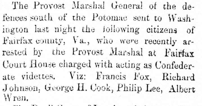
    On January 8, 1864, Confederates struck a Yankee picket post at Flint Hill.[43] In March, Mosby himself brought a detachment to bear a detachment against a 14-man outpost guarding Jermantown east of Difficult Run.[44] April 22 found Mosby and William Hunter leading three dozen men from Company A in an attack on the 2nd Massachusetts Cavalry at Hunter’s Mill.[45] On June 5, Mosby and a crew of rangers including Bush Underwood staged an unsuccessful rendezvous in Fairfax County from which they hoped to penetrate as deep into Union lines as the Telegraph Road in Alexandria.[46] Company B—a unit rife with men from Hunter’s Mill and Vienna—raided near Fairfax Court House.[47] Mosby personally led a fifty man detachment into Fairfax on August 28. This unit split into three marauding units. Mosby commanded one, local boy Albert Wrenn commanded another, and the third under Harry Hatcher was supplemented by Bush Underwood.[48]

    The murder of John D. Read on October 18 did not interrupt this pattern. Bush Underwood and twenty men struck a Federal wagon train one mile west of Vienna on December 19.[49] Underwood returned with William Trammell on February 5, 1865. Together they laid an ambush in the forests near Vienna.[50]

    As the Army of Northern Virginia withered in the Petersburg trenches and Confederate maneuver across Loudoun and Fauquier Counties became less secure, attacks did not drop off in Fairfax County. The March 7th bushwhack near the Flint Hill stockade was but a small taste of Rebel operational capacity in the Vienna sphere. On March 12, fifty Mosby men struck the Federal position where the Lewinsville Road intersected the Leesburg Pike two miles west of Vienna. This was the same location above Wolf Trap Creek where Montjoy and company appeared in the hour after murdering John D Read five months prior.[51] That very day, Bush Underwood and Richard Farr Broadwater—cousin to the Hunters of Hunter Mill—guided a Mosby unit as far east as Bailey’s Crossroads.[52]

    Given the larger tactical scenario in Northern Virginia, these late-war strikes deep in Fairfax County suggest local gravity. Seventy-five Confederates were unlikely to muster in the Blue Ridge foothills, ride hell bent for leather across contested territory, thread through an immense forest and then dart across the creek valleys of Fairfax County, strike Federals, take prisoners, and then wind their way back to Upperville. Simply, the elevated presence and enduring efficacy of these rangers suggests that Difficult Run was more than a waymarker. It was a base, a safe overnight space, and a step-off place.

    Few places in Northern Virginia were so ready-made to serve in this role. Hidden trails, deep creeks, and impassable thickets jacketed with hardwood forests tied friendly properties together in a web that encircled the Federal camp at Vienna.

    Long-neglected in favor of pastoral Loudoun and the rough-shod Shenandoah Valley, the woods near Vienna were a vortex of violence that served as the easternmost hub in Mosby’s Confederacy.


    [1] The War of the Rebellion: Official Records of the War of the Rebellion. Serial 095, Page 0546-0549, Chapter LVIII, “Skirmish Near Flint Hill.” Ohio State University. https://ehistory.osu.edu/books/official-records/095/0546

    [2] Keen, Hugh C. And Horace Mewborn. 43rd Battalion Virginia Cavalry Mosby’s Command. Lynchburg: H.E. Howard, Inc, 1993. Pg. 137.

    [3] Netherton, Nan, Donald Sweig, Janice Artemel, Patricia Hickin, and Patrick Reed. Fairfax County, Virginia: A History. Fairfax: Fairfax County Board of Supervisors, 1978. Pg. 526.

    [4] The War of the Rebellion: Official Records of the War of the Rebellion. Serial 005, Page 0443-0445, Chapter LVIII, “Skirmish Near Vienna, VA” Ohio State University. https://ehistory.osu.edu/books/official-records/005/0443

    [5] The War of the Rebellion: Official Records of the War of the Rebellion. Serial 005, Page 0446-0447, Chapter LVIII, “Skirmish Near Vienna, VA” Ohio State University. https://ehistory.osu.edu/books/official-records/005/0446

    [6] The War of the Rebellion: Official Records of the War of the Rebellion. Serial 005, Page 0506-0508, “Operations in MD., N VA., and W. VA.” , https://ehistory.osu.edu/books/official-records/005/0506

    [7] The War of the Rebellion: Official Records of the War of the Rebellion. Serial 016, Page 0270-0272, Chapter XXIV, “Operations in N. VA., W. VA., and MD,” https://ehistory.osu.edu/books/official-records/016/0271

    [8] The War of the Rebellion: Official Records of the War of the Rebellion. Serial 018 Page 0803. Chapter XXIV. Correspondence, Etc.-Union.” https://ehistory.osu.edu/books/official-records/018/0803

    [9] Alexandria Gazette: 1834-1974. Chronicling America: Historic American Newspapers. Library of Congress. <https://chroniclingamerica.loc.gov> July 10, 1857. P. 3, col. 3.

    [10] The War of the Rebellion: Official Records of the War of the Rebellion. Serial 016, Page 0087, Chapter XXIV. GENERAL REPORTS> https://ehistory.osu.edu/books/official-records/016/0087

    [11] The War of the Rebellion: Official Records of the War of the Rebellion. Serial 040, Page 0504, Chapter XXXVII, N. VA, W. VA, MD., PA. https://ehistory.osu.edu/books/official-records/040/0504

    [12] RG 393, US Army Continental Commands, Part 2, Entry 4337, Letters Sent, 5th Army Corps, April 1863-April 1864. Citation and documentation courtesy of Bob O’neill.

    [13] Greg Weaver of ViennaVAHistory.com has done further research on the ecological transformation that occurred near Vienna during the war. Through soldier accounts and post-war testimony to the Southern Claims Commission, Weaver has pieced together the thorough denuding of oaks and chestnuts from the area that became the Vienna cavalry camp.[13] This process surely extended beyond that acreage.  Weaver, Greg. “Vienna’s Ayr Hill in the Civil War: Photos & Context.” April 16, 2023. Vienna Virginia History. https://viennavahistory.com/2023/04/16/viennas-ayr-hill-in-the-civil-war-photos-context/

    [14] Alexandria Gazette: 1834-1974. Chronicling America: Historic American Newspapers. Library of Congress. <https://chroniclingamerica.loc.gov> January 18, 1843. P. 3, Col. 6. https://tile.loc.gov/storage-services/service/ndnp/vi/batch_vi_bees_ver01/data/sn85025007/00414215725/1843011801/0065.pdf

    [15] Alexandria Gazette: 1834-1974. Chronicling America: Historic American Newspapers. Library of Congress. <https://chroniclingamerica.loc.gov> January 2, 1863. P. 2, col. 1.

    [16] Keen, Hugh C. And Horace Mewborn. 43rd Battalion Virginia Cavalry Mosby’s Command. Lynchburg: H.E. Howard, Inc, 1993. P. 6.

    [17] O’Neill, Robert F. Chasing Jeb Stuart and John Mosby. Jefferson: McFarland & Company Inc, 2012. P. 100.

    [18] Ibid 206-207.

    [19] Used with Robert F. O’Neill’s permission. The Litchfield-French Papers, Clements Library, Anne Arbor, Michigan.

    [20] Hakenson, Donald C. And Charles V. Mauro. A Tour Guide and History of Col. John S. Mosby’s Combat Operations in Fairfax County. Fairfax: HMS Productions, 2013. Pg. 94-95.

    [21] Ira and John Follin’s mother, Jane Louisa Lanham (1826-1915) was daughter to Margaret Adams (1798-1854) was brother to Samuel Adams (1792-1864) whose son was Charles Adams (1827-1877).

    [22] The War of the Rebellion: Official Records of the Civil War. Serial 091, Page 0414-0415. Operations in N. VA, W. VA., MD., PA. Chapter LV. https://ehistory.osu.edu/books/official-records/091/0414

    [23] Evans, D’anne A. The Story of Oakton, Virginia: 1758-1990. Oakton: The Optimist Club of Oakton, 1991. p. 103.

    [24] Crowl, Heather K. “A History of Roads in Fairfax County, Virginia: 1608-1840. Masters Thesis, (American University, 2002). Pg. 95. https://aura.american.edu/articles/thesis/A_history_of_roads_in_Fairfax_County_Virginia_1608–1840/23878788?file=41875287 This thesis has been an important touchstone for understanding the way that contemporary Fairfax roads are actually snippets of larger systems that ran through current developments to reach distant destinations.

    [25] Lewis, Jr., James, and Charles Balch with Kenneth Jones. Forgotten Roads of the Hunter Mill Corridor. Oakton: Hunter Mill Defense League, 2010. Pg. 9.

    [26] Crowl, Heather K. “A History of Roads in Fairfax County, Virginia: 1608-1840. Masters Thesis, (American University, 2002). Pg. 53.

    [27] Weaver, Greg. “Clark’s Crossing Road West of the WO&D: A Short History.” Vienna Virginia History. March 5, 2023. https://viennavahistory.com/2023/03/05/clarks-crossing-road-west-of-the-wod-a-short-history/

    [28] Map of n. eastern Virginia and Vicinity of Washington. General Irwin McDowell. 1862. Library of Congress. https://www.loc.gov/resource/g3881s.cw1009001r/?r=0.284,0.257,0.438,0.262,0

    [29] Jones, Virgil Carrington. Ranger Mosby. Chapel Hill, University of North Carolina Press, 1944. Pg. 90.

    [30] “Ship Timber.” Alexandria Gazette. April 20, 1857. Pg. 3, Col. 3. https://tile.loc.gov/storage-services/service/ndnp/vi/batch_vi_drive_ver01/data/sn85025007/00414215968/1857042001/0522.pdf

    [31] Source for John Underwood as a woodsman: Seipel, Kevin H. Rebel. New York: St. Martin’s Press, 1983. Pg. 78. For the family’s move from Loudoun to Fairfax, see the disparity between the 1840 and 1850 census.

    [32] Probably my favorite rendering of this informal path-making process comes from an 1856 real estate advertisement. MC Klein marketed his property on Difficult Run in the valley west of Hunter Mill Road as “bounded on the west by Difficult Run, on which there are Merchant Saw-Mills of convenient access; also, abundantly supplied with timber of original growth.” Alexandria Gazette: 1834-1974. Chronicling America: Historic American Newspapers. Library of Congress. <https://chroniclingamerica.loc.gov> March 3, 1856. P. 3, col. 7.

    [33] The War of the Rebellion: Official Records of the Civil War. Serial 091 Page 0414 Operations in N. VA., W.VA., MD., AND PA., Chapter LV. https://ehistory.osu.edu/books/official-records/091/0414

    [34] Mitchell, Beth. 1860 Fairfax County Maps. 1977. This story is often muddled to suggest that John D. Read was snatched from his own home, which was not, in fact, true. John lived at Bailey’s Crossroads. Hiram, his brother, lived in Falls Church, adjacent to Daniel Sines.

    [35] The War of the Rebellion: Official Records of the Civil War. Serial 071 Page 0387-389 OPERATIONS IN N.VA., W.VA., MD., AND PA. CHAPTER XLIX. https://ehistory.osu.edu/books/official-records/071/0387

    [36] Keen, Hugh C. And Horace Mewborn. 43rd Battalion Virginia Cavalry Mosby’s Command. Lynchburg: H.E. Howard, Inc, 1993. Pg. 202.

    [37] The War of the Rebellion: Official Records of the Civil War. Serial 049. Page 0026. OPERATIONS IN N.VA., W.VA., MD., and PA. Chapter XLI https://ehistory.osu.edu/books/official-records/049/0026

    [38] Johnson II, William Page.  Brothers and Cousins: Confederate Soldiers & Sailors of Fairfax County, VA. Athens: Iberian Publishing, 1995. 16-17.

    [39] Hakenson, Donald C. And Charles V. Mauro. A Tour Guide and History of Col. John S. Mosby’s Combat Operations in Fairfax County. Fairfax: HMS Productions, 2013. Pg. 119

    [40] Mitchell, Beth. 1860 Fairfax County Maps. 1977. https://www.fairfaxcounty.gov/history-commission/sites/history-commission/files/Assets/documents/1860CountyMap/50-1.jpg

    [41] Lewis, Jr., James, and Charles Balch with Kenneth Jones. Forgotten Roads of the Hunter Mill Corridor. Oakton: Hunter Mill Defense League, 2010. p. 22.

    [42] The War of the Rebellion: Official Records of the Civil War. Serial 091 Page 0539 Chapter LV. CORRESPONDENCE, ETC. – Union. https://ehistory.osu.edu/books/official-records/091/0539

    [43] The War of the Rebellion: Official Records of the Civil War. Serial 060 Page 0365 Chapter XLV. CORRESPONDENCE, ETC. -Union. https://ehistory.osu.edu/books/official-records/060/0365

    [44] Keen, Hugh C. And Horace Mewborn. 43rd Battalion Virginia Cavalry Mosby’s Command. Lynchburg: H.E. Howard, Inc, 1993. P. 116

    [45] Ibid 119.

    [46] Ibid 131.

    [47] Ibid 147.

    [48] Ibid 167.

    [49] Ibid 234.

    [50] Ibid 244.

    [51] Ibid 250.

    [52] Ibid 251.

  • Into the Trees

    Into the Trees

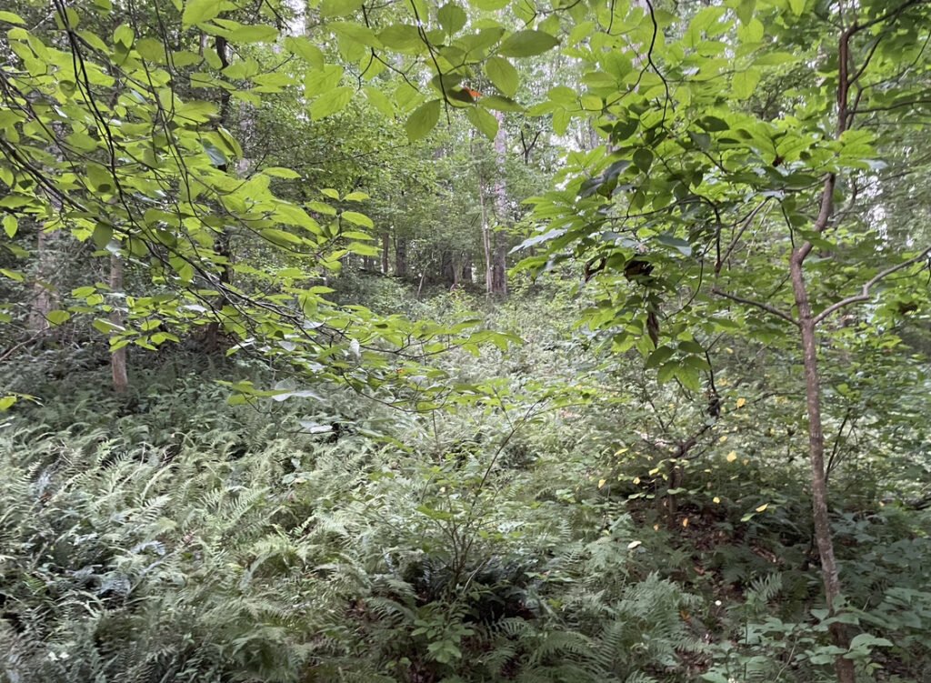
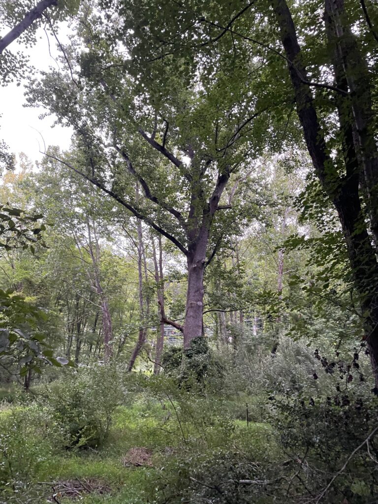
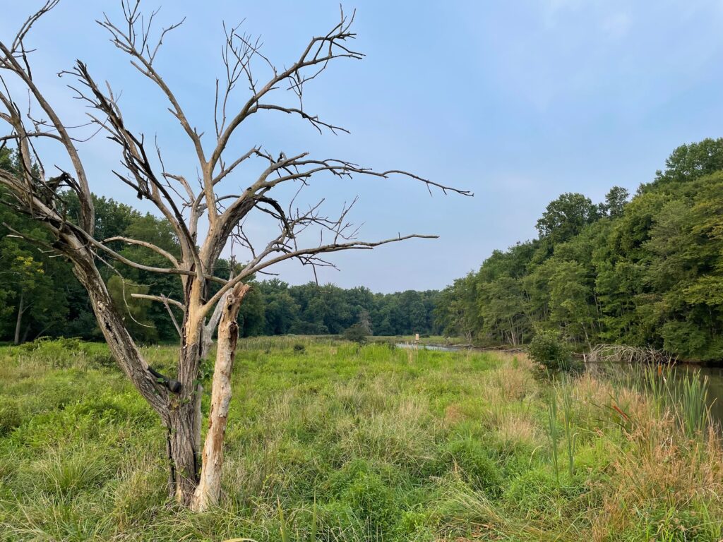
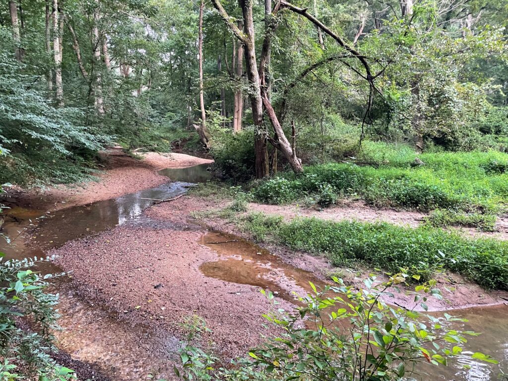
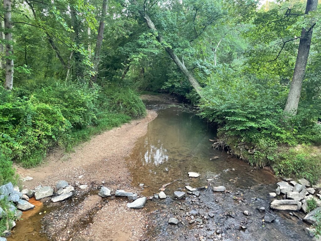
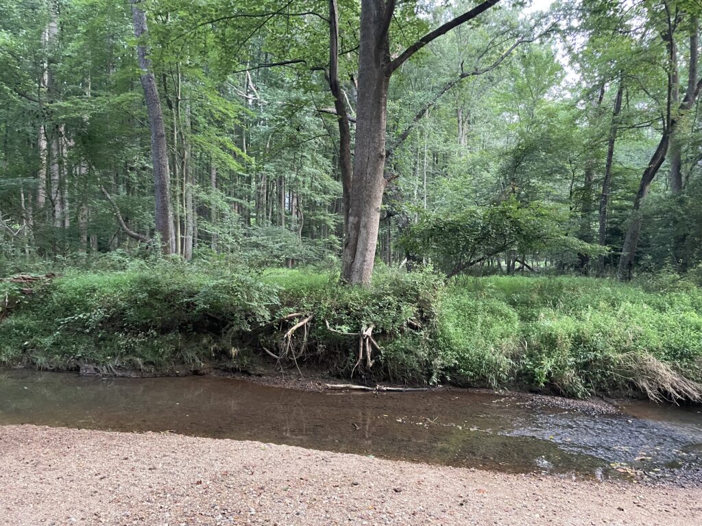
    (Difficult Run west of Miller Heights circa 2023)

    TL;DR–Heavy timber served as both venue and motivator for Mosby and his men.

    In April of 1864, Moby Dick author Herman Melville—by then an expert chronicler of American tumult—accompanied his friend, Col. Charles Russell Lowell of the 2nd Massachusetts Cavalry, on a reconnaissance in force against Mosby from the Federal stronghold at Vienna.1

    Two years later, Melville published an epic poem account of the raid. “Scout Toward Aldie” wove a narrative from threads familiar to readers of the author’s other work. Brave, but anxious men carve their way through a dread-soaked ecology towards an inevitable battle with a cunning foe.

    No mere fictionalization, “Scout Toward Aldie” was a high-fidelity recreation of the corridor between Vienna and Loudoun County to the west. The narrative arc of the poem itself conformed to the geography of Difficult Run, with the poet dropping breadcrumbs that identify familiar landmarks on the Federal cavalry’s trek westwards from Vienna. 

    “They file out into the forest deep,” marks a point of departure, by which the Yankee horsemen ride down the Lawyers or Old Courthouse Road towards an intersection with Hunter Mill. There, “they pass the picket by the pine and hollow log—a lonesome place.” Only to “cross the freshet-flood, and up the muddy bank,” moments later as they negotiate the historically troublesome ford of Difficult Run near Hawxhurst’s burned mill.

    The fire-eaten structure and its attendant decay caught Melville’s eye. A few stanzas later, he remarks “a squirrel sprang from the rotting mill.” It wouldn’t have been far from the ford to Money’s Corner (today’s intersection of Lawyers, Fox Mill, and the Reston Parkway) where an 1862 Federal map had the road from Hunter’s Mill intersecting with the Fox Mill Road that led to Frying Pan.

    Melville phrases this place in ways an after-action report never could: “By worn-out fields they cantered on—Drear fields amid the woodlands wide; by cross-roads of some olden time, In which grew groves, by gatestones down—Grassed ruins of secluded pride: A strange lone land, long past the prime, Fit land for Mosby or for crime.”

    (Taken in February of 1864, this image of the cavalry camp at Vienna documents the treeless landscape where Melville and his companions left the known world and entered into a Mosby-haunted forest near Hunter’s Mill on Difficult Run. LoC.)

    A stanza later, at an interval when the 2nd Massachusetts could have been passing the Frying Pan church, a favorite target and assembly point for John Mosby, Melville describes, “Hard by, a chapel. Flower-pot mould danced and decayed the shaded roof; the porch was punk; the clapboards spanned with ruffled lichens gray or green; red coral-moss was not aloof; and mid dry leaves green dead-man’s-hand, Groped toward that chapel in Mosby-land.”

    Melville’s journey into the heart of John Mosby’s Confederacy continues over 801 lines. Of these, 56, or nearly seven percent—an auspicious number for a casual poem—make explicit mention of woods, trees, leaves, thickets, or branches. 

    It was, apparently, Melville’s seasoned judgement that one could not tell the story of the gray ghost without depicting the scenery that shielded the Confederate guerrilla from Federal raids. Melville probably said it best: “Maple and hemlock, beech and lime, are Mosby’s Confederates, share the crime.”

    TWIN NARRATIVE

    Symbiotic relationships between flora landscapes and John Mosby’s operations in Fairfax County represent a crucial linkage. Abundant hardwood timber and scrub brush or pine succeeding from previous land clearance efforts were the defining features of Difficult Run circa 1863. So too, these irregular groves were an important force multiplier for John Mosby and a motivator for locals who served with him.

    This inextricable interrelation between people and forests long-preceded the outbreak of war. Understanding this long-standing co-evolution is an important pre-condition for grappling with Fairfax County during the 1860s. 

    In the opening sections of the definitive Fairfax County, Virginia: A History, Donald Sweig contextualizes early colonial Virginia with a borrow from Richard Hofstader, in which the eminent historian recalls a 1750 account from a mariner who claimed to have smelled the sprawling pine forests of the Old Dominion as far as one hundred and eighty miles out to sea.2

    Beth Mitchell, devoted Fairfax historian and expert student of early metes and bounds, titled her exhaustive study of colonial Fairfax County property lines “Beginning At A White Oak” in honor of the “king of kings” tree that served as the most common and prominent boundary marker for surveyors.3

    This arbor-oriented thought was not a later graft, but a contemporaneous feature of the way the land was perceived and communicated. When a proposal emerged in 1789 to move the County Court House westwards from Alexandria to a point near modern Annandale, locals bemoaned the prospect of shifting the municipal institution “into the woods.”4

    The move was a loaded proposition. Equal parts opportunity and obstacle. In a pre-modern world, forests were both asset and hindrance. 

    An account from the late-17th century honed in on the labor-intensive raw forests of Virginia as a selling point to citizens of the Old World accustomed to the relative deforestation of their native land.

    “So much timber have they that they build fences all around the land they cultivate. A man with fifty acres of ground, & others in proportion, will leave twenty-five wooded, & of the remaining twenty-five will cultivate half and keep the other as a pasture & paddock for his cattle. Four years later, he transfers his fences to this untilled half which meanwhile has had a period of rest and fertilization, & every year they put seeds in the ground they till. They sow wheat at the end of October and beginning of November, & corn at the end of April.”5

    These forests and the nutrient-rich virgin soil they underlying them represented a tremendous prospect and a terrible burden. George Mason and other prominent landowners of Difficult Run property drew out prescriptive leases that stipulated tenants perform a variety of intensive upgrades to raw forest. The development and construction of fields, orchards, and tobacco barns all necessitated a huge outlay of calories and time.6

    With this effort came an opportunity beyond crop yield. Old-growth hardwood harvested as a matter of necessity created a surplus of materials from which vernacular architecture and productive infrastructure sprouted. Forests quickly became houses, barns, distilleries, spring houses, outhouses, and miles of fencing. 

    Traces of these process still exist in Fairfax County. 

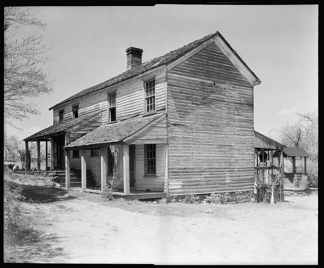
    (Archived at the Library of Congress as “House Beyond Fairfax Court House on Route 50,” this 1930s-era photo by Frances Benjamin Johnston was intended to capture vernacular Southern architecture. Curiously, the white washed sides and the old clapboard siding (likely jacketing a timber frame), potentially date back to pre-war origins. More enticing still, the 1862 McDowell Map notes a “White House” north of the Little River Turnpike just west of Fairfax Court House at a point a half mile south of Fox’s Upper Mill. Is this the White House? We will never know, but the structure on display is assuredly built from timber that grew in the Difficult Run basin.)

    Just south of the once-and-former Old Bad Road, otherwise known as Vale Road, the recently remodeled Squirrel Hill was first built with early-1700s hewn oak spline floors and rafters and a 1757 addition constructed primarily from chestnut.7

    At Sully Plantation just south of Frying Pan, tulip poplar beaded siding harkens back to a history of abundant hardwood.8

    Nearer still in both geography and chronology, George Waples III’s 20th century memoir, Country Boy Gone Soldiering, depicts the Upper Difficult Run valley being rich in chestnut trees. Waples specifies the iconic hardwood’s practical use as a farm instrument. “Those trees (chestnuts),” he wrote, “were also used for the rail fences throughout the south in the older times.”9

    Locally-sourced, locally-processed, locally-utilized timber was likely the predominant pattern for early deforestation. In a region bountiful in old-growth timber, lands like Difficult Run that were poorly served by shoddy roads were unlikely to have fostered much interest for timber exporters. Instead, wood products probably stayed close to the areas from which they were harvested.

    Adding complexity to the work-cost of these efforts was a lack of mechanical sawing capacity. The hand-sawn paradigm endured in Upper Difficult Run until the late-1780s when Amos Fox opened his titular mill.10 

    Fairfax historiography has a fixation with grain, which became the defining agricultural product of the 19th century. Historical narratives focus on the emergence of grifting capabilities at local mills while giving short shrift to the sawing operations that often co-occupied mill spaces with grist stones.11

    Fox’s Mill was known to have been fitted with a sawing operation in the first decade of the 1800s, but the substance of an 1802 lawsuit from neighbor Thomas Fairfax against Amos Fox’s son Morris suggests that extensive timber sawing occurred along Difficult Run beginning in the late 1790s. 

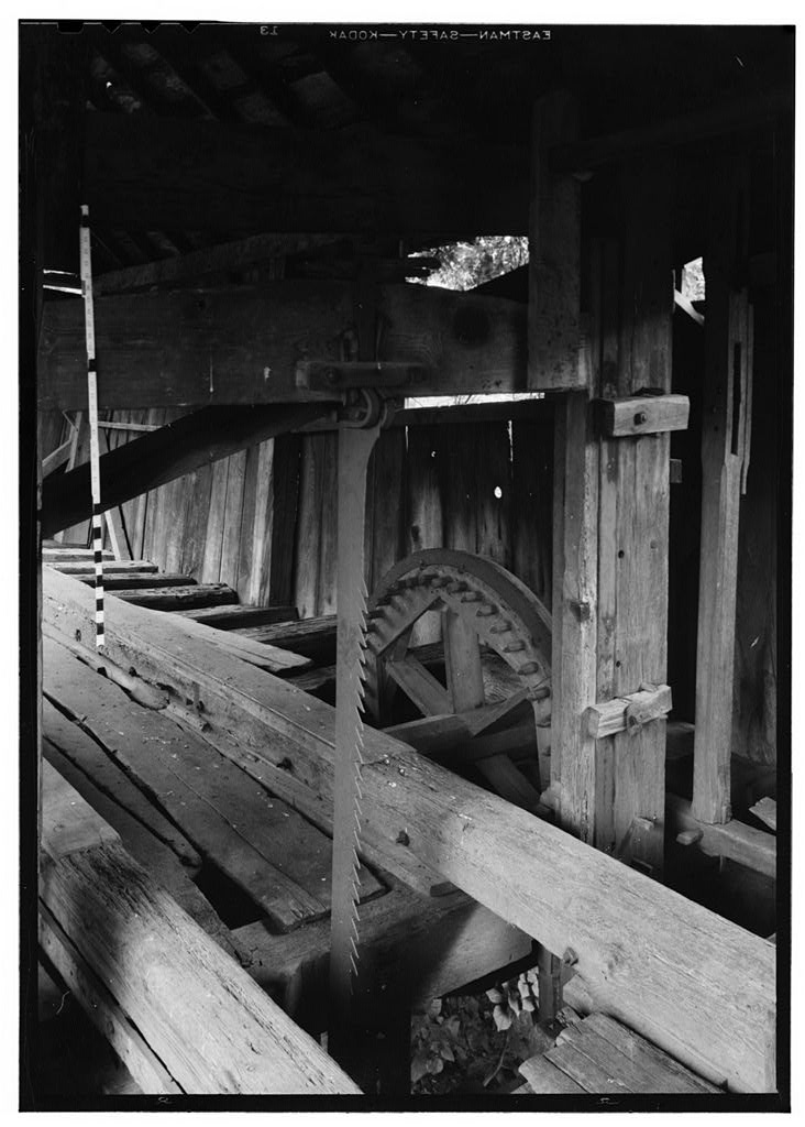
    (Another 20th century photograph, this one from Sperryville west of Warrenton, depicts the blade of a classic 19th-century sawmill. Earlier up and down sawmills, such as the one likely installed at Fox’s Mills, utilized a blade that was six inches wide. LoC.)

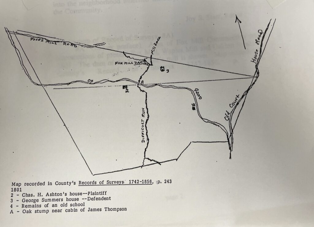
    Fairfax took Fox to court for having illegally harvested a staggering amount of trees from the boundary between their two properties. The final tally was one thousand oaks, one thousand hickories, and one thousand other trees taken, amounting to a total of $6000 in damages.12

    This is a staggering amount. Beyond the obvious work load of felling and milling three thousand trees, it is amazing that Thomas Fairfax didn’t notice the loss of timber until the pilfering had reached an immense scale. The case speaks to both a culture of absentee landlordism in Fairfax and the laxity with which timber resources were managed and adjudicated. 

    In fact, trees—the defining natural feature of Western Fairfax County—were so common and undervalued as an asset that information about standing timber was a rare addendum to area real estate listings for the first three decades of the 19th century. 

    When Ann Fox died in 1813, a listing for her property at Fox’s Mills included information about slaves, livestock, and even distilling equipment, but not a word about trees.13 When eight hundred acres of nearby property was advertised for sale in March of 1821, a similar silence surrounded the question of available timber.14 

    Simply, it was not important. 

    TIMBER THRIVES IN PLAYED OUT LANDS

    The apparent disinterest with which land brokers and investors treated timber in the early 19th century is an artifact of an interesting plateau in the relationship between humans of Fairfax County and their natural resources. 

    After almost a century of extractive cultivation practices, the area was on the cusp of a crisis. “Frontier communities are, by their very nature, notorious exhausters of the soil,” writes agricultural historian Avery Odell Craven. Describing the economic pressures that shaped early colonial farms in Virginia, Craven elaborates, “the one crop with highest value in outside exchange, drives all other major crops from the fields.”15

    In Fairfax and tidewater Virginia at large, tobacco was the definitive cash crop that pushed all other agricultural considerations aside, for a time. The soil simply could not support the degree of production encouraged by eager frontier Virginians who saw vast wealth in the endless horizons of virgin land. By 1800, tobacco was nearly played out as a cash crop in Fairfax County. The quality of what comparatively little broad leaf was grown paled in comparison to the harvests of a few years prior. 

    With a quick stroke of ingenuity, Fairfax farmers replaced tobacco with wheat. Grain could be grown successfully on land too nutrient-sapped for tobacco.16 Alexandria quickly pivoted from tobacco hub to a leading wheat port. Those who segued into the new cash crop were handsomely rewarded as macroeconomic conditions in the Atlantic Basin created a strong international demand for Virginia grain. At its peak in 1811, Alexandria wheat merchants exported two million dollars worth of Virginia grain and flour.17

    Many of the Civil War-era landmarks and much of the transportation infrastructure in Western Fairfax County was developed in the wheat years. Turnpikes were financed to bring Loudoun, Prince Willian, and Fauquier County granaries into alignment with Alexandria’s wharves. Innumerable mills represented enterprising attempts by savvy merchant middle men to intercept raw grain and process it for a premium. 

    The defining ecological feature of the early wheat years was a continuance of tobacco-era land use strategies. For wheat as with its noxious leafy predecessor, trees were both hindrance to the plow and competition for sunlight. As Fairfax County farmers rode the wheat wave, it behooved them to seek out well-cleared, well-lit, and largely flat parcels of land that demanded the least amount of effort to bring a profitable crop to market. 

    Hence, in 1813 flaunting available stands of timber in a real estate listing was not necessarily a wise strategy. 

    As before, the market for this cash crop settled at more modest demand (and price) levels. A historic culture of over-production encouraged further soil exhaustion. Expensive sub-industries developed around practices designed to elongate plantability and increase yields.18 Clover and Timothy cover crops, gypsum soil-amendments, and the application of expensive, but effective Peruvian guano helped Fairfax wheat farmers continue producing wheat, but at a heightened cost. 

    Large-scale gentlemen planters, like the owners of Sully Plantation, successfully kept their heads above water.19 Many others slipped into a cycle of asset liquidation and unceasing annual debt.20

    Plenty of Fairfax farmers could not keep up with either the debt nor the onerous burden of planting increasingly unproductive land. From 1800 to 1840, the County’s population fell by thirty percent.21

    The economic panic of 1837 and a subsequent money shortage in 1842 capped off this precipitous decline with a liquidity crisis that pushed many owners of used-up land past the brink.22 Land in Fairfax County depreciated rapidly. Five to fifteen dollars was fair asking price for an acre. For comparison, the rate for a similarly sized plot of land in New York at the same time was between forty and seventy dollars.23

    As banking tumult and agricultural decline undercut the Fairfax farming community, timber suddenly began to factor heavily in real estate listings for land along Difficult Run.

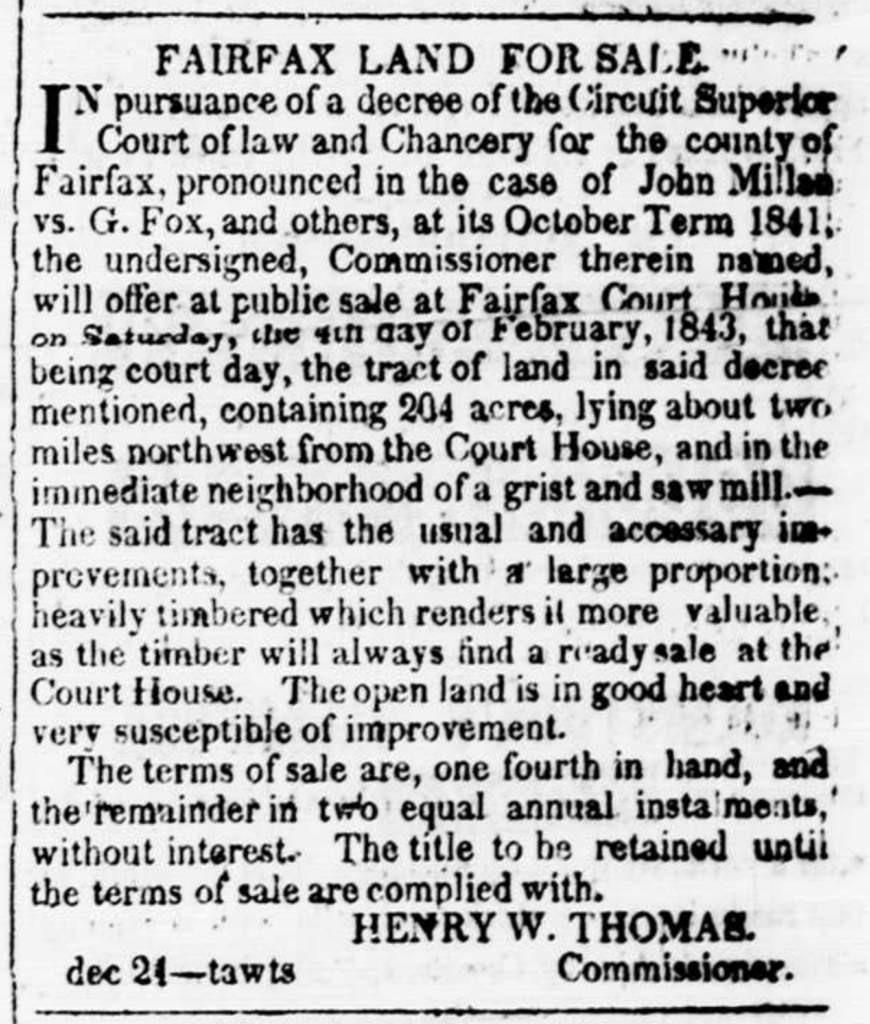
    Dogged by a lawsuit in the final year of his life, Fox Mill owner Gabriel Fox attempted to sell 203 acres of land along Difficult Run in January of 1843. Assurances that the property’s acreage was “a large proportion heavily timbered” figured prominently in the listing Gabriel took out in the Alexandria Gazette.24

    Three months later, the owner agents for a two hundred acre property located between Fox’s Mill and the Little River Turnpike promised would-be buyers that the “greater part” of the farm was in “heavy timber.”25

    “An ample quality of Wood and Timber” was the verbiage used to accompany the 1847 auction listing for a similarly sized plot of land west of Difficult Run near Frying Pan.26

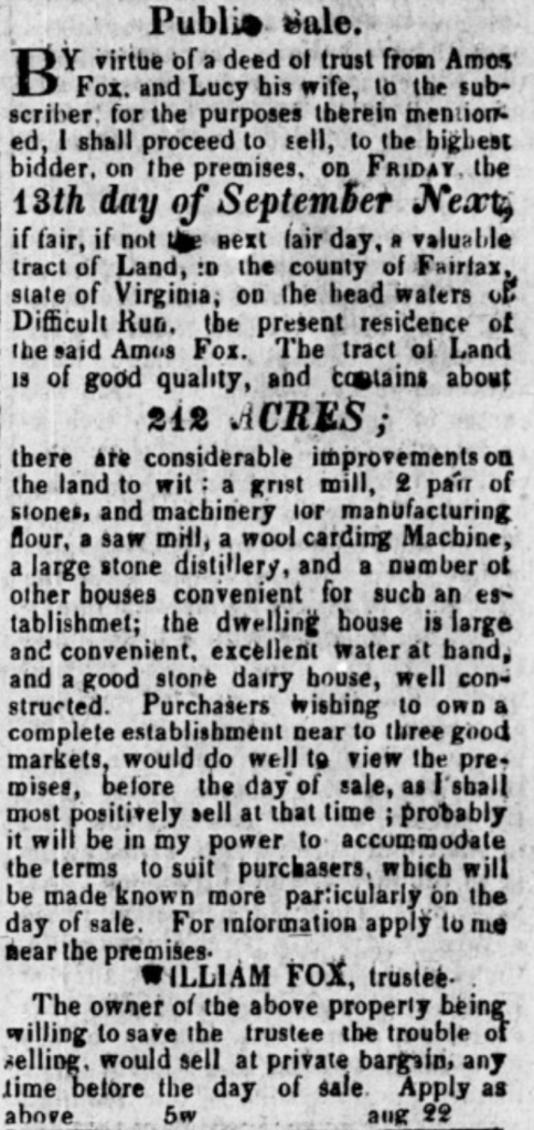
    The inducement was clear. Gabriel Fox’s 1843 land listing put it most astutely: “timber will always find a ready sale at the Court House.”

    (Found on Page 3, Column 6 of the January 18, 1843 Alexandria Gazette(

    For a community pinched in a liquidity crisis, timber represented an incredibly salable asset. Once harvested, timber became chattel. Like slaves, cut hardwood timber was one of the best liquid assets one could own in a monetary crisis. Easily sold, appreciating constantly, and requiring no upkeep—stands of old growth timber were a savvy way to convert existing resources into quick value.27

    As with tobacco and wheat before, microeconomies enveloped this fresh cash crop in tendrils of infrastructure that brought the resource to market. The 1850s found local investors and merchants reconfiguring to embrace and exploit this readily available timber into a network of demand. 

    An 1853 announcement from timber dealers along Accotink Creek in Fairfax Court House emphasizes both the abundance of white oak and red cedar timber and its suitability for the “ship timber and plank, wharf timber, millwrights, or wheelwrights.”28

    Three years later, the Engineering Office for the then under-construction Alexandria, Loudoun, & Hampshire Railroad put out a public call for rail-road cross-ties “to be delivered in lots of about 2700 to each mile or section.” A hint at the available supply can be gleaned from the specificity of the request. The engineers sought only “perfectly sound White Oak, Post Oak, Chestnut Oak, Chestnut, or Locust timber, cut into lengths of 8 feet.”29 Modern carpenters will never know what it feels like to be this picky.

    The coup d’grace in this glut of hardwood timber pouring out of the Difficult Run area came from a disgraced English wool wholesaler named Benjamin Thornton. He and his brother skedaddled from their native land in the 1840s under duress from a cloud of accusations including forgery, the cashing of substantial amounts in bad checks, and general fraud. 

    Thornton and his brother Joseph resurfaced in Fairfax County in 1852 with a new heap of investment capital and a vision for yet another crack at the merino wool industry. Having acquired 8,200 acres of prime forest land north of Lawyers Road in modern Reston, Benjamin Thornton apparently had a business epiphany. Sheep generally require pastureland and hardwood tree canopy generally precludes good grazing foliage. Benjamin Thornton identified an important opportunity as he cleared his land of oaks.30 

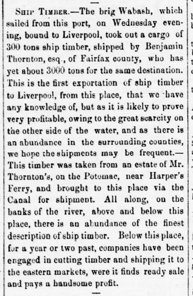
    An 1857 profile in the Alexandria Gazette marks the departure of the brig Wabash from Alexandria with “a cargo of 300 sons ships timber, shipped by Benjamin Thornton, esq. of Fairfax County, who has yet about 3000 tons for the same destination.” 

    Though Thornton was well-situated to exploit what the Alexandria Gazette called “the great scarcity (of timber) on the other side of the water,” he was not alone. The author concluded the piece by describing a network of Alexandria-aligned woodsmen who “for a year or two past…have been engaged in cutting timber and shipping it to the eastern markets, where it finds ready sale and pays a handsome profit.”31

    (From Page 3, Column 3 of the July 10, 1857 Alexandria Gazette)

    Thornton initially used the Potomac canal to transport his timber to Alexandria. That changed in 1858 when the oak-rail hungry Alexandria, Loudoun & Hampshire Railroad began operations. Both Benjamin Thornton’s milling complex and Hunter’s Mill enjoyed stations that were no doubt planned into the rail route by virtue of the wealth of timber that was rolling out of Difficult Run by those points.32

    A few short years before the outbreak of war, an authentic boom was taking place along Upper Difficult Run. All of the important preconditions had been satisfied. An existing and previously undervalued resource was identified. Domestic and international markets emerged. Infrastructure developed. 

    By the time a fresh national liquidity crisis emerged with the Panic of 1857, savvy landowners and eager speculators were already trading in a robust real estate market symbiosis premised on the value of timber leases.33

    An 1856 advertisement for the sale of one hundred and ninety seven acres of land near Frying Pan began by addressing the target audience: “TO WOOD AND TIMBER GETTERS.” The prime selling point was a tract “very HEAVILY TIMBERED with oak and pine of large size.” Ad copy quickly doubled back to business-minded woodsman. “Wood and timber getters are particularly invited to view this property,” the broker opined, “as property so suitable to their purposes is seldom offered in market.”34

    That same year, real estate investor MC Klein sold two tracts of adjoining land on Difficult Run just north of Fox’s Mills and south of Old Bad Road. A familiar pitch centered on the value of the trees that crowded the creek basin. The ad that Klein and business partner James Love ran in the Alexandria Gazette pointedly described the land as “bounded on the west by Difficult Run, on which there are Merchant Saw-MIlls of convenient access; also, abundantly supplied with timber of original growth.”35

    This amounted to a turn-key business proposition. Buy the land that has the trees, fell the trees, and then drag them south along Difficult Run to Fox’s Mills or north to Hawxhurst’s Mill where you can convert the trees into supplies or specie. 

    Alexandria-based land speculators John and Wilmer Corse (younger brothers, incidentally, to Montgomery D. Corse—commander of the 17th Virginia Infantry and eventual skipper of George Pickett’s “lucky” fourth brigade that spent the Third of July, 1863 guarding the railroad at Hanover Junction rather than storming Cemetery Ridge), coined a phrase that appeared time and time again in late-1850’s advertisements for tracts of land in Western Fairfax County. 

    Quoth the brothers Corse: “There could be wood and timber enough sold off this place to pay more than the price asked for it.”36

    More than a fad, the timber investment mentality had weight to it. By 1860, major lenders and investors like Tom Love, his son James Love, Lee Monroe, and Joshua Coffer Gunnell, had purchased large tracts of land on or abutting the upper Difficult Run Basin.37

    FORESTS AT WAR

    To say that the Upper Difficult Run has been overlooked in Civil War historiography would be an understatement. With a few choice exceptions, it has been neglected entirely. The National Park Service knows with a degree of certainty where the wood lines were at Gettysburg, but a similarly rigorous understanding of the landscape jacketing the creek beds and undulating hills north of the Little River Turnpike has likely been lost to history. 

    We’re left to reconstruct the wartime ecology from a hodge podge of sources ranging from tax records and real estate announcements to post-war accounts of land use and aerial surveys conducted seventy years ex post facto. What emerges is a landscape marbled with cultivated farmland and dense timber. Neither fully virgin forest nor rolling wheat fields, Difficult Run was a patchwork culmination of a century or more of extraction and processing practices writ large on the land. 

    The 1870 agricultural census attests to mixed ratios of woodland and improved land. Along the Little River Turnpike and west of Fox’s Mill, one substantial tract enjoyed thirty cleared acres set amongst three hundred acres of trees. Across from today’s Waples Mill Elementary School, two hundred improved acres encircled sixty two timber acres. The area around Fox’s Mill was just about a fifty-fifty split. The modern intersection of Vale and Fox Mill Roads was similarly disposed. North of Fox’s Mill in the Difficult Run valley across from the property that MC Klein listed in 1856, John Fox paid taxes on two hundred and seventy five wooded acres in 1870.38

    Other such documents corroborate the abundance of timber on Difficult Run in the years after the war. 

    A July 1867 real estate transaction between Thomas Lee and the new owner of Fox’s Mill, Henry Waple, yielded a prolonged legal dispute centered around disputed acreage that was “being in timber.” It’s clear that there was a belt of timber at least twelve acres large east of Difficult Run and spread between the road to Fox’s Mill and Fox’s Lower Mill to the north.39

    Just across Difficult Run, James Fox’s farm went to auction in 1877. The land was described as “well wooded.”40 Identical verbiage was used as enticement in the auction announcement for an 87 1/2 acre farm “near Fox’s old mill” the following year.41

    In 1881, the 617 acre Whited Tract south of Lawyers Road and west of Hunter’s Mill Road went to market as a “valuable tract of TIMBER LAND.”42 

    Not only was the market for timber intact in the decades after the war, but the supply was still available. Timber of the quality advertised here could not have sprouted magically in the interregnum between Appomattox and 1881. These valuable trees were surely in place and fully grown during the war years.

    Stands of old-growth investment trees were only part of the equation. Extensive early colonization and especially tobacco cultivation on the sandy-soiled floodplains of Difficult Run likely established a succession regime of impenetrable undergrowth. Much of the Lawyers Road line—an early colonial corridor for both transit and homesteading—was known to be densely thicketed during the war.43

    Students of the Civil War in the east might recognize this description of thick undergrowth thriving where primary growth trees had been clear cut previously. The Wilderness in Spotsylvania County similarly beguiled fighting men of both armies who were pushed to the tactical brink by vision-obscuring brambles and bushes.44

    Interestingly, the Wilderness was the product of patterned deforestation beginning in the late 1830s and accelerating into the 1840s with the establishment of a smelting operation at the Catherine Furnace. Trees were felled and burned to feed the pig iron fires at the facility on a scale and timeline that matches the emergence of timber production in the Difficult Run Basin.

    The comparison is worth pondering. As Melville plainly describes, dense foliage unsuitable for fighting sounds consistent with a mini-Wilderness within Difficult Run. 

    ENTER MOSBY

    John Mosby found his way through the forest of Difficult Run during the first winter of the war. On February 12, 1862, then Private John Mosby was on picket duty in Fairfax Court House when JEB Stuart ordered Captain William Blackford to detail Mosby on a curious mission. The future partisan was tasked with accompanying “two young ladies living at Fairfax Court House, acquaintances of his (Stuart) had arranged to send them to the house of a friend near Fryingpan.”45 These women were likely the cousins Antonia Ford and Laura Ratcliffe who became frequent companions and admirers of Stuart. 

    On that February night, Mosby likely ferried the women along today’s Waples Mill and West Ox Roads. A prominent local roadway at the time of the war, it was also the most direct avenue between the two points. This route would have taken the party within a stone’s throw of Fox’s Mill and throw the hardwood forests that crowded the banks of Difficult Run at Fox’s Ford. 

    Mosby would be back, and soon. In the last days of August 1862 as Confederate and Federal forces brawled on the plains of Manassas southwest of Difficult Run, Mosby was fulfilling his duties as one of JEB Stuart’s most renowned scouts. Nervous Yankee farmers who were living in Fairfax County despite the ebb and flow of hostile forces sensed a new hazard. On August 28, Alexander Haight of Sully Plantation decided to flee to the safety of Union lines. 

    John Mosby and a squad of Confederate cavalry interrupted Haight’s flight from Fairfax at the corner of the Chain Bridge and Hunter Mill Roads in modern day Oakton. At the iconic oak from which the town derived its name, Mosby asked Haight for his papers. Haight handed over the documents and spurred his horse on a mad dash for freedom. He escaped safely despite having to dodge seven pistol shots.

    Mosby returned again four months later as the vanguard of a JEB Stuart raid that targeted Federal stores at Fairfax Station before escaping via the Hunter Mill Road/Frying Pan axis. As the Confederate force rode through Vienna, they captured “a large number of ‘contrabands’ engaged in felling timber in the neighborhood of Vienna.”46

    (Whether the setting was inspired by reality or a piece of fictive license on the part of the artist, imagination of John Mosby during the war centered around forested landscapes. LoC.

    A few hours after intercepting an illicit deforesting operation conducted by freed slaves, Stuart signaled to Mosby his intention to establish the young scout as an independent partisan ranger.47

    It is little wonder that Mosby returned to the forested roads he had scouted over the prior two years. The belt of trees between Frying Pan and Vienna satisfied both conditions essential for John Mosby’s success. These forests were laced with little used paths—some ancient, others more recent, such as the timber skids that surely connected property’s like MC Klein’s to the adjoining commercial saw mills. So too, these little used paths connected plots of land that were home to families that were sympathetic or supportive of the Confederate cause. 

    The sons of these families swelled the ranks of Mosby’s Rangers and augmented the command with an encyclopedic knowledge of paths connecting mills to markets, highways to shunpikes. By no coincidence, an overwhelming number of Rangers from Difficult Run were connected to the timber industry. 

    The forest ecology was also an economy and that economic/ecologic guild was the lifeblood of Confederate families in the basin. 

    As sons of the family that owned a significant sawmill, Ranger Lieutenant Frank Fox and his younger brother, Private Charles Albert Fox, benefited from an obvious connection to healthy timber resources. Their brother-in-law, Jack Barnes, not only married into a milling family, but had inherited his own mill on Pope’s Head Creek. Their neighbor, Jim Gunnell, became a professional charcoal producer after the war.48 

    Just up the road, neighbor and early ranger enlistee Minor Thompson was a carpenter by trade. Still other neighbors, the Trammell family, benefited from the Hunter Mill timber economy. Deepening their ties to that economic sphere was the marriage of Margaret Trammell to woodsman John Underwood. 

    It was said of Underwood that he knew paths even rabbits hadn’t found.49 Described as a native of the Frying Pan area, Underwood likely worked the timber belt near the Thornton holdings north of Lawyers Road. As a favorite scout for John Mosby in 1863, Underwood converted his former workplace into a maneuver corridor and ambush venue.50

    MOTIVATION BY THE CORD

    In retrospect, secessionist thought feels like an automatic product of Southern identity. We allow ourselves to assume these sentiments were the prime motivators for Confederate service. It’s important to consider that the economic and ecologic context of their lives inspired a deeper practicality. 

    For men who were tied to the forests of the Upper Difficult Run Basin, independence meant safeguarding one’s family and one’s livelihood. Regular Confederate service could satisfy some abstract sense of protecting the South from the Yankees, but the reality of Civil War armies and the nature of logistics in the conflict could potentially have inspired men connected with the local timber industry to pursue a special pragmatism. 

    Civil War armies consumed resources at prodigious levels. More than food or gunpowder, brigades of men ate trees and wood. One estimate puts the rate of wood consumption at 400,000 acres of trees used per year of the war amounting to two million acres of trees used by the end of the conflict.51

    Fairfax County, Virginia saw the worst of this process. The post-war landscape resembled a “prairie” devoid of trees and structures.52 An account of wartime Fairfax Court House printed in the New York Times painted a similarly bleak portrait of the landscape: “Farms and orchards have been made into common roads, fruit trees are uprooted, forest burned, fences destroyed, and the whole country presents a melancholy air.”53

    (In 1861, Alfred Waud depicted Fairfax, Virginia as the site of organized deforestation. LoC.)

    Local records from the post-war Southern Claims Commission further attest to the scale of timber and timber products consume during the war. William Ansley of Flint Hill had an entire home consumed for firewood as well as 5000 yards of fencing. Josiah Bowman, who lived on a hill overlooking the Union cavalry camp at Vienna, claimed 2000 shingles, 38,334 rail stakes, 10,000 rail posts and 3,254 cords of wood. Flint Hill’s Squire Millard lost a paltry two cords of timber, 1467 rails and 2705 cords of wood on top of the loss of a 30’x40’ wood barn and a dwelling house that were consumed for fire wood.54 All taken by the Army of the Potomac.

    No matter the affiliation, an army occupation had the potential to eat away a literal fortune worth of resources. A passing two week interlude of camp life near Difficult Run could erode the prospects of secessionist farmers and woodsmen for a generation to come. If the South won the war, but locals lost all of their timber, would they still be victorious? 

    By December 1, 1863, the Confederate army had occupied the area around Difficult Run twice and the Army of the Potomac had been through three times. Worse yet, the “contraband” free slaves that JEB Stuart and his men captured near Vienna in late December of 1863 were symptomatic of a larger deforestation effort. On August 18, 1864, Lt. Col. Benjamin Alexander, Chief of Engineers for the Military District South of the Potomac, provided an insight to the sourcing efforts that provided timber assets to the prodigious fort-building efforts around Washington, D.C.

    Alexander wrote, “We are again in want of a considerable quantity of timber and abates for the works South of the Potomac. That obtained from vicinity of Vienna last spring will be exhausted by the structures in progress at Fort Wards and Fort Ellsworth.”55 In this case, “last spring” would indicate a time frame of Federal timbering in Vienna at some point early in 1863—precisely the time that John Mosby arrived and local men joined his efforts. This immediate pressure to valuable timber reserves cannot be understated in the motivational matrix for local Confederate rangers.

    (Woodcutting infrastructure on a railroad the cut through Fairfax County not far from Difficult Run. Note deeper, untouched forests behind scrub pine that was saved from the axe. LoC.)

    It behooved locals to assert control over the landscape by turning the basin into a no-go zone for marauding Yankees and an area whose challenging landscape and absence of enemy threats would not encourage the presence of a mainline Confederate unit. Whether intentional or not, zealous partisan warfare was possibly the smartest strategy for ensuring valuable timber remained at war’s end.

    As the 1870 agricultural census and post-war real estate listings attest, the abundant timber along Old Bad Road survived the war. Fairfax County rebuilt in the ensuing decades. The many burned fence posts, railings, and structures were replaced with freshly hewn timber that was processed at places like Waples Mill, as Fox’s Mill came to be known after it was reopened in 1867.

    The fact that a commercial saw mill was able to sustain business within two years of Appomattox hints at the degree of timbering occurring in the basin. Fifteen years later, the Vale area (where modern Vale and Fox Mill Roads intersect) was known as a hub for charcoal production.56 Charcoaling was typically a follow-up industry that rode the coattails of broad-scale timber harvesting to convert unsatisfactory wood products into a viable fuel product. 

    With an abundant supply of timber and eager local markets for both wood products and charcoal, the extensive scale of deforestation along the route once known as Old Bad Road is easy to express. In 1964, County Planner Rosser Payne connected the success of previous charcoaling endeavors to the lack of large trees in the land north of Vale Road.57 

    Timber sustained Difficult Run after the war as it had before. This economic incentive presents important context to the area’s role in the Civil War. Mosby’s war in Fairfax County and the fervor with which he occupied and manipulated the land along Difficult Run created a symbiotic strategy. Mosby could terrorize and maraud against Federal forces while local men could preserve an asset by fostering an enduring notion that the basin was a place best left alone. 

    Though woodland assets enriched the community in the wake of the conflict, this success was purchased at cost. Frank Fox and John Underwood—men whose economic identities were premised on preserving productive woodland—did not live to benefit from the arrangement. Minor Thompson’s younger brother William did not survive to partake in his brother’s post-Appomattox successes. Still others were tarnished by diseases contracted in service or the physical toll of prolonged time spent in Federal POW camps. 

    Human cost aside, it’s essential to consider the potent confluence of ecology and microeconomics that preceded, potentially motivated, and likely sustained guerrilla warfare on Difficult Run.

    A CENTURY LATER

    In a curious twist of synchronicity, the same area where a blend of forest and motivated locals played host to a successful guerrilla campaign provided a venue for an important chapter in 20th century counter insurgency.

    One hundred years after John Mosby infiltrated Difficult Run, a state department employee named Robert Hilsman rode out to Hickory Hill—a tony house off Chain Bridge Road north of Vienna. Fresh from Vietnam, Hilsman pitched then Attorney General RFK on a group of strategies designed to eradicate communist Vietnamese guerrillas who fought not unlike Mosby had a century before.58

    Prominent in this package was a program named Strategic Hamlets in which rural civilian Vietnamese were to be removed from the countryside and concentrated in more developed areas that could not hide guerrilla fighters. The less well-publicized corollary to this project was still another initiative, this one more sinister. 

    Instituted the same year as Strategic Hamlets, Operation Ranch Hand pursued the systematic deforestation of the Vietnamese landscape by chemical amendment. Incredibly toxic, this broad scale ecocide has reverberated in the genetics of all the Vietnamese and Americans who—unwittingly or not—participated in it.59 

    On the ridge overlooking Difficult Run, a latter-day Phil Sheridan in bureaucratic garb was attempting to process lessons learned during the Civil War. The only imaginable way to win against the VC was to parse the insurgents from the population and peel away the ecology that sheltered them both. 

    The key to victory in Vietnam was well known to Herman Melville and the Federal troopers with whom he rode through Difficult Run in 1864: there would be no war without the trees.

    SOURCES
    1. Melville, Herman. “The Scout Toward Aldie.” In Battle-Pieces and Aspects of the War, DeCapo Press, 1995. Published via American Battlefield Trust. https://battlefields.org/learn/articles/scout-toward-aldie-herman-melville 
    2. Netherton, Nan, Donald Sweig, Janice Artemel, Patricia Hickin, and Patrick Reed. Fairfax County, Virginia: A History. Fairfax: Fairfax County Board of Supervisors, 1978. P. 58.
    3. Mitchell, Beth. Beginning At A White Oak. Fairfax: Fairfax County Administrative Services, 1977. P. 9. 
    4. Netherton, Nan, Donald Sweig, Janice Artemel, Patricia Hickin, and Patrick Reed. Fairfax County, Virginia: A History. Fairfax: Fairfax County Board of Supervisors, 1978. P. 43.
    5. Durand de Dauphine, A Huguenot Exile in Virginia, or Voyages of a Frenchman exiled for his Religion with a description of Virginia and Maryland, (Gilbert Chinard, editor), The Press of the Pioneers, New York, 1934, p. 117. As cited on “Colonial Agriculture in Virginia” at virginiaplaces.org.
    6. Evans, D’anne A. The Story of Oakton, Virginia: 1758-1990. Oakton: The Optimist Club of Oakton, 1991. P. 14. 
    7. Joe Reeder Interview. Conducted with Jason Hampel at Squirrel Hill sometime in 2013. Video provided by Jason Hampel. 
    8. Gamble, Robert S. Sully: The Biography of a House. Chantilly: Sully Foundation, 1973. p. 163.
    9. Waple, George Henry, III. Country Boy Gone Soldiering. Bookman Publishing, 2004. p. 37. 
    10. Lundegard, Marjorie. “Mills and Mill Sites in Fairfax County, Virginia and Washington, DC.” Society for the Preservation of Old Mills Mid-Atlantic Chapter (August 10, 2009). https://spoommidatlantic.org/uploads/editor/files/Mid-Atlantic_Mills/Fairfax_County%2526_DC_Mills-Book-5-8-2009.pdf p. 23. 
    11. Zimiles, Martha, and Murray Zimiles. Early American Mills. New York City: Clarkson N. Potter, 1973. p. 51. 
    12. Court Case 523. Fox Morris 1119 13 May 1802 NN Z: 185. Box 1, Folder 7: Research Notes, Deeds, Tax Records & Cemeteries, 1969. Joy S. Starr Collection on Vale History. Collection 06-18. Virginia Room. Fairfax County Library.
    13. Alexandria Gazette: 1834-1974. Chronicling America: Historic American Newspapers. Library of Congress. <https://chroniclingamerica.loc.gov> August 10, 1813. p. 1, col. 4. 
    14. Alexandria Gazette: 1834-1974. Chronicling America: Historic American Newspapers. Library of Congress. <https://chroniclingamerica.loc.gov> March 6, 1821. p. 3, col. 3. 
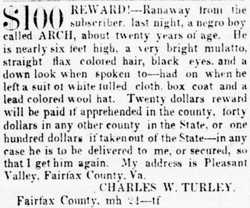
    15. Craven, Avery Odelle. Soil Exhaustion as a Factor in the Agricultural History of Virginia and Maryland, 1606-1860. Columbia: University of South Carolina Press, 2006. p. 19-20.
    16. ibid 68.
    17. Netherton, Nan, Donald Sweig, Janice Artemel, Patricia Hickin, and Patrick Reed. Fairfax County, Virginia: A History. Fairfax: Fairfax County Board of Supervisors, 1978. P. 184-185.
    18. Craven, Avery Odelle. Soil Exhaustion as a Factor in the Agricultural History of Virginia and Maryland, 1606-1860. Columbia: University of South Carolina Press, 2006. p. 94.
    19. Gamble, Robert S. Sully: The Biography of a House. Chantilly: Sully Foundation, 1973. p. 78.
    20. Genovese, Eugene D. The Political Economy of Slavery. Middletown: Wesleyan University Press, 1989. p. 89.
    21. Netherton, Nan, Donald Sweig, Janice Artemel, Patricia Hickin, and Patrick Reed. Fairfax County, Virginia: A History. Fairfax: Fairfax County Board of Supervisors, 1978. P. 184-185.
    22. ibid 261.
    23. Abbott, Richard H. “Yankee Farmers in Northern Virginia, 1840-1860.” The Virginia Magazine of History and Biography 76, no. 1 (1968): 56-63. https://www.jstor.org/stable/4247368
    24. Alexandria Gazette: 1834-1974. Chronicling America: Historic American Newspapers. Library of Congress. <https://chroniclingamerica.loc.gov> January 18, 1843. p. 3, col. 6. 
    25. Fairfax Gazette. Virginia Chronicle: Library of Virginia. <https://virginiachronicle.com> Vol. 1, Number 4, 25 April 1843. P. 1, col. 3. 
    26. Alexandria Gazette: 1834-1974. Chronicling America: Historic American Newspapers. Library of Congress. <https://chroniclingamerica.loc.gov> February 10, 1847. p. 1, col. 6. 
    27. R.H.P. “Timber Deeds in Virginia.” Virginia Law Review 37, no. 6 (1951): 885-99. https://doi.org/10.2307/1069334
    28. Alexandria Gazette: 1834-1974. Chronicling America: Historic American Newspapers. Library of Congress. <https://chroniclingamerica.loc.gov> July 20, 1853. p. 2, col. 7. 
    29. Alexandria Gazette: 1834-1974. Chronicling America: Historic American Newspapers. Library of Congress. <https://chroniclingamerica.loc.gov> February 1, 1856. p. 3, col. 2. 
    30. “Benjamin Thornton, Joseph Thornton, & Samuel Stead: English Rascals, Vienna-Area Landowners.” Vienna Virginia History. September 5, 2022. Https://viennavahistory.com/2022/09/05/benjamin-thornton-joseph-thornton-samuel-stead-english-rascals-vienna-area-landowners/
    31. Alexandria Gazette: 1834-1974. Chronicling America: Historic American Newspapers. Library of Congress. <https://chroniclingamerica.loc.gov> July 10, 1857. P. 3, col. 3. 
    32. Harwood, Jr., H.H., Rails to the Blue Ridge. Falls Church: Pioneer America Society, 1969. p. 2-3.
    33. Huston, James L. The Panic of 1857 and the Coming of the Civil War. Baton Rouge: Louisiana State University Press, 1987. p. 70-71.
    34. Alexandria Gazette: 1834-1974. Chronicling America: Historic American Newspapers. Library of Congress. <https://chroniclingamerica.loc.gov> November 13, 1856. P. 3, col. 6.
    35. Alexandria Gazette: 1834-1974. Chronicling America: Historic American Newspapers. Library of Congress. <https://chroniclingamerica.loc.gov> March 3, 1856. P. 3, col. 7. 
    36. Alexandria Gazette: 1834-1974. Chronicling America: Historic American Newspapers. Library of Congress. <https://chroniclingamerica.loc.gov> December 25, 1858. P. 3, col. 6. 
    37. Gunnell owned a good chunk of Ox Hill from Ox Junction to the Little River Turnpike and east to a point roughly coinciding to the eastern boundary of today’s Penderbrook golf course. An account penned by Colonel AJ Grigsby of Winder’s Confederate Brigade described this area as “a densely-wooded crest.” The War of the Rebellion: Official Records of the Civil War. Ohio State University eHistory. <https://ehistory.osu.edu/books/war-rebellion-official-records-civil-war> Serial 027 Page 1010 “OPERATIONS IN N.VA., W.VA., MD., AND PA.” Chapter XXXI.
    38. United States Agricultural Census 1870. ancestry.com. <https://ancestry.com/search/collections/catalog/> Fairfax County.
    39. Fairfax Co., 1880-017, Cff102J. Chancery Records Index. Virginia Memory—Library of Virginia. <https://lva.virginia.gov/chancery/>
    40. Alexandria Gazette: 1834-1974. Chronicling America: Historic American Newspapers. Library of Congress. <https://chroniclingamerica.loc.gov> September 24, 1877. P. 3, col. 6. 
    41. Alexandria Gazette: 1834-1974. Chronicling America: Historic American Newspapers. Library of Congress. <https://chroniclingamerica.loc.gov> March 15, 1878. P. 3, col. 6. 
    42. Alexandria Gazette: 1834-1974. Chronicling America: Historic American Newspapers. Library of Congress. <https://chroniclingamerica.loc.gov> August 26, 1881. P. 1, col. 3. 
    43. O’Neill, Robert F. Chasing Jeb Stuart and John Mosby. Jefferson: McFarland & Company Inc, 2012. p. 207. 
    44. Stackpole, Gen. Edward J. Chancellorsville. Harrisburg: Stackpole Books, 1988. P. 101-102.
    45. Mosby, John Singleton. Reminiscences. New York: Dodd, Mead & Company, 1887. P. 19.
    46. Alexandria Gazette: 1834-1974. Chronicling America: Historic American Newspapers. Library of Congress. <https://chroniclingamerica.loc.gov> January 2, 1863. P. 2, col. 1. 
    47. Keen, Hugh C. And Horace Mewborn. 43rd Battalion Virginia Cavalry Mosby’s Command. Lynchburg: H.E. Howard, Inc, 1993. p. 6. 
    48. Evans, D’anne A. The Story of Oakton, Virginia: 1758-1990. Oakton: The Optimist Club of Oakton, 1991. p. 63.
    49. Jones, Virgil Carrington. Ranger Mosby. Chapel Hill, University of North Carolina Press, 1944. p. 90. 
    50. O’Neill, Robert F. Chasing Jeb Stuart and John Mosby. Jefferson: McFarland & Company Inc, 2012. P. 207. 
    51. Nelson, Megan Kate. Ruin Nation: Destruction and the American Civil War. Athens: University of Georgia Press, 2012. p. 104-120. As cited in Boutin, Cameron. “The Roles of Natural Environments in the American Civil War.” Armstrong Undergraduate Journal of History, Vol. 5, Issue 2. 2015. 
    52. Netherton, Nan, Donald Sweig, Janice Artemel, Patricia Hickin, and Patrick Reed. Fairfax County, Virginia: A History. Fairfax: Fairfax County Board of Supervisors, 1978. p. 371. 
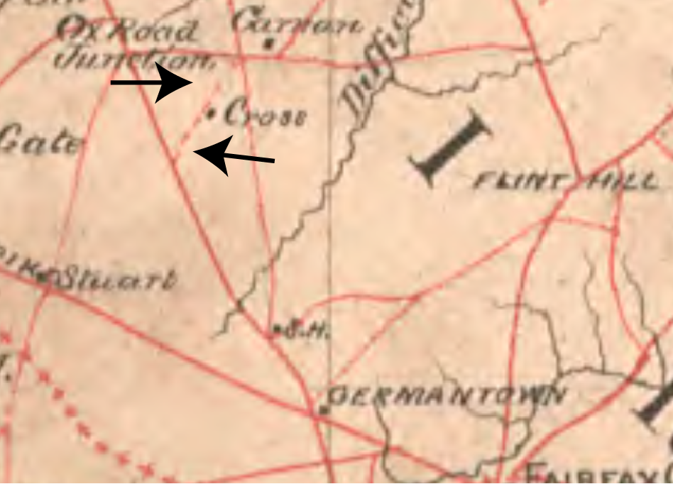
    53. Johnson II, William Page. “McClellan at Fairfax Court House: First Advance of Army of the Potomac.” The Fare Facs Gazette 9, no. 1 (Winter 2012): 1-17. https://historicfairfax.org/wp-content/uploads/2012/05/HFCI91-2012.pdf 
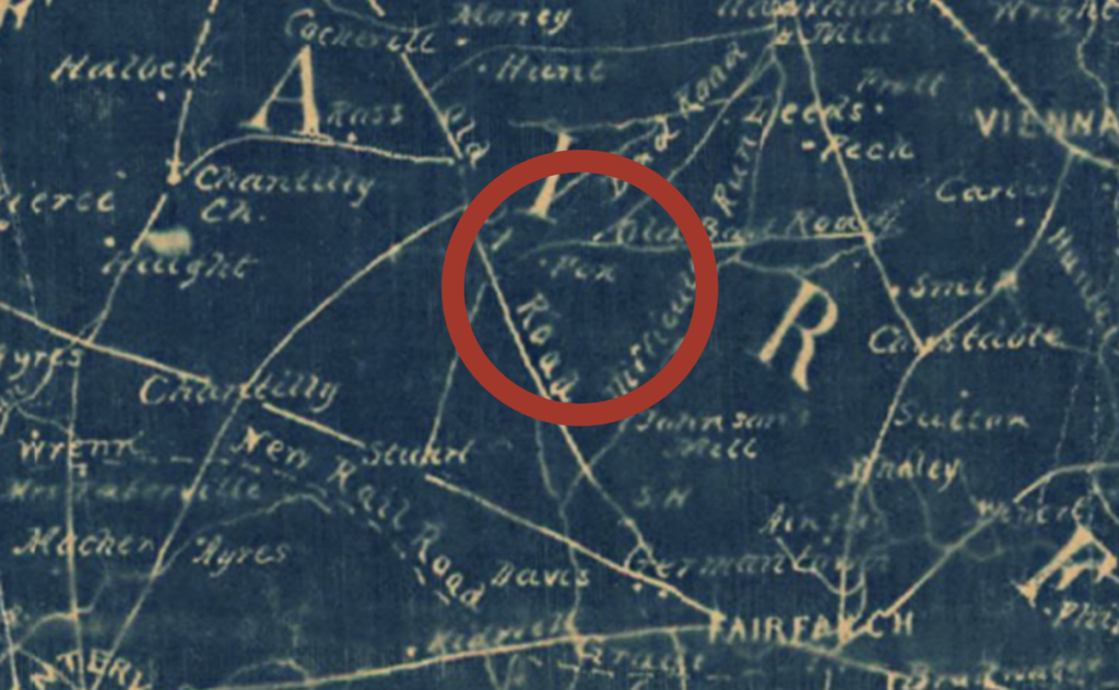
    54. Southern Claims Commission Records. ancestry.com. <https://ancestry.com/search/collections/catalog/
    55. Crouch, Howard R. “A Virginia Artillery Camp at Centreville, Virginia.” HSFC Yearbook 19 (1983): 65-71. https://archive.org/details/hsfc-yearbook-volume-19
    56. Joe Reeder Interview. Conducted with Jason Hampel at Squirrel Hill sometime in 2013. Video provided by Jason Hampel. 
    57. Box 1, Folder 3: “Vale History: From Money’s Corner Through Difficult.” 1991-1995. Joy S. Starr Collection on Vale History. Collection 06-18. Virginia Room. Fairfax County Library.
    58. Friedman, Andrew. Covert Capital. Los Angeles: University of California Press, 2013. p. 94. 
    59. Buckingham, William A, Jr. The Air Force and Herbicides in Southeast Asia: 1961-1971. Washington, D.C.: Office of Air Force History, 1982. https://nal.usda.gov/sites/default/files/agent-orange/04154.pdf p. 72. 
  • Complex Places

    Complex Places

    (Surveyed from 1911-1912 and engraved in 1915, this early-20th century topographic map of Fairfax is a unique informational datum for place and form in an ever-changing landscape.)

    TL;DR–Places are always constructed and dynamic, never stationary, and rarely purely natural.

    It’s easy to forget that the Civil War was fought on a planet spinning at a thousand miles an hour while it hurtled through space going 67,000 miles per hour around the sun. 

    Our civil war is a hyper object—a massive thing that weighs heavily against the fabric of history. The minutiae of the conflict and its broad scope represent immense challenges to subject mastery.1 We struggle to get our arms around the whole thing. Many—myself included—choose to pick apart tiny corners of the thing to get even the smallest taste of understanding. 

    Fashioning the amorphous flood of sources and sentiments that fed into, crystallized, and erupted from the war years has occupied the efforts of generations’ worth of historians far more talented than I. Standing on their shoulders affords an opportunity to step back and question a necessary evil of Civil War historiography.

    For simplicity’s sake, much of history is built on the assumption that historical subjects are actors on a stationary stage. They deliver their lines and act out their arcs. We applaud or hiss. The theater remains roughly the same. The boards that absorb so much shoe leather wear out in place. We can predict where the curtain will fall and where all the exits are. 

    The existing stable state model is brilliant in use cases where it’s appropriate to obsess over the events of a single afternoon. As soon as you begin to wonder about longer stretches of time, a certain uneasy shifting can be felt beneath the feet. This is seasickness; a deep understanding that you are in motion married to a constructed conviction that you remain in place.

    Maybe this explains why Bruce Catton and Shelby Foote were content to follow the armies through the war. The momentum of retrograde maneuvers and brave advances masks the nauseating churn of life in a dynamic world. 

    I am not so lucky. My area of expertise belongs less to the soothing swing of great campaigns and more to the queasy undulations of an idea called place. 

    Grappling with a fragment of a watershed—thirteen square miles of uncelebrated creek valley, forest, and thicket in Northern Virginia—invites the frequent use of the single most destabilizing word in the English language: why. 

    Why did roads appear? Why did populations concentrate where they did? Why have people been drawn to this place for thousands of years? Why does this valley rarely appear in histories of the Civil War? Why is there mounting evidence that this place nonetheless figured prominently in the conflict? 

    The simple answer is also the most compelling: it’s complex. 

    All places are complex. Any attempt to argue otherwise is futile and foolish. This also explains why we avoid wrestling with the complexity of place when we tell stories. Simplicity in setting foregrounds humans and magnifies their agency. We are a vain species, after all. One that loves telling stories about ourselves. Sharing the limelight with the inanimate has never been our forte. 

    Personally, I think the time is right to invert that pattern. In an age of influencers and celebrity-worship, it can feel cathartic to decenter people from narratives. Besides, we live in the Anthropocene where we’re keenly aware of our impact on the natural world. So too, the increasing litany of catastrophic and unprecedented natural disasters invites a dialogue that frames the world as an ecosystem of phenomena and not necessarily a hierarchy with humanity sitting tall on top. 

    I want to share the framework I’ve explored as both corollary and necessary precondition to studying the place where I was raised. Like Deleuze and Guattari offer in “Of the Refrain,” “what is necessary is a simple figure in motion and a plane that is itself mobile.” Let’s stand still together for a second and let the world spin around us.2 

    (In December of 1915, DC-newspaper correspondent and enthusiastic atavist, The Rambler, ducked once more into Difficult Run where he photographed and journaled about the charcoaling operation that heavily altered the basin’s landscape. LoC. Evening Star: December 12, 1915.)

    Somersaulting Through Time

    In a letter from December 1817, John Keats credited Shakespeare’s success to an esoteric psychological skill set that could be useful for our purposes. “I mean negative capability,” Keats wrote, “that is, when a man is capable of being in uncertainties, mysteries, doubts, without any irritable reaching after fact and reason.”3

    Negative capability—the ability to embrace uncertainty and allow contradicting impulses to exist side by side without feeling the need to subordinate one beneath the other—is valuable when considering places. 

    The Virginia Site and Soil Evaluation advises that “a landscape is a collection of related landforms.”4 A monolithic face fractures into many smaller components upon closer inspection. Still deeper analysis reveals a wide variety of constituent parts therein: rocks and plants and animals. All of which have different properties that respond to one another in different ways. Over a long enough timeline, higher level forces like tectonics or climate cause these supposedly inert forms to collide and act upon each other. 

    Systems of systems is probably the best way to put it, because living and non-living facets of the natural world that share spaces adapt or conform to one another in interesting ways that support or squash certain modes of life. Other groupings flourish nearby and the adjacencies where they collide—the infinitely prolific ecotones—incubate still other forms of life. There is an inexpressible complexity to this physical world.

    At a raw level of first nature set to the tempos of deep time where the impact of humankind is barely a trifling concern, our complex world and its many landscapes express a dynamic equilibrium. There is no single story or narrative that can render these spaces in high-fidelity. Instead, it’s worth considering that the supposedly straight forward track of natural systems is actually the mean tally of the contradictory net forces pushing against one another to constitute that place. Wendy Smith and Marianne Lewis put it best whey they describe systems as gyroscopic shock absorbers that find balance by “adapting to a continuous pull in opposing directions.”5

    This alone might be enough to challenge preconceptions about the stage upon which human events play out, but this model of dynamic equilibrium needs to be augmented and amplified before it’s sufficient. Assuming that nature is a closed loop neglects an impactful force on the world: human agency. 

    Landscape phenomenologist Christopher Tilley describes the deceptively invisible and impactful human/nature interfaces that exist in every place. Says Tilley, “A centered and meaningful space involves specific sets of linkages between the physical space of the non-humanly created world, somatic states of the body, the mental space of cognition and representation and the space of movement, encounter and interaction between persons and between persons and the human and non-human environment.”6

    Murray Bookchin offered a version of these same ideas wrapped in the more conversational shorthand of social ecology. Bookchin’s theories elaborate on models depicting a sum of processes shaping the natural world by suggesting that human processes entangle themselves with the natural world. This social dynamic finds abstract patterns like philosophy, culture, cosmology, psychology, and economics honing concrete behaviors like agriculture, land use, building science, infrastructural development, and transportation that both act upon the physical world and are acted upon by this same material world in kind.7

    Just as succession patterns and system stabilizing responses in the natural world channel the reverberations of impactful events in the distant past, human processes focus, interpret, and sublimate a long dependency chain of perceived pasts. 

    For better or for worse. Often these pasts are not entirely pleasant. Yesterday’s tragedies have a way of becoming the bone broth starter for the soupy morass we humans float through today.

    In The Body Keeps the Score, Bessel Van Der Kolk offers scientific proof of an intuitively understood phenomenon, by which trauma lives in the body of the traumatized. “Long after the actual event has passed,” says Van Der Kolk, “the brain may keep sending signals to the body to escape a threat that no longer exists.”8 

    These signals are powerful enough that they do not die with the body, but communicate downwards by genetic inheritance through the branches of the family tree. What one acutely self-aware sufferer might recognize as an inorganic behavior learned by a person to overcome a traumatic event has the potential to propagate, broaden, and ultimately crystallize from an informal reaction into a rigid cultural form. 

    Thomas Moynihan elaborates a particularly bleak take away from this mode of thinking that bridges epigenetic behavior with long term physiological evolution. In Spinal Catastrophism, Moynihan postulates that the human neural system itself is a refined pattern of pain responses. Moynihan eventually asks a question designed to draw electric pangs of anxiety from the sacrum up to the brain stem: “What is a spine and a brain other than a way for trauma to enter into self-relation and to recollects its history?”9

    If this reactive, solipsistic, long-suffering articulation of trauma shapes behaviors that ultimately pour into relationships with and on space, it is not alone. In one of his more cogent and conciliatory passages, Nick Land pours the foundations for a model of earth history he coins “geotrauma.” Here, ancient catastrophes ripple forwards in time and leave marks on the natural world in much the same way human history sears itself into generations of homo sapiens. 

    “Fast forward seismology,” Land quips, “and you hear the earth scream.”10

    These traumatic ecologies—be they natural or humanistic—have become the subject of intense inquiry under the auspices of Chaos Theory. A sub-sect of which obsesses over “complex adaptive systems.” This school of non-linearity eschews the idea that world dynamics achieve a laminar forward flow. As if to borrow from the dynamic model, complex adaptive systems study the push and pull of contradictory forces that nudge, shove, or draw systems—including geologic landscapes, biomes, and human societies—into “basins of attraction” that are intensely sensitive to initial conditions. Crucially, a sensitivity to yesteryear’s horror, be it the collision of continents or the Thirty Years War, affects the properties that emerge when all this complexity stews together.11

    Suddenly the static stage has absorbed all of human history as a mere foot lamp in a higher drama with huge arcing feedback loops and possibilities for tectonic ruptures. It’s almost too much to handle. Our world has been and continues to be shaped by energetic and often painful cross-currents that resemble more the sheer patterns and shifting track models of a hurricane than the steady simplicity of a road map.

    The easiest way to begin to come to grips with the immensity of potentials from which our spatially-rooted existence has been carved is to consider its most accessible expression: place. As Susanne Kuchler theorizes, landscape is memory.12 For an astute observer staggering beneath the existential weight of complex trauma that informs our world, braiding these forces in an understanding of place can be a tremendous relief.

    The earth is striated and scarred. It has been plotted, carved up, extracted from, augmented, folded, flooded, and burned in ways that bear silent testament to intensely intriguing and immensely concerning narratives of both nature and mankind.

    Interpreting this world requires a change in language to accompany a change in perspective. Gone are the actors from the old stage. In their place, we struggle to articulate a vomitorium of effects: variability, resilience, persistence, resistance, sensitivity, surprise, possibility, aspiration, colonization, erosion, weathering, wasting, and cohesion. This is the language of complex places. A phraseology of slippery focus where man and its domain cannot be fully separated from one another. 

    (Located in a predominantly poplar grove east of Difficult Run at Waples Mill, this long-tenured wolf oak hints at a possible former home or barnyard site located nearby. A considerable amount of oak was harvested from the area after the Civil War. This enduring tree could have served a household shade function at the Eugenia Fox farm.)

    Perceptive Divide

    These negotiations are rough as is. Taking spaces for granted only to have some blogger inculcate you into a deep time network of complex power dynamics is its own trauma.

    Unfortunately, we haven’t gone far enough yet.

    If we perceive place as a system of contradictory impulses negotiating itself, we owe it to ourselves to reconcile how similarly ambiguous interpretations buck consensus in the way humans see landscapes and negotiate their meaning. 

    Dickering about the when and where in natural histories demands that we quibble about the how and why in human perception. Like Heraclitus and his river, the species never produces the same mind twice. Rarely do two humans who have not been coerced into agreement by media of some form achieve natural consensus on their own. 

    As discussed previously, the thinking, perceiving brain is not a zero-degree device that enters the world free from bias. Thousands of years of ancestral experience leave fingerprints on our gray matter. So too, the earliest circumstances can drastically affect vision. Would Ted Kaczynski have become the Unabomber if he hadn’t have been put in full hospital isolation at nine months old? Could we have avoided the Holocaust if someone had just validated Adolf Hitler’s greeting card art? These are contingent, but important considerations.

    In “The Beholding Eye,” D.W. Meinig connects the panoply of potential human perceptions to the all-important locus of place. Frameworks from the aesthetic to the historical to basic survival became archetypal relationships between mankind and its surroundings for Meinig, who prefaces the essay by offering wisely that “the individuality of places is a fundamental characteristic of subtle and immense importance to life on earth, that all human events take place, all problems are anchored in place, and ultimately can only be understood in such terms.”13

    With so many adventures to choose between, Meinig accounts for the somersaulting variability of self-reference with which humans of similar backgrounds and shared geographies can embody so many divergent ideas about their habitat. Nostalgia, progressivism and barren doom co-exist with opportunism, radical indifference, and a blissful concept of infinite bounty in simultaneous and complex interrelationships. 

    Put simply: there is no single consensus, no exclusive ownership over the interpretation of place. Instead, another degree of complexity emerges in the form of parallax. Two people can look at the same place and have entirely different interpretations. Yikes. 

    An excellent example looms large in Fairfax County, Virginia, where a team of preservationists fought doggedly in the late-1980s against Jack Herrity, the development-inclined Chairman of the Board of Supervisors, to save the Chantilly Battlefield. Herrity saw the place’s highest and best use as a shopping mall while Ed Wenzel and Bud Hall felt the battlefield deserved preservation. You can guess where my allegiances fall. Even two decades later, people with whom I grew up and shared an identical education with felt very differently than I. Go figure.

    Inevitable conflict between perceptions of purpose for place spill over into ruptures of scale. We delimit place and its processes in curious ways that are not uniform. This, in turn, begs another layer of complexity—time. 

    In what remains an avant garde curiosity deep in the complex adaptive system of historiography, Reinhart Koselleck bandied about the idea that continuity and rupture coexisted within recurring structures and phenomena of perceived time. The long and the short of his offering was that differing ideologies produced different awareness of temporal position. This accounts for the aching laments of people who perceive themselves as having been born too late or too soon or those who feel either bored to tears by their age or utterly frightened by its rapidity.14 

    The stratified temporal angle is important, because time is inherently bounded in space. If an ideology or inherited mentality can shape the way we understand the tempo and hour of our existence, it can surely translate into important variations in the way people perceive the vessel of time: place. 

    Storms of interdependent complexity that surround places are more than heady abstractions. They are productive, constitutive, definitive mechanisms for concrete things. Like a loom, human and natural systems interweave to create a geographic fabric in which history appears as flecks of color or texture. 

    The trick is to read the often confusing, if beautiful, patterns that splash and run across so much warp and weft. Magma cools and butts upwards before continents collide and bake the earth into a soil form that favors melting away against the last tendrils of glaciation so that a valley of alluvial soil set amongst calorie-rich acorn forests unfolds beneath a seam of white quartz suitable for the creation of hand tools, which was set at a confluence of ridges that became roads that later ushered a group of tobacco farmers down into that deep cut valley where they eventually learned to produce wheat before shepherding timber and sheep that their sons killed enthusiastically to preserve before the forests became fields for dairy and the fields became homes for people who used rare earth to make machines talk to one another—each successive generation interpreting and extracting from this same place. 

    Or at least that’s how I see it, because these same complex processes that have loomed the varied threads of Difficult Run together over millennia have woven me in place as well. This final conceit is the most important. I, too, am a complex person who is the product of a complex place. My genetic and cultural inheritance informs the way I act upon and interpret my place, which acts upon me reciprocally in ways I do not fully understand.

    Don’t forget, Dan: you are in a complex place, hurtling through space away and toward things that are truly unknowable.

    Sources
    1. For anyone with a hunger for a quasi-psychedelic philosophy to undergird new perspectives on the war, Harman’s chapter on the American Civil War here is a magnificent portal. Harman, Graham. Object-Oriented Ontology: A New Theory of Everything. New York City: Penguin Random House, 2018. p. 114.
    2. Deleuze, Gilles, and Felix Guattari. A Thousand Plateaus. Minneapolis: University of Minnesota Press, 1987. P. 344. 
    3. Wigod, Jacob D. “Negative Capability and Wise Passiveness.” PMLA 67, no. 4 91952): 383-90. https://doi.org/10.2307/459816
    4. Conta, Jay, Tom Saxton, Erik Severson, and Steve Thomas. Virginia Site and Soil Evaluation Curriculum. Richmond: Virginia Department of Health, 2014. https://vdh.virginia.gov/content/uploads/sites/20/2016/05/Virginia-Site-and-Soil-Evaluation-Curriculum_2014.pdf p. 43. 
    5. Smith, Wendy K. And Marianne W. Lewis. “Toward A Theory of Paradox: A Dynamic Equilibrium Model of Organizing.” The Academy of Management Review 36, no. 2 (2011): 383-403. https://www.jstor.org/stable/41318006
    6. Tilley, Christopher. A Phenomenology of Landscapes. Oxford: Berg, 1994. p. 10.
    7. Best, Steven. “Murray Bookchin’s Theory of Social Ecology: An Appraisal of ‘The Ecology of Freedom.’” Organization and Environment 11, no. 3, (1998): 334-53: https://www.jstor.org/stable/26161633.
    8. Van Der Kolk, Bessel. The Body Keeps the Score. New York City: Penguin Books, 2014. p. 54.
    9. Moynihan, Thomas. Spinal Catastrophism. Windsor Quarry: Urbanomic, 2019. p. 267.
    10. Land, Nick. Fanged Noumena. Cambridge: Urbanomic, 2011. P. 499.
    11. Lansing. J. Stephen. “Complex Adaptive Systems.” Annual Review of Anthropology 32 (2003): 183-204. https://www.jstor.org/stable/25064826
    12. Kuchler, S. “Landscape as Memory: the Mapping of Process and Its Representation in a Melanesian Society,” in B. Bender (ed.) as cited in Tilley, Christopher. A Phenomenology of Landscapes. Oxford: Berg, 1994.
    13. Meineg, D.W. “The Beholding Eye.” In The Interpretation of Ordinary Landscapes: Geographical Essays. New York: Oxford University Press, 1979. https://csun.edu/~rdavids/404JAF09/404JAreadings/Meinig_The_Beholding_Eye.pdf 
    14. Koselleck, Reinhart Javier Fernandez Sebastian, and Juan Francisco Fuentes. “Conceptual History, Memory, and Identity: An Interview with Reinhart Koselleck.” Contributions to the History of Concepts 2, no. 1 (2006): 99-127. Https://www.jstor.org/stable/23731013.
  • Amos Fox’s World

    Amos Fox’s World

    TL;DR—The life of the prodigal son of Fox’s Mills reminds us of the inherent complexity of people living on Difficult Run in the 19th century.

    No known photos of Amos Fox survive. We have to rely on this image of his twin brother, Lt. Frank Fox of Mosby’s Rangers to satisfy our curiosity.
    The Real War

    Writing ten years after Appomattox, Walt Whitman warned us. 

    The poet laureate of the antebellum/post-war divide rightly contended that “the real war would never get in the books.” Whitman worked across a traumatic threshold in American history that closed with a narrative crystallization which served to scab over the horror and confusion of the  lived war. 

    As a poet, Whitman was rightly concerned about the consequences of a memorialization that privileged big and simple ideas of the war. This tendency to simplify, Whitman contended, had the unintended effect of obscuring a tapestry woven from small and complex psychic landscapes. This miniature phenomenological topographies were already melting away from the war generation against the warmth and tumult of mass media, industrialization, and the reductionism of the Gilded Age. 

    “Such was the war,” penned Whitman. “Its interior history will not only never be written—its practicality, minutia; of deeds and passions, will never be even suggested. The actual soldier of 1862-’65, North and South, with all his ways, his incredible dauntlessness, habits, practices, tastes, language, his fierce friendship, his appetite, rankness, his superb strength and animality, lawless gait, and a hundred unnamed lights and shades of camp, I say, will never be written—perhaps must not and should not be.”1

    These words came from the pen of a man who self-described as a constellation of multitudes. The connection, if not obvious, is intuitive. Whitman’s sense of self and his grasp of the substance of the Civil War intersected in a notion that words were still insufficient to reproduce either accurately. 

    The people who fought and lived through the war were not statuesque. They were cast in bronze much later in an attempt to make sense of what had transpired. The war generation itself was not so simple and not so easily reduced. 

    Understanding these people requires a healthy dose of the Whitman perspective—a hunger for the multitudinous and a certain comfort with contingency. Only in the realm of possibility and ambiguity does life and its infinite could-have-beens congeal into something approaching the reality of lived experience. 

    No figure along Old Bad Road stretches the shadowy framework of complex biography and contradictory personage more than Amos Fox. 

    The real Amos Fox has never and will never get in the books. Too much has been lost. 

    What remains is a raft of biographical information relating snippets from the life of the eldest son of the Fox milling family. Every additional fact seems to bring the mosaic of his life further out of focus. In selective retrospective, contradiction was the guiding principle of his life.

    Born rich in the comparatively poor Difficult Run valley, Amos was often cash-strapped. The idyllic milling landscape that lined his family’s pockets only drove him away into the faster life of nearby towns and cities. There, fortune forever eluded him. Brash, outspoken, hot-headed, and chivalric, Amos surrounded himself with secessionist friends and ideology in the years before Fort Sumter, yet failed to muster with his militia company and was never found in Confederate service. The war nonetheless treated him unkindly. His livelihood evaporated and his family imploded. Amidst the spartan retrenchment of Post-War Fairfax, Amos Fox sought relief in the escapism of bacchanalia. Despite a total want of military service, he took on the appearance of a tough guy and alienated the community of his birth in the process. He eventually found a place for himself in Alexandria, but was a constant presence in Fairfax County. Though his name never graced the fastidious rolls for Mosby’s Rangers, his obituary claimed otherwise. 

    Named today after the Waples family that bought Gabriel Fox’s mill after the war, this meadow in Oakton, Virginia, would have figured prominently in Amos Fox’s childhood. Remnants of the mill race remain in the woods to the right.
    The Shape of Amos Fox

    Who was this man? 

    He was a twin. Likely the older of the two, because James Amos Fox bore the privileged family name of his father’s father. The original Amos Fox moved the family from New Jersey in the 1780s and purchased land along Difficult Run where he created a successful milling business. 

    Unlike most of the tenant farmers or low-earning property owners whose meager agricultural products patronized Fox’s Mills, we cannot be sure of the circumstances surrounding the birth of Amos and his twin brother, Frank. 

    The Fox family had money. With money came prestige and connections in Alexandria. It is likely these connections helped Amos and Frank’s father familiarize himself with Jane Millan, their mother. Jane was herself born into a wealthy family. The Millans owned a substantial plot of prime farming acreage near what is now the Fair Lakes development and the county dump. Jane Millan’s own familial prestige probably brought her into contact with her first husband, Harvey Summers, who was himself the scion of a wealthy land-owning family.

    Neither her upbringing nor the death of her first husband in 1820 nor her marriage to Gabriel Fox found Jane flirting with poverty. To the contrary, we know from the memoir of her granddaughter, Sally Summers Clarke, that Jane Millan Summers Fox maintained a house in Alexandria until the outbreak of the Civil War. In fact, there was a great to-do at Fox’s Mills when the relatively sophisticated urban slaves Jane owned met the “country” slaves she kept along Difficult Run.2

    Amos and Frank’s father owned Squirrel Hill, a prime home that has been integrated into a modern structure along today’s Lyrac Street, not far from the location of Fox’s Mills. Still, Jane Fox’s children from her first marriage were born in Alexandria. It is not known how she chose to deliver Amos and Frank. 

    If Amos wasn’t born in Fox’s Mills, he was certainly raised there. The Fox Family enjoyed a near monopoly on land and infrastructure for much of the mid-1800s. Many others moved in to the area, farmed its fields, and harvested timber from its hillsides, but no surname meant more than Fox. Multiple branches of the original line forked and set about in developing a couple thousand acres of productive grazing lands. Better still, Amos and Frank’s father and his three mills were well positioned to purchase raw wheat, wool, and hardwood to be sold at a premium for export at Alexandria. 

    Sarah Summers Clarke’s account of pre-war Fox’s Mills depicts a pastoral wonderland rich with bullfrogs and sunny afternoons set amidst the bucolic rhythms of prosperous farm life. This life captured neither Amos Fox’s imagination nor aspirations.

    In 1844, when Amos and Frank were thirteen, their father, Gabriel, died. A glowing obituary depicted a man who was both an astute entrepreneur and a generous humanitarian.3 Four years later, their remarried for the third and final time. Her ultimate groom was Richard Johnson, himself a widower whose family’s sprawling Fauquier County wheat holdings propelled him into Alexandria society.4

    Gabriel Fox’s obituary from page 3, column 2 of the September 4, 1844 Alexandria Gazette.

    Richard Johnson was an adroit administrator of Jane’s resources. He became guardian for the Fox children and saw to the annual leasing of their inherited slaves. Eventually, he became the operator of Fox’s Mills. 

    An awkward situation emerged as Amos and Frank grew into adulthood. Dickering about an inheritance materialized in a bizarre 1850 legal case, by which Jane Fox sued her children for administrative control over her deceased husband’s assets.5 There are connections between Frank, Fox’s Mills, and his new stepfather that extend well into the war years, but Amos’ connection with the Difficult Run Basin appears to have withered in the years after his father’s death.

    The 1850 census records both Frank and Amos living as boarders in Fairfax Court House. Amos is listed as a barkeeper. Thus begins the first pivot of Amos Fox’s adult life. While his twin brother became a farmer, Amos was drawn to hospitality and nightlife, which are generous ways of framing a constitutional thirst for a faster lifestyle premised on alcohol. 

    Amos would have been no stranger to liquor. His family manufactured it at their mill, as was commonplace anywhere in the United States where grain was processed. An 1817 sale listing for Fox’s Mills lists “a new Stone Distillery, 36 feet square, supported by a never failing spring of water.”6

    It would be extraordinary if young Amos had access to this facility and its products for his entire childhood but only sampled alcohol for the first time when he moved to Fairfax Court House in his late teens. 

    Either way, Amos found both a new home and a new role model at the Union Hotel in Fairfax Court House. 

    A barkeeper position at the Union—later the Willcoxon Tavern—would have afforded Amos a ringside seat for the dramatic circus that unfolded across the street at the county court house. More to the point, Amos was under the tutelage of the single greatest source of drama in Fairfax Court House—Union Hotel proprietor, James W. Jackson.7

    Jim Jackson’s business card courtesy of the Library Company of Philadelphia.

    Given the turn James Jackson’s life would take in the next decade, the choice of name for his establishment was a curious one. Jackson was a proud Southerner and a staunch secessionist. Shortly after John Brown’s Harpers Ferry Raid in 1859, Jackson began scouring the county for abolitionists, even going so far as to undertake a citizen’s arrest of two men he found circulating Hinton Helper’s book, which had incensed many Southerners with its incisive critique of slave-holding society.8

    A December 1860 court order named Jackson as a captain of the night patrol and put twenty nine privates under his command. Jackson apparently declined the honor, but the statement was out there: Jackson was the sort of guy local secessionists would empower to command a roving pack of armed men designed to meted out justice to any would-be abolition-inclined terrorists thought to be lurking in the shadows of Fairfax County.9

    Jim Jackson, who some doting genealogists on Family Search have enshrined as a “Southern Martyr.” Closer to the truth would be an epitaphic borrow from Tombstone screenwriter, Kevin Jarre: “he was just too high strung.”

    On January 21, 1861, a special legislative election convened in Fairfax Court House to determine who would represent the district in the General Assembly. The fire-eater candidate, Alfred Moss, eventually won the race, but not before an extremely contentious scene played out on the Court House steps. Prominent members of Fairfax society wielded pistols in an attempt to intimidate would-be Unionist voters. Among those who freely dealt in violence that day was Jim Jackson. Unionist and future Federal Scout Jonathan Roberts remembered that Jackson and “his gang of bullies” were throwing their weight around outside the Fairfax County Court House.10

    There is a strong possibility that Amos Fox was among this gang of bullies. Over the previous ten years, he shaped his life to intersect that of his employer and mentor, Jim Jackson. We also know that Amos was an eager recruit to the Fairfax Riflemen, the local pro-Southern militia that coalesced in 1859 to anticipate the coming war.11 The kinetic posturing of the pre-war period appealed to him.

    Less obvious is a pattern of questionable financial decisions, by which Amos began to leverage inherited property and family prestige to secure luxury goods consistent with someone desperate to ingratiate themselves with a status-conscious impresario. 

    Liquidation was the order of the day in 1858 when Amos sold Lloyd Kidwell his inherited plot of sixty acres abutting Fox’s Lower Mill.12 A year prior, Fairfax courts ordered Amos to remand $321.62 to notorious lender JC Gunnell, from whom Amos had borrowed the funds a year earlier.13 In the same month he earned six hundred dollars from a land sale, Amos was similarly court-ordered to pay yet another local loan shark, JR Grigsby, the princely sum of $1231.14 

    Term papers from still another debt case from 1860 include a list of fine clothing items that Amos Fox had purchased on bad credit from William Massey.15 

    A glimpse into Amos Fox’s spending habits to be found in Fairfax Term Papers 1860-439. Courtesy of the Honorable Christopher J. Falcon, Clerk of Court.

    We will never fully know how the coins that slipped through Amos’ hand were spent. A helpful hint comes at the place where Jim Jackson, Amos Fox, and doomed hospitality establishments intersect with the main line of American history.

    Sally Summers Clarke, memoirist of antebellum Fox’s Mills and niece to Amos Fox, described her Uncle as a “partner” to Jim Jackson. By early 1861 the two men were co-proprietors of the Marshall House in Alexandria, Virginia.16

    In what was potentially one of the most boneheaded business decisions of all time, Jim Jackson and Amos Fox, known hotheads and secessionists, moved their hotel operation in 1861 from the relative safety of Fairfax Court House, preferring instead to open a new venture in 1861 just across the Potomac River from Washington, D.C. in Alexandria, Virginia. An intensely optimistic advertisement in the Alexandria Gazette from January of 1861 promised that Jackson and Company were “prepared to receive, and entertain in true Virginia style, his friends and the public generally” at the corner of King and Pitt Streets.17

    Wartime image of the Marshall House complete with its famous flagpole. LoC.

    In a sense, Jim Jackson was prepared to receive in true Virginia style. The already prominent four story structure was quickly affixed with a twenty foot flag pole, upon which Jackson rigged a large Confederate flag that could be seen waving from across the river in the Federal capitol. 

    On May 24, 1861, Union infantry crossed the river in force to respond to Virginia’s secession ratification the day prior. A dashing Colonel named Elmer Ellsworth led a small detail of Yankees into the Marshall House, where Ellsworth pulled down Jackson’s Confederate flag, and began to descend to the troops waiting below. On a second-story landing, Col. Ellsworth encountered Jim Jackson. The hotel owner unloaded a shotgun into Ellsworth’s chest, killing him instantly. 

    As a reward, Jackson took a musket ball to the face at point blank range from Union Private Francis Brownell who then proceeded to bayonet Jackson repeatedly, hurtling Jackson’s corpse down the stairs. 

    Jim Jackson’s murder of Col. Elmer Ellsworth at the Marshall House became a popular motif for Union political propaganda, gracing countless envelopes from men serving in Yankee armies. LoC.

    We know Amos Fox was around the Marshall House that day because one of the most vivid memories of Sally Summers Clarke’s childhood was Amos careening in his buggy down to Fox’s Mill with Jackson’s widow and daughter on board, all soaked in his dead partner’s blood.18 

    If Amos had leveraged his connections and inheritance to buy into the Marshall House, any hope of recouping those funds died with Jackson. The money was soon the least of Amos’ worries. His association with Jackson and his conduct over the previous years earned him a reputation as an outspoken secessionist. 

    Given that he was already a standing corporal in the militia company that would become the 17th Virginia, Company D, Amos Fox was a prime candidate to serve in the Confederate Armies. However, he did not.19

    This decision was never justified on public record. It is somewhat curious given the honor society in which Amos was raised and his own apparent penchant for harsh speech, young Amos eschewed military service. 

    Maybe Amos was physically unwell. He had flipped his buggy in 1859, an accident that rendered him temporarily “insensible.”20

    Or perhaps he beat his twin brother, future Mosby Lieutenant Frank Fox, to the act of guerrilla warfare by surreptitiously taking to the shadows to avenge his fallen business partner and mentor. A news account from The National Republican in June of 1861 reported the murder of Union pickets who were being killed off by “two brothers of the late James Jackson…who are said to be finely mounted and…know every cow trail in the vicinity of the Untied States lines in Fairfax and Alexandria counties.”21The paper was mistaken—Jackson’s brothers were not in Fairfax County in 1861. Was it Amos? 

    Salient facts demyth both possibilities. Many an ill man took the field to serve their country in 1861. An injury significant enough to preclude service would have also disqualified one from the rigors of opening a demanding business like a hotel. So too, Amos’ identity as the long-anonymous picket sniper that haunted Federal lines in 1861 is dubious. As we will see, a pattern of braggart behavior that haunted him through most of his life almost assures us that had Amos done anything valiant during the war, he would have told someone sooner rather than later. 

    Instead, we have to consider the possibility that Amos Fox, like many a sharp-tongued barfly, was a coward. It would be tragic if true, because few men in Fairfax County were worse treated by Federal authorities during the war than Amos. 

    In August of 1862 as the Army of Northern Virginia began to churn towards Fairfax County, Federal authorities rounded up known secessionists, including Amos and his two younger brothers, George and Albert.22

    A little over a year later, Amos was again arrested and locked up in the Old Capitol Prison as part of a larger clean out of secessionist citizens along Difficult Run.23 Between these two bookend arrests was a third and more intriguing stint in Federal prison. The circumstances of this middle event deserve scrutiny.

    When John Mosby came to town in January of 1863, he began to accumulate the services of Fairfax locals who knew their way off the beaten path in the marginal spaces where Federal cavalry dared not tread. One such local was Amos’ brother-in-law, John Barnes, who joined the Mosby command in early March of 1863.

    Jack Barnes after the war.

    Barnes was with the Gray Ghost when Mosby famously slipped in to Fairfax Court House on March 9, 1863 and captured Union Brigadier General Edwin Stoughton.24

    In a trend that continued well after the Fairfax Raid, Mosby and his men preyed upon Federal Cavalry stretched out on the Ox Road between Fairfax Court House and Frying Pan. Even though Mosby likely entered Federal lines farther south on a line consistent with today’s Chantilly High School, the families at Fox’s Mill and their political leanings soon fell under closer scrutiny. 

    One week after the March 9 raid, Amos Fox, who was then “well known to many of our citizens,” again became an unconsenting guest of the Federal government as part of a larger round up of prominent secesh locals.25

    When Fairfax historian emeritus Patricia Hickin fleshed out these arrests, her wording created an interesting frame. “In 1863,” wrote Hickin, “Joshua C. Gunnell as well as Amos Fox were arrested and taken to the Old Capitol Prison.”26

    Many locals were arrested that year. It’s that these two would be bulked together, especially given that Amos’ twin, Frank, and their stepfather, Richard Johnson, were arrested the following day for “acting as Confederate videttes.”27

    This charge is far more specific and serious than merely harboring Confederate sympathies. It’s curious that these men were considered as kinetic assets for John Mosby while their brother has been lumped in with prominent lenders and first citizens of Fairfax. 

    It’s interesting to note that Gunnell owned a house near the one from which General Stoughton was snatched, a property that was quite close to the former Union Hotel where Amos Fox worked as a bar keeper. It’s also intriguing to remember that Amos once loaned a substantial sum of money from Gunnell. 

    Further, post-war information from Unionist Johnathan Roberts provides curious context. In the days prior to Stoughton’s capture, the General gave audience to Joshua C Gunnell, who apparently warned the Union chieftain of a pending raid from John Mosby and his men who were hiding in the vicinity of Frying Pan.28

    Moral ambiguity was in vogue in Fairfax. Gunnell, a vocal secessionist known as a fire-eater by his friends and neighbors, apparently saw fit to ingratiate himself with Federal authorities by attempting to inform on John Mosby. 

    This begs another question: how would Gunnell have known? Federal patrols were thick those days and Gunnell himself was a town figure. He didn’t have business or a farm in the western part of the county, which would have brought him in close contact with Mosby and his men. But he did know Amos Fox, whose brother-in-law was then guiding Mosby through the forests of Fairfax County and whose brother and stepfather would soon be arrested for a similar infraction. 

    Did Amos Fox empower Joshua Gunnell with information which could be used to betray John Mosby?

    Frank Fox became an illustrious part of the Mosby command. Charles Albert Fox served honorably throughout the war. Yet, Amos has never been associated with a Mosby command that lived in legend throughout the locale in which he was raised. Was he shunned? 

    We don’t know. It’s very curious that his 1909 obituary in the Alexandria Gazette purports that Amos Fox served in Mosby’s Battalion during the war.29 This is the only reference connecting Amos to John Mosby. Perhaps the reporter was confused or maybe Amos made a habit of telling little white lies or it could be that Amos had a brief support role as an intelligence source in 1863. Again, we don’t know. What is certain, however, is that John Mosby was alive and living in Washington, D.C. when the obit ran. Did he see it? What would he have thought?

    Amos’ obituary as published on page 3, column 2 of the October 25, 1909 Alexandria Gazette. LoC.

    The near half century interval between Appomattox and Amos’ death in 1909 provide little in the way of absolute answers to the Amos Fox quandary. In the immediate wake of the war, Fairfax Court House was at its absolute lowest nadir. The grim pallor of devastation and defeat presided over a once prospering town that descended into a well-documented spree of alcoholism and violence.30

    Accounts of Amos’ life provide a unique lens to this demimonde in which he was a central figure. Amos Fox spent the balance of the 1860s in Fairfax Court House. Physically stationary, he became a connoisseur of experiential and pharmacological escapism. Few worked as diligently as Amos to channel the spectacular into an absurd alternative from an otherwise bleak landscape of stripped farms, broken psyches, and vacant chairs. 

    As soon as September of 1865, Amos chaired the committee of arrangements and served as a marshal for a Grand Tournament at Fairfax Court House. This pageant of knightly combat was a throwback to the pre-war culture of masculinity and romanticism that predominated in the boisterous antebellum social climate. Amos and others sought to recapture the energies of 1860.31  These efforts carried over into 1867, at which point Amos was reestablished as a Fairfax Court House bar owner and man about town.32

    That November, Amos found himself in a spot of trouble when an argument with well-heeled Henry B. Tyler, Jr., whose father then owned the Union Hotel, boiled over into assault. The source of the argument is unknown. Both Amos and Henry, Jr. were known factors in Fairfax Court House. Both enjoyed social prominence and neither had served in the Confederate Army despite having brothers and cousins who did so. It’s surprising to find out a man who was apparently inclined to pacifism in a time of war felt the need to resort to violence two years into the peace.

    In the lone shots we know Amos fired in anger during his lifetime, the eldest Fox pressed his pistol to Henry B. Tyler, Jr.’s breast and shot twice. Justice Job Hawxhurst contended that Amos intended to kill Tyler.33 He must have been angry. Fortunately for Tyler, a button on his coat was enough to deflect the ball from Amos Fox’s pistol, saving his life and setting up an acquittal of Fox a year later in a “no harm, no foul” legal handwashing.34 

    The subsequent fallout from Amos Fox’s attempt to leverage unilateral violence to solve a petty dispute is an interesting barometer for Fairfax Court House’s general cultural mores in 1868. Not only was Amos not ostracized from the community, but his newest venture, the Metropolitan Hotel, was embraced as the gold standard for local hospitality. Indiscriminant shooting was good for business, apparently. 

    An account of Fairfax Court House published in the Alexandria Gazette in May of 1868 gushed, “We defy your city to produce a place which, for summer delights of the liquid gender, can compare with the Metropolitan Saloon of Mr. Amos Fox.” The generosity of the reporter’s hyperbole knew no bounds that day. He described the particulars of the Metropolitan Hotel with a barely restrained adoration. “For a cool, pleasant, commodious retreat, it vies with the best of its kind.”  And besides, the proprietor’s “accommodating spirit” (italics their’s) was “unsurpassed.”35

    As a seasoned writer of bar reviews for a weekly newspaper in Los Angeles, I am familiar with this use of language. Glow of this sort emanates forth from an afternoon in which a shrewd bar owner comps an excitable reporter a few too many in anticipation of a glowing review. Juked or not, Amos’ business dealings in Fairfax were underpinned with a deeper substance. By 1868, he had arranged for his saloon to be the stopping point for a stage coach line connecting Alexandria with Winchester.36

    To borrow from Lincoln, Amos Fox could fool some of the people all the time, and all of the people some of the time, but could not fool all of the people all of the time. Promotion for the 1868 Knights Tournament revealed substantial disparities in the way Amos advertised himself and the reality of his place in Northern Virginia society. 

    Where Amos previously served as a key figure in the organization and execution of the annual Knight’s Tournament, the 1868 event found Amos relegated to Floor Manager. The event announcement that ran in the Alexandria Gazette mentioned Amos’ name last in a field of thirty-six other contributors. 

    Reasoning behind Amos’ fall from grace isn’t difficult to uncover. Col. John S. Mosby was slated to deliver the coronation address. It’s not puzzling that Amos would be shuffled to the lowest available position, especially if Col. Mosby developed a wartime distaste for the bon vivant from Fox’s Mills. Interestingly, one of the top billed participants was John Barnes, Amos’ brother-in-law and a former Mosby Ranger in good standing.37

    In the years following this slight, Amos’ stature translated into print as an individual lacking renown and compensating accordingly by turning himself into a spectacle. 

    Where his friends at the Alexandria Gazette printed a darling account of Amos single-handedly subduing a horse thief in April of 1868, later profiles were not so heroically framed.38 Amos Fox became a source for agricultural curiosities. In 1869 and 1870, his Irish potatoes and “fine tomatoes” earned praise. Nothing could quite top his May 1869 discovery of a freak chicken.

    Per the Gazette: 

    “Mr. Amos Fox, of Fairfax Court, has sent to this office, nicely preserved in alcohol, a chicken with four well developed legs, which lived ninety-six hours after it was hatched. Fairfax Court House has long been remarkable for the unique specimens of humanity it has turned loose upon the world, but this freak, together with the existence of another phenomenon there—a bull which gives milk—are brand new evidences that the spirit of revolution now abroad has invaded the natural history of that place.”39

    During this period, Amos continued operating the Metropolitan Hotel and began dabbling in horse race promotion at the Piney Branch Race Course in Fairfax.40

    Between 1873 and 1874, something unknown occurred. Amos Fox quit Fairfax Court House for Falls Church. Maybe a lease ran out or he outstayed his welcome. Or perhaps he sensed opportunity in a Falls Church community that was closer to Alexandria, on the railroad and without a single saloon. If he was motivated by the latter, it was a decision making process akin to investing in the Marshall House at the outbreak of the Civil War.

    Falls Church had no saloons, because the residents of Falls Church were rapid supporters of the temperance movement. When they caught wind of Amos’ intent, they circulated a letter asking him to desist from opening a bar in their town, which Amos, of course, ignored. Soon after, a liquor delivery intended for Amos was left unattended on the train platform where local residents bored the casks and spilled the booze.41

    When the culprit was discovered and compelled to compensate Amos Fox for his losses, a subscription paper was circulated and residents chipped in to help pay for what they viewed as a righteous deed.42

    Amos got the hint and moved on. He reappears in 1876 as a real estate agent and proprietor of still another bar, this one in Herndon. Amos had apparently followed the railroad west where he discovered the same problem as before. Local temperance advocates set their sights on the corrupting influences of Amos Fox’s establishment. Less docile than before, Amos went so far as to lock teetotaling protestors in his bar for nine hours until they could be collected by their husbands.43

    As was the pattern with Amos’ life, the happenings of his public persona were swept by deeper turbulence. The death of his nine day old daughter, Dollie, in 1875 hints at an important undercurrent in Amos Fox’s life.44 The loss of one child could have been a calamity for Amos, but more telling in historical memory is the case of his surviving daughter, Francis.

    Names would have meant something to the man who was named for the grandfather that built Fox’s Mills. It is important that the younger Amos Fox named his eldest child after his deceased twin brother. Lt. Frank Fox died from a Yankee bullet during an 1864 Mosby raid into Maryland. His name lived on in the life of his twin brother’s surviving child. 

    This deep sentimentality calls into question Amos’ brash behavior, his boozing, his thirst for attention, and the culture of self-aggrandizement and alcoholism in which he spent the first decade after the war. Was this man a free spirit? Was his coping for the shame of having not served alongside his brother? Was he grieving for a lost twin and for the man he once wished to become but had never lived up to?

    These questions and the underlying psychological processes on which they skimmed over seem to have accumulated weight over time. When we next hear from Amos Fox in 1877, he is a member of the Temperance Party serving as secretary and running for magistrate “upon the principle of the great temperance reform, upon which there seems to be great feeling.” What an event his first temperance meeting must have been.45

    Amos Fox on the Temperance Ticket, a difficult thing to believe without seeing it yourself. From page 2, column 1 of the May 19, 1877 Alexandria Gazette.

    Amos lost that election and a subsequent go for Commissioner of Revenue in 1879. In 1880, the census taker caught up with Amos at his new home in Alexandria. He had left Fairfax County and was working as a hotel clerk. We have to wonder if he was back at the Marshall House.

    This time was different. After a long and contentious post-adolescence spent in the Fairfax hospitality industry, Amos was beginning to cultivate a modest respectability. Thus begins the law and order stage of Amos Fox’s life. In 1881, he served as a special U.S. Deputy Marshall providing protection during the trial for James Garfield’s assassin, Charles Guiteau.46 Amos served as a jury foreman for the trial of two Fairfax men charged with assaulting and robbing a farmer on the railroad tracks.47 Three years later, Amos Fox, a man once charged with attempted murder and assault, was appointed jailer for Alexandria.48

    By the time of his death ten years later, Amos morphed into a salt-of-the-earth, pillar-of-society type. Exactly the type of man an unsuspecting obituary writer could have confused for a former Mosby Ranger. 

    What to Make

    Nine years after Amos’ demise, an interesting story flowed forth from the pen of Harry Shannon. Better known as “The Rambler,” Shannon wrote a column for the Sunday Star in which he rambled (literally) across Northern Virginia and mined stories of a bygone past that was steadily disappearing (even then!). On one particular occasion, The Rambler rambled into a stretch of Lower Difficult Run just below Hunter’s Mill and Wolf Trap known then as Forestville. 

    Shannon got to gabbing with a local blacksmith that he identified as a son of Fielder Trammell. This smithy had married Amanda Grimes, which could only make him Louis T. Trammell. Born in 1840, Louis Trammell was brother to John Trammell of the 8th Virginia, cousin to Mosby Rangers William, LB, and James P Trammell, a cousin to Mosby Ranger George West Gunnell and a nephew by marriage to John Underwood.49 Having spent the entirety of his life living in the Difficult Run Basin, he would have enjoyed a good lay of the social landscape. 

    The smithy himself, Louis Tom Trammell.

    Interestingly, Trammell went back and forth with the Rambler about people who had come and gone back when. Among them was Jim Jackson, Amos Fox’s old business partner. This spun the dialogue into familiar territory and provoked one of the more intriguing quotes in The Rambler catalog:

    “The conversation turning on ancient taverns and old preachers, the Rambler touched a spring in the old blacksmith’s mind and he let himself out with great earnestness. He said that the cause of the upset of so many of the old families was whisky! whisky! whisky! ‘The sons of the rich men wouldn’t work, but they would drink,’ and he gave the Rambler a long list of the sons of men of property who dissipated their wealth and died poor because of whisky. This blacksmith, seventy-three years old and who had been shoeing horses in Fairfax County nearly all those years, is one of the most determined prohibitionists in that county, and, of course, that means also one of the most determined prohibitionists in the United States.”50

    It would be remarkable if Amos Fox weren’t on the top of the list and nigh-on miraculous if he wasn’t mentioned at all. 

    Amos Fox was neither the first nor the last to propel himself out of the countryside and into a town atop a rocket of grain alcohol. We have to wonder what Amos was shooting towards, or perhaps the better question is what he was running from.

    Writing about a time frame when Amos Fox was already approaching dignity, historian Michael Lesy speculates on a larger and longer impetus towards urbanization in late 19th century American life: 

    “The people who left the land came to the cities not to get jobs but to be free from them, not to get work but to be entertained, not to be masters but to be charges. They followed yellow brick roads to emerald cities presided over by imaginary wizards who would permit them to live in happy adolescence for the rest of their lives. By leaving the land, they disavowed a certain kind of adulthood whose mature rewards they understood to be confusion and bereavement. By going to the emerald cities, they chose a certain kind of adolescence forever free from frailty, responsibility, and death. It is this adolescent city culture, created out of the desperate needs and fantasies of people fleeing from the traps and tragedies of late nineteenth-century country life, that still inspires us seventy years later.”51

    If Amos Fox’s existence spells out to us in confusing ways, it is because the arc and substance of his life eschewed the linear cohesiveness we have grafted on to the antebellum world of his birth. Amos was brought up in a world steeped in honor, tradition, rigid hierarchies, and a stoic sort of romanticism. He watched this world burn and his first and most formative instinct was to step out of the way while his brother did not. From this fracture, Amos likely struggled to piece himself together in a coherent way. It would be extraordinary if he ever took measure of himself and saw it as a cohesive whole and not a collection of pragmatic solutions and spiritual band aids.

    This is not a judgement. These are reasonable assessments of a man whose chaotic, often confusing, somewhat liberal penchant for remaking and reidentifying himself plays not as an Old South cautionary tale, but as an early modern or even post-modern stab at answering the all important Gaugin questions: “Where do we come from? What are we? Where are we going?”

    A spiteful Mosby declared after the war that “society is a thin coat of varnish.” Amos Fox might have agreed, which would explain why he coated himself time and time again with fresh layers of different colored shellac, trying steadfastly always to conceal his true self beneath so much veneer.

    Beneath so many masks of personal modulation, Amos had one final face with which to surprise anyone who attempted to decipher his life. The man who escaped Fox’s Mills to live a town life returned to die. Amos Fox left this world at the hamlet of Pender—a post-war name given to the homes surrounding a post office not far from what was once his father’s mill.52

    Sources
    1. Whitman, Walt. “The Real War Will Never Get in the Books.” American Literature. Accessed September 1, 2024. https://americanliterature.com/author/walt-whitman/essay/the-real-war-will-never-get-in-the-books 
    2. Milliken, Ralph LeRoy. Then We Came to California: A Biography of Sarah Summers Clarke. Merced: Merced Express, 1938. Https://hdl.handle.net/2027/mdp.39015041065445. p. 1-3.
    3. “Died.” Alexandria Gazette. September 4, 1844. Image 3.
    4. “Fairfax County Items.” Alexandria Gazette. March 5, 1888.
    5. Virginia Chancery Index. Fairfax Co., 1850-006, Cff30-Ff, Jane Fox vs. Infants of Gabriel Fox. https://www.lva.virginia.gov/chancery/full_case_detail.asp?CFN=059-1850-006#img
    6. “Public Sale.” Alexandria Gazette & Daily Advertiser. Volume 18: Number 5092, 8 December 1817.
    7. Johnson, William Page, II. “The Freedman’s Bureau and School at Fairfax Court House.” The Fare Facs Gazette Vol 13, Issue 4. (2016): 1-27.
    8. “Arrest.” Alexandria Gazette. December 22, 1859. 
    9. “Virginia News.” Alexandria Gazette and Virginia Advertiser. December 1, 1860. 
    10. Catlin, Martha Claire. The Quaker Scout: Testimony of a Civil War Non-Combatant of the Woodlawn Antislavery Colony. Columbia: Quaker Heron Press, 2022. p. 155.
    11. Johnson II, William Page.  Brothers and Cousins: Confederate Soldiers & Sailors of Fairfax County, VA. Athens: Iberian Publishing, 1995. p. 59.
    12. “Land Sales in Fairfax County.” Alexandria Gazette. Volume 59. Number 276. November 19, 1858.
    13. TP June 1857 Gunnell, JC vs. Amos Fox 1857-210. Term Papers (Judgments), 1818-1952. Historic Records Center. Fairfax County Courthouse.
    14. ibid TP December 1858 Grigsby, John R vs Amos Fox 1858-703.
    15. ibid TP November 1860 Massey, William D vs J Amos Fox 1860-439. 
    16. Milliken, Ralph LeRoy. Then We Came to California: A Biography of Sarah Summers Clarke. Merced: Merced Express, 1938. Https://hdl.handle.net/2027/mdp.39015041065445. p. 8.
    17. “Marshall House.” Alexandria Gazette. February 2, 1861.
    18. ibid.
    19. Johnson II, William Page.  Brothers and Cousins: Confederate Soldiers & Sailors of Fairfax County, VA. Athens: Iberian Publishing, 1995. p. 59.
    20. “Accidents.” Alexandria Gazette. August 26, 1859. 
    21. “The Murderers of the United States Pickets.” The National Republican. June 6, 1861.
    22. The War of the Rebellion: Official Records of the Civil War. Ohio State University eHistory. <https://ehistory.osu.edu/books/war-rebellion-official-records-civil-war> Serial 117, Page 0382, “Prisoners of War and State, Etc.”
    23. “Committed to the Old Capitol.” Evening Star. September 15, 1863, p.2, c. 4.
    24. Keen, Hugh C. And Horace Mewborn. 43rd Battalion Virginia Cavalry Mosby’s Command. Lynchburg: H.E. Howard, Inc, 1993. p. 294.
    25. “Prisoners.” Alexandria Gazette. March 17, 1863. p. 1, c. 1.
    26. Netherton, Nan, Donald Sweig, Janice Artemel, Patricia Hickin, and Patrick Reed. Fairfax County, Virginia: A History. Fairfax: Fairfax County Board of Supervisors, 1978. p. 355.
    27. “War News.” Alexandria Gazette. March 18, 1863. p. 1, c. 3. 
    28. Catlin, Martha Claire. The Quaker Scout: Testimony of a Civil War Non-Combatant of the Woodlawn Antislavery Colony. Columbia: Quaker Heron Press, 2022. p. 263
    29. “Death of Mr. Fox.” Alexandria Gazette. October 25, 1909. p. 3, c. 2. 
    30. Netherton, Nan, Donald Sweig, Janice Artemel, Patricia Hickin, and Patrick Reed. Fairfax County, Virginia: A History. Fairfax: Fairfax County Board of Supervisors, 1978. p. 373-374.
    31. “Local News.” Alexandria Gazette and Virginia Advertiser. August 31, 1865. p. 3, c 1. 
    32. “Grand Tournament and Ball.” Alexandria Gazette and Virginia Advertiser. September 2, 1867. p. 3, col. 4.
    33. TP August 1868 Commonwealth of VA vs. Amos Fox 1868-212. Term Papers (Judgments), 1818-1952. Historic Records Center. Fairfax County Courthouse.
    34. “Attempt to Shoot.” Alexandria Gazette and Virginia Advertiser. November 6, 1867. P. 3, c 1. 
    35. “Letter From Fairfax County.” Alexandria Gazette and Virginia Advertiser. May 30, 1868. p. 2, c. 4.
    36. “Alexandria and Winchester Mail Stage Line.” Alexandria Gazette and Virginia Advertiser. August 6, 1868. p. 2, c. 6.
    37. “A Grand Tournament & Pic-Nic at Carlin’s Springs.” Ibid 
    38. “Arrest of a Horse Thief.” Alexandria Gazette and Virginia Advertiser. April 2, 1868. p. 3, c 1. 
    39. “Lusus Nature.” Alexandria Gazette and Virginia Advertiser. May 15, 1869. P. 3, c 2.
    40. “Alexandria in the Field.” Evening Star. July 16, 1873. P. 1, c 2.
    41. “Letters From the People. Excitement at Falls Church Over the Prospective Establishment of a Drinking Saloon There.” The National Republican. June 1, 1874. p. 4, c 5.
    42. “Local Brevities.” Alexandria Gazette and Virginia Advertiser. June 2, 1874. P. 3, c. 4.
    43. “Crusaders.” Alexandria Gazette and Virginia Advertiser. February 14, 1876. P. 3, c. 2.
    44. “Died.” Alexandria Gazette and Virginia Advertiser. July 3, 1875. P. 2, c. 6.
    45. “Temperance Ticket.” Alexandria Gazette and Virginia Advertiser. May 19, 1877. p. 2, c. 1.
    46. “The Trial of Guiteau.” Evening Star. November 14, 1881. p. 1, c. 2.
    47. “Affairs in Alexandria.” Evening Star. February 24, 1896. p. 3, c. 5.
    48. “County Items.” Alexandria Gazette and Virginia Advertiser. August 31, 1899. P. 3, c. 1.
    49. Johnson II, William Page.  Brothers and Cousins: Confederate Soldiers & Sailors of Fairfax County, VA. Athens: Iberian Publishing, 1995. p. 160.
    50. “The Rambler Writes of Old Families Living Near Forestville, Va.” The Sunday Star. June 2, 1918. P. 42. 
    51. Lesy, Michael. The Wisconsin Death Trip. Albuquerque: University of New Mexico Press, 1973.
    52. “Death of Mr. Fox.” Alexandria Gazette. October 25, 1909. p. 3, c. 2. 
  • Creek Hypothesis

    Creek Hypothesis

    TL;DR–By virtue of their loose formations and personal histories, Mosby’s Rangers potentially used creeks like roads.

    Difficult Run looking mighty roadlike just downstream from the site of Fox’s Lower Mill, August 2023.

    There’s a great factoid from a lecture Steve Knott gave at the US Army War College in 2013. As he puts it, the second largest city in the Confederacy after New Orleans was wherever the United States Army of the Potomac was at any given time.1

    This Civil War, the war as it was lived and experience in real time, was a teeming, rambunctious, lively, and crowded affair. Today, not so much.

    Those of us who still visit or even live in the War Between the States one hundred and sixty years later know this hard truth: the Civil War can be a lonely place. 

    Most of the work I do involves interrogating the dead to represent a haunted landscape of long-forgotten memories. This is mostly a solitary pursuit, a one-way dialogue. With that in mind, it’s a great and rare pleasure to gab with anyone who is similarly captivated by the Civil War.

    My much-dogeared copy of Robert F. O’Neill’s incredibly helpful Chasing JEB Stuart and John Mosby.

    Recently, I was lucky to get in touch with Robert F. O’Neill, whose detailed monographs Chasing JEB Stuart and John Mosby: The Union Cavalry in Northern Virginia from Second Manassas to Gettysburg and Small but Important Riots: The Cavalry Battles of Aldie, Middleburg, and Upperville have been essential sources for piecing together my work. 

    Besides being a valuable opportunity to compare notes on Fairfax Court House circa 1863, talking with Bob was a powerful incentive to distill and refocus a now sprawling body of local research into a single important idea.

    For John Mosby and his men, creeks could be roads. 

    MOSBY on DIFFICULT RUN

    Surviving Federal dispatches and a raft of Mosby lore that paints Yankees as categorically inept make more sense in this new context. The Federals tasked with running down John Mosby in Fairfax County, Virginia, were beholden to formal maps and the known roads they depicted. Local Confederates—many of whom were vital components of Mosby’s command—had mental maps of low profile routes directly between milling centers. As critical hubs of hyperlocal economies, these mills were connected in some way or another to every farm in the area. More importantly, what roads that did exist in 1863 had often been purpose-built to access these mills. 

    Such landmarks and their attendant infrastructure loomed large in the identity of Difficult Run boys that scouted and fought for John Mosby. In an area rife with mills, these all-important places have been conceptually neglected in studies of the Civil War. 

    They exerted a gravitational pull on the surrounding landscape and altered the ecological conditions in unpredictable ways. At Fox’s Mill, the upper gristing facility was known to harness every drop of Difficult Run when in operation. A quick close of the dam resulted in a bone dry creek bed and prodigious flooding of the marshy land above. A mile north at the lower Fox Mill, a dam of stone construction was reliably used to create a large and deep swimming hole as late as the 1930s. 

    Many century (or even millennia) old patterns of resource extraction along Difficult Run carved paths through the basin that oriented themselves along or across the creek. In a Civil War-era Northern Virginia renowned for poor road quality and steep turnpike tolls, these creek-centric bridle paths would have vital pieces of unmapped infrastructure.

    Beyond the scope of the manmade, there were clear advantages to be found along creeks, especially in the Difficult Run basin. As Robert O’Neill writes in Chasing JEB Stuart and John Mosby, and as I can attest from a childhood spent on Difficult and Little Difficult Runs, these deep-sunk waterways were known to generate long-lasting inversion layer fogs that jacketed the already bank-cloaked creek beds in a thick haze.2

    These factors are the foundation of my creek hypothesis. Raw place potentials and the opportunities for maneuver and concealment that they afforded can be overlaid with data about the economic interests and loyalties of local property owners, their support for and participation in Confederate service, and the values that shaped life in the basin to create a map of interconnected runs that were the functional equivalent of alternative roads for those with access and knowledge. 

    Difficult Run at Gabrielson Gardens Park in Oakton, Virginia, looking eminently walkable three days after the last rain.

    BIGGER THAN JOHN

    This hyperlocal theory is part of a much larger reassessment. A body of work is emerging to broadly highlight how important creeks were to the Civil War. 

    In All Roads Led to Gettysburg—a book I heartily recommend to anyone interested in Civil War fighting tactics—historian Troy D. Harman inverts traditional narratives about the war’s most celebrated battle to foreground natural resources, landform, and powerful spatial arrangements as determinants in the outcome of Gettysburg.

    Harman’s extensive interpretation of the battlefield reconfigures the fight’s history away from an accidental run-in towards a deliberate maneuver by both armies to secure and position= forces around valuable water sources. Like a negative topographic image, he flips the familiar story of struggles for crests of famous ridges to a keen focus on the valleys between these heights. 

    Harman in good company on my bookshelf.

    When addressing the way Cemetery and Seminary Ridges loom—literally and figuratively—over the historiography of Gettysburg, Harman writes, “Beyond the fight itself, these ridge lines are best understood as cover for water used to sponge artillery rounds approximately 25,000 times, to nourish 60,000 horses and mules pulling wagon trains in the rear, for hydrating 175,000 military personnel in front and rear, and for treating approximately 27,000 wounded.”3

    This an exceptional insight. One that removes much of the mysticism surrounding the Civil War and replaces it with a wise, administrative psychology in keeping with the tenor of the West Point education that prepared so many officers in both armies.

    Even as I celebrate this utterly reasonable position that creeks were objects of great interest and value to men who made conscious and rational decisions about orienting around them, I need to leave room for the very same irrationality that Harman demyths. 

    I contend that the true power of creeks in the Civil War was equally unconscious and instinctive. 

    Mind body circuits connecting fragile psyches with flagging physiologies exerted tremendous influence over conflicts like the Civil War where closed order linear tactics defined the dominant mode of fighting. Unit cohesion, fighting spirit, maneuverability, and resilience in the 1860s was inordinately dependent on the behavior of individuals who formed the unit’s literal connective tissue. 

    Fear, vulnerability, exhaustion, and confusion can ignite destructive behavioral feedback loops that undermine a unit’s ability to fight. This fear, vulnerability, exhaustion, and confusion can be mitigated or multiplied as a function of position and landform.

    Like any other animal, humans arrayed in an organized herd that is enduring effective threats from a more concealed or better positioned opponent can experience deep-set emotional responses that override strategic evaluations in favor of brute kinetics. 

    Creeks and creek beds are critical factors in this equation. 

    It’s interesting that I cannot think of a single instance where Civil War units that were developed into battle lines traveled parallel to the course of a creek. 

    Invariably, companies, regiments, brigades, divisions, and corps shift to advance on a creek perpendicular to its flow so that the entire length of the unit (and hence its ability to concentrate firepower) fronts to the creek bed. 

    I’m open to being wrong, but it seems to be a rule that the presence of a creek bed either dictates initial deployment or bends units in its vicinity into its hydrology features in predictable ways.

    There are some obvious facets of reasoning that could affect this phenomenon. 

    First, creeks make for excellent defensive lines. Readymade breastworks could be occupied by skirmishers and concentrated riflemen in a protective schema that served as a force multiplier against attackers. 

    Even if a creek wasn’t occupied, its very presence was an obstacle to unit cohesion. Irregular paths and non-standard depths merged with poor footing and loose soils to create a disastrous potential for dissolving massed formations. In linear tactics that depended on sheets of volley fire, fording or even negotiating a creek as a battle line equated to crucial moments of lost firepower mired in disorganization. 

    Still more dangerous was the danger a creek presented when its course forced a partial crossing or even split a battle line—one part on this side and the other part across the run. If one wing of a regiment proceeded at regular speed, while the other became embroiled with the dog leg of a creek, that regiment could effectively large proportions of its firepower in a lengthy and complicated attempt to realign troops that were suddenly in or across a body of water. Once split, it would be easy to get bogged down, bent or ambushed without support. 

    On a deeper and even less conscious level, the very fact that creeks represent the lowest point of a slope would have been a powerful incentive to face them head on. Basic Civil War tactics were based on a system of guides by which NCOs and officers struggled to maintain straight lines focused on single geographic objectives. Often, as was the case with wheel maneuvers, men of authority had little say. It was up to individual soldiers to maintain lines of sight with one end of their regiment while pushing their arms against the opposite side to maintain unit cohesion. 

    This type of unit is inherently sensitive to landform. Men who want to fight and obey orders will still succumb to the downward pull of a path of least resistance. At a quick time pace of 110 steps per minute, even a handful of unintentional missteps can compound into a divergence that pulls a fighting unit apart. 

    Excellent soldiers with elite NCOs and efficient officers could still be susceptible to these erroneous footfalls when under fire or exhausted from a long march. As one side of a regiment slipped towards a creek at the foot of the hill, it would be easy for the rest of the unit to simply align on the errant element. Thus, a formation of any size could find itself unwittingly oriented parallel to a creek and receiving concentrated rifle fire on one or more flanks.

    The disparity between instinct and intent is difficult to evaluate. What was a command initiative and what was unconscious? How much did these patterned interactions with creeks owe to good military sense and how much was the natural consequence of unwieldy linear formations sloughing deeper into paths of least resistance? 

    Kenneth Noe hints at a similar phenomenon in his book on Civil War weather, The Howling Storm. He discusses a small reformation of the Federal line at the Battle of Logan’s Cross Roads in language that anticipates my quandary. 

    “As the Confederates extended their flanks, however, the Union defenders withdrew up the road through a ravine,” he writes. “They halted at a stout split-rail fence that ran along an intersecting country road. This fence line soon became the vortex of battle, drawing an increasing number of troops.”4

    Though not a statement on creeks, Noe’s reflection is couched in terms of geographic fixations, battlefield gyres, and gravitational guides that pulled and drew troops against plan and best interest into unfortunate positions. 

    My mind can’t help but wander to James Longstreet’s assault on July 2 at Gettysburg, in which her divisions were supposed to attack en echelon northwards up the Emmitsburg Road, but wound up deploying to assault eastwards instead. Terrain and enemy dispositions obliterated orders and created conditions that led to individual initiative from the divisional level down. This found Confederate forces aligned on Plum Run and Houck’s Ridge—land features of tremendously magnetic importance to men accustomed to Civil War combat. 

    Tantalizing Implications

    The creek hypothesis is particularly engaging not just because it identifies patterned use of creeks, but because it implicates broadly held psychological phenomena and the way these mentalities engage and shape instincts. Specific topographies encourage particular maneuvers that exist beyond the pale of the conscious. In many ways, our everyday conduct is unknowingly shaped by the places we inhabit. Geography inspires mental processes and triggers the body into familiar behaviors. In this way, orientation to landform could be an asset or a tremendous liability.

    As a commander of atomized troops that never fought in an ordered line of battle, John Mosby did not have the same problems with creeks that vexed his colleagues in mainline Confederate formations. This cleavage from tradition into a dissolved fighting paradigm is a critical evolution in military technology and an important clue to the viability of creeks in Mosby’s successes. 

    A group of loosely assembled men on horseback would not suffer the potentially catastrophic consequences that required others to orient themselves to creeks in predictable ways. Mosby’s Rangers were free to improvise, innovate and channel their base instincts for protection and maneuverability into a symbiotic, not adversarial, relationship with creek formations.

    Difficult Run emerges as an important laboratory of this greater creek hypothesis. At one level, standard linear tactics employed by Federal forces failed to effectively counter or even identify a Rebel force that mimicked the creek bodies in which it hid by dissolving prescribed linear form and achieving a loose, watery formation.

    In this way, John Mosby flowed across the hillsides and passed up and down creek beds that themselves tied into pre-existing paths unknown to any map. This pragmatic place-negotiation has never really been addressed in the field of Mosbyana, but happens to explain the phantasmagoric effect with which John Mosby was able to maneuver and thrive when the roads of Fairfax County were choked with Yankee cavalry. 

    On a deeper and more philosophically satisfying level, a rigorous consideration of creek topographies and their role in the Civil War brings a complex and previously neglected alternate geography to the foreground. There are unseen axes and invisible intersections where people, their needs, and their social worlds laced into both built infrastructure and patterns of weathering that carved convenient footfalls into the earth.

    These relationships are so pervasive as to become utterly unconscious. People of the Civil War era and modern humans share the common experience of being drawn ever downwards into comfortable dispositions with specific places. In these invisible relationships, a wellspring of possibilities rich in contingency trails off the shoulders of a robust geographic determinism.

    Understanding the way cultured vision, landform weathering, and the overlay of geography intersect emerges as a holy grail in a field of study far broader than just the Civil War. 

    On the former John Fox property, where I speculate John Mosby and his men crossed frequently, Difficult Run measures 30 feet bank-to-bank. There is broad floodplain on either side, gently sloping banks that offer concealment without being too great obstacles, generous bands of dry sediment in the creek bed itself, and shallow pools. All make for a hydrological feature that could be mistaken for a path.
    Sources
    1. “Battle of Gettysburg: Why J.E.B. Stuart Ends Up in Carlisle.” Steve Knott. U.S. Army War College. 2013. https://youtube.com/watch?v=lrXxz4iniRs
    2. O’Neill, Robert F. Chasing Jeb Stuart and John Mosby. Jefferson: McFarland & Company Inc, 2012. p. 108.
    3. Harman, Troy D. All Roads Led to Gettysburg. Lanham: Stackpole Books, 2022. P 7-8.
    4. Noe, Kenneth W. The Howling Storm: Weather, Climate, and the American Civil War. Baton Rouge: Louisiana State University Press, 2020. p. 102
  • Klan Geographies

    Klan Geographies

    TL;DR–Overlapping geography and ideology (and potentially personnel) bridge the gap between John Mosby’s wartime operations and the post-war KKK in Fairfax County, Virginia

    A KKK funeral in Fairfax circa 1927. Image courtesy of Chris Barbuschak at the Virginia Room at the City of Fairfax Public Library.

    Any discussion of the Ku Klux Klan, or the fault lines of race, class, and modernity that aided its formation, should be undertaken carefully. Emotional charge brings inaccuracy. This favors the creation of paper cut outs when a nuanced topographical map would be of more help, as is the case when navigating a landmark as treacherous as the KKK. 

    By mapping what little details we have about the lengthy history of the klan in Fairfax County, we can construct a geographic timeline that depicts a highway of thought and deed running from the antebellum era through today. John Mosby and his men appear at important intersections on this path.

    As a successful marauder in Confederate service, John Mosby assembled fighting men with southern loyalties, independent dispositions, a propensity for violence, and pro-slavery beliefs into a martial force that used familiar farms and known paths to wage war against the Yankee invaders.

    When the war ended, Federal armies dispersed and were replaced by a Freedmen’s Bureau that pursued the interests of former slaves at a perceived cost to war-ravaged locals. Crucially, these efforts on the part of the Federal government were transposed on lines and sites almost identical to the disposition of Federal forces during the war.

    These place-rooted conflicts set the stage for patterns of social thinking premised on intimidation, violence, and the elevation of certain categories of people over others.

    It is useful to understand the ways in which this southern status quo was rationalized and defended in post-war Fairfax County, if only to better comprehend a long history of conflict premised on ethnicity, religion, social position, and the all important choice between an embrace of the past and a hope for the future. 

    Close scrutiny of the 1927 Klan funeral reveals hood insignia designating the membership as members of Klavern #2, one of two overarching Klan organizations that VCU has identified as operating in Fairfax County during the 1920s. Image courtesy of Chris Barbuschak at the Virginia Room at the City of Fairfax Public Library.

    Three Klans

    There is no single Ku Klux Klan, no uniform fabric woven from the spun threads of systemic racism and calculated violence that stretches back and blankets Fairfax history from the end of the Civil War onwards. 

    Instead, it’s useful to think of the KKK as a mask, a symbolic face that has been worn by multiple groups at different times to signal adherence to an undercurrent of white supremacy knit with an entitlement to physical force that runs rampant throughout American history. 

    Sociologist Richard T. Schaefer structures the cyclical embrace of klan regalia, terminology, and direct action around three periods.1 These triple phases conform well to historical evidence about the klan in Fairfax County. 

    The third and most recent instantiation of the Ku Klux Klan began in the post-WWII era and accelerated through the 1950s and 60s as a response to court decisions and legislation that challenged racial hegemony in the United States. Desegregation under the auspices of the Brown v. Board of Education decision in 1954, resulting “mass resistance,” and the Civil Rights and Votings Rights Act heralded a response from many who found meaning and comfort in the familiar hierarchies of a social order premised on ethnic category. 

    Not strictly a southern phenomenon, this incarnation of the klan has stretched across the United States over the course of many decades. This third klan sprouted forth from a culture of surreptitiousness and subtle behind the scenes power jockeying to embrace a certain brazenness. From the high profile publicity-seeking of former grand wizard David Duke to recent events that have found the klan merging with other white-identity groups, this version of the KKK has sought quiet institutional power marbled with publicity-hungry provocation. 

    Little is known of this klan in Fairfax County except in the odd moments where privately-held sentiment has breached the public sphere. A spurt of anonymous klan literature that appeared  around the Sully District in 2021 is an excellent example. 

    This latter-day klan was a far cry from the “Second Klan,” which held great sway over American sub-urban life in the 1920s. Mainstream-adjacent, this KKK was the genesis point of much that we associate with klan culture. Its formal ranks, costuming, rituals, and messaging refined in this period as a deliberate means to achieve political and ideological legitimacy.

    In Fairfax County, the Second Klan was an accepted part of local society that operated with great comfort in broad daylight. Hooded klan members paraded together and staged public funerals for deceased members. They operated a KKK-sponsored newspaper, the Fairfax County Independent, from their official headquarters in the former Fairfax Elementary School.2

    Though controversial on a national level, the Second Klan’s appeals to traditional values, isolationism, anti-catholicism, and both de facto and de juris racism rang true for many in a Fairfax that was still predominantly white and rural. The Jazz Age had begun. Industrial society had produced untold changes in transportation and communication. Cultural forms were becoming less hidebound and more free-wheeling, with increasingly progressive mores about sex, dress, and conduct revolutionizing personal identity.

    In a retrospectively-inclined Fairfax, these changes were greeted with some amount of scorn. Wherever the agrarian lifestyles still predominated, the klan was no great secret. It was an open and legitimate organization that grafted together similarly concerned individuals, many of whom operated in the agricultural sphere.

    Throughout the 1920s, this klan had its own day at the craft and livestock-oriented Fairfax Fair. A 1926 report about a Dranesville farmers picnic in September of 1926 noted “the County Chamber of Commerce and the 4-H Clubs frolicked on the third day while the visible & invisible empire [of the KKK] held sway on the last day.”3 

    At center the KKK are represented at a Herndon Community Day. Image courtesy of Chris Barbuschak at the Virginia Room at the City of Fairfax Public Library.

    Public and popular though it may have been, the Second Klan was still a subject of controversy. It existed in a paradoxical space where tacit approval and public disavowals kept it both out of the mainstream, but alive and well. 

    In 1974, eminent Fairfax historians Patrick Reed and Nan Netherton conducted an interview with Joseph Beard, the former Agricultural Extension Agent for Fairfax County who operated out of Frying Pan—a popular site for John Mosby during the Civil War that became a hub for Fairfax farm life from Appomattox through the modern period. 

    When questioned about the Klan during the 1920’s, Beard’s responses are at once hesitant and familiar. His words betray a calculation, by which he attempts to renounce the Klan’s darker aspects without indicting (or identifying) friends who operated within the organization.

    NARR: Do you know anything about the Ku Klux Klan in the County or its activities?

    BEARD: Well, the Ku Klux Klan: I knew of it, I knew there was such a thing. Of course, I never was a member, but I did attend one or two political rallies in 1927 on what is now the parking lot of the George Mason Annex here, which was formerly the old Fairfax City High School. There must have been fifteen-hundred Ku Klux people there that night in support of some issue one way or the other, one of the political organizations.

    NARR: Would you say then there was much racial animosity in the County? Was this the direction of the Klan’s activities at that time?

    BEARD: I never saw or heard locally anything that had to do specifically with special racial problems. Of course, you know what they stood for: they were prejudiced in racial situations. It seems to me that the rallies that I attended…they didn’t even have on hoods or anything. They had on uniforms, white uniforms, but their faces were not covered. I knew who some of them were, because I saw some friends there, and it was more of a political rally at the time as far as I understood.4

    In a draft of a separate monograph detailing the history of Frying Pan Park during this same period, a grease pen note counsels the author to write out the Ku Klux Klan.5

    Despite after-the-fact attempts to sterilize its history, Fairfax County’s 1920’s-era klan and its mission to gain legitimate footing in local politics left a tantalizing trail of sources. Unfortunately, the same cannot be said of the original KKK in Fairfax County, whose silence and shadowy conduct has flummoxed all historians that have sought to understand the place of race-oriented violence and Confederate memory in the post-Civil War period.

    Look Away, Frying Pan

    Patrick Reed and Nan Netherton, the same twentieth century historians that sought to tease out an anecdote of the Second Klan from James Beard, were similarly frustrated in their attempts to flesh out the original klan’s role in Fairfax during the 1860s. 

    In the County’s official history, a simple reference to this first invisible empire offers simply that the KKK had formed in Fairfax by late 1867 or early 1868.6 We are left, as is often the case, to read between the lines.

    Properly contextualized, the KKK’s earliest formation in Fairfax County was a nexus at the point where heightened freedom, enfranchisement, and government support focused on recently freed African-American slaves at a perceived cost to former Confederates and the white patrician order they unsuccessfully fought to preserve. 

    At war’s end, there were 2,941 free African-Americans living in Fairfax County.7 Almost immediately following the cessation of fighting, the Freedman’s Bureau arrived in Fairfax. There, amidst the desolation that had destroyed the fortunes of so many native white citizens of Fairfax, recovery efforts focused on the elevation of former slaves. Upon passage of the 15th Amendment in February of 1869, this population was empowered to vote on an equal basis with their former masters. 

    This was an earth-shattering psychic wound for many Fairfax residents who had gleefully supported a bloody war that was premised on forestalling the very subversion of traditional white society they were now witnessing. 

    Patricia Hickin described the fallout:

    “The difficulty most Fairfax natives faced in accepting black suffrage can scarcely be overestimated, especially after it became clear that the blacks were thoroughly radical in their politics and had not the slightest intention of voting as their former masters wished. Probably nothing that happened in the course of the war was more traumatic to the whites after the war than sharing the ballot with former slaves whom they could not, at least in this respect, dominate.”8

    Two facts feel obvious: not everyone who felt or expressed these sentiments in post-Civil War Fairfax County was a member of the KKK, but everyone who was a member of the KKK in Fairfax County at this time surely felt this same way. 

    An item that appeared in 1868 in the local paper of record—the Alexandria Gazette—shines light on the way righteous indignation factored in to the formation of the KKK as a load-bearing pillar. “The Ku Klux Klan unites in a secret order,” says the story, “to defend itself against oppression and wrong.”9

    The language used to bulwark the first klan’s supposed moral high ground echoes calls to enlist in Confederate service eight years prior. These appeals resonated. Self-defense against oppression conjured familiar images of honor warfare conducted to prevent defilement at the hands of a Yankee horde. Though the Union Army was long gone, its successor, the Freedmen’s Bureau, was an appropriate stand in for northern interference and its hallmark encouragement of African-American “usupers.” 

    The Freedmen’s Bureau did itself few favors when it arrived in Fairfax in the summer of 1865 and promptly took possession of every structure the Union Army had built in Fairfax County during the war.10

    Wartime Federal infrastructure was inextricably linked with efforts to neutralize John Mosby. As was the case, the disposition of these structures invariably concentrated along Federal picket lines that were established after Mosby’s emergence in early 1863. Fairfax Court House, Flint Hill, and Vienna—three communities that sat just above Difficult Run and were premier targets of Mosby’s Rangers during the war—became focal points in the constellation of Freedmen’s Bureau holdings after the war. Additionally, a “colored school” at Frying Pan sat at a junction where a road accessing the Little River Turnpike and the Ox Road joined Horsepen Run. Both Federal cavalry and Mosby Rangers occupied this intersection frequently during the war.

    Gracious acceptance was not the mode in which these installations were received. Rather than the resigned acquiescence of a defeated people, locals embraced an offensive posture that utilized tactics which had been perfected in the area during the recent war. 

    In 1866, areas once rich in Confederate sympathy across the southern and border states began to experience a rash of clandestine violence. Gone were the days of direct confrontation against Federal troops. Instead, anonymous night riders began targeting institutions that benefited African-Americans. Locally available papers ran an abundance of coverage documenting the rash of arson affecting colored schools throughout the nation. On March 16, 1866, the Evening Star published an account of a colored school burning in Centerville, Maryland.11 In June, DC’s National Republican published accounts of mass arson that leveled numerous African-American institutions in Memphis, Tennessee.12 Six weeks before the colored school at Frying Pan was torched, the Evening Star offered a snippet about the newly completed colored school in Stephenson, Alabama burning to the ground before it could even open.13

    With repetition comes normalization, which creates the opportunity for mimicry. Fairfax was no exception. 

    The year prior to the formal foundation of the KKK in Fairfax County found early night riders executing a guerrilla campaign against the Freedmen’s Bureau. Targeted arson destroyed a school and church at Lewinsville and torched the Vienna quarters of the Freedmen’s Bureau’s agent, Captain Ross.14

    So too, the colored school near Frying Pan fell to arson in December of 1866.15

    Given that Vienna was a known redoubt of Quakers and Unionists during the war, the fact that a piece of Federal property supporting the education and empowerment of freed slaves was burned in that area suggests that someone travelled there to do the deed. At that point, there was no shortage of former Mosby men living not far from Vienna in the folds of Difficult Run or on the eastern limit of the Culpeper Basin. This same body of men demonstrated previous inclinations for this kind of work and harbored a unique body of knowledge regarding less travelled avenues in and out of Vienna.

    More intriguing is the case of the colored school at Frying Pan. In his definitive history of the Sully Plantation, Robert Gamble described the arson as the work of “mysterious hands” that “piled brush against the door” and “set it afire.”16

    At the time, the identify of these “mysterious hands” was likely not so mysterious. The colored school at Frying Pan was auspiciously located a stone’s throw away from the home of Richard Turley, a Mosby Ranger. Fellow Rangers Curg Hutchison, Phillip DC Lee, Albert Wrenn, and George Turberville lived within a couple miles, but the mere presence of Richard Turley near a colored school that burned to the ground is enough to raise eyebrows.

    Prior to the war, Richard and his father CW owned one of the largest plantations in Fairfax. In 1860, they owned twenty slaves.17 These twenty humans were emancipated by war’s end and  became the likely constituents of the colored school that burned. 

    The Turleys were in tumult in the years after the war. Loss of labor and diminished agricultural returns appear to have sent Richard and his father, CW, into a behavioral tailspin that found the father/son tandem engaging in risky and violent behavior.

    Both Turleys earned “assault with intent to kill” charges after an incident on a nearby roadway on October 12, 1867. Richard Turley fired a pistol three times at William Trammell, himself a former Mosby Ranger. Charles Turley, Richard’s father, then grabbed William Trammell and instructed his son to “shoot him, damn him, kill him.” 

    CW Turley was found guilty of having unlawfully “shot, beat, wound and ill treat” William Trammell. This came hot on the heels of an unsuccessful defense against a debt charge brought by Amos Fox to satisfy an obligation of $40 upon which Charles Turley had reneged in June of 1867. It was a long fall from grace for a man who posted a $100 reward for the return of an escaped slave in march of 1855.18 

    The details of Turley’s 1855 advertisement for the return of his escaped slave add possible nuance to the depths of his post-war ego death and enrich a possible motivation for his involvement in the arson of the colored school in 1866.

    Printed in the March 28, 1855 Alexandria Gazette. LoC.

    Offering as much as $100 for the immediate remedy of a slave escape demonstrates a certain paternalism and a willingness to leverage whatever means possible to secure order in Turley’s household. So too, the description of the escaped person, “Arch,” is intriguing. “He is nearly six feet high,” the posting reads, “a very bright mulatto, straight flax colored hair, black eyes, and a down look when spoken to—had on when he left a suit of white fulled cloth box cloth and a lead colored wool hat.” 

    This description and the desperation with which his return was sought match a slave of value. It also describes a slave of mixed extraction who potentially sprang forth from the very loins of the Turley family itself. Fine clothing, flax colored hair, and an almost proud characterization of apparent intellect betray genetic proximity, possibly even an offspring relationship with CW Turley. Is it conceivable that the colored school at Pleasant Valley represented the severance of CW Turley from not just valuable property, but a piece of his own family? 

    We will never know if the Turleys were either Klan affiliated or the culprits to the school burning that occurred adjacent to their home. It hardly matters, because this kinship unit was but one of many that belonged to a Frying Pan community which was steeped in a rugged brand of protectionism and paternalism.

    Most, if not all, of the prominent pre-war land owners thereabouts were members of the Baptist Church at Frying Pan. This church was renowned for integrating slaves into the congregation on a socially-subservient, but equal-before-god basis. The limits of faith were tested in 1859 when this seemingly progressive church was one of the first to organize a slave patrol, which combed through the fields around Pleasant Valley and Frying Pan at night, ensuring that violence against whites was not afoot.19

    This organization was a cultural precedent to the night riding of the Ku Klux Klan. Before the KKK was even a glimmer in local consciousness and years before John Mosby ever set foot in the area, the local planter elite sponsored and participated in an institution designed to operate after sunset as a means to mete out justice against imagined enemies. 

    Interestingly, the slave patrols in Virginia grew in prominence after watershed moments like the John Brown Raid in 1859, the Nat Turner revolt in 1831 and the Gabriel uprising in 1800. However, the slave patrol as an institution dated to 1726.20 The pre-war night patrol empowered some of the most secessionist inclined and hot-headed members of Fairfax society to conduct armed operations in geographies that coincided with both guerrilla activity during the war and post-war racially-oriented violence. Not coincidentally, an 1860 court order designed CW Turley as captain over nine privates in a Frying Pan neighborhood night patrol that played as a rehearsal for later night riders.21

    By which CW Turley becomes an original night rider in pre-war Fairfax County. From the December 1, 1860 Alexandria Gazette.

    In this same Frying Pan neighborhood which hosted some of the most lucrative, large, and closely held agricultural lands in Fairfax County, a strong desire to control any possible vector of challenge to the planter elite would have been a target before and after the Civil War. This was also foundational mentality for the establishment of the KKK. 

    Modes of defensive thinking rooting in class, property ownership, and insular cohesion against perceived invasion dominated at Frying Pan. The church and its well-spring of independent-oriented social thinking stemmed forth from the mind of Jeremiah Moore, a local Primitive Baptist preacher whose early arrest for challenging religious establishment in Virginia caused him to see the shadow of the heel of big government around every corner. In his teachings and correspondence, Moore couched independence in the language of a material prosperity set in the terms of human slavery. 

    In a letter he sent to Thomas Jefferson on July 12, 1800, Moore wrote “of course to be born poor in Virginia is to be born a Slave.”22 Stalwart defense against either literal or economic subjugation became something of a cultural birthright in the Frying Pan community he shepherded.

    Decades after Moore’s death and years after the Civil War, former Mosby Ranger and neighbor to the torched colored school, Phillip DC Lee, was asked to opine on a proposal to move the Frying Pan Church to conform to road improvements. In talking about the church, he spoke of his home and the attitudes with which it was regarded. Lee’s response parroted rhetoric that echoed Jeremiah Moore, harmonized with neo-confederate thinking, and amplified a mode of self-determination reminiscent of familiar klan ideology.

    “The church is a sacred place to them, I believe. I have no evidence but what they met there and enjoyed themselves undisturbed until this question of boundary arose. From what I know they love the place and would not give it up for any consideration. Nothing could induce them to give it up as a place of worship. They are endeared to that place as you or I are endeared to home. It is unnatural or unreasonable that they should protect it—loving it as I have described I believe they do?”23

    There is a continuity of community between these events. One that stretches into the pre-war slave patrols and the knights tournaments that found future Mosby Rangers riding and competing with one another to gain and retain status in communal and spatial relationships premised on love. Lee begs to know what is unreasonable about people protecting a thing that they have loved dearly. Though he is not discussing the Klan in this context, he is expressing a long-held local sentiment that challenges attempts to access and alter familiar landmarks and mores to suit modern standards. 

    This “love” is indistinguishable from camaraderie, which would have certainly been apparent between locals who fought together on these same lands during the war. The physical community that draped itself in a morally ambiguous “love” is the very same agricultural redoubt which James Beard described two decades later as being saturated with KKK membership. 

    In general, mapping sites where formal Klan activity or shadowy racial violence occurred between 1865 and 1930 nets an interesting configuration. Known concentrations in Fairfax City and Herndon coincide with familiar wartime landmarks. Arson at Frying Pan and Vienna reads geographically like wartime reports of a Mosby raid. 1920s era Klan days at the Fairfax Fair and contemporaneous rallies at the same site (once Paul V High School) put white hoods in areas where Mosby was known to sulk and prey upon Union cavalry. So too, a mass initiation of 103 KKK members in a formal cross burning ceremony at Five Oaks (across from today’s Oakton High School) in 1923 pins Klan activity at yet another location on the fringe of Difficult Run. 

    In many ways, the battle lines and social fractures that developed during Mosby’s tenure in Fairfax County during the war endured in a long-tailing conflict over the very same issues and land that brought the first conflict. John Mosby was no advocate of racial violence, but it’s impossible to separate the patterning he left on the land.

    By channeling practiced views about place, social order, and mutual defense into an organized network of partisans who battled federal forces with impunity and great success, John Mosby unwittingly facilitated the earliest evolutions of racially-oriented violence which became the KKK.

    This connection goes deeper than abstract principles and happenstance place arrangements.

    A Dead Rebellion Not Soon Forgotten

    In the scope of the larger, ongoing Civil War, the subtle capitulation by Federal authorities during the Reconstruction Period remains one of the least understood and most consequential battles. 

    Adopted in 1869 and implemented in 1870, Virginia’s new post-war constitution enshrined the right to vote for all male citizens above the age of twenty-one. In short order, the 13th, 14th, and 15th amendments abolished slavery, established citizenship, and provided suffrage for adult males who had once been held in bondage. In Fairfax, that was the long and short of the good news for freed slaves. 

    1870 also marked the point when funding for Freedmen’s Schools dried up and the doors closed. Largely the product of private benevolence, these schools depended on money sent from the Friends Association of Philadelphia for the Aid and Elevation of the Freedmen. Enthusiastic fundraising and generous donations to educational efforts south of the Mason/Dixon line withered in proportion to one another as the first half decade after Appomattox closed.

    Two years later, Congress pulled the plug on the Freedmen’s Bureau in general. Any formal support for the education, economic advancement, and voting rights of the newly freed slaves lost its institutional backbone overnight.24 

    Simultaneously, former Confederates who had operated in the shadows in the years after the war began to emerge into formal positions of power that were in keeping with their pre-war standing. 

    In 1870, James M. Love, brother of Mosby Ranger Tom Love and himself a veteran of the Black Horse Cavalry that raided so often in Fairfax County during the war, was elected Commonwealth Attorney. Thus began an illustrious career that culminated with a lengthy career on the bench as a prominent judge in the County legal system.25

    One year after the Freedmen’s Bureau dissolved, former Mosby Ranger Richard Farr Broadwater was elected sheriff of the county.26 The old guard of former slaveowners and enthusiastic secessionists regained control of the local legal apparatus with the added benefit of four years worth of combat experience and personal relationships cemented therein. 

    If there were night rides and intimidation campaigns during this time, we do not know about it. Either it didn’t happen or it went wisely unreported. We do know that the interlocking martial traditions of horsemanship and mock combat were still cherished and practiced in Fairfax, as evidenced by the continuance of pre-war Knights Tournaments.

    Before the war, men who figured prominently into the Mosby command like Jack Barnes, Frank Fox, Charles Albert Fox, and Albert Wrenn promenaded through Fairfax Court House before competing against one another in feats of hand-to-hand combat and mounted maneuvering. Flamboyant names like “Knight of the Valley” and “Ingomar” gave the event a feel reminiscent of a Sir Walter Scott neo-romanticist field day. Virginal maidens and a customary feast completed the trappings of pageantry.27

    Despite a notion that the Civil War effectively murdered romantic leanings in the American South, the Knights Tournaments continued after the war with an important twist. Reminiscences of fallen comrades and land consecrated by battle added an impetus for grafting the chivalric competition on to the substance of the lost Confederate cause. 

    Though coded in the trappings of the Middle Ages, the Knights Tournament that occurred on July 22, 1868 on the site of the Battle of First Manassas was perhaps the first Civil War re-enactment. Historic dress, semi-scripted combat, and doting crowds all presage the formal re-enacting movement that would emerge a century later. More importantly, the event mythologized the Confederate cause and framed the rebel dead as heroic knights who died in honorable battle. 

    James F. Clarke, esq., of Luray, Virginia, delivered an opening invocation that unmistakably laid claim to both Confederate moral and spiritual superiority while paving the way for an athletic tradition of active resistance rooted in formal memorialization.

    The Alexandria Gazette described Clarke’s speech: “He spoke to the Knights of the days in which, under the Southern Cross, they had upon that very field, joined in a contest where every thought was but of victory or death; and of the result of their trials and dangers; then of that flag under which they now lived, and of the noble men who had supported it, and the various celebrated battle fields over which it had waved; and, lastly, he charged them as men of Southern chivalry to do their upmost in the coming contest to display the respect which they had for those ladies who were sacrificing time and money to erect a suitable monument for their former brothers in arms.”28

    Indeed, the entire contest and its air of Lost Cause aggrandizement were held under the auspices of erecting a memorial for two thousand Confederate dead still buried on the field. 

    This pattern repeats itself in Fairfax, where the substance of what the klan symbolized—a retrospective longing for a utopian past torn asunder by the usurpations of the Yankee and his agent, the slave, at the cost of noble Southern men who laid their lives down so that their country may live—expressed itself in the formation of a recalcitrant Southern identity that demanded recognition with monuments to its vaunted Confederate dead. 

    The power of rebel memory was such that a late 19th-century drive to fund and install a monument to Confederate dead in the Fairfax Cemetery became a bi-partisan effort. The Confederate Monument Association of Fairfax County featured donations from a who’s who of locals power brokers including former Confederate and then Commonwealth Attorney James Love, judges HW Thomas and DM Chichester, and a generous offering of twenty dollars from General Jubal Early. 

    Interestingly, another source of revenue sprang forth from the sale of relics harvested from the Chantilly battlefield, giving the monument the unique distinction of being funded by the looting of hallowed ground. More intriguing still are the names of prominent local Yankees who were targeted by rebel forces during the war, but contributed to the monument nonetheless.

    Dairy baron JB Bowman and much maligned Civil War-era loyalist Job Hawxhurst both donated to the fund. No champions of the Confederate cause themselves, there is reason to believe that both men contributed in deference to the abundance of Confederate sentiment remaining in Fairfax. It’s not unreasonable to believe that the prevalence and power of unreformed Confederates in western Fairfax County was sufficient for men of extreme influence and wealth to sue for peace in the form of a generous donation to a memorial fund.29

    This movement towards memorialization and the potent groundswell of support it garnered bookend the violence against Freedmen’s facilities two decades prior. Confederate memory became the symbolic foundation for a return to racial hierarchies and social stability. This paradigm was thoroughly established in Fairfax by 1900. 

    As the South attempted to stabilize itself in the decades after the war, violence against African-Americans and Confederate memorialization were two sides to the same coin. Order was bestowed by the twin normalization of domineering attacks on racial others and the elevation of Confederate dead to the status of mythic heroes. 

    An item from the earlier school burning era that appeared in the Evening Star collated news stories from across the country in an intriguing and apparently normal sequence. A graph detailed arson against colored schools in Memphis bled immediately into a rosy item about a community effort to spruce up the graves of fallen Confederates in Richmond.

    A study in contrasts from the June 1, 1866 Evening Star is perhaps more ordinary than we would like to admit.

    The reader was guided through an apparently harmonious transition that segued between mob violence and the “extensive preparations” leading up to the suspension of business in Richmond that enabled “the entire white population to repair” to Hollywood Cemetery to witness the floral decoration of Confederate graves.30

    By 1902, support for the education and empowerment of African-Americans had long since dwindled while unbridled enthusiasm for Confederate mythology accelerated. Between these two complimentary phenomenon, a lethal space emerged.

    It is perhaps a testament to the efficacy of a local legal apparatus that was itself steeped in the force dichotomies of pre-war racial hierarchies that lynchings did not occur in Fairfax. Local print media primed the citizenship for the application of Lynch law.

    An 1883 “special dispatch” printed for the Fairfax readership by the D.C.-based Evening Critic reported the story of “a negro boy, of 18 years, named Jim Ball” of Fairfax who purportedly dragged the 11-year-old daughter of a local blacksmith into the woods and attempted to rape her. Jim Ball was detained by local workmen who prevented the girls’d father from killing the youth “on the spot.” The title of the news item was “HE DESERVED LYNCHING.”31

    From the June 20, 1883 Washington, D.C. Evening Critic.

    Sensational and dubious stories were known fodder for the local press whose readership apparently savored the thought of violent remedies to perceived racial problems. An 1877 story in the Alexandria Gazette detailed a fanciful story that never appeared in ink again. It was so unbelievable that the editors themselves saw fit to temper the narrative with a shrugging admission that it might not be true.

    “NEWS FROM HOME—A Washington paper says:—‘A white fifteen year old girl married a negro in Fairfax, Va., No clergyman or magistrate could be found who would perform the ceremony, and so the couple simply swore on the Bible, in the presence of witnesses, that they would be faithful as husband and wife. The girls’ father, on hearing of the marriage, killed the negro.’ If the above is true, it is not known in this city or the parts of Fairfax adjacent thereto.”32

    The editors seem to have known that the story was false and saw fit to print it anyway, likely because it was an outrageous item that was not terribly dissonant from the beliefs and values of its readership. 

    These mores formed a climate around a heritage of night riding that extended back from before the war to embrace a subsequent movement towards Confederate memorialization. Charles Craven unwittingly detonated this cultural minefield when he initiated a crime spree in Herndon, Virginia. 

    The Equal Justice Initiative records no lynchings in Fairfax County from 1877 to 1950, but they document three in adjacent Loudoun County.33 However, a refined map published on Plain Talk History credits one of Loudoun’s three to Fairfax County, which was the geographic source of the men who lynched Craven in July of 1902.34

    At around 2 p.m. on July 31, 1902, a mob of one hundred and fifty men from Fairfax and Loudoun Counties overpowered the guard at the Leesburg jail. An ironworker from Frederick, Maryland named Harry Nipple used a sledgehammer to batter through the iron bars separating Charles Craven from the mob.35 A gang of women encouraged the men as they removed him from the jail. Though the mob intended to remand Craven back within the legal limits of Fairfax County before dispatching him to the great beyond, the impetus to kill made for impatience. Craven was strung up within a mile of the jail along the Leesburg Pike.

    The lynching was the culmination of a multi-day chase, during which a crowd of enraged white locals hunted Craven over hill and dale. Previously convicted for arson, Craven’s death occurred as a direct result of his accused involvement in the murder of Herndon farmer, William H. Wilson.

    The issue of race was an unavoidable component of Craven’s demise. Newspapers reported that he had fled to his mother’s house after slaying Wilson, where he was heard to say he would kill “every white —— .”36 Indeed, he had killed a white man. Further complicating the moral equation was the salient fact that Charles Craven made the mistake of murdering a former Mosby Ranger.37

    Confederate affiliation quickly became a prominent, if confusing, undercurrent in the Craven lynching. Not only was Craven’s victim a Mosby Ranger, but Scott Bradley, the man who was charged with literally pulling the rope that ended Craven’s life, apparently executed Craven while prominently wearing a badge from a Mosby Ranger Reunion.38

    The badge was a curious choice given that Bradley was not himself a Mosby Ranger. Instead, the accessory was likely symbolic, serving a semantic role in identifying the assailant as a man who counted himself a member of the post-Confederate world. Scott Bradley was not alone, apparently. He was acquitted a few short weeks later when dozens of witnesses who had previously boasted of seeing Bradley do the deed suddenly recanted. The Craven case became a vast whodunit as state’s witnesses recalled seeing many men wearing Confederate badges while the lynching occurred.39 Who could be sure the culprit was Bradley?

    The fact that a lynch mob would festoon itself in Confederate iconography in Northern Virginia is less interesting than the fact that a bona fide Confederate guerrilla, Elijah White, was on hand for the event and actively admonished the crowd to spare Craven’s life. White’s credentials as a Mosby colleague and the commander of his own successful independent partisan company were apparently insufficiently impressive.40 The mob was not buying what Elijah White was selling.

    If White felt marginalized in that moment, he was not alone. John Mosby’s inordinately pragmatic approach to reasonable post-war politics had by then earned him the ire of his fellow Virginians. The mob that lynched Charles Craven was emblematic of a larger shift. It embraced Confederate symbolism and conveyed Neo-Confederate common law in an alignment with mythic Confederate identity that scorned the moderating influence of actual Confederates.

    When a judge opened proceedings against a select few who were known to have participated in the lynching two weeks after the fact, he commented, “Saddest of all is to consider the character of the men who did this deed. The mob was composed only, I am told, in a small degree of the base and degraded among us. It consisted largely of men from whom we had the right to expect better things; men of standing and education in the community; men whom we should expect to find upholding and maintaining, ready to fight for, even to die for, the laws and rights and government so dear to their ancestors, and these men were the leaders in heedless violence, in rank lawlessness.”41

    What Judge Tebbs apparently had not considered is that the upstanding men of western Fairfax County and eastern Loudoun County were compelled by their culture, their education, and their standing in the community to fight and die for informal laws and rights that had diverged from formal legal considerations.

    In twenty years time, the KKK held rallies not far from where William Wilson died. Rallies where membership did not feel beholden to hide behind robe and hood. It was a secret in plain sight, a secret that assembled ideas and practices that were popular in this district because they represented the status quo. This status quo existed before the war and helped stabilize Fairfax County after the shocks of the war. 

    They did not need masks nor the formal governance of an organized klan. Violence, typically race-oriented, was by then an established facet of a successful underground conspiracy to reinstitute the pre-war status quo. 

    It could be argued that the formal KKK with its symbolism and pageantry was less potent in late 19th-century Fairfax County than its informal corollary: white, patrician, racially-configured, unreconstructed Confederate identity. In the same way we can compare the real estate holdings of pro-secession men in Mosby service to determine avenues with which the gray ghost operated during the war, these same corridors seem to have hosted an unusual amount of KKK activity and informal, racially-motivated violence. 

    Sources
    1.  Schaefer, Richard T. “The Ku Klux Klan: Continuity and Change.” Phylon (1960-) 32, no. 2 (1971): 143-57 https://doi.org/10.2307/273999.
    2.  Rhodes, Whitney. Fairfax. Charleston: Arcadia Publishing, 2013. Pg. 52.
    3.  Elizabeth Brown Pryor Manuscript Papers on Frying Pan Farm. MSS 08-167. Fairfax Library Virginia Room Manuscript Collection. Part V: Community, pg. 15. 
    4.  Elizabeth Brown Pryor Manuscript Papers on Frying Pan Farm. MSS 08-167. Fairfax Library Virginia Room Manuscript Collection. Interview with Joseph Beard: former Agricultural Extension Agent, Fairfax County, Virginia. November 1974. Interviewers—Patrick Reed & Nan Netherton. Transcribed by D’Anne Evans. Item 6. 
    5.  Elizabeth Brown Pryor Manuscript Papers on Frying Pan Farm. MSS 08-167. Fairfax Library Virginia Room Manuscript Collection. Part V: Community, pg. 15. 
    6.  Netherton, Nan, Donald Sweig, Janice Artemel, Patricia Hickin, and Patrick Reed. Fairfax County, Virginia: A History. Fairfax: Fairfax County Board of Supervisors, 1978. Pg. 384.
    7.  ibid p. 381.
    8.  ibid p. 385.
    9.  “The Loyal Leagues and the KKK” Published April 11, 1868. Alexandria Gazette: 1834-1974. Chronicling America: Historic American Newspapers. Library of Congress. <https://chroniclingamerica.loc.gov>
    10.  Johnson II, William Page. “The Freedman’s Bureau and School at Fairfax Court House.” The Fare Facts Gazette 13, no. 4 (Fall 2016): 1-27. Https://historicfairfax.org/wp-content/upoads/2012/05/HFCI1304-2016.pdf. 
    11.  “Reported Outrages On Colored People.” Evening Star, March 16, 1866. https://tile.loc.gov/storage-services/service/ndnp/dlc/batch_dlc_leonberger_ver03/data/sn83045462/00280654255/1866031601/0590.pdf
    12.  “From Memphis.” National Republican, June 1, 1866. https://tile.loc.gov/storage-services/service/ndnp/dlc/batch_dlc_hawaiian_ver01/data/sn86053571/00237288968/1866060101/0535.pdf
    13.  “Telegrams.” Evening Star, October 25, 1866. https://tile.loc.gov/storage-services/service/ndnp/dlc/batch_dlc_leonberger_ver03/data/sn83045462/00280654279/1866102501/0452.pdf
    14. Johnson II, William Page. “The Freedman’s Bureau and School at Fairfax Court House.” The Fare Facts Gazette 13, no. 4 (Fall 2016): 1-27. Https://historicfairfax.org/wp-content/upoads/2012/05/HFCI1304-2016.pdf. 
    15.  Alexandria Gazette: 1834-1974. Chronicling America: Historic American Newspapers. Library of Congress. <https://chroniclingamerica.loc.gov> December 19, 1866. Image 2. 
    16. Gamble, Robert S. Sully: The Biography of a House. Chantilly: Sully Foundation, 1973. p. 116.
    17.  Tax Records, 1817-1942. Historic Records Center. Fairfax County Courthouse.
    18.  Alexandria Gazette: 1834-1974. Chronicling America: Historic American Newspapers. Library of Congress. <https://chroniclingamerica.loc.gov> March 28, 1855, Image 2.
    19.  Netherton, Nan, Donald Sweig, Janice Artemel, Patricia Hickin, and Patrick Reed. Fairfax County, Virginia: A History. Fairfax: Fairfax County Board of Supervisors, 1978. Pg. 315.
    20.  Wish, Harvey. “American Slave Insurrections Before 1861.” The Journal of Negor History 22, no. 3 (1937): 299-320. https://doi.org/10.2307/2714510
    21.  “Virginia News.” Alexandria Gazette and Virginia Advertiser. December 1, 1860. p. 2, c. 4.
    22.  Moore, Jeremiah. “To Thomas Jefferson From Jeremiah Moore, 12 July 1800.” Founders Online. https://founders.archives.org/documents/Jefferson/01-32-02-0036
    23.  Elizabeth Brown Pryor Manuscript Papers on Frying Pan Farm. MSS 08-167. Fairfax Library Virginia Room Manuscript Collection. Part V: Community, pg. 15. 
    24.  Johnson II, William Page. “The Freedman’s Bureau and School at Fairfax Court House.” The Fare Facts Gazette 13, no. 4 (Fall 2016): 1-27. Https://historicfairfax.org/wp-content/upoads/2012/05/HFCI1304-2016.pdf. 
    25.  Alexandria Gazette: 1834-1974. Chronicling America: Historic American Newspapers. Library of Congress. <https://chroniclingamerica.loc.gov> November 14, 1870, Image 2. 
    26.  ibid November 8, 1873, image 2. 
    27.  ibid September 28, 1860. Image 2. 
    28.  ibid July 23, 1868, Image 2. 
    29.  “Confederate Monument Association of Fairfax County.” Fairfax Herald, Vol. 7, Number 9, 27 July 1888. Virginia Chronicle: Library of Virginia. 
    30.  “Telegrams.” Evening Star, June 1, 1866. https://tile.loc.gov/storage-services/service/ndnp/dlc/batch_dlc_leonberger_ver03/data/sn83045462/00280654267/1866060101/0136.pdf
    31.  “He Deserved Lynching.” The Evening Critic. June 20, 1883, Page 1, Image 1. 
    32.  Alexandria Gazette: 1834-1974. Chronicling America: Historic American Newspapers. Library of Congress. <https://chroniclingamerica.loc.gov> December 21, 1877, Image 3.
    33.  “Racial Terror Lynchings.” Equal Justice Initiative. https://lynchinginamerica.eji.org/explore
    34.  “Map of White Supremacy’s mob violence.” Plain Talk History. https://plaintalkhistory.com/monroeandflorencework/explore/map2/#6.94/38.78/-78.766
    35.  “Placed Under Arrest.” Evening Star, August 4, 1902. https://tile.loc.gov/storage-services/service/ndnp/dlc/batch_dlc_japanesechin_ver01/data/sn83045462/00280655648/1902080401/0133.pdf
    36.  ibid July 31, 1902. Page 2. Image 2. 
    37.  Keen, Hugh C. And Horace Mewborn. 43rd Battalion Virginia Cavalry Mosby’s Command. Lynchburg: H.E. Howard, Inc, 1993. P 384.
    38.  “Inquest on Craven.” Evening Star. August 2, 1902. https://tile.loc.gov/storage-services/service/ndnp/dlc/batch_dlc_japanesechin_ver01/data/sn83045462/00280655648/1902080201/0107.pdf
    39.  “Scott Bradley Acquitted.” Evening Star, September 16, 1902. https://tile.loc.gov/storage-services/service/ndnp/dlc/batch_dlc_saluki_ver01/data/sn83045462/00280655636/1902091601/0012.pdf
    40.  “Jury to Take Action Today in the Craven Lynching.” Washington Times, August 1, 1902. https://tile.loc.gov/storage-services/service/ndnp/dlc/batch_dlc_barack_ver01/data/sn87062245/100493160/1902080101/0086.pdf
    41.  “God Save Virginia, Prays Judge Tebbs.” The Washington Times. August 12, 1902. Page 2, Image 2. Chronicling America. Library of Congress.
  • Who Burned Fox’s Mill?

    Who Burned Fox’s Mill?

    tl;dr–Fox’s Mill burned during the Civil War. The only people who know the exact details are long dead. 

    (Dated April 1864, the Michler Map depicts the former Fox’s Mill at center as “Burnt Mill.” LoC.)

    Fox’s Mill was my hook into the world of Old Bad Road.

    I grew up nearby and attended Waples Mill Elementary—then a newly-built hallowed hall of learning named after the family that took over the Fox milling operations and rebuilt the sprawling grist and saw facility after the Civil War.

    During 2020, I found myself on a prolonged (and unbeknownst to me, permanent) sabbatical from my life as a writer in Los Angeles. It was a deeply uncomfortable time in my life, in which I turned to the targeted disassociation of diving in to local history. 

    I began to read accounts of yesteryear’s Oakton, Virginia. The more I read, the less I felt I knew. Questions began to congeal and ruminate in my mind. What began as a curiosity morphed into something bordering on the obsessive. 

    The issue of Fox’s Mill really irked me. The fact that it burned during the war is an article of faith  in the canon of local history, but the circumstances of its burning are never fully fleshed out. Citations are poor, if they exist at all. The whole situation is murky at best.1

    We have two sources for the burning of Fox’s Mills. First, Sally Summers Clarke, granddaughter of Jane Fox, who was the matriarch of the Fox family that owned the mills at the time of the war, left an offhand remark in her 1938 biography in which she explained that Fox’s Mills “were burned during the war by the Union troops.”2 Second, a map attributed to Federal cartographer Nathaniel Michler and dated April 23, 1864 records Fox’s Mill as “Burnt Mill.”

    For the last four years, these two meager points have provided a skeleton framework for a deep dive into potential scenarios for the burning of Fox’s Mills. 

    Before

    It helps to understand the place as it was before the conflict. Fox’s Mills—indeed, all prominent milling operations in Northern Virginia and the America of 1860—were more than just buildings with some machinery inside. They were villages.

    In his riverine saga The Potomac, Lee Gutheim describes the social importance and spatial centrality of grist and saw mills in 19th century Northern Virginia.

    “At the mills, the farmers’ hay and straw were baled for shipping and storage. In the amorphous countryside, an unrelieved landscape for farms, the mill became an important center and the miller an outstanding figure. His business led to wide connections. People found it easier and safer to leave the money for their crops at the mill than to take it home. The mills expanded and became banks, sources of credit; they issued scrip which frequently had currency beyond their neighborhood. When mills failed, it was a calamity to the entire community.”

    Gutheim goes on to describe the local network of mills as honeycomb. “Each community achieved its little urban nucleus,” he says, “usually around a mill.” 

    The gravity of commerce was often ginned up by the milliners themselves. Men who were driven by economic opportunity and encouraged by local necessity to become “men of enterprise” who acted as wholesalers, shopkeepers, light manufacturers, lenders, and all around neighbors.3

    Fox’s Mills were no different.

    Amos Fox, vulpine pater familias and New Jersey emigrant, petitioned the state of Virginia in 1784 for a mill seat to be built upon his sizable lands along Difficult Run. Permission was granted three years later. The final decades of Amos’ life were dedicated to the development of an enterprise and neighborhood that came to be known as Fox’s Mills.4

    Sensing, perhaps, a budding calumny between his three sons, Morris, Isaac, and Gabriel, Amos attempted to sell the mill complex in 1817. Five years later, his sons and inheritors sought to negotiate a bitter disagreement over the Amos Fox estate be liquidating the mill holdings. In both cases, descriptive sale advertisements in the Alexandria Gazette provide a snapshot of Fox’s Mills.

    (Alexandria Gazette, August 29, 1822. Courtesy of Library of Virginia)

    The 1822 listing offers that “the tract of land is of good quality and contains about 242 acres; there are considerable improvements on the land to wit: a grist mill, 2 pair of stones, and machinery for manufacturing flour, a saw mill, a wool carding Machine, a large stone distillery, and a number of other houses convenient for such an establishment; the dwelling house is large and convenient, excellent water at hand, and a good stone dairy house, well-constructed.”5

    A distillery and machinery capable of processing multiple raw resources hint at a larger utility as both utilitarian economic way station and social center. Additional reports from subsequent owners identify a store in the area, which is consistent with an understanding of mills as versatile, community-oriented enterprises.6

    (Drawn in the late 20th century, this map was depicts the neighborhood of Fox’s Mill as George Henry Waple III remembered it in the 1920s and 1930s. Notice the store, the rebuilt mill, and the road arrangement. Courtesy of Chris Barbuschak at the Virginia Room Collection of the Fairfax County Library.)

    Deeper social dynamics are evident in the 1844 obituary for Gabriel Fox, who was the son of Amos Fox, wife to Jane Fox, and ultimately the sole owner of Fox’s Mills in the wake of a bitter chancery case between he and his two brothers. 

    “He will be much missed by the poorer class of people in his neighborhood,” wrote the Alexandria Gazette. “His course toward them in many points are well worthy of imitation by those having the ability. For instance, in the latter part of the summers when corn was scarce, and the waters low, and persons of property would come to him to engage him to supply them with meal, perhaps offering him an extra price, he would tell them you have means to purchase with, go elsewhere and buy; I cannot more than supply those of my customers who have not the means of procuring from other sources. Thus instead of speculating on the necessities of the people, he would forego an extra profit to supply the poor with bread.”7

    Subtext is rich. The use of “his neighborhood” implies more than presence. The word choice here hedges on ownership. It was truly his neighborhood. His father built it and he acquired it. More importantly, much is made out of his benevolence and charity. A pattern that would repeat itself in coming decades when his widow, Jane Fox, financed the construction, maintenance, and staffing of a neighborhood school house just east of Difficult Run from the Upper Mill. In both cases, the largesse with which Gabriel and his widow blessed their lesser neighbors seems to be premised on a robust and lucrative wholesaling business.8 

    Simply, Gabriel did not merely mill wool, timber, and grain into a finished product that local producers could then take to market. The language of the obituary seems to confirm that Gabriel bought the resources raw, finished them, and then took them to market himself at great increase.

    On the eve of the Civil War, this arrangement developed into its own social milieu—one steeped in the dominant Whig values that permeated the Commonwealth of Virginia. Jane Fox pushed heavily for infrastructure and social betterment for the neighborhood around her business interests. The structure of this society was laid upon twin foundations: charity and debt. Locals were expected to do for themselves, but were not above accepting kindness or loans from a class of wealthy land owners like Jane Fox, her husband Richard Johnson, or nearby money-lender and barrister Joshua C. Gunnell. 

    (Looking south towards Little River Turnpike and the former Fox Mill pond from the mouth of the Waples Mill Meadow Park on Waples Mill Road. Circa 2023.)

    Spatially, this social patterning carved itself into the land with myriad trails and paths cutting towards the centripetal gravity of Fox’s Mills. By 1860, this single-owner facility stretched roughly a mile and a half from modern-day Valley Road near Little River Turnpike where the upper millpond began to the dead man’s curve on today’s Fox Mill Road. There the road once sluiced down to Difficult Run where the Lower Mill fulled and carded wool. 

    This disposition was more than class-hierarchy and microeconomics. These many desire paths connected independent farms to what might be considered an early third place. People gathered at Fox’s Mills. They shot the breeze and drank. They potentially received their mail. They spread gossip and passed news there.

    Sally Summers Clarke describes hunters traveling from far and wide to use buckwheat loaded shotguns to kill bullfrogs in the half mile by quarter mile large millpond. During the summers, Camp Revival meetings occupied the twelve acre pastureland of today’s Waples Mill Meadow Park.9

    (The incident between Amos Fox’s business partner and Union Colonel Elmer Ellsworth became fodder for a slew of propaganda piece imagery. Not least of which was a popular early war envelope marketed to patriotic Yankee troops. LoC.)

    More importantly, on May 24, 1861, when Federal forces crossed the Potomac from Washington, D.C. into Alexandria and a rabid secessionist hotel-owner named Jim Jackson murdered Union Colonel Elmer Ellsworth, Jackson’s business partner and Jane Fox’s eldest son, Amos Fox (not to be confused with his grandfather and Fox Mill founder, who was also Amos Fox), rushed Jackson’s widow and daughter on a bee line straight to Fox’s Mills where he spread the news of the Federal invasion.10 This place was a nexus.

    Burning Issue

    The economic and social enticements for cutting paths and roads to Fox’s Mill in the years before the war also served to channel military forces during the conflict. On a local level, all roads led to the mills that served as the economic and social engines of the micro-communities within the Upper Difficult Run Valley.

    As a consequence, Fox’s Mill and its competitor, Hunter’s Mill, four miles north, appeared frequently on otherwise unreliable military maps and served as landmarks for patrols and after-action reports.11 

    (Dated 1861, this field map of Fairfax County found in the Library of Congress catalog uses the line of Difficult Run between “Foxe’s Mill” and “Hunter’s Station” as its western limit. LoC.)

    In February of 1862, Colonel Freeman of the Federal Cameron Dragoons used Fox’s Mills as a way marker on a raid through Fairfax County.12 JEB Stuart himself name-checked Fox’s Mill in his after-action report for the Battle of Chantilly. He described “passing Fox’s Mill and following a narrow and winding route in the midst of a heavy-thunder storm.”13

    Importance was a double-edged sword for the local mills. Both Fox’s Mills and Hunter’s Mill burned during the war.14 By whom or under what circumstances we cannot be sure. Those answers are lost to time. 

    What we know for sure is that Fox’s Mill changed hands many times during the war. Each new regime brought with it the capacity to burn or welcome burning of the mill, as the torch was a favorite punitive instrument of both sides. 

    Mapping these moments of potential arson shines light on the burning mystery and further illuminates the importance of the Fox’s Mill position as a village that became a wartime landmark which was also an enticing target.

    Timeline

    In 1861, men from Fox’s Mills were quick to muster with the Fairfax Rifles, a pre-war militia unit that integrated into the 17th Virginia Infantry as Company D. However, the first documentable occupation of Fox’s Mill by forces of either side occurred long after the men of the Fairfax Rifles decamped from the Difficult Run valley.

    In early July of 1861—mere weeks before the First Battle of Bull Run—the 8th South Carolina was stationed at nearby Jermantown. Not compact, elements of the regiment sprawled outwards to picket and occupy today’s Jermantown Road, the area near the modern-day Route 66/Little River Turnpike cloverleaves and Jermantown proper. Also in the mix, Company B of the 8th South Carolina under Captain MJ Hough, projected outwards to hold Fox’s Mills.15

    Much of the fledgling Confederate host in the area was oriented east of Jermantown near Fairfax Court House. However, the position at Jermantown was significant. A month prior, on June 1, 1861, a lightning Federal cavalry raid generated the first Confederate KIA of the war when Lt. John Quincy Marr of the Warrenton Rifles was shot dead near the courthouse. These Federal forces charged through the Confederate position on the Little River Turnpike before escaping northwards on the Jermantown Road.16

    The result of this low casualty dust-up elevated the importance of the Jermantown intersection and ensured that it was both tactically secure, but also considered strategically. Consequently, a regiment of South Carolina infantry occupied the area and gave the intersection an appearance of military utility. 

    This was not a fortunate event for Jermantown. Though military utility heightened the neighborhood’s importance, it also ensured that Union troops put it to flame on their way to Manassas. 

    (Jermantown is circled on this 1912 topographic map. The green arrow points to the site of Fox’s Mill. Full map available here.)

    R.C. McCormick, Esq., correspondent for the New York Evening Post, accompanied Tyler’s Federal Division on its advance through Vienna, Flint Hill, and Jermantown. He described an empty country, one where “not one house in ten is occupied.” 

    Surrendered by the populace, the landscape made a perfect stage for an orgy of wanton destruction. Not least of which was the burning of Jermantown at Yankee hands.

    “I am sorry to say that after Colonel Keyes’ brigade, which I accompanied,” wrote McCormick, “had passed through Germantown, certain excited soldiers applied the torch to a half-dozen of the buildings and in a moment they were in a splendid blaze. The sight was grand, but of the impropriety of the procedure there cannot be two opinions.”

    Men of the 1st Maine, 1st, 2nd, and 3rd Connecticut under Erasmus Keyes were not alone in their urge to destroy. A day prior, McCormick wrote of the charred remains of railroad cars and a ruined depot at Vienna, all of which “the rebels lately burned.”17

    If local infrastructure was up for grabs, could men of the 8th South Carolina have burned Fox’s Mill on July 17, 1861? Or did bitter stragglers from Tyler’s Division follow the road from Jermantown northwest and apply fire a little too liberally? 

    Burning was not the exclusive purview of the van or rear of Civil War armies. Men in the middle could have taken a stroll and struck a match. In a letter written to his father from Fairfax after the Battle of Bull Run on July 21, Private Daniel J. Hileman of the Stonewall Brigade remembered a scavenged and torched landscape that bore signs of hard hearts in both armies. 

    “Dear Father…we are camped on the ground, where the Enemy was camped the night before the batle the fencing is all torn away & we are a burning them. You may be glad if they never reach their if they act like they do here. I came nine miles from the Junction (of Manassas) and nearly all the fencing is burnt,” wrote Hileman.18

    Fire was a universal. Not just as an instrument of war, but as a necessary evil common to places where concentrations of humans find themselves needing to cook over open fires.

    Occupation during the winter of 1861/1862 further exacerbated the problem of bilateral destruction. The reflexive push of Confederate forces back into Fairfax County after the defeat of the Union Army in July found rebel infantry concentrated on a line east of Fairfax Court House. Wise reconsideration encouraged a retrograde movement, by which Confederate brigades concentrated around Centreville by October. 

    The Confederate cavalry centered at Camp Qui Vive—Camp “Who Goes There”—a central hub of activity where JEB Stuart maintained his headquarters beginning in October of 1861.19 Located on the site of what would become today’s Fairfax County dump, Camp Qui Vive is probably best known for its social scene.

    (The green star at left represents the approximate site of Camp Qui Vive in the fall of 1861. Note proximity to both Fairfax and Fox’s Mill [marked with green arrow].)

    In the Fall of 1861, the war was young. JEB Stuart was a dashing hero of the conflict’s only significant battle to date. The soon-to-be christened cavalry chief of the nascent Confederate host curried a culture that was closer to the notion of romantic war than the realities of the total war that awaited both armies in the coming years.

    Female guests were entertained. Minstrels played liberally. Jokes were told and stories embellished. At this point in the war, JEB Stuart even took a pet raccoon.20

    Beyond the merriment and gallivanting, a little war between pickets and patrols was brewing in the no man’s land between the armies. Each day, southern soldiers sallied forth from Camp Qui Vive to lurk in the woods and secure the roads north and east. 

    This put places as far as Lewinsville and Accotink Creek firmly in Stuart’s sphere. So too, Fox’s Mill would have been a critical juncture for both Confederate and Federal scouts. Thanks largely to the efforts of Jane Fox, the road between Jermantown and Frying Pan that worked past Fox’s Mill had been improved to the point that Federal maps mistook it for the Old Ox Road. 

    Jane Fox was bullish about infrastructure. Road petitions and the account of her granddaughter suggest that the family matriarch valued spatial connections. This hints at the fact that the connection between Camp Qui Vive and Fox’s Mill was surely well established. 

    Camp Qui Vive sat on the Millan Farm, the very same property on which Jane Fox (nee Jane Millan) was born and raised. The milling complex she inherited and the home she’d known as a child were a mere four miles apart by well-documented roads. In a tactical environment that intensified with each passing day, this familial infrastructural link likely funneled Stuart and his forces into and through the Difficult Run valley around Fox’s Mill. 

    The resulting outpost war is one of the most likely timeframes for the burning of Fox’s Mill. Quasi-lawless and practical in its occasional brutality, the conduct of this largely unsupervised micro-war between detachments of both armies often centered around the destruction of specific structures known to aid and abet enemy forces. 

    Countering Stuart was a priority and the means with which those efforts were transacted could very well have included the torch. On February 8, 1862, men of the Fifth Pennsylvania Cavalry raided through Flint Hill towards Hunter’s Mill and “pursuant to orders, set fire to an old barn which has for a long time afforded the pickets protection…”21

    A week later, this same body of men struck through Fox’s Mill and reported their movements from that place north and east toward Hunter’s Mill before returning to Flint Hill (Oakton). Men who were empowered to burn prominent infrastructure to deny the enemy shelter at critical points on important roads came through Fox’s Mill during this interregnum. 

    (This 1864 Confederate map shows the area of operations for the February 1862 Cameron Dragoon raids. Circled at top is the Peck House, which we know was intentionally burned at this time to prevent it from further sheltering Confederate pickets. LoC.)

    These raids came less than a month before one of the best documented chapters of Civil War history in Fairfax County: the withdrawal of Confederate forces past Manassas and south of the Rappahannock concurrent to the advance of the Federal Army of the Potomac. By late February of 1862, President Lincoln grew impatient with the tempo of the war and a perceived wastage of the mighty army then under the command of George McClellan. 

    Lincoln urged, coaxed, ordered, and eventually cajoled Little Mac into confronting the Confederates still encamped around Centreville. For four days in early March, 36,000 bluecoats occupied Fairfax Court House and the surrounding countryside.22

    The Yankees brought a vengeful spirit, which was surely felt at Fairfax. Union troops of the 3rd and 8th Pennsylvania Cavalry—sister regiments to the unit that had raided past Fox’s Mill three weeks prior—looted the court house.23

    If Federal soldiers were universally inclined to apply the torch to Fairfax, their ambitions of arson were stymied by a want of fuel. Much of the surrounding area had already been laid to waste. One Yankee soldier wrote home to describe the approach to Fairfax in bleak terms, “For a distance of six or seven miles not a whole house was to be seen. Where the buildings had not been burned down, the cavalry pickets had torn off the weatherboards for firewood and used the structures as horse stables.”24

    This account corroborates both arson prior to March 1862 and a certain willingness amongst the Federal cavalry to scavenge and destroy in a pragmatic and ruthless manner. 

    Further confirmation of previous destruction was communicated in a letter from a Wisconsin private in which he described numerous burned structures in Jermantown.25

    Though short lived, the intensity of Federal presence was high. An entire corps of infantry encamped at Jermantown on the site of today’s Home Depot. On March 11, one division occupied Flint Hill and another fanned out near Hunter’s Mill. Each of these sprawling military formations would have included a cavalry screen that punched out into the Difficult Run basin. Any one of these outriders could have put Fox Mill to flame.26

    The untested Yankee army soon withdrew to the Potomac and a date with destiny at the gates of Richmond. However, the war was not gone from Fairfax. By the last days of August, Confederate cavalry was fanning through western Fairfax County on a prolonged scout in advance of Robert E. Lee’s Army of Northern Virginia.

    These preliminary feelings peaked on September 1, 1862, when Jackson’s Corps duked it out with two Federal divisions just north of the former Camp Qui Vive on the southern slope of Ox Hill. The battlefield has since been subsumed into the Fairfax Town Center. Crucially, a little known sideshow to the Battle of Chantilly occurred just north of modern-day Fair Oaks Mall on Difficult Run in near proximity to Fox’s Mill. 

    (This is one of three maps that Federal cartographer Robert Knox Sneden produced of the Battle of Chantilly. Sneden missed the battle and pieced his maps together with second-hand accounts and existing maps. General troop dispositions are muddy. As is the terrain. LoC.)
    (Problematic as it may be, the upper right corner of Sneden’s map emphasizes the Fox Mill complex at the intersection of Ox Road and Difficult Run. Unfortunately, Sneden mistook Fox’s Mill for the nearby John Fox property. LoC.)

    Confederate and Union cavalry battled one another on a line that extended along Difficult Run as far as the Fox Mill pond just north of the modern Penderbrook development. So too, Federal Cavalry commander John Buford stationed himself at Jermantown and reported his scouts were two miles down the Ox Road to his right on a line consistent with the modern-day Waples Mill Road and the historic Fox Mill.27

    These federals encountered mounted Confederates. A firefight between these two parties added to the din of nearby fighting. Combat on the line of the Fox Mill Road worsened as JEB Stuart himself advanced from Ox Junction by way of the Fox family’s famed establishment.

    JEB Stuart wrote in his after action report, “Passing Fox’s Mill and following a narrow and winding route in the midst of a heavy thunder-storm, I reached the summit of the ridge which terminates in Flint Hill about dark, and discovered in my immediate front a body of the enemy, a portion of which was thrown out as sharpshooters to oppose our farther advance.”28

    (Sketch of forces during the Battle of Chantilly overlaid on the valuable 1912 Topographic Map. Solid red and blue lines to the middle left represent Jackson’s Confederate Corps facing Kearney and Stevens’ Union divisions south of the Little River Turnpike. Faint red and blue lines just east of that position denote where Fitz Lee’s Confederate cavalry fought Union skirmishers from the 1st Rhode Island Cavalry and, later, the 97th, 21st, and 80th New York Infantry regiments. Above these positions, interlacing blue and red dashed lines mark the respective maneuvers of John Buford’s cavalry patrols moving northwards from Jermantown and JEB Stuart moving eastward off Ox Hill towards Flint Hill. The green star marks the position of Fox’s Mill.)

    Fox’s Mill changed hands on September 1, 1862 amidst the tension and sensory overload of a nearby battle. It’s worth considering that the mill burned that day, by either accident or intent. 

    If not September 1, September 2 is an intriguing option as well. Confederate cavalry brigades projected eastwards to and beyond Fairfax Court House to skirmish with their Yankee counterparts while the entire Confederate army rested and recouped between the Ox Road and Pleasant Valley west of Chantilly.2930 Deliberate Confederate arson of Virginia property feels unlikely at this juncture of the war, but accidents happen.

    Beginning September 3, 1862, both armies maneuvered apart from one another and away from Difficult Run towards Sharpsburg, Maryland. The subsequent vacuum invited more coy guerrilla warfare from John Mosby’s predecessors in the Black Horse Cavalry, Elijah White’s Comanches, and the Chinquapin Rangers. 

    In the final week of 1862, Stuart returned to the Difficult Run basin on the last leg of his Fairfax Station raid, which famously culminated in an order for John Mosby to stay behind with a handful of carefully selected men to raise a little hell. 

    Mosby’s sudden presence amidst a tinder box of friendly locals ensured that 1863 would be an active year for combat around Difficult Run, but few could have predicted that the area surrounding Fox’s Mills would be the lynchpin of that violence. 

    There was distortion between the Federal command picture in Fairfax County and the reality on the ground. Insufficiently detailed Yankee maps struggled to cobble together a sense of space. Poorly understood roads, unknown vegetation conditions, and little social wherewithal gave regional commanders a two-dimensional understanding of the basin that led to facile decision making. On paper, Difficult Run looked like a space where Federal cavalry could dominate with a basic set of outposts and patrol routes. 

    For Union field officers at the Colonel grade or below, the reality of holding sway over Difficult Run was much less approachable. Not only was the area densely thicketed and criss-crossed with a hodge podge of poor roads, but the dominant socius was actively hostel.

    This much was clear long before the arrival of John Mosby. As a known associate of Elmer Ellsworth’s assassin and local firebrand Jim Jackson, Amos Fox was on the Yankee radar early in the war. The tendrils of this intelligence are not difficult to trace. Jim Jackson himself was an object of fascination for Jonathan Roberts, a particularly prickly Quaker emigrant to Virginia who volunteered his services as a scout to the Union Army in Fairfax during the war. Roberts’ account of the raucous Secession vote in 1861 and the menacing undertones of rebel sympathizers at the court house includes a description of “Jim Jackson and his gang of bullies.”31 Amos Fox was certainly included in this group.

    The association would explain how Amos and his younger brothers George and Albert (a future Mosby Ranger) ended up in Federal custody in 1862 despite not being in Confederate ranks. Exchanged for actual Federal POWs in mid-August, Amos Fox was held in the Old Capitol Prison for his known sentiments long before John Mosby earned independent command.32

    Fast forward to March of the following year when Mosby’s burgeoning command began to stab closer to Jermantown via the Frying Pan Road, which fronted Amos Fox’s family’s mill. It’s difficult to imagine that Federal authorities did not immediately suspect the involvement of Amos and his kin. These suspicions were all fun and games until Mosby’s daring raid into Fairfax Court House on March 9, 1863, which resulted in the much publicized capture of Union Brigadier General Edwin Stoughton. 

    The aftermath of this raid was not pleasant for local civilians harboring Confederate sympathies. Amos Fox was among a set of high-profile Fairfax citizens who Federal authorities immediately swept up.33

    This information itself is a flimsy pretext for the burning of Fox’s Mill. However, Amos’ incarceration was not an isolated event. Typically civilians arrested in Fairfax County on suspicion of leaning towards Southern affiliation were reported as being “rebel sympathizers” or “rabid secesh.” 

    In one of the most interesting uses of creative nomenclature expressing civilian arrests in Fairfax County during the war, Amos’ twin brother, Frank—himself a future Mosby Lieutenant—and their step-father, Richard Johnson, were arrested nine days after Mosby’s Fairfax raid. They were charged with acting as “Confederate videttes.” A vidette is a mounted scout or picket that screens ahead of a main body of troops. If we follow the specificity of language used, then Federal gendarmerie had reason to believe that men who owned Fox’s Mill were performing specific duties as unofficial partisans.34

    (Hints from the pages of the Alexandria Gazette. LoC.)

    These arrests occur at the inauguration of a season I refer to as “the critical interval.” Beginning in February of 1863, John Mosby was particularly active in an area that suggests the deliberate and patterned use of the space between Fox’s Mill and Hunter’s Mill to the north. 

    Following a heavy rain on April 25, Mosby failed to cross Difficult Run at an unknown point. However, his previous raids on the Ox Road two miles west of Fox’s Mill suggest that this aborted crossing occurred downstream and in proximity to that facility. Two days later, with Federal cavalry dispatched to operate in conjunction with the Army of the Potomac’s advance in what would become the Chancellorsville Campaign, two regiments of Yankee infantry—the 111th and 125th New York—were advanced on the road between Jermantown and Frying Pan to guard against Mosby.35

    The Yankee foot soldiers who were posted in the vicinity of a nice mill complex known to be owned and operated by Confederate sympathizers are an alluring choice for culpability. In 1863, the men of both the 111th and 125th New York regiments had substantial chips on their soldiers. By no fault of their own, they were involved in the mass surrender of Federal troops to Stonewall Jackson at Harpers Ferry during the Antietam Campaign the previous September. Paroled back into service with the labeled with the stigmatizing nickname “the Harpers Ferry Cowards,” these Empire State men had something to prove. 

    (Blue line denoting the stretch of road that the 111th and 125th New York held in late April of 1863. Note Fox’s Mill at center bottom.)

    Three months after their service on the road to Fox’s Mill, they proved their mettle in gritty dogfights on July 2 and July 3 along the Emmitsburg Road. Men with the moral fiber to lock horns with and defeat William Barksdale’s Brigade on a Thursday and shatter elements of Pettigrew’s Division during Pickett’s Charge on the next day surely had hate enough in their heart to burn down a mill.36

    We may never know if men from the 111th or 125th New York were the responsible parties. The potential was surely there. If not them, other options were on the near horizon.

    When the bluecoat infantry left, men of the 6th Michigan Cavalry occupied the same line from Jermantown to Frying Pan. On June 3, with Frank Fox and numerous other locals already in his fold, Mosby used Fox’s Mill as the staging area for an ambush of these same Federal forces operating on Lawyer’s Road.37

    The dust-up resulted in an enhanced presence at Fox’s Mill. Men of the 6th Michigan maintained a camp at the corner of modern-day Waples Mill and Fox Mill Roads, or in the parlance of 1863, they occupied Fox Mill itself.38

    What killer instincts the 6th Michigan naturally possessed had yet to be fully realized. By the time they arrived on Difficult Run, they were a mere month away from receiving a new brigade commander—George Armstrong Custer—who promptly ordered the men into the maw at Gettysburg. By war’s end, the 6th Michigan and their fellow regiments in the Michigan Brigade were an elite unit that played the antagonist for much of the later Mosby story. 

    In June 1863, they were still on the tenderfoot side of total war. One trooper, JH Kidd, described the regiment’s sojourn near Fox’s Mill in language uncommonly flowery for Civil War soldiers stationed in Northern Virginia. “The Difficult Creek duty,” he wrote, “was a sort of romantic episode in our military experience—a delightful green oasis in the dry desert of hard work, exposure, danger, and privation. Many pleasant acquaintances were made and time passed merrily.”39 

    Barring undisclosed psychopathy, this description does not match the profile of a unit that willfully burned a civilian structure during the same period.

    More Yankees would pass through soon and en masse. On June 16, 17, and 18, heavy columns of Federal infantry marched through Fairfax County as the Army of the Potomac maneuvered across its namesake river to confront Robert E. Lee at Gettysburg. Marching orders from June 16 place one corps—either the 1st or 11th—on “the route by Frying Pan, Old Ox Road, and Farewell Station.” The 12th Corps passed through Hunter’s Mill with the 6th marching just behind it and bivouacking along Difficult Run. Just south of Fox’s Mill, the 5th Corps passed along the Little River Turnpike.40

    Four months later to the day—October 15, 16, and 17, 1863—the Federal 5th Corps took up a position at Jermantown with Sedgwick’s 6th Corps arrayed to the west at Chantilly.41 On both occasions, Fox’s Mill was well within walking distance for mischievous stragglers. So too, the facility was in the geographic umbrella of patrols that would have screened outwards from the main body of infantry—especially in light of the guerrilla presence active in Fairfax at the time.

    Still, neither of these pass through events feels as significant to the mystery of who burned Fox’s Mill. Especially in light of the micro-war occurring around there during the summer of 1863. 

    The Official Records of the War of the Rebellion hint at a harsh conflict that played out near Fox’s Mill at a time when the fate of the war hung in the balance. Rebel raiders under John Mosby were routinely slipping through Federal lines between Jermantown and Flint Hill on a path that likely took them through or past Fox’s Mill. 

    After a substantial strike on sutlers and supply wagons east of Fairfax in early August of 1863, Mosby retreated with his quarry on the road past Fox’s Mill, but in an overland and covert manner so as to avoid the detection of his federal pursuers. Yankee commander Rufus King reported that a party of his Union cavalryman “heard that a band of 30 or 40, with some 20 mules in their possession, had passed Fox Mills, up toward Frying Pan. Our cavalry pursued them vigorously to Frying Pan, but could not overtake.”42

    A week later, Colonel Charles R. Lowell, Jr. of the 2nd Massachusetts Cavalry bird-dogged John Mosby and offered a flummoxing explanation of the Confederate partisan’s maneuvers. Mosby, wrote Lowell, “moved down yesterday forenoon through Ox Road junction toward Flint Hill. Hearing that our pickets were there, turned to the north again, and, passing through Vienna by Mills Cross-Roads, to Little River Pike, near Gooding’s Tavern.”43

    (Mosby’s maneuvers from Ox Junction into the Difficult Run Basin transposed on the 1864 ANV Engineers map.)

    Translated into modern parlance, John Mosby and his men came down the West Ox Road from near the Fox Mill Shopping Center. At the modern intersection of Vale Road and West Ox, the Confederates darted onto Waples Mill Road and took that route past Fox’s Mill to the edge of Oakton where they turned back around and used an unknown byway in the Difficult Run basin to translate northwards to Vienna.

    Federal forces knew that Mosby was lurking in the woods near Fox’s Mill. They were also quite invested in destroying Mosby. This moment in time is particularly alluring as a possible solution to the burning mystery of Fox’s Mill because of the stakes and the known intensity of conflict occurring within a stone’s throw of the structure.

    Also, we know that the mill burned by April of 1864, because it was included on the Federal Michler map as “burnt.” Corroborating this is a twist of vernacular in Federal after action reports. After a scout in September of 1864, Union Colonel Henry S. Gansevoort of the Thirteenth New York Cavalry mentioned that his unit “crossed Fox’s Ford, on Difficult Run.”44

    Known the year before for the structure that dominated the landscape at the intersection of the Old Ox Road and Difficult Run, this same area was referred to in 1864 as nothing more than a ford. Apparently, the mill was long gone.

    Doctrine

    The war against John Mosby was an incubator for a school of strategic thinking and tactical action that would evolve over many decades into counter insurgency. By way of example, seeds of destruction that found the Union army targeting buffalo in a mass extinction gambit to deprive the enemy plains Indians into capitulation were planted in early efforts to starve John Mosby out of Northern Virginia.

    On October 12, 1864, Henry Halleck, chief administrator of the Federal armies, ordered the targeted destruction of every house that sat within a ten mile wide swath of land bordering the railroads.45

    Six weeks after that order, Ulysses S. Grant encouraged the systematic destruction of farmlands in Loudoun County. Grant’s reasoning was Biblical. “As long as the war lasts,” he opined, “they must be prevented from raising another crop.”

    Phil Sheridan, his subordinate, relayed Grant’s orders to Wesley Merritt who was tasked with executing what came to be known as the burning raid. Sheridan wrote, “You will destroy and consume all forage and substinence, burn all barns and mills with their contents, and drive off all stock in the region…”

    Of the three Federal brigades involved, one alone took responsibility for destroying at least eight mills.46

    As evidenced by the reports from Federal raids in February of 1862, the application of the torch was always an element in the Union army’s anti-guerrilla toolkit. However the expansion of that practice ballooned drastically in late 1864. Fox’s Mill burned sometime between the two events. 

    We do not know the details, but the body of potential burning windows begs the question: was Fox’s Mill burned intentionally and, if so, was this methodology an important segue way to a broader comfort with fire therapy as a means for achieving counter insurgency?

    (There are no extant sources describing Fox’s Mill before the Civil War, except mention of it being a stone structure. This 20th century photograph of nearby Colvin Mill is not a one for one substitute, but given a limited local vernacular architecture for mill construction, the prominent water wheel and spillway bridge from the millrace lend a nice impression. LoC.)
    One Last Option

    Sally Summers Clarke, granddaughter of Jane Fox and niece to three Mosby Rangers, is our sole source attributing the burning of Fox’s Mill to Union forces. I have no reason to disbelieve here, but need to present one alternative just in case.

    Grist mills were notorious for fire due to the combustible nature of particulate wheat flour. So much so that millers were beholden to the use of wooden shovels to prevent sparks from kicking up accidentally if a metal shovel hit an exposed nail head.47

    There were no new taxation figures calculated during the war, nor was there an agricultural census. However, we have strong evidence from both pre and post war figures suggesting that some members of the Fox family who lived close to, but apart from, the milling complex, maintained much of their livestock despite repeated intrusions by men of both armies.

    Were they able to bring in a crop in 1863 and, if so, did they attempt to mill that grain at Fox’s Mills? Is it possible that a want of man power or an attendant lack in equipment like wooden shovels created a situation where best practices were not followed? Is it worth considering that perhaps Richard Johnson, a cousin, or a neighbor burned down Fox’s Mill accidentally? Would it be above these men to then blame their tragic mistake on the nearby Yankee hordes? 

    Food for thought. 

    On the Unwitnessed Disappearance of a Beloved Old World

    A cloud of possibility surrounds a very concrete reality. Sometime between 1861 and 1864, a village burned in Fairfax County, Virginia. The particulars are not remembered because the event itself was mundane in a region that experienced near universal destruction. 

    An entire microcosm turned to ash in a “new normal” that arrived as a deferred cost for armed rebellion. What once was at Fox’s Mill ceased to be. An event horizon of unknowing cloaks the truth surrounding an act of destruction that gobbled up a piece of Fairfax County’s antebellum status quo.

    Sources
    1.  The origin of the Fox Mill burning story can be traced to an off-hand remark Sally Summers Clarke dictated to her stenographer Ralph LeRoy Milliken in Los Banos, California some seventy years after the war. In the text of “Vale History: From Money’s Corner Through Difficult” found in Joy S. Starr Collection on Vale History. Collection 06-18. Virginia Room. Fairfax County Library, the authors cite an excerpt of Sally Summers Clarke’s Then We Came to California, which detailed her experiences at Fox’s Mill before the war and her wartime accounts. This excerpt was printed in the HSFC Yearbook circa 1963. (Milliken, Ralph LeRoy. “Then We Came to California.” HSFC Yearbook 8 (1962-1963): 1-44. https://archive.org/details/hfsc-yearbook-volume-8) Unfortunately, that chapter includes no reference to the burning of Fox’s Mill. I had to track down the full text, which primarily detail Sally’s life after the war in California. In the concluding chapter, Clarke devotes a page to details of a 1917 visit back to Virginia, in which she mentions that the mills (plural) were burned during the war by Union troops. The full text can be found here: Milliken, Ralph LeRoy. Then We Came to California. Merced: Merced Express, 1932. https://hdl.handle.net/2027/mdp.39015041065445
    2.  Milliken, Ralph LeRoy. Then We Came to California. Merced: Merced Express, 1932. https://hdl.handle.net/2027/mdp.39015041065445 p. 103
    3. Gutheim, Frederick. The Potomac. Baltimore: Johns Hopkins University Press, 1949. p. 185
    4.  Lundegard, Marjorie. “Mills and Mill Sites in Fairfax County, Virginia and Washington, DC.” Society for the Preservation of Old Mills Mid-Atlantic Chapter (August 10, 2009). https://spoommidatlantic.org/uploads/editor/files/Mid-Atlantic_Mills/Fairfax_County%2526_DC_Mills-Book-5-8-2009.pdf  23-24.
    5.  “Public Sale.” Alexandria Gazette & Advertiser. Volume 22, Number 6268, 29 August 1822. 
    6.  Waple III, George. Map of Waple’s Mill 1. Scale Not Given. Hand drawn in colored pencil. In the Virginia Room Collection, Fairfax Public Library, 05-53 Vale Club Records, Series 9: Maps, Undated, Oversize Manuscripts Drawer.
    7.  “Died.” Alexandria Gazette. September 4, 1844, Image 3. 
    8.  Milliken, Ralph LeRoy. Then We Came to California. Merced: Merced Express, 1932. https://hdl.handle.net/2027/mdp.39015041065445 p. 13-14.
    9.  ibid 13-16.
    10.  ibid 24-25.
    11.  Part of what has made this project somewhat difficult to undertake is the existence of two Fox’s Mills. Not just a Lower and an Upper Mill as was the make-up of “Fox’s Mills” in Fairfax County, but an actual second Fox’s Mill of no relation to the first and sitting on the Rapphannock River in Fauquier County in such a place that it merited a number of its own references in the Official Records. Great pains have been taken to ensure contextual clues refer to the correct Fox’s Mill(s).
    12.  “February 22, 1862—Expedition to Vienna and Flint Hill, VA.” Official Records. Operations in MD., N. VA., and W. VA. Chap XIV. 
    13.  Official Records. War of the Rebellion: Serial 016 Page 0744 “Operations in N.VA., W.VA., AND MD.” Chapter XXIV.
    14.  Hawxhurst’s Mill is not included in this description, even though it appears on the Michler Map of 1864 as a burned mill. It burned in 1856 and was a charred carcass of a building at war’s start. More information about that facility is available in David Alexander Colby and Mathew Evan Corcoran’s “An Inquiry Into The History of Mills Along Difficult Run” published in the HSFC Yearbook Volume 17, 1981. Regarding Hunter’s Mill, a real estate listing from 1868 (Alexandria Gazette, Volume 69, Number 91 16 April 1868) offers that “The mills, both grist and saw, were destroyed during the war.” 
    15.  “First Brigade, Army of the Potomac, Eighth South Carolina Infantry.” firstbullrun.co.uk. Accessed December 26, 2023. Https://firstbullrun.co.uk/Potomac/First%20Brigade/8th-south-carolina-infantry.html
    16.  Evans, D’anne A. The Story of Oakton, Virginia: 1758-1990. Oakton: The Optimist Club of Oakton, 1991. Pg. 34.
    17.  “The Advance—the March Towards Richmond.” Long Island Farmer, and Queens County Advertiser, 23 July 1861. NYS Historic Newspapers Database.
    18.  Leigh, Jr., Lewis, and Dr. Joseph L. Harsh. “Letters Postmarked Fairfax County 1861-62.” HSFC Yearbook 19 (1983): 35-64. https://archive.org/details/hsfc-yearbook-volume-19 pg. 46.
    19.  Trout, Robert J. With Pen & Saber: The Letters and Diaries of J.E.B. Stuart’s Staff Officers. Mechanicsburg: Stackpole Books, 1995. Pg. 41.
    20.  ibid pg 50.
    21.  Official Records. War of the Rebellion: Serial 005 Page 0506 “Operations in MD., N. VA., AND W. VA.” Chapter XIV.
    22.  Johnson II, William Page. “McClellan at Fairfax Court House: First Advance of Army of the Potomac.” The Fare Facs Gazette 9, no. 1 (Winter 2012): 1-17. https://historicfairfax.org/wp-content/uploads/2012/05/HFCI91-2012.pdf  pg. 1.
    23.  ibid pg. 5. 
    24.  ibid
    25.  ibid pg. 7.
    26.  ibid pg. 12. 
    27.  Official Records. War of the Rebellion: Serial 018 Page 0786 “Operations in N. VA., W. VA., and MD.” Chapter XXIV.
    28.  Official Records. War of the Rebellion: Serial 016 Page 0744 “Operations in N. VA., W. VA., and MD. Chapter XXIV.
    29.  Von Borcke, Heros. Memoirs of the Confederate War for Independence. Madison & Adams Press, 2019. Pg. 62.
    30.  Hartwig, D. Scott. To Antietam Creek: The Maryland Campaign of September 1862. Baltimore: Johns Hopkins University Press, 2012. Pg. 91.
    31.  Catlin, Martha Claire. The Quaker Scout: Testimony of a Civil War Non-Combatant of the Woodlawn Antislavery Colony. Columbia: Quaker Heron Press, 2022. Pg. 155.
    32.  Official Records. War of the Rebellion: Serial 117 Page 0382 “Prisoners of War and State, Etc.”
    33.  Netherton, Nan, Donald Sweig, Janice Artemel, Patricia Hickin, and Patrick Reed. Fairfax County, Virginia: A History. Fairfax: Fairfax County Board of Supervisors, 1978. Pg. 355. 
    34.  Alexandria Gazette: 1834-1974. Chronicling America: Historic American Newspapers. Library of Congress. <https://chroniclingamerica.loc.gov> March 18, 1863, Image 1. 
    35.  O’Neill, Robert F. Chasing Jeb Stuart and John Mosby. Jefferson: McFarland & Company Inc, 2012. Pg 157-163.
    36.  Rollins, Richard, ed. Pickett’s Charge. Mechanicsburg: Stackpole Books, 2005. Pg. 292-293.
    37.  ibid 206-207
    38.  Joy S. Starr Collection on Vale History. Collection 06-18. Virginia Room. Fairfax County Library. “Vale History: From Money’s Corner Through Difficult.” Pg. 12.
    39.  Kidd. J.H. Personal Recollections of a Cavalryman with Custer’s Michigan Cavalry Brigade in the Civil War. Ionia: Sentinel Printing Company, 1908.
    40.  Official Records. War of the Rebellion: Serial 045 Page 0151 Chapter XXXIX “Correspondence, Etc., Union.”
    41.  Official Records. War of the Rebellion: Serial 049 Page 0324 Chapter XLI “Operations in N.C., VA., W. VA., MD., and PA.”
    42.  Official Records. War of the Rebellion: Serial 044 Page 0989 Chapter XXXIX. “Mosby’s Operations, ETC.”
    43.  Official Records. War of the Rebellion: Serial 048 Page 0068 Chapter XLI “Operations in N.C., VA., W. VA., MD., and PA.”
    44.  Official Records. War of the Rebellion: Serial 090 Page 0616 Chapter LV. “Operations in N. VA., W. VA., MD., and PA. 
    45.  Seipel, Kevin H. Rebel. New York: St. Martin’s Press, 1983. Pg. 125.
    46.  Divine, John, Wilber C. Hall, Marshall Andrews, and Penelope M. Osburn. “Loudoun County Burning Raid.” Loudoun History. Accessed June 1, 2024. Https://loudounhistory.org/history/loudoun-cw-mosby-burning-raid/
    47.  Zimiles, Martha, and Murray Zimiles. Early American Mills. New York City: Clarkson N. Potter, 1973. Pg. 36-40.
  • Chantilly Approaches

    Chantilly Approaches

    (wartime photo of John Mosby pictured hatless and standing at center with some of his men. LoC)

    tl;dr—To the south and west of the Difficult Run Basin, a belt of Mosby men and sympathizers owned large tracts of land with ideal terrain features for guerrilla warfare

    The doctrine of any successful guerrilla war has two important preconditions: an unwieldy aspect of landform and the proverbial hearts and minds of those who occupy it. 

    Mosby found both in Fairfax County, Virginia. 

    In his memoirs, the celebrated partisan illuminated the methodology he brought to the field. 

    “Recruits came to us from inside the enemy’s lines, and they brought valuable information. Then, I had picketed for some time in Fairfax the year before and had acquired considerable local knowledge..we began operations on the outposts of Fairfax. The weak points were generally selected for attack.”1

    These local recruits and their supportive families never disappointed Mosby. After the war, he gushed about the heroic quality of their devotion.

    “Although that region (northern Virginia) was the Flanders of the war, and harried worse than any of which history furnishes an example since the desolation of the Palatinates by Louis XIV, yet the stubborn faith of the people never wavered. Amid fire and sword they remained true to the last, and supported me through all the trials of the war.”2

    These are deeply felt, but politically-worded hints at Mosby’s fighting doctrine. Like a newly-elected president thanking his many donors for their contributions without specifying what those donations were and why they were offered, Mosby accounts for his successes with respectful ambiguity. 

    We’re left to cobble together a specific portrait of Mosby fighting methodology in Fairfax County from various and sundry shards left littered about the historic record.

    In his Reminiscences, Mosby bemoaned the fine quality of the rolling hill landscape of Fauquier and Loudoun Counties because “there was no such shelter there as Marion had in the swamps of the Pedee.”3 

    Mosby hungered for the marshy lowlands and thick timber that shielded his idol, the Swamp Fox—Francis Marion, from the British two generations before. He found just such a place along Difficult Run.

    A trace published on August 15, 1864 in a New York Tribute article entitled “Rebel Scouts” describes perfectly the situation off the highways of western and central Fairfax County. “Our scouts are on the alert on the hills, valleys, and through the dense woods, but are unable to catch these picket-shooting assassins and marauding highwaymen.”4

    There is significant evidence to support the idea that the Upper Difficult Run Basin served Mosby as both hidden highway and ad hoc forward operating base. The hills, valleys, and dense woods therein were some of the most socially and topographically appealing places for prolonged guerrilla occupation during most of 1863. Here he found a place that offered many of the same tactical advantages as Marion’s Pee Dee swamp.

    Demonstrable Confederate presence along Difficult Run begs a wider question: how did they come to be there in the first place? Located just over a dozen miles from the Federal capital, this region was not exactly an easy place to infiltrate in 1863. 

    The sprawling depression in western Fairfax County (covering thirteen square miles between the Fairfax County Government Center and modern Oakton) sat behind well-travelled Union picket lines on the north/south roads connecting Herndon and Centreville.

    A signature pattern of Mosby warfare emerges in the study of places where loyal citizens inhabited advantageous terrain features that were just off the beaten path, but still adjacent to prized objectives.

    DUNBLANE

    In northern Virginia, the example par excellence was Dunblane. Built in 1829, the home at modern 2400 Loudoun Drive in Haymarket, Virginia sat just east of an off-map pass over the Bull Run Mountains some four miles south of Aldie. 

    A rebuilt version of the home remains at 2400 Loudoun Drive in Haymarket. Here, Route 15 parallels the squat obstacle of the hills that feed the headwaters of the famed Bull Run that runs through the battlefield eight miles southwest to which it lends its name. Today, the combined Dunblane and Edgehill estates preside over an unmarked thoroughfare that represents one of the few roads passing over these mountains. Just to the north is Buchannon Gap, a minor pass that connects contemporary drivers to “Deep Hollow Lane.” 

    The landscape and language of hidden places is rich here. 

    In 1862, Dunblane’s owner, Dr. Jesse Ewell, received his wounded cousin, Confederate Major General Dick Ewell, after the latter lost his leg at Brawner’s Farm. The loyalties of the man of the house were unquestionably Confederate.5

    Ewell’s sympathies and his willingness to leverage his property for the Southern cause were no great state secret. In May of 1863, Federal authorities received information that Dr. Ewell was making arrangements with neighbors on behalf of his Confederate quartermaster son to pasture thousands of cavalry horses for a great southern host on or near the Bull Run Mountains. This intriguing prelude to the area’s role as a staging ground and early conflict point in the Gettysburg Campaign three weeks later has its center of gravity fixed firmly on Dr. Ewell’s property.6

    Extant Federal documents fail to record whether the Yankee braintrust in northern Virginia understood that Dr. Ewell’s Dunblane property was also serving as a shortcut and staging area for John Mosby and his men. 

    Virgil Carrington Jones wrote frequently of an “unguarded bridle path” in the Bull Run range, which served as a conduit for Mosby’s raids in 1863.7 Ranger John Munson described a Gettysburg-era prisoner of war collection point that Mosby’s men “established in the Bull Run Mountains.”8 Robert O’Neill, modern Mosby scholar and astute observer of landform, identifies Dunblane as a favorite Mosby haunt set astride a “seldom-used path over the Bull Run Mountains.”9

    (Virginia Historic Landmarks Commission report for Dunblane. Note the Mosby reference at the bottom of the page.)

    O’Neill’s granular approach to studying John Mosby yields another important hint. As early as February 1, John Mosby paid a visit to a friend at Arcola while he side-stepped Federal pickets at Chantilly in a maneuver towards the week defensive position at Frying Pan.10

    Arcola was a minor agricultural community north of the Little River Turnpike and west of Gum Springs (today’s Dulles Airport). Positioned six miles northeast of Dunblane, the hamlet’s wartime connection to the Ewell house that Mosby frequented can feel tenuous. 

    There’s distortion here. In fact, it’s the very same deception that handicapped Federal forces whose inability to capture John Mosby suffered from a cartographical fixation on roads. 

    Federal missions against Mosby and contemporary attempts to locate the Confederate partisan in the geography of northern Virginia share a bias towards known highways and roads as landmarks and thoroughfares. Commanding broken columns of single-file riders that traveled without heavy baggage, Mosby himself was not spatially constrained by established roadways. 

    A different geography reveals itself in a paradigm where terrain features are more prominent than highways. 

    (A contemporary road map built on a topographic survey illuminates a number of salient points. First, the entire plain south of Middleburg, Aldie, and Arcola is laced with creeks, many of which have substantial profile-masking ravines. Second, the Bull Run Mountains offer a sudden and sharp elevation change that fractures the landscape. Third, Dunblane, Arcola, and Frying Pan are arrayed in a next proximity chain that is crocheted together with creek beds.)

    The Little River Turnpike was the predominant vehicle for punitive federal raids into the communities of Aldie, Middleburg, and Upperville where John Mosby was known to roost. Yet, well-equipped and decently-informed Federal forces were unable to capture the Gray Ghost. 

    The solution to this paradox is topographical: Mosby and his men utilized an elaborate network of creeks and rivers that fan outwards from the “seldom-used” path over the Bull Run Mountains at Dunblane. Tributaries of Goose Creek and Little River dart southwards from the Turnpike near Rector’s Crossroads and Middleburg. If the main road was occupied by Federal forces, a generous complex of low-slung creek beds could obscure Mosby’s command from the point of rendezvous almost to the entrance of the Bull Run pass.

    East of Dunblane, it’s a short mile and a half jump to the upper reaches of Bull Run. A mile past that, the south fork of Broad Run offers shelter and a winding path northwards to Arcola. From there, a quick jaunt over open flatland at Gum Springs separates the home of Mosby’s unknown friend from Horsepen Run, which traverses the forests of Frying Pan to the shoulder of Difficult Run.

    Creeks deserve consideration as alternative roadways in Confederate service. They would have been the epitome of the local knowledge that Mosby prized. Thanks to networks of mills and a pragmatic practice of driving livestock and access trails to convenient fords on adjacent waterways, they also very likely connected to a substantial network of intermediary bridle paths that laced through the landscape of northern Virginia. 

    On a more basic level, creeks are the lowest part of the Piedmont terrain. They naturally obscure horsemen in abundant brush and cut banks. Crucially, these local topographical minima connect to other creases in the earth where the positive feedback loops of thousands of years of flowing water dig paths of least resistance into the earth itself.

    Most importantly, the pattern at Dunblane—Confederate sympathies controlling advantageous paths over land that skirted known highways while connecting to creek beds—repeats itself time and time again in the periphery of Difficult Run.

    A network of families who either harbored Confederate sympathies or supported members in Confederate service ringed the boundary of Upper Difficult Run and provided access to numerous avenues of approach that sidestep picket posts and major roads in favor of known paths and winding creek beds. 

    THE FRYING PAN NEIGHBORHOOD

    One of the most storied Mosby locations in Fairfax County, Frying Pan deserves top billing in any discussion of the confluence between landform and loyalty. The area surrounding the Baptist Meeting House presented a number of valuable spatial opportunities for advantageous tactical dispositions.

    Federal forces concentrated pickets here because the landmark sat along the major north/south thoroughfare on Fairfax County’s western edge. So too, the church was sited at the original terminus of the famed Ox Road, which darted via multiple channels along the ridge that separated Difficult Run and the Piedmont Basin before lacing into both the Little River Turnpike and Warrenton Pike to the south. 

    Augmenting these conventional mobility corridors were twin creeks that bifurcated west of the Frying Pan meeting house into diverging branches. Today, you can hoof your way up the Frying Pan Stream Valley Park east from the shuddered Baptist Church to a point where Fox Mill Road and the Fairfax County Parkway intersect. To the southeast, the more robust Horsepen Run reaches down towards Chantilly before petering out in the Franklin Farms neighborhood. At its highest point, the low crease of Horsepen Run is a mere half mile west of the headwaters of Little Difficult Run and a half mile north of the origin point for Flatlick Branch. 

    If creeks carried road potential for Confederate guerrillas, then this square mile of terrain on the cusp of Difficult Run would have been a rich intersection for irregular traffic. If Mosby bemoaned the flat plains of Loudoun County as an inopportune ecology for the concealment of partisan cavalry, the area around Frying Pan offered a much more appealing character. 

    Real estate listings from the half decade preceding secession offer a tantalizing portrait of a forest regime near Frying Pan. An offering of eight hundred acres of land posted in the Alexandria Gazette in March of 1857 promises “a large portion of which is in timber; the original growth being chiefly oak.”11 Another listing dating to December of 1856 and describing a property “within one (mile) of Frying Pan Church,” capitalized “HEAVILY TIMBERED” and assured would-be buyers that “wood and timber getters are particularly invited to view this property.”12

    Fortuitous hydrology, rich stands of obscuring timber, and an abundance of established and well-travelled roads drew John Mosby to Frying Pan long before his tenure as an autonomous partisan. As early as February 12, 1862, an aide to JEB Stuart, acting on the General’s explicit commands, ordered Private John Mosby to escort two loyal women from Fairfax Court House to the area around Frying Pan.13 These loyal women were very likely Laura Ratcliffe and Antonia Ford, two vehemently secessionist cousins who enjoyed flirtatious and adoring relationships with the very married JEB Stuart. Ford, who belonged to one of the most prominent families in Fairfax Court House, and Ratcliffe, a prominent citizen of Herndon, were known to visit one another frequently.14 

    If Mosby did indeed trek through Frying Pan that snowy winter’s eve, he possibly returned five months later. A report from the Evening Star published on the day that the Second Battle of Manassas began traffics in reports of bold encroachments by Confederate forces west of the District of Columbia. 

    “Three rebel scouts were seen upon the highway near Frying-pan Church (in Loudoun County, about 20 miles from this city), last evening. We hear that this forenoon there were signs of the presence of rebel scouts in the vicinity of Vienna, Fairfax County.”15

    As Confederate horsemen projected deeper into Fairfax County, no single figure in the Army of Northern Virginia was superior to John Mosby in both his knowledge of local land and credentials for providing theatre-scale intelligence. The future Gray Ghost was very likely among this bunch.

    At very least, we can confirm that Mosby joined JEB Stuart at Frying Pan in December of 1862 at the tail end of the Fairfax Station raid. Here, on Laura Ratcliffe’s literal doorstep, JEB Stuart unofficially formalized the idea of an independent Mosby command. 

    Confederate Major John Scott penned an account of the moment in his post-war memoir.

    “Stuart…called, in company with several of us, to make a visit to Miss Laura Ratcliffe, who resided near Frying-pan Church, in Fairfax County. As our party rose to bid this lady farewell, I was surprised and pleased to hear the general address her in the following language.

 'You are such good Southern people through this section, I think you deserve some protection, so I shall leave Captain Mosby, with a few men, to take care of you. I want you to do all you can for him. He is a great favorite of mine and a brave soldier, and, if my judgement does not err, we shall soon hear something surprising from him.'”16

    What emerges from these anecdotes and muddled clues is the other half of the Frying Pan equation: dumb luck in the arrangement of resources, roads, and terrain features guilded with vast human resources to create a potent opportunity zone. 

    Laura Ratcliffe demonstrated time and time again that her knack for collecting actionable intelligence was matched only by the zeal with which she delivered it to John Mosby.17 Still, her many invaluable contributions to Mosby’s operations played second fiddle to another local who came to be the highest revered scout in Mosby lore—John Underwood.

    In the early months of Ranger Mosby’s tenure in Fairfax County, John Underwood, a known resident of Frying Pan, provided integral route and place knowledge to the budding partisan.18 Underwood was said to know “paths that not even rabbits had found.”19 A woodsman by trade, Underwood was familiar with the fertile timber belt that stretched from Frying Pan eastwards into the sawmills of Difficult Run and the Thornton Brothers’ impressive old-growth export operation west of Hunter’s Mill. Professional geographies merged with personal spaces in December of 1861 when John Underwood married Margaret Trammell, a daughter of a once prominent milling family who lived on Old Bad Road in the heart of Upper Difficult Run.20 

    As Mosby began raiding down the Ox Road and into Difficult Run in the spring of 1863, he did so on the advice and expertise of John Underwood. The local woodsman and staunch southerner guided Mosby through the woods and across Federal lines via the Horsepen Run axis. 

    (The Broad Run hydrology basin, including Horsepen Run, has been illuminated to show a potential creek bed route between known Mosby hangouts at Arcola and Frying Pan. Also pictured are the approximate positions of Ben Hatton, Laura Ratcliffe, and John Underwood. The site of the Tyler Davis house skirmish added for extra context.)

    Still more privileged local knowledge was available at Frying Pan via calculated coercion.

    Today, the intersection of Frying Pan Road and Monroe Street in Herndon carries the little-used place name Hattontown in honor of its wartime owner, Ben Hatton. A prominent merchant, Hatton voted in favor of secession at Fairfax Court House.21 His patriotism had waned, apparently, by 1863 when he began to see the wisdom of trading with Federal pickets in western Fairfax County.

    Virgil Carrington Jones described the nature of Hatton’s transgressions most poetically, characterizing Old Ben as a “farmer who traded mostly with Yankees and whose tongue loosened as the pile of Federal coins grew in his palm.”22

    Mosby himself put it more succinctly. “One night I went down to Fairfax to take a cavalry picket,” said Mosby. “When I got near the post I stopped at the house of one Ben Hatton. I had heard that he had visited the picket post that day to give some information to them about me. I gave him the choice of Castle Thunder or guiding me through the pines to the rear of the picket. Ben did not hesitate to go with me.”23

    The picket post in question was a baited trap set by the 18th Pennsylvania Cavalry at the Tyler Davis house near the place where a firehouse sits today on the Reston Parkway, just behind Glory Days Grill.24 The closest route between Hatton’s home and the target was a winding trip down Frying Pan Branch up into a stand of woods that opened into the rear of the Federal position.

    The raid was a success for Mosby. Unfortunately, Ben Hatton got shot in the thigh for his troubles.25

    RICHARD TURLEY

    Few in western Fairfax County had more at stake in secession than C.W. Turley. 

    Known to his neighbors as a rabid secessionist, the elder Turley was deeply invested in the institution of chattel slavery and the attendant cornerstones of social subordination, concentrated wealth, and monoculture upon which the Confederacy was founded.

    C.W. Turley’s 450-acre Clover Hill was a sprawling and prosperous instance of the iconic Piedmont Virginia plantation. Located just over a mile south of Frying Pan, the Turley estate experienced immense growth over the decade prior to secession. They owed their success to their slaves, whose labor brought in solid crops and allowed their ranks to swell as C.W. Turley established himself as a prime buyer at the Alexandria auction block.

    In 1851, the Turleys were taxed on fourteen slaves over sixteen years of age. By 1860, they owned nineteen slaves of age sixteen or older and twenty total who were at least twelve years old. Their household’s total aggregate value on the eve of the war was $7,910. They paid a princely sum of $56.44 in taxes that year.26

    Richard Turley, C.W.’s son, cast his lot with John Mosby in 1864.27 His enlistment only formalized the tacit approval with which the Turleys treated local Confederate forces. More than just another plantation, Clover Hill was tactically valuable. 

    Perched on the eastern fringe of the Culpeper Basin, the home, its fields, and its dependencies sat at an important intersection where flatlands began to integrate into the wooded ridges separating the warren of bad roads in Difficult Run from the rolling plains to the west. 

    Nearly fifteen hundred acres stretched west from the Frying Pan Road to the Loudoun County border. For comparison, imagine the Turley home on or near the Chic-Fil-A that is nestled between two unmarked, but very sophisticated office buildings protected by Federal guards. 

    The Turley holdings encompassed the highest reaches of Dead Run and stretched as far as the headwaters of Cub Run. Both of which represented important hydrological pathways lacing southwards towards Pleasant Valley where John Mosby was fond of fighting. 

    Those same lands today include the southern limit of runway 1R and the easternmost area of runway 12-30 at Dulles Airport. 

    (Potentially the first time an FAA aerodrome map has been utilized to locate Civil War sites, this runway plan from Dulles Airport helps contextualize the Turley estate, which included the easternmost section of Runway 30 and southernmost asphalt of Runway 1R. It’s important to remember that the site for Dulles Airport was selected in no small part due to its flat landscape, which was ideal for the earthmoving associated with airport building. This section of the Culpeper Basin would have made for easy riding during the war–a terrain feature that was at once an opportunity and tremendous hazard for an outmanned outfit like Mosby’s Rangers.)

    On the other side of the Turley holdings, Cain Branch darts northwards from near Clover Hill towards the Episcopal Church on Franklin Farms Road. It terminates within a half mile of the forested farmland near West Ox Road where Horsepen Run, Flatlick Branch, and Little Difficult Run come closest to one another.

    If this disposition were not appealing enough, there was an added manmade feature near Ranger Richard A. Turley’s home that would have been alluring to even the most novice partisan. 

    Sick of sharing rails (at an onerous fee) with the Orange and Alexandria Railroad, the Manassas Gap Railroad in 1854 undertook the construction of an independent rail right of way westward from Alexandria. The line was never completed, but its terrain-accommodating features were completed before the Panic of 1857 made the company insolvent. Today, this abandoned infrastructure is best known in Civil War circles as the procuring cause of the ready-made trenches that Stonewall Jackson’s Corps occupied at Second Manassas.28

    (Beth Mitchell’s celebrated creation–1860 property lines juxtaposed on a 1980s road map–reveals the sprawling Turley holdings. The red star at top marks Frying Pan. Deep red line at bottom represents the railroad cut and line leading to it.)

    Little known and seldom appreciated was a spur line that was partially built and similarly discarded at the same time. The Loudoun Spur broke from the mainline at a point near today’s Chantilly High School. Poplar Tree Road was built on the mainline’s right of way and the spur arced north across the Little River Turnpike near Lee’s Corner Road. 

    Just northeast of Sully Plantation on that property’s boundary with the Turley estate, a sizable cut had to be dug out of the soil to accommodate trains. Readily apparent on modern LiDAR scans, that remarkable gash in the land created an avenue of invisible mobility for horsemen looking to dart between the Dead Run/Cub Run corridors and Cain Branch to the east. 

    WRENNS, TUBERVILLES, LEES AND HUTCHISONS

    More than any creek bed or railroad cut, the obvious choice of landmark for John Mosby to gain entry into Fairfax County and the friendly hiding holes around Difficult Run was the Little River Turnpike. 

    Growing up, a paved and revamped version of this same nineteenth century turnpike served as the main east/west thoroughfare in my neck of woods. Until 2023, it bore the name “Lee-Jackson Memorial Highway” in Fairfax County and John Mosby Highway in Loudoun. The names were at once a pointed recognition of the roadway’s historical import to the Confederate war effort and a not-so-subtle statement about the pro-Confederate sentiments that inundated state and local government. 

    The road looked very different during the war, but served a similar function as a conduit for power. Fifty feet wide and paved with the macadamized process, the Little River Turnpike was an infrastructural development designed to integrate the fertile wheat fields of Loudoun County into the economic hierarchy of Alexandria.29 

    By the outbreak of hostilities, wheat exports were the furthest thing from anyone’s thought. The prominent resource extraction avenue soon became a double-edged sword. The Little River Turnpike was a dagger that carried the potential to funnel Mosby and his men directly from his base around Aldie into the Federal stronghold at Fairfax Court House. So too, Federal cavalry co-opted the many major intersections and tollbooths that were interspersed along the highway and created a net of pickets that stymied Mosby and offered staging points for raids against him. 

    (With sincerest apologies to the colorblind, I offer an annotated version of a section of Beth Mitchell’s 1860 property map. At right, the green line running from top to bottom represents the beginning of the Difficult Run watershed to the east along the line of the Ox Road. Stars along that line mark Ox Junction and Ox Hill. Small plots outlined in turquoise on that line match with similar parcels to the west, which denote properties owned by the Wrenn family. Nearer still to the Ox Road along the diagonal of the Little River Turnpike at center is the Turberville property. Beyond the Wrenn holdings beneath the Little River Turnpike is a massive chunk of land, which highlights the Fairfax County holdings of the Hutchisons and Lees. Above them in dark blue is the Fairfax County holdings of C.W. Turley. Obviously, the Fairfax County 1860 property map does not extend into Loudoun, which does short shrift to the mass of Hutchison and Turley lands that reached westwards towards Gum Springs.)

    In many ways, the Little River Turnpike became the definitive axis of Mosbyana. Not only was the Gray Ghost known to frequent the road, but the highway itself appeared in high-fidelity on every available map and pointed a direct line towards the Confederate guerrillas known staging area. What Federal authorities began, historiography continued. The telling of the Mosby story is itself intertwined with the geography of the Little River Turnpike.

    And yet, the raft of writing about John Mosby’s war in Northern Virginia is rich in hints that the gray raider would knowingly shun the turnpike at critical moments. 

    A thorough comparison of the 43rd Virginia Cavalry Battalion and the 1860 property map of parcels south of the Little River Turnpike reveal a familiar pattern: die hard Rangers like Lycurgus Hutchison, Albert Wrenn, and George Tuberville, Jr., lived in the belt of woods south of the Turnpike where Mosby successfully executed some of his most impressive fetes. 

    This patchwork landform has yet to be thoroughly investigated and offers an ethnographic key to understanding prolonged Confederate presence in and around Fairfax. Three sprawling properties stretching from Pleasant Valley (near today’s Costco) eastwards to a place near the Fair Lakes Shopping Center offered John Mosby a valuable avenue of ingress and egress through friendly farms. 

    Any discussion of the possibilities afforded by people and place south of the Little River Turnpike should begin near Foamhenge, the plastic replica of Stone Age marvel that Cox Farms installed east of South Riding on the Braddock Road. In 1860, this area near the boundary of Loudoun and Fairfax Counties would have been the heart of the Hutchison family’s holdings. 

    A large patch of siblings, cousins, aunts and uncles spread between a few thousand acres that straddled both counties and the Little River Turnpike. Today, Apple Maps identifies the section of Herndon above the Dulles Toll Road and west of 657 as “Hutchison.” This place name recalls the fact that a thick belt of this surname could be found on property maps bridging the area between Gum Springs (present day Dulles Airport) and the Frying Pan/Sully corridor. In 1860, one of the most important extended Hutchison family homesteads was the Silas Hutchison House (still standing today at 4322 Cub Run Road) and saw mill on Cub Run.30

    The saw mill is particularly important. Rebuilt in the twentieth century, the mill dam survives as a two hundred foot long, seven feet tall, cement-reinforced embankment. By 1863, the Hutchison dam would have carried the potential for a massive mill pond that could have defined the length of Cub Run between the site and the Little River Turnpike to the north. 

    The area between Hutchison’s Mill and the Little River Turnpike figured decisively in an early iconic Mosby victory on March 23, 1863. Seeking to attack a Federal picket at the Chantilly Plantation, John Mosby scouted east from Aldie on the Little River Turnpike. Mosby described his approach: “When I got within two or three miles of it (the Federal post), I turned obliquely off to the right, in order to penetrate, if possible, between them and Centreville, and gain their rear.”31

    Though not initially a success, the maneuver Mosby related seems to involve the Cub Run area of Pleasant Valley where the Hutchison family was strong. The area afforded strong cover in the form of timber and hydrological topography. Both of the latter features came in handy as Mosby found his command riding exhausted horses into a gunfight in which the rebel raiders were heavily outnumbered. The Yankees chased them as far as the northern limit of the Silas Hutchison property where Mosby determined to act on the maxim of Frederick the Great and retain the offensive.32

    A reciprocal report filed by Mosby’s federal opponent, Lt. Col. Robert Johnstone describes the scene where Mosby and his men routed their blue-coated pursuers by doubling back through a stand of heavy timber.

    Per Johnstone, “Between Saunders tollgate and Cub Run there is a strip of woods about a half a mile wide through which the road runs. Within the woods, and about a quarter of a mile apart, are two barricades of fallen trees; our troops pursued the enemy between these barricades.”33

    No Hutchison was yet in Mosby’s ranks on March 23, 1863, but the area was staunchly Confederate. Silas Hutchison’s three sons were away serving in Thrift’s Rifles, the locally-raised company G of the 8th Virginia Infantry. Charles Hutchison died of Typhus at Chimborazo Hospital on June 24, 1863. His brother, James, was captured in the collapse of Picket’s Division at Gettysburg nine days later. Their sibling, Joshua, survived Confederate service into 1864 when he was granted a transfer to Mosby’s command.34

    Crucially, Joshua Hutchison was preceded in Mosby’s Rangers by three of his cousins, Lewis E. Hutchison and his first cousins Lycurgus and Philip Augustus Hutchison. These latter two are important, especially in the context of understanding how Mosby integrated the area south of Pleasant Valley along the Little River Turnpike into a corridor for guerrilla activity.

    Near the farm of Lycurgus and Philip Augustus’ father, Redding Hutchison, Fairfax County’s meager corner of the Culpeper Basin begins to rut and slough off southwards as a delta of tributaries—Elkins, Upper Cub, and Flat Lick Runs—join and twist towards Bull Run. Masked with timber and the marshlands we would associate with a prominent milling operation, the Hutchison properties represented the entrance to a vast hydrological path network that stretched east towards modern Greenbriar and Chantilly where Big Rocky Run darts deeper towards Jermantown and Difficult Run along a low profile. 

    Mosby was fond of this area. Its topography dovetailed with a Federal fixation for placing pickets and patrols on high, established roads. This slice of land east of Pleasant Valley was the site where John Mosby and his men left the Little River Turnpike and darted through a known gap in the Yankee line on the ranger’s famous March 9, 1863 raid into Fairfax Courthouse.

    To quote Virgil Carrington Jones on the episode, “Mosby’s idea was to cut through the triangle formed by the Little River Turnpike, the highway from Warrenton through Centerville to Fairfax, and the Frying Pan Road, in this manner avoiding the pickets on each of the two main highways and passing through the Federal outpost line in the woods north of Centreville.”35

    The area Jones details is exactly the acreage abutting the Hutchison properties—a known haunt of Mosby Rangers until the end of the war. Anyone speculating as to the relationship that local enlistees enjoyed with their chieftain (and the attendant delivery of place/route knowledge that entailed) need look no further than this rare post-war photo of Colonel Mosby with three of his men. 

    Mosby was not fond of reunions and seldom attended gatherings of his men. Nonetheless, he sat in July of 1914 for a photo sandwiched between Lycurgus Hutchison and George Turberville V.

    Turberville and “Curg” Hutchison both enlisted in Mosby’s Rangers on the same day—June 10, 1863.36 This was likely not a coincidence given that the two were neighbors. George Turberville’s father, also, predictably, George Turberville, owned a massive farm of seven hundred and eighty nine acres in the wedge of land between the gash of Flatlick Run, which cuts across Little River Turnpike near Sully Plaza, and Frog Run. His property encompassed modern Chantilly High School.37

    These boys, who clearly earned Mosby’s favor, grew up in a place that afforded them intimate knowledge of bridle paths that would have inevitably crossed or aimed towards these road-spanning creeks. 

    (Lycurgus Hutchison and George Turberville V flank John Mosby in 1914. The caption reads “Manassas Battlefield.” I’m not so sure about that. A quick survey of structures on the battlefield proper (rebuilt Henry House, Dogan House, Matthew House, Stone House) do not reveal any fully brick-clad structures. Were I a betting man, I would hazard this particular structure was located in nearby Centreville or Manassas itself.)

    Better still, the area between the Hutchison and Turberville families was rich in Confederate sympathies. Curg Hutchinson lived just west of the Hermitage, a prominent plantation owned by Thomas W. Lee, whose wife, Harriet Hutchison Lee, was born into the Hutchison clan.38 Thomas and Harriet’s son, Phillip DeCatesby Jones Lee, served under John Mosby beginning on April 25, 1863.39 Prior to his formal enlistment, Phillip Lee was rounded up alongside four other prominent secessionists who all happened to belong to the Baptist congregation at Frying Pan.40 So it was that Phillip Lee found himself incarcerated with Richard Johnson who administered the fulling mill on Difficult Run where evidence suggests that a corridor of friendly farms, bad roads, and advantageous terrain created an avenue for Mosby and his men. Also locked up with Phillip Lee was Frank Fox, stepson of Richard Johnson, future Lieutenant in Mosby’s Rangers, brother to Mosby Ranger Charles Albert Fox, and brother-in-law to prominent Ranger Scout John Barnes.

    George H. Cook, who disappeared into the folds of history shortly thereafter, rounded out the bunch. Also listed as a Confederate Vedette under Federal arrest was another remarkable figure who won laurels serving John Mosby and whose family name saturated the area south of Little River Turnpike between the Turberville Plantation and the Hutchison Mill and Pleasant Valley: Albert Wrenn.

    Often stylized with a single “n,” the Wrenn name carries back deep into the earliest chapters of Fairfax County history. James Wren, Albert Wrenn’s great-great grandfather, was an early justice of the piece who carries the distinction of having designed the Falls Church and Fairfax County Courthouse among other local historic treasures.41

    Architectural historians will recognize the surname thanks largely to Christopher Wren. A first cousin seven times removed to Lieutenant Albert Wrenn of Mosby’s Rangers fame, Christopher Wren was the gold standard for sacred architecture in 17th century London.42 With the pedigree came prominence and with the prominence came land. 

    By the outbreak of the Civil War, the Wrenn family retained ownership of significant parcels of land throughout western Fairfax County. Between familial genealogy and geography, we can center the world of Albert Wrenn along a piece of connective land rich in both hydrological and road resources that transpose neatly over future Mosby operations.

    Like the Hutchisons, with whom they had intermarried, the Wrenn family real estate holdings south of the Little River Turnpike between Chantilly Plantation and Pleasant Valley were owned by individual brothers in a network of adjacent plots typical of extended kinship networks. Eight hundred acres stretch from the Centreville Road (present Route 28) north and east towards an important parcel of ninety six acres that paralleled Flatlick Branch at its intersection with the Little River Turnpike. There, Albert Wrenn’s father owned the former McAtee Tavern, a roadside “ordinary” or watering hole dating back to 1814.43

    The pattern, which finds James Wrenn IV, his four brothers, and their brother-in-law, William A Hutchison, incorporated into adjacent real estate parcels varying in size from seven acres to one hundred and eight five acres, suggests the fissures and arrangements of post-primogeniture inheritance. The Wrenn boys clearly inherited this land and kept it without selling out to one another. This is a safe inference, chiefly because the pattern repeats itself three miles to the east.44 

    At the southwest corner of the intersection between Little River Turnpike and the Ox Road, all five Wrenn boys and William Hutchison retained adjacent woodlots between six and eight acres apiece. The six plots cover the area between modern Pender Vet and the movie theatre at Fairfax Town Center.

    Absent conglomeration or an established record of intrafamily litigiousness, we can presume a certain shared cordiality between the brothers and their families. As an inheritor to those relationships, Albert Wrenn would have enjoyed intimate place knowledge garnered over a childhood spent roaming the eight hundred acre swath of creekside farms joining the Hutchison, Lee, and Turberville properties. More importantly, he would have grown up adjacent to the turnpike at a point where the road dips into a steep local creek valley and a hydrology basin fans outwards from the highway both north and southwards.

    This spatial understanding alone would have been a tremendous asset to John Mosby. Luckily for the Gray Ghost, young Albert was raised at the heart of a widely distributed kin and friendship network that spanned multiple highways and at least three major creek networks. 

    Albert Wrenn’s father owned land astride both the Little River Turnpike and the Warrenton Pike (Route 29) to the south. The family woodlots along West Ox Road would have brought Albert Wrenn in contact with that historic thoroughfare, the nearby wooded slopes of Ox Hill and the Difficult Run Basin beyond. To the south, a similar sixty six acre plot in his father’s name would have familiarized Albert Wrenn with the spaces between Big Rocky Run and Little Rocky Run where the Warrenton Turnpike carved southwest from Fairfax to Fauquier County.45

    More privileged perspective would have come in the form of visits to his Uncle Samuel, who lived on two hundred and thirty eight acres at exactly the place where Horsepen Run darts southeast from Frying Pan, Cain Branch pulls northeast from the Turley farm and Pleasant Valley and Flatlick Branch cuts upwards from the James Wrenn owned tavern on Little River Turnpike. 

    The Samuel Wrenn House survives to this day on—you guessed it—Wrenn House Road just east of the Fairfax County Parkway.46 Modern surroundings are very different from environmental conditions in 1860. Nonetheless, a quick glance at a topographical map measured against a road map from the Civil War era presents at interesting possibility. It would have been far more convenient for a young Albert Wrenn to utilize some portion of Flatlick Branch as a route to Lees Corner Road and Thompsons Road to visit his uncle. Still more convenient when considering total mileage, Albert Wrenn and his younger brother James (also a Mosby Ranger) could have plodded along the creek banks of Flatlick Branch to a point under half a mile from their Uncle’s farm. 

    More enticing still for anyone attempting to winnow down John Mosby’s use of the Ox Road above Little River Turnpike is the small matter of land ownership at Ox Junction. The Civil War era tripartite intersection on the northeastern slope of Ox Hill marked the beginning of the Difficult Run Basin and the union of the West Ox Road with the Fox Mill Road (known to Federal forces during the war as the Ox Road and today named Waples Mill Road) with modern Vale Road, which bore the map name “Old Bad Road” during the war. 

    Samuel Wrenn, Albert’s uncle, owned a modest five acre plot fronting Ox Junction. Whether this was a wood lot or a commercial location is unknown, but the fact remains that the uncle of a noted partisan lieutenant owned property at a vital landmark. 

    Amplifying the likelihood that Albert Wrenn enjoyed intimate knowledge of the property around Ox Junction—the gateway to Fox’s Mill—comes from Sarah Summers Clarke’s biography, Then We Came to California. A niece to rangers Frank Fox and John Barnes, Sarah Summers grew up at Fox’s Mills and was privy as an adolescent to the social structure there that merged seamlessly with Mosby’s wartime efforts. In describing locals from the area who transitioned into Mosby Men, Clarke said, “Another boy who had been raised right near our family at Fox’s Mills was Lieutenant Albert Wren.”47

    The places Albert Wrenn knew before the war knot together into a critical piece of the puzzle that is Mosby’s War in Fairfax county. Anyone needing further proof that Albert Wrenn socially straddled the geography between Pleasant Valley and Fox’s Mills need look no further than his marriage in 1866.

    (A specific look at Lt. Albert Wrenn’s world. Annotations built on my stitched-together copy of the Beth Mitchell 1860 map.)

    One year after the close of the war, Albert Wrenn married his cousin Lucinda Fox.48 Lucy Fox was the daughter of John F. Fox, who was the son-in-law of Jane Fox, matriarch at Fox’s Mills. More importantly, John Fox owned the land north of Fox’s Lower Mill where I contend that John Mosby penetrated Federal lines throughout most of 1863.

    KINCHELOE INTERLUDE

    So far, a raft of evidence has knitted together the idea that geographic features in the hands of Confederate sympathizers tied together by kinship, religion, and mutual social interest could illuminate a network of paths and roads beyond the purview of traditional roadways.

    An L-bracket of Hutchisons, Wrenns, Lees, Turbervilles, Underwoods, and Ratcliffes built a frame to the south and west of Difficult Run where the winding creeks of the Culpeper Basin tuck against the unmarked boundary points in which thicketed forests provided immediate access into Fairfax Court House, Vienna, and Annandale beyond.

    South of the Warrenton Pike, the terrain is closer to that of Difficult Run than the broad flatlands  of Loudoun County. Was this area similarly utilized as a guerrilla corridor? A quick roster analysis of the 43rd Battalion Virginia Cavalry presents a potential theoretical corroboration. 

    Mosby was not the only Confederate guerrilla in Northern Virginia. Members of the Black Horse Cavalry, Elijah White’s Comanches of and the 35th Virginia Cavalry, and Captain Brawner’s Prince William Rangers all marauded within specific domains. The latter case is especially interesting.

    Raised by Captain William Brawner, the Prince William Rangers centered around the Centreville/Manassas axis along Bull Run. Officially Company H of the 15th Virginia Cavalry, the unit was chartered beneath the same Partisan Ranger Law that enshrined Mosby’s Command. In fact, the two units collaborated at times. Fifteen of Brawner’s men accompanied Mosby on his June 11/12, 1863 raid across the Potomac.

    That night in Maryland, Brawner caught some Yankee lead that laid him in his grave. A native of the area south of Union Mills along Bull Run, James C. Kincheloe, assumed command.49

    A year later, Kincheloe disbanded the Prince William Rangers and merged his men with Mosby’s Rangers. He and his command augmented Mosby’s ranks at a time when the fighting shifted westwards towards the Shenandoah Valley. Nonetheless, in a war of heavy attrition, it’s worth wondering how Brawner, Kincheloe, and the rest of the Prince William Rangers were able to survive in southern Fairfax County for multiple years.

    Familiar motifs emerge from genealogies. The Kincheloe family was long-tenured in the milling industry. In the late 1700s, Willoughby Newton hired James Lane, Jr. to build a grist and saw mill at the meeting point of Cub Run and Big Rocky Run west of Centreville.50 After renting the mill for many decades, the Kincheloe family purchased it in 1857. 

    (The Kincheloe holdings along Bull Run near Yates’ Ford circa 1860)

    Farther south, another Kincheloe-owned mill fell into disrepair in the early 1800s and its site was eventually integrated into the Union Mill complex—itself a famous landmark during the Civil War.51 Early processing prosperity helped solidify the Kincheloes, who retained nearby land assets along Pope’s Head Creek through the Civil War.52 

    (The star marks the nexus of Cub and Popes Head Runs–site of the sprawling Union Mills complex where Daniel Kincheloe held considerable sway.)

    Unsurprisingly, the same Kincheloe family that furnished no less than nine sons to Confederate service was also firmly established on three major creeks in an area ill-served by roads and known to be heavily forested, boggy, and prone to obscuring cardinal directions within winding creek valleys.53 

    Time and time again an aptitude for Confederate guerrilla service coincides with having spent a childhood traversing creek basins. The Kincheloes are no exception.

    DON’T TRIFLE WITH THE THOMPSONS

    The Kincheloe men were well-remembered in Fairfax County for their service to the Confederacy. A few miles north, at the juncture where Difficult Run nestled against the Ox Road on the farthest reaches of Little Difficult Run, the Thompson family has received relatively short shrift for its considerable sacrifices to the southern cause. Not least of which was a devoted body of service to John Mosby that potentially unlocked the area between the Wrenn holdings and Old Bad Road. 

    This Thompson family was the same collection of kin whose real estate holdings gave the name “Thompson’s Corner” to the intersection of Thompson Road and Ox Road. Today, this lane enters West Ox Road just northwest of Navy Elementary. Thompson’s road ducks westwards off the crest of the Ox Road ridge on a winding path through suburbia that takes it over Flatlick Branch before dead ending at the Fairfax County Parkway. The original road trace picks up again on the other side of the major regional connector where it briefly parallels Cain Branch before terminating on Lees Corner Road near Franklin Middle School (Go Falcons).

    During the war, the twelve foot sound barrier jacketing abutting homes from the din of four lanes of the Fairfax County Parkway was obviously not a consideration. Instead, the farm lane would have been a natural point for Federal forces to establish a picket post. The Thompson Road began at a point within a half a mile of the railroad cut through Sully plantation adjoining the Culpeper basin. Its proximity to Cain Branch and Flatlick Branch, which were known and utilized by members of the pro-Confederate Wrenn family would have been a potent asset for guerrillas and conventional cavalry alike. 

    (Outlined in red, the Thompson and Davis properties sat at a central location between Hunter’s Mill, Fox’s Lower Mill, and Frying Pan. Each property was the site of an important skirmish early in Mosby’s career as Fairfax County’s most famous partisan. Note the annotated hydrology of both Difficult and Little Difficult Runs. The Thompson properties would have included low-profile draws that channeled runoff into modest creek beds.)

    More importantly, Thompson’s Road ended on Ox Road at a point where the headwaters of Little Difficult Run began to gather into a substantial catchment. On the eastern side of Ox Road, Ellzey Thompson and his wife Eliza lived adjacent to their son, Austin D. Thompson, on a collected parcel of nearly two hundred acres sited along modern Fox Mill Road. Just to their north, where West Ox Road met Lawyers Road (today’s Fox Mill Shopping Center), was the home of Tyler Davis, Eliza Davis’ brother. 

    Properties belonging to both surnames hosted Mosby raids in the first six weeks of the partisan’s independent command in Fairfax County. On February 2, a sizable Federal picket post at the Tyler Davis house was ambushed. Three weeks later on February 25, another 50-man post at Thompson’s Corner found itself on the business end of John Mosby’s revolver.54

    The selection of these two targets had little to do with the allegiances of the greater Thompson/Davis clan. The properties had been predetermined for use by Federal cavalry due to their advantageous location along the Frying Pan Road. Mosby hit them because they were sited along lines that were easily accessible from Horsepen Run, Frying Pan Run, and Thompson’s Road—all lines of approach leading to the flatlands of the Culpeper Basin where the Gray Ghost held sway. 

    There was immense latent potential available to irregular Confederate forces at the point on the Ox Road between the Thompson family and their cousins in the Davis family. If Upper Difficult Run was a potent avenue for single-file maneuver conducted over unmapped bridle paths known only to locals, Little Difficult Run carried these same potentials. 

    Inside the basin beyond the Ox Road, tendrils of minor creek tributaries lace through forest-jacketed bottom lands that frequently hold obscuring fogs after rain events. The two legs of Little Difficult Run begin mere feet from the Ox Road and dip quickly into camouflaged thicket and floodplain before colliding with the main course of Difficult Run just above Hawxhurst’s Mill at a point on Lawyer’s Road known to host Confederate ambushes.55

    Firsthand knowledge of the Little Difficult Run corridor presented itself to Mosby in the form of four enlistments. Minor Thompson—son of Ellzey and Eliza Thompson—enlisted in the 43rd Battalion on March 30, 1863.56 Minor’s brother, William Thompson, joined Mosby on June 10, 1863.57

    Early in 1864, the Thompson brothers’ first cousins, Edgar and William H. Davis, added their names to the Mosby rolls. Edgar Davis rode with Mosby’s Rangers for three months until he was killed in a fight at Upperville on October 29, 1864. William survived long enough to be paroled at Winchester with a good many other Mosby Rangers on April 22, 1865. The enduring presence of William H. Davis in Mosby’s fold suggests a long-lasting piece of place knowledge connecting the Frying Pan cove to the Little Difficult Run basin until war’s end.58

    More intriguing from a spatial perspective are the respective biographies of Minor and William Thompson. Minor Thompson was a fixture of the Vale neighborhood for decades to come. His name appeared on a list of local farmers in Chataigne’s Directory of Alexandria and Fredericksburg.59 Minor, however, was not living the bucolic life of a quiet country farmer. In February of 1896, he caught a $20 sentence for carrying a concealed pistol when he “caused a disturbance” in Alexandria.60

    This was not a one off occurrence. In 1858, Minor Thompson was convicted of assaulting Cornelius White after he “did wound and ill treat” White.61 This event came five years after Minor’s Uncle, Tyler Davis, assaulted his father, Ellzey Thompson, in a rigorous enough fashion to force a trial.62

    The family had a penchant for the rough and tumble. This characteristic proved to be a boon for both William and Minor Thompson. In 1851, William served the Machen Family as overseer for their substantial Walney Plantation on Big Rocky Run. Not a profession typically associated with weakness, William Thompson would have been equipped with a whip and ample permission to use this implement to coerce labor. 

    Walney was located on Big Rocky Run just south of the Hutchison/Lee/Wrenn/Tuberville complex. Not only would William Thompson have been accustomed to the application of cruelty, but that vocation would have been spatially contextualized in a way that connected his professional haunts near Centreville to the many roads and creeks separating him from his home on Little Difficult Run.63

    In similar fashion, Minor Thompson parlayed a certain for violence into a successful career as a tavern owner. He owned a grubby watering hole on the northern limit of Fairfax Court House on what is Jenny Lynne Lane today. There were even rumors that men in General Edwin Stoughton’s command spent the night of the general’s capture at Mosby’s hands getting drunk in Minor Thompson’s establishment.64

    If William Thompson maintained a mental map of the routes between Walney and his father’s home, Minor Thompson would have had a similar body of knowledge that was augmented by yet another career. Before the war, ranger Minor Thompson was established as a carpenter and builder. In the case of both his boyhood home and his tavern, the nearest sawmill for the purchase of processed timber would have been Fox’s Mills. 

    (This 1864-vintage Confederate map marks Thompson’s Corner [underlined here], as well as Minor Thompson’s property just north of Fairfax Court House [underlined at right]. At bottom left, Lewis Machen’s Walney Plantation is underlined as well. William Thompson’s tenure as overseer is represented spatially with a dotted line. As is Minor Thompson’s connection across Difficult Run. The bold rectangle at top marks the approximate position of their father, brother, and uncle’s lands.)

    Both Thompson brothers had wide-reaching spatial connections that brought them far afield from the Difficult Run Basin and back again. They would likely have been asked to utilize this knowledge in service of John Mosby.

    Back at the ranch, the Thompson farm would have carried strong potential as a hiding place for Rangers. Not simply because of William and Minor’s affiliation with the Mosby command, but because the family was staunchly pro-Confederate.

    Ellzey Thompson lost three sons during the war. William Thompson died of diarrhea he contracted at the prisoner camp in Point Lookout, Maryland, after being captured in November 1863.65 The eldest brother, Austin D. Thompson, died mysteriously in 1862. Austin wasn’t included in any Confederate service records for Fairfax County. In the case of the Thompson family, this doesn’t preclude Confederate service. 

    The youngest Thompson brother, Charles T., was not mentioned on any Fairfax County rolls of Confederate veterans. Yet, we now know he ran away from home in August of 1861 as Confederate forces retook Fairfax Court House in the wake of the Battle of Bull Run. Enthused by the cause, apparently, Charles T. Thompson threw his lot in with the 19th Virginia. His year-long enlistment ended early when Charles died in hospital on February 1, 1862.66

    With at least two sons who sacrificed their lives in Confederate service, it would be bizarre if Ellzey Thompson didn’t provide some form of material or behavioral assistance to Mosby. 

    FRIENDLY FARMS

    Similarly affiliated properties bordered the Little River Turnpike from the crest of the Ox Hill ridge that defined the boundary of the Difficult Run watershed east into Jermantown. 

    Though Mary Thrift and Mary Jerman were not connected to Mosby himself, they had family in conspicuous places in Confederate service. Mary Thrift owned one hundred and ninety three acres of prime farmland where Fairfax Town Center is now located on the West Ox Road. Her property played host to most of the action at the Battle of Chantilly on September 1, 1862. 

    Mary’s father was Major James Thrift, the man who enlisted most of the Confederate soldiers in the Dranesville district into his company of the 8th Virginia Infantry, known as “Thrift’s Rifles.”67 Located in the triangle formed by the Warrenton Pike, Little River Turnpike, and Centreville Road, the Thrift property would have been wide open to Confederate partisans.

    Two miles to the east where the Federal cavalry maintained an immense encampment at the intersection of the Warrenton Turnpike, the Little River Turnpike, and the road to Fox’s Mills, Mary Jerman and her son, Middleton, lived on a hundred acres. The Jerman family lent their name to the hamlet of Jermantown and were mainstays there before and after the war.

    Middleton Jerman was himself in Confederate service with the 18th Virginia Cavalry.68 His mother was in absolutely no position to render aid to John Mosby. We cannot even prove conclusively that she was present in Jermantown during the war. Nonetheless, the pro-Confederate ownership of the land deserves mention.

    (Potentially friendly farms along the Little River Turnpike. Mary Thrift at left. Maaziah and Mary Thomas in the center. Middleton Jerman and his mother, Mary Jerman, at right.)

    As does the case of the sprawling Thomas property that bridged the Jerman holdings with Ox Hill on the north side of the Little River Turnpike. Occupying almost all of Valley Road, Fairfax Farms Road, and the eastern half of today’s Penderbrook development, the Maaziah and Mary Thomas farm was wedged at the time of the war between the Fox Mill pond and the Little River Turnpike. 

    Maaziah Thomas died in 1857. His wife and son retained possession of the land briefly before initiating an installment sale to John G. Bedell and his wife, Philmena Hunt. The issue of ownership came to the courts in 1867 with Bedell and Maaziah Thomas’ widow going at it over the trifling matter of two missed payments during the war. Of particular interest is an affidavit describing the house as unoccupied and the land being under cultivation by an abutting neighbor. When laced together with the sequence of missed payments during the war, it seems likely that Bedell and his wife were not at home during the conflict.69

    Like the Wet Bandits in Home Alone, absentee owners presented tremendous opportunity for a Ranger like Mosby who preferred to cut overland when the Turnpikes were too busy with Federal forces. The interval between Mary Thrift’s land near Chantilly and Mary Jerman’s property in Jermantown featured a landscape that further incentivized Mosby to use the land to his advantage. 

    A post-battle report from Major H.J. Williams of the Fifth Virginia Infantry who commanded Winder’s Confederate brigade at the Battle of Chantilly described Ox Hill as a “densely-wooded crest overlooking the little village of Germantown.”70 

    In his memoirs of the war, Heros von Borcke, a professional German soldier serving on JEB Stuart’s staff described the stretch of roadway fronting Thomas’ property as “thick pine-woods which lined the turnpike on either side.”71

    At the highest points of the Difficult Run Basin, a forested landscape of either absent or politically amenable property owners created an opportunity for guerrilla operations. 

    THE OAKTON THRUST

    Beginning at the Jerman farm and extending northeast to modern Oakton and historic Flint Hill is a geologic thrust that supports a ridge. This protracted hill defines the local boundary of Difficult Run and overlooks the area. In 1863, the Oakton Thrust and its many avenues up out of the Difficult Run floodplain and over the Chain Bridge and Jermantown Roads were owned by Confederate sympathizers with sons in Confederate ranks.

    Where Oakton Road takes two close ninety degree turns near Miller Heights Road before dipping into the Difficult Run Basin, Lee H. Monroe owned two hundred and fifty acres of heights in 1860. The forested western edge of this property would have occupied the bluff overlooking both of Fox’s Mills and the schoolhouse on the eastern side of Difficult Run. 

    No wonder then that Mosby Ranger Thomas Lee, whose father was the schoolteacher at Fox’s Mills, married Lee Monroe’s daughter, Martha Jane Monroe, in 1860. During my childhood in Oakton, Virginia, we typically paid visits to friends on adjoining properties by way of the shortest paths possible. Cumbersome driveways and street access were seen as unnecessary impediments to simple friendship. It’s difficult to believe that courtship in the mid-19th century was any different. It’s distinctly possible that Thomas Lee’s expertise as a Mosby’s Ranger was augmented by the journeys he took from his family’s bottom land up a hillside to the home of his future wife.72

    The Monroes were loyal Confederates themselves. Thomas Lee’s brother-in-law, Deskin Monroe, served in the Fairfax Rifles of the 17th Virginia Infantry before deserting from the Army of Northern Virginia in the Spring of 1865. He was detained by Federal forces and sent to Washington, D.C. in a group of “rebel deserters” gathered from the vicinity of Fairfax Court House in March of 1865. This suggests that Deskin was at home for some period of the war.73

    Immediately to the north of the Monroe spread on the Oakton thrust was an immense four hundred and thirty acre farm that stretched all the way from the Jermantown Road near Flint Hill proper to mid-course along Difficult Run, where it abutted the property of John Fox. 

    (Landmarks of Upper Difficult Run juxtaposed against properties owned by Lee Monroe, James J. Love, and Lewis D Means. Thomas Lee’s family purchased their land from Henry Waple after the war. The circled name “Lee” is centered on the approximate location of their family cemetery.)

    In a previous post, I’ve outlined how this particular segment of Difficult Run is rich in evidence suggesting that it could have been used by John Mosby as a hidden corridor for cutting through Federal lines. When analyzed from the heights above, this section looks equally promising.

    The substantial property separating John Fox’s farm from Flint Hill was under the ownership of James J. Love and Lewis D. Means. Lewis Means was rumored to be a Confederate supply officer during the war.74 More germane to the topic at hand was Means profession as a serial real estate speculator. A quick search of the Freedman’s Bureau’s survey of abandoned lands after the war returns multiple properties in Means’ name.

    So too, the other name on the title had affiliations to the Confederate Army that were equal in magnitude to his connection to available speculative capital. Future Judge James Monroe Love was the second son of one of Fairfax’s most wealthy citizens, Thomas R. Love. The elder love was himself a prodigious speculator. There’s a strong change that he backed his son’s play with Lewis D. Means. 

    At the war’s outbreak, James Love enlisted in the Black Horse Cavalry—Company H of the 4th Virginia. This unit was known to maraud through Fairfax County in its own guerrilla war that ran parallel to that of John Mosby. Their area of operations was slightly south and west. There’s no evidence to suggest that James Love brought his compatriots to his investment property.75 

    However, James was not the only Love in the ranks of the Confederate Army. His older brother, Robert, was killed in action at Seven Pines. His younger brother, Thomas R. Love, Jr., was in Mosby’s Rangers. In fact, Tom Love, Jr was one of two men riding personally with Mosby when the partisan commander was gut shot at Lud Lake’s house in 1864.76

    Interestingly Thomas Love, Sr., just happen to own eighty seven acres on the northwest corner of Old Bad Road and Hunter Mill Road. Exactly the terminus of the route through the valley of Difficult Run that figures so prominently in Mosby histories.77

    (Love land conspicuously located at the terminus of Old Bad Road at Hunter’s Mill Road.)

    Further coincidences abound in the Love family genealogy. Thomas Love, Jr. served in Mosby’s Rangers with his first cousin, Thomas Moss. Thomas Moss’ father was Alfred Moss, the Clerk of Court for the City of Fairfax at the time of secession. In Alfred Moss’ custody was George Washington’s will, which he deemed to be unsafe in Fairfax. Moss absconded with the document and hid it at Evergreen Farm, the home owned by his daughter’s husband between New Baltimore and Warrenton, Virginia. There the map remained until October of 1862.78

    So it was that both Thomas Love, Jr. and his cousin Thomas Moss had knowledge of the area around Fairfax Court House, but also knew a safe place to hide things on the plains above the Warrenton Pike near Dunblane.

    PERKS OF MARRIAGE

    One final spatial relationship worth mentioning is the dowry that Margaret Trammell brought to her marriage with John Underwood. Not only did Margaret enjoy a kinship familiarity with the Difficult Run corridor, she was also the owner of one hundred and ninety two acres of land on the Potomac just south of Perry Island.79

    It’s interesting to think that the man who “knew trails rabbits didn’t even knew about” also enjoyed a connection to a rare point on the Potomac River where two islands help bridge the distance between shores downstream from Great Falls. What a tremendous asset that could have been in the hands of a seasoned guerrilla. 

    These coincidences have been largely glossed over as a casualty of the scale of John Mosby’s operations and the magnificence of his myth. The reality is that a series of very fortuitous place relationships galvanized by political affiliation and military service into a hidden map of waterways and kinship trails that provided access to the Difficult Run basin and Fairfax beyond.

    (The 1862 Federal McDowell Map clearly marks the vicinity of Margaret Trammell’s land along the Potomac. Seen in reference to Frying Pan and Old Bad Road.)
    SOURCES
    1.  Russell, Charles Wells, ed. The Memoirs of Colonel John S. Mosby. Boston: Little, Brown, and Company, 1917. https://docsouth.unc.edu/fpn/mosby/mosby.html p. 150.
    2.  Mosby, John Singleton. Reminiscences. New York: Dodd, Mead & Company, 1887. p. 41-42.
    3. ibid
    4.  Trexler, Jr. Edward Coleman. “Mosby’s Horse Artillery and the Annandale Stockade Raid.” The Fare Facs Gazette 11, no. 3 (Summer 2014): 1-8. https://historicfairfax.org/wp-content/uploads/2012/05/HFCI1103-2014.pdf 
    5.  “Dunblane.” Virginia Historic Landmarks Commission. File 76-94. Negative #4351. https://eservice.pwcgov.org/library/digitallibrary/hsdw/D_Folder/Dunblane76-94/pdfs/Dunblane76-94SurvB.pdf 
    6.  The War of the Rebellion: Official Records of the Civil War. Ohio State University eHistory. Serial 040 Page 0566. “N. VA., W. VA., MD., and PA. Chapter XXXVII.” https://ehistory.osu.edu/books/official-records/040/0566
    7. Jones, Virgil Carrington. Ranger Mosby. Chapel Hill, University of North Carolina Press, 1944. P 141 and 149
    8.  Munson, John W. Reminiscences of a Mosby Guerrilla. New York: Moffat, Yard and Company, 1906 p. 76.
    9.  O’Neill, Robert F. Chasing Jeb Stuart and John Mosby. Jefferson: McFarland & Company Inc, 2012. p. 231.
    10.  ibid 81.
    11.  “Public Sale of a Valuable Tract of Fairfax Land.” Alexandria Gazette. March 17, 1857. https://www.newspapers.com/image/767220214/?terms=”Frying Pan”&match=1
    12.  “To Wood and Timber Getters.” Alexandria Gazette. November 27, 1856. https://chroniclingamerica.loc.gov/lccn/sn85025007/1856-11-27/ed-1/seq-3/#date1=1777&sort=date&rows=20&words=Church+Frying+Pan&searchType=basic&sequence=0&index=14&state=District+of+Columbia&date2=1963&proxtext=“frying+pan+church”&y=0&x=0&dateFilterType=yearRange&page=1
    13. Mosby, John Singleton. Reminiscences. New York: Dodd, Mead & Company, 1887. P. 19
    14.  “Mosby’s Rangers: Lessons in Intelligence and Special Operations.” Center for the Study of Intelligence, Central Intelligence Agency, 2015. https://cia.gov/readingroom/docs/MOSBYS%20RANGERS%20%20LESSONS%20I%5B14652261%5D.pdf p. 57. 
    15.  “Rebel Scouts.” Evening Star. August 28, 1862. https://chroniclingamerica.loc.gov/lccn/sn83045462/1862-08-28/ed-1/seq-3/#date1=1777&sort=date&rows=20&words=church+Frying+Frying-pan+pan&searchType=basic&sequence=0&index=18&state=District+of+Columbia&date2=1963&proxtext=“frying+pan+church”&y=0&x=0&dateFilterType=yearRange&page=1
    16.  Cited in Hakenson, Donald C. And Charles V. Mauro. A Tour Guide and History of Col. John S. Mosby’s Combat Operations in Fairfax County. Fairfax: HMS Productions, 2013. p. 19. Really an excellent source for local Mosbyana. 
    17.  ibid 28-29, for instance. 
    18.  Keen, Hugh C. And Horace Mewborn. 43rd Battalion Virginia Cavalry Mosby’s Command. Lynchburg: H.E. Howard, Inc, 1993. p. 6.
    19. Jones, Virgil Carrington. Ranger Mosby. Chapel Hill, University of North Carolina Press, 1944. p. 90.
    20.  Keen, Hugh C. And Horace Mewborn. 43rd Battalion Virginia Cavalry Mosby’s Command. Lynchburg: H.E. Howard, Inc, 1993. p. 377.
    21. Conley, Brian A. Fractured Land. Fairfax: Fairfax County Public Library, 2001. p. 63. As “Hattan.”
    22. Jones, Virgil Carrington. Ranger Mosby. Chapel Hill, University of North Carolina Press, 1944. p. 77
    23. Mosby, John Singleton. Reminiscences. New York: Dodd, Mead & Company, 1887. p. 32
    24.  Hakenson, Donald C. And Charles V. Mauro. A Tour Guide and History of Col. John S. Mosby’s Combat Operations in Fairfax County. Fairfax: HMS Productions, 2013. p. 25. 
    25.  Mosby, John Singleton. Reminiscences. New York: Dodd, Mead & Company, 1887. P. 24.
    26.  Tax Records, 1817-1942. Historic Records Center. Fairfax County Courthouse.
    27.  Keen, Hugh C. And Horace Mewborn. 43rd Battalion Virginia Cavalry Mosby’s Command. Lynchburg: H.E. Howard, Inc, 1993. p. 376.
    28.  Brown, Walter Barrett. “The Gap Line.” HSFC Yearbook 10 (1969): 11-16. https://archive.org/details/hsfc-yearbook-volume-10 
    29. Crowl, Heather K. “A History of Roads in Fairfax County, Virginia: 1608-1840. Masters Thesis, (American University, 2002). P. 101-103.
    30.  “Silas Hutchison House and Hutchison-Whaley Cemetery.” The Clio. Accessed June 4, 2024.  https://theclio.com/entry/107442
    31.  Mosby, John Singleton. Reminiscences. New York: Dodd, Mead & Company, 1887. p. 87.
    32.  ibid 90.
    33.  ibid 92-93.
    34.  Johnson II, William Page.  Brothers and Cousins: Confederate Soldiers & Sailors of Fairfax County, VA. Athens: Iberian Publishing, 1995. P. 82-83
    35.  Jones, Virgil Carrington. Ranger Mosby. Chapel Hill, University of North Carolina Press, 1944.  p. 91.
    36.  Keen, Hugh C. And Horace Mewborn. 43rd Battalion Virginia Cavalry Mosby’s Command. Lynchburg: H.E. Howard, Inc, 1993. p. 334 and 376.
    37.  Mitchell, Beth. 1860 Fairfax County Maps. 1977. “Fairfax County History Commission. “ 45-1, 44-2, 44-4 < https://fairfaxcounty.gov/history-commission/1860-Fairfax-county-maps
    38.  “Heritage Dulles” Accessed June 20, 2024. https://heritagedulles.com/landmark?uid=41 A really superb GIS application created to interpret the “lost” spaces subsumed by the construction of Dulles Airport. I cannot say enough nice things about this project, except to highlight a longitudinal feature that presents maps of the same area in four increments: 1870, 1957, 1994, and today.
    39. Keen, Hugh C. And Horace Mewborn. 43rd Battalion Virginia Cavalry Mosby’s Command. Lynchburg: H.E. Howard, Inc, 1993. p. 341
    40.  “Frying Pan Baptist Church Records.” Virginia, Historical Society Papers, 1607-2007. https://familysearch.org p. 35-45. Beginning in the 1840s, the names of the Turley, Wrenn, Fox, and Lee families begin to appear with regularity on the rolls of the Frying Pan Church. Gabriel Fox was not supposed to be terribly religious, but his successor in the affections of his widow, Richard Johnson, did not have such qualms. When Richard Johnson and Jane Fox were married on Thursday, Nov. 23, 1848, prominent Baptist preacher and theologian Samuel Trott did the honors. “Married.” Alexandria Gazette. November 28, 1848. https://www.newspapers.com/image/767200905/?terms=”jane fox”&match=1
    41.  Netherton, Nan, Donald Sweig, Janice Artemel, Patricia Hickin, and Patrick Reed. Fairfax County, Virginia: A History. Fairfax: Fairfax County Board of Supervisors, 1978. p. 70-71.
    42.  A wealth of resources about Christopher Wren are available. Few skew closer to my interests in psychogeography and the built world than From Hell by Alan Moore or London: A Biography by Peter Ackroyd. Regarding the genealogical situation, Architect Sir Christopher Wren (1632-1723) was the son of Rev. Christopher Wren (1589-1658), whose brother was Nicholas Wren (1570-1640). Nicholas was father to Richard Wren (1605-1676) who sired another Nicholas Wren (1630-1701). This Nicholas immigrated to Virginia and fathered William Wren Sr. (1679-1710), who in turn had a son John Wren (1701-1750) that beget James Wren the architect (1728-1815). This James named his firstborn male James Jr. (1758-1820). This favor was paid forward to James III (1776-1843) and James Wrenn IV (1813-1887), who broke the cycle by naming his eldest male son Albert Wrenn (1840-1910). 
    43.  Robison, Debbie. “McAtee’s Tavern, Built 1807 (Mitchell/Weeks House) Chantilly, Virginia.” Northern Virginia History Notes. December 29, 2012. https://www.novahistory.org/MitchellWeeks/McAteesTavern.htm#_edn8 information about the Wrenn ownership of the property can be accessed via the “McAtee’s Tavern” entry on the Historical Marker Database https://www.hmdb.org/m.asp?m=104247
    44.  Mitchell, Beth. 1860 Fairfax County Maps. 1977. “Fairfax County History Commission. “ < https://fairfaxcounty.gov/history-commission/1860-Fairfax-county-maps > maps 44-1, 44-2, 44-2, 44-4.
    45.  ibid 55-1.
    46.  “Real Estate Assessments: Parcel 0351 04170031” Fairfax County Department of Tax Administration. Accessed May 1, 2024. https://www.fairfaxcounty.gov/gisapps/ParcelInfoReportJade/ParcelInfoReportPrint.aspx?ParcelID=0351 04170031
    47.  Milliken, Ralph LeRoy. “Then We Came to California.” HSFC Yearbook 8 (1962-1963): 1-44. https://archive.org/details/hfsc-yearbook-volume-8 pg. 41. 
    48.  Both Lucy Fox and Albert Wrenn shared a great-grandfather, James Nichols Wren.
    49.  Ward, Claudette Crouch. “The Other Fairfax Family.” HSFC Yearbook 32 (2017): 21-49. Https://archive.org/details/hfsc-yearbook-volume-32/
    50.  Lundegard, Marjorie. “Mills and Mill Sites in Fairfax County, Virginia and Washington, DC.” Society for the Preservation of Old Mills Mid-Atlantic Chapter (August 10, 2009). https://spoommidatlantic.org/uploads/editor/files/Mid-Atlantic_Mills/Fairfax_County%2526_DC_Mills-Book-5-8-2009.pdf p. 36 and 27.
    51.  ibid 35-35.
    52.  Mitchell, Beth. 1860 Fairfax County Maps. 1977. “Fairfax County History Commission. “ < https://fairfaxcounty.gov/history-commission/1860-Fairfax-county-maps > maps 85-3, 85-4
    53.  Johnson II, William Page.  Brothers and Cousins: Confederate Soldiers & Sailors of Fairfax County, VA. Athens: Iberian Publishing, 1995. P. 91-93. Count ‘em.
    54.  Keen, Hugh C. And Horace Mewborn. 43rd Battalion Virginia Cavalry Mosby’s Command. Lynchburg: H.E. Howard, Inc, 1993. p. 23 and 27. 
    55.  From Melville’s “Scout Toward Aldie” to snippets from Official Reports and Mosby accounts, the area mentioned is active as a frequent venue for minor conflicts. One interesting report has 20th century relic hunters discovering the halberd lost from the 2nd Massachusetts Cavalry’s flag guidon in the marshy creek bed near Hawxhurst’s Mill. Evans, Thomas J. And James M. Moyer. Mosby’s Confederacy: A Guide to the Roads and Sites of Colonel John Singleton Mosby. Shippensburg: White Mane Publishing, 1991. P. 61.
    56.  Johnson II, William Page.  Brothers and Cousins: Confederate Soldiers & Sailors of Fairfax County, VA. Athens: Iberian Publishing, 1995. p. 157.
    57.  ibid.
    58.  ibid, p. 38 and 42.
    59.  “Fairfax County in 1887-1888 as described in Chataigne’s Directory of Alexandria and Fredericksburg.” HSFC Yearbook 11 (1971): 87-93. https://archive.org/details/hsfc-yearbook-volume-11 
    60.  “Alexandria Happenings.” The Morning Times. February 7, 1896. Page 7, Image 7. https://tile.loc.gov/storage-services/service/ndnp/dlc/batch_dlc_dutch_ver02/data/sn84024442/211103024/1896020701/0039.pdf
    61.  Term Papers (Judgments), 1818-1952. Historic Records Center. Fairfax County Courthouse. TP June 1858 Commonwealth of Virginia vs Minor L Thompson 1858-270
    62.  Term Papers (Judgments), 1818-1952. Historic Records Center. Fairfax County Courthouse. TP June 1853 Commonwealth of Virginia vs. Tyler Davis 1853-150
    63.  Johnson II, William Page.  Brothers and Cousins: Confederate Soldiers & Sailors of Fairfax County, VA. Athens: Iberian Publishing, 1995. p. 157.
    64.  Johnson II, William Page. “The History of the Roberts/Chichester House.” The Fare Facs Gazette 1, no. 2 (Spring 2003): 1-7. https://historicfairfax.org/wp-content/uploads/2012/05/HFCI12-2003.pdf 
    65.  Keen, Hugh C. And Horace Mewborn. 43rd Battalion Virginia Cavalry Mosby’s Command. Lynchburg: H.E. Howard, Inc, 1993. P. 374.
    66.  19th Virginia Company Muster Rolls. August 1861-February 1862. fold3.com.
    67.  Johnson II, William Page.  Brothers and Cousins: Confederate Soldiers & Sailors of Fairfax County, VA. Athens: Iberian Publishing, 1995. p. 158.
    68.  ibid p. 87.
    69.  Chancery Records Index. Virginia Memory—Library of Virginia. <https://lva.virginia.gov/chancery/> 1868-035 Fairfax Co. Chancery Cases: John G. Bedell vs Mary Thomas + C.
    70.  The War of the Rebellion: Official Records of the Civil War. Ohio State University eHistory. Serial 027 Page 1010. “OPERATIONS IN N.VA., W.VA., MD., AND PA.” Chapter XXXI. https://ehistory.osu.edu/books/official-records/027/1010
    71.  Von Borcke, Heros. Memoirs of the Confederate War for Independence. Madison & Adams Press, 2019. p. 61.
    72.  Johnson II, William Page.  Brothers and Cousins: Confederate Soldiers & Sailors of Fairfax County, VA. Athens: Iberian Publishing, 1995. p. 100.
    73.  ibid p. 113.
    74.  Baumgarten, Ron. “In Search of Contraband Camps of McLean.” August 29, 2013. All Not So Quiet Along the Potomac.
    75.  Johnson II, William Page.  Brothers and Cousins: Confederate Soldiers & Sailors of Fairfax County, VA. Athens: Iberian Publishing, 1995. p. 100-101
    76. Jones, Virgil Carrington. Ranger Mosby. Chapel Hill, University of North Carolina Press, 1944. P. 245-247. 
    77.  Mitchell, Beth. 1860 Fairfax County Maps. 1977. “Fairfax County History Commission. “ < https://fairfaxcounty.gov/history-commission/1860-Fairfax-county-maps > 37-2
    78.  Frey, John T. “Introduction to the Last Will and Testament of George Washington.” June 2023. P. iii. 
    79.  Mitchell, Beth. 1860 Fairfax County Maps. 1977. “Fairfax County History Commission. “ < https://fairfaxcounty.gov/history-commission/1860-Fairfax-county-maps > 20-2
  • One or Many Ox Roads

    One or Many Ox Roads

    TL;DR—At the time of the Civil War, the Ox Road west of Fairfax, Virginia, was actually two roads: “West” Ox Road and today’s Waples Mill Road

    (A romantic post-war depiction of General Phil Kearney’s final moments on earth at the Battle of Ox Hill/Chantilly on September 1, 1862. Kearney stumbled upon Confederate forces during a heavy thunderstorm. When he realized his mistake and attempted to flee, a Confederate rifleman put a minie ball into his butt that traveled into his chest cavity. You don’t see a lot of Civil War-era portraits depicting scenes like that. LoC.)
    Double Vision at the Battle of Chantilly

    September 1, 1862 was a confusing day for both armies. 

    It was the capstone on a long season of campaigning that began in Fairfax, Virginia, in March before a marathon bloodletting on the Peninsula that mutated into an ugly, hot, and hard-fought contest for central Virginia that climaxed on the plains of Manassas from August 28 through the 30th. 

    Over three violent days, the Confederate Army of Northern Virginia was stretched to the limits of its operational capacity while a conglomerate Federal army under John Pope came uncomfortably close to its own destruction.

    Fitful maneuvers on August 31 led to a murky situation. A large Confederate host lurked somewhere on the Little River Turnpike within striking distance of Jermantown where the retreating Federals were funneling wounded men, supply wagons, and intact line units eastwards towards the safety of Washington. 

    Aware of one another, rival generals wondered where exactly their opponents were. Scouting parties groped through the woods and roads of western Fairfax County hoping to catch a fruitful glimpse of their enemies. 

    On the afternoon of the 1st, massed infantry finally came to blows on the southern slope of Ox Hill where the historic Ox Road slalomed down to intersect the Little River Turnpike east of a plantation named Chantilly. 

    Stonewall Jackson’s corps deployed into the fields south of the road where elements of Phil Kearney’s division of the Third Corps and Isaac Steven’s division of the Ninth Corps assaulted them during a fierce thunderstorm.1

    Awkward terrain features, harsh weather conditions, and the sudden death of both Federal division commanders made for a sharp, murderous battle set-dressed with rampant confusion. 

    The immediate disorientation was only the beginning. 

    On January 12, 1863, then Brigadier General Jubal Early—a prominent mid-to-late war Confederate officer in the ANV—submitted a lengthy report detailing his command’s service with Stonewall Jackson from August 16 to September 1, 1862.

    Early describes his brigade’s position on the afternoon of the battle:

    “On reaching Ox Hill in the afternoon, where the Ox Road crosses the turnpike, indications of the approach of the enemy on the turnpike from Centreville having been observed, Trimble’s and Hays’ brigades were moved to the right and placed in line of battle on the right of Jackson’s division and occupying positions in the edge of a field beyond a piece of woods through which the Ox Road here runs.”2

    Other Confederates in proximity to Early and numerous Federal sources who fought against them corroborate the battlefield’s location along the Ox Road. 

    Unfortunately, other units who were not near the battlefield nor on the same road also recorded a position on the “Ox Road” that night. 

    (A modern map with arrows denoting the respective positions of Confederate Jubal Early and Yankee John Buford at the same time on the evening of September 1, 1862.)

    Two miles to the east of Jubal Early, Union cavalry commander John Buford moved his brigade to a position at Jermantown where his troopers masked Fairfax Court House and the vital Warrenton Pike from marauding Confederates.

    At 7:15 p.m. on September 1, 1862, Buford placed his headquarters at Jermantown, the intersection where today’s Waples Mill Road hits Route 50 by Burlington Coat Factory. Buford notified his superior that “the report from my right, up the Ox Road, is that 2 1/2 miles from this point its advance was fired upon by a footman. Immediately after, and near the head of the column, a mounted man came out of the woods, and on being challenged answered that he belonged to Stuart’s cavalry, and when ordered to surrender he clapped spurs to his horse and made his escape.”3

    Was John Buford confused about his location? Not likely. 

    (Close up of one of Union cartographer Robert Knox Sneden’s maps of the Battle of Chantilly. Sneden was not present at the battle and relied on the accounts of others to piece together the terrain. At top right, Sneden depicts the Ox Road as splitting from the Little River Turnpike at Jermantown. This suggests that Sneden used the 1862 McDowell Map [which he had helped compile] as a base layer for the Chantilly maps. Further, it suggests that today’s Waples Mill Road was known as the Ox Road by many Yankees who referenced aforementioned McDowell Map. LoC)

    Buford was beyond reliable. Most famous for a decisive stand on the ridges west of Gettysburg early on July 1, 1863, he and his men rendered expert service screening Federal forces and delaying James Longstreet at Thoroughfare Gap in the week prior to Chantilly.4

    The core of Buford’s reputation was built around his ability to discern and accurately report force dispositions at specific locations. When he fixed a position two miles distant from Jubal Early but on a road with an identical name, Buford was expressing in high-fidelity a very disorienting peculiarity of Fairfax place names. 

    Who Cares?

    One hundred and sixty some years later, the paradox is esoteric. Amidst a sea of confusing reports in a war full of uncertain positions, the ambiguous quality of two roads with the same name in a footnote battle can feel somehow meaningless. 

    Miniature as the Ox Road may seem in the grand scheme of things, a project premised on sussing out tiny trails three feet wide in a forgotten valley necessarily gravitates to exactly this sort of perplexing local puzzle. These Ox Roads (plural!) loom especially large. 

    This should be cleared up before we move forward: at the time of the Civil War, there were two Ox Roads. 

    Bread Crumbs in Time

    There are hints scattered about. Not least of which is the fact that what remains of the Ox Hill battlefield where Jubal Early’s brigade fought is located on West Ox Road. “West,” of course, implies that there is another, more eastward Ox Road. 

    This concept is corroborated on the Federal McDowell Map of 1862, which associates the road to Fox’s Mill (known today as Waples Mill Road) as the Old Ox Road. John Buford would certainly have had a copy of this map with this route name.5 

    (The 1862 Federal McDowell Map clearly labels the road to Fox’s Mill–known today as Waples Mill Road–as the “Old Ox Road.” LoC)

    It all comes together on an 1864 map created by the Chief Engineer of the Confederate Army of Northern Virginia. North of the battlefield along the road that Early occupied and northwest of John Buford’s 7:15 p.m. position along the road he occupied is an intersection labeled as “Ox Road Junction.”6

    (This is the exact same “Ox Road Junction” where Federal forces reported that John Mosby entered the Difficult Run Basin and disappeared before cutting through Federal lines near Vienna on August 11, 1863.)7

    (1864-vintage Confederate Engineer Map of eastern Virginia. Ox Road Junction represented at center in exactly the place where modern West Ox Road and Waples Mill Road intersect. LoC)

    “Junction” expresses a union of like things. In this case, Ox Roads. Plenty of other thoroughfares connect to the Ox Road, but this is the only one known as “Ox Road Junction,” chiefly because it is the only place where two Ox Roads collided. 

    Paths of Least Resistance

    There’s rich context here. Bedrock type socio-cultural stuff that merits taking a moment to examine. If only to illuminate a piece of infrastructure that functioned as a utilitarian boundary object uniting multiple worlds over multiple time periods. 

    By September of 1862, the Ox Road was well established as an expression of energy. More than any other local road, this demi-highway channeled flows of resources, religious ideas, social impulses, and commercial forces like current traveling over a twisted conductor. A certain electricity surged through and utilized portions of the road, cohering to temporary paths of least resistance that united people, places, and things in ad hoc configurations. 

    This narrative begins in time immemorial. Local history has it that the Ox Road in western Fairfax County was an expansion of an existing Indian trail.8 I’ve detailed the role of indigenous roads in a previous post. In summary, a trading paradigm encouraged extraction of resources both rare and common. What became the Ox Road once represented an early piece of pragmatic infrastructure used to bring these resources out of creek bottoms and deep forests towards the Potomac and its rich culture of trading. 

    Much later, the co-opting of an indigenous route was a necessary component in a project founded on a similar spirit of wealth extraction and laced with spite. 

    During the first decades of the 18th century, future Fairfax County hosted an elite land grab executed at massive scale. Select families with existing wealth and ties to the crown vied with one another to assemble real estate holdings consisting of tens of thousands of acres.9 One such land impresario was Robert “King” Carter, who patented 19,000 acres in 1729 alone.

    Included in that number was a parcel his son Robin discovered the year before. Known today as Frying Pan, the land along a stretch of Broad Run was rich in an ore that Robin Carter mistook for copper. Once assayed in London, his mistake was discovered, but not before King Carter, his sons, and a son-in-law established a mining company that ended in a petty squabble with their equally ambitious neighbor, Thomas Lee.

    After Carter announced his intentions to transport the ore overland to a proposed port at Little Falls on the Potomac, Thomas Lee patented the coveted waterfront land. It was a bitter affront. Like many men of wealth and prestige, humiliation was an unacceptable encroachment on King Carter’s aura of power. So he bullishly funded the creation of an Ox Road connecting a riverine port at Occoquan to Frying Pan.10

    (Though not known for their rigorous proofing, early Virginia maps offer excellent hints. In this case, a slice of Bishop James Madison’s 1807 map interprets an Ox Road that carves northwest from Occoquan before slicing just west of Fairfax Court House [marked C.H.]. The road takes a course that could easily follow modern Little River Turnpike/West Ox/Fox Mill Roads to Frying Pan.)

    The Ox Road never served its intended purpose. Mostly, its early years found the new cut road achieving its highest and best use as a concrete reminder of the influence that King Carter wielded in the area. 

    As the area began to fill out, minor land speculators, settlers, and would-be tenants utilized the rare good road as a taproot to establish themselves in the rich soils and virgin hardwood forests along the Ox Road. The road to Williams Gap (later known as Snickers Gap or the Snickersville Gap) tied the Ox Road apparatus into an influential east-west corridor that sluiced tobacco and grain growers into the warehouses and banks at Alexandria. Conversely, the lands around Ox Road were prime candidates for farmers who could not afford prime land, but still valued access to markets.11

    In a well-research, adroitly argued, and valuably illustrated thesis, anthropologist Heather K. Crowl charted the origin of roads in Northern Virginia. She mapped the original, early-18th century western branch of Ox Road as forking from the eastern branch near Pohick on a line that occupied part of the present Colchester Road near Clifton. This is a very possible reality. 

    Deprecated branches and withered alleys of various past Ox Roads informed and enabled the creation of many future roads and development paradigms. Often sequential generations of the roadway did not attach to one another and instead opened possibilities to new routes, not unlike a game of dominos or the forked tongue of a lightning strike. That Crowl’s representation of early Ox Roads differs from my Civil War-era interpretation matters little. The road was somewhat amorphous.12

    Multipolar Difficult Run

    The Ox Road achieved new and unlikely prominence as a civic corridor in 1757 when the formation of Loudoun County brought all of Fairfax County west of Difficult Run into a new political sphere centered around Leesburg.13 Even after this section was returned to Fairfax County in 1798, the area was known as “the pocket” owing to its multipolar existence.14

    During those four decades, Alexandria’s proximity and prominence as a port and commercial center far outweighed that of any municipality in Loudoun County. However, the allure of the western county would have incentivized locals in the pocket to travel the Ox Road deeper towards taverns at Dranesville and the courts at Leesburg. 

    (John Henry’s roadless 1770 map is one of the few to depict the 1757-1798 boundary between Fairfax and Loudoun Counties which was synonymous with Difficult Run.)

    Loudoun was then in the midst of an agricultural revolution which brought Quaker know-how and cutting edge methodologies into praxis. At a time of growing soil exhaustion, farmers benefited immensely from the “Loudoun System” of deep plowing and gypsum soil amendments.15

    By the time Virginia seceded from the Union in 1861, most of the land west of Difficult Run in Fairfax County still oriented itself north and west. Men of the Difficult Run valley largely cohered to these invisible boundaries and allegiances when they volunteered for Confederate service. Most of those who lived on west of Fox’s Mills joined Thrift’s Rifles, a company of the 8th Virginia which was raised in Dranesville. Those who lived east of Difficult Run or close to Fox’s Mills on the road to Jermantown more often than not found themselves in Company D of the 17th Virginia—the Fairfax Rifles.

    Almighty Infrastructure

    Orientation to the Ox Road was an immense influence on these polarities in ways that transcended the social. Very practical considerations about infrastructure development built themselves around or literally over the old Ox Road. 

    When Amos Fox purchased one thousand acres along Difficult Run from Samuel Oldham for three thousand pounds in 1764, he acquired prime milling land that split between Loudoun and Fairfax Counties.16 As a miller, Amos Fox would nominally have been concerned about achieving a direct route to the port at Alexandria by either an eastward path to the Chain Bridge Road or a trail south to intersect the section of the Ox Road that ran east to west from Fairfax to Ox Hill. Yet, the long-privileged road to Fox’s Mill began at the future Ox Junction to the west. His clearly prioritized integrating with the Millan farm and other large land holdings along the Ox Road in Loudoun County over a closer path to business dealings on the Potomac.17

    (A crucial source from 1801 charts the Ox Road west of Fairfax on a line consistent with what would soon become the Little River Turnpike north of Fair Oaks Mall. At left, the road jukes northwards on a course that overlays West Ox Road before intersecting the Foxe’s Mill Road at a place known as Ox Junction during the Civil War. Today, this intersection is a mutilated four-way confluence where Vale Road, Ox Ridge Road, and Waples Mill Road shed off of the West Ox thoroughfare. Courtesy of the Honorably Christopher J. Falcon, Clerk of Court. Records of Surveys 1742-1856, p. 243, 1801.)

    So it was that the Upper Difficult Run was opened westwards towards Dranesville and Frying Pan before it was integrated into the eastern part of Fairfax County. This spatial relationship is laid bare in a survey dated to 1801. A trace of the Ox Road stemming off from Old Courthouse Road in what was then Providence, the new court house town that would become Fairfax Court House, dribbled westwards before jogging north in the trace of today’s West Ox Road. There it intersected with the Fox Mill Road, which indicates that the milling facility was accessible only by the road from Ox Hill.

    More critical to our interests, the map in question shows the first iteration of the Fox Mill Road that would bear the label “Old Ox Road” during the Civil War. The place where it leaves the Ox Road would eventually come to be known as Ox Junction. Not yet a full path from Ox Hill to Jermantown, the road is clearly an afterthought. One that confirms that the road to Fox’s Mill may have been called the Old Ox Road at one point, but was, in fact, never the original Ox Road.

    Five years later, the section of the Ox Road pictured here achieved still greater utility when it was itself co-opted for use as part of the thirty-four mile long Little River Turnpike stretching from Alexandria to Aldie.18

    Shunpike Alley

    In the same way that the Ox Road was built to bring select resources directly to an export port, the Turnpikes were large scale infrastructural projects devoted to the concept that breadbasket counties like Fauquier and Loudoun could be incentivized with good roads to enter business dealings with Alexandria wheat wholesalers. 

    The attempt was successful, if only for a time. The Warrenton Pike, Little River Turnpike and Middle Turnpike all had their days in the sun before the railroad eclipsed them. Unexpectedly, one of the crucial unsung impacts of these thoroughfares was the reality that tollroads incentivized travelers to wend their way across the landscape on roads other than that turnpikes. Nowhere was this process of shunpiking more popular than in the vicinity of tollbooths. Two such areas were located near the Ox Road—one at Pleasant Valley just south of Sully and Frying Pan and the other on Difficult Run just west of Jermantown and a mile upstream from Fox’s Mill.

    During the logistical lead-up to the Gettysburg Campaign in 1863, Army of the Potomac Chief of Staff Dan Butterfield described the area around Frying Pan as “full of roads.”19 This noteworthy design feature was a likely consequence of a patterned history of shunpiking, which incentivized travelers and locals to slip around existing tollbooths to find a way into Fairfax Courthouse. The historic Ox Road was the perfect avenue to execute this maneuver. 

    The pragmatic needs of this particular moment spawned another mutation in the Ox Road. In the decades after the opening of the Little River Turnpike, the dead-end road that connected Fox Mill to the historic thoroughfare at Ox Hill opened up eastwards to Jermantown, Flint Hill, and Fairfax Court House beyond. 

    This expansion was probably not coincidence given the presence of a prominent and unavoidable tollbooth on the Turnpike just south of the road to Fox’s Mills. Fox’s Ford as it came to be known was the easiest and nearest way to cross Difficult Run without paying money. All you had to do was dart northwards from roughly the position Jubal Early occupied in 1862 and take a quick shortcut east. 

    Residents and business owners in the area were keen to formalize this new energy. In 1845, Jane Fox, daughter-in-law of Amos Fox and heir to her husband’s family’s mill, successfully petitioned Fairfax County to grade and clear a road from Fox’s Mill eastwards to Jermantown. Critically, Fox indicated that the path in question “has been a public road for thirty years,” which dates the route to a time period just after the Little River Turnpike opened and began collecting tolls.20

    That same year, her son-in-law, John Fox, petitioned the County to commission a road from Ox Junction eastwards to Hunter Mill Road. This is the origin of “Old Bad Road” as it came to be known in the Civil War. More importantly, it indicates economic and social energy rippling off of the Ox Road into previously underserved areas.

    Baptist Gravity

    In John Fox’s petition, the Ox Road is referred to simply as the “Frying Pan Road.” There’s a hint here. 

    Gabriel Fox, husband of Jane Fox and son of Amos Fox, began attending the Baptist Church at Frying Pan in 1840.21 Gabriel’s 1844 obituary indicated that he “made no profession of religion,” however, his wife became a prominent patron of summer revival meetings at Fox’s Mills.22 In 1848, she selected Samuel Trott, a prominent Baptist clergyman at Frying Pan, to officiate her third and final wedding.23 

    (Baptist Roads would be an excellent band name and a suitable description for the importance placed on the route between Jane Fox and Richard Johnson’s home at Fox’s Mill and Frying Pan to the West. Wedding announcement, Alexandria Gazette, November 28, 1848. LoC)

    Between simple spur of the moment attempts to avoid an onerous toll or richly engrained patterns of religious practice, energy and traffic was arcing off of the Ox Road on a line down the Fox Mill Road into Jermantown. 

    Interestingly, Herman Boye’s 1859 Map of the State of Virginia does not even represent the modern West Ox Road that would play a prominent role in the Battle of Chantilly three years later and John Mosby’s operations later int he war. Instead, the road from Jermantown through Waples Mill is depicted as a straight avenue with a robust stroke appropriate for a major thoroughfare. This route patently crosses the highest reaches of Difficult Run above Little River Turnpike near Fox’s Mills and maintains an arrow straight line to Frying Pan, at which point it continues westward on an arc that brings it to Gum Springs.

    (When Federal Maps were commissioned after the First Battle of Bull Run, the most recent and reliable source was Herman Boye’s 1859 Map of the State of Virginia, which was not terribly reliable. It does not even depict the West Ox Road, nor any roads forking off of it into the Difficult Run basin. Instead, we are left to understand that the most important road in the area [besides the Little River Turnpike] is a straight shot road from the vicinity of Jermantown, which tracks over Difficult Run to Frying Pan. For engineers or cartographers seeking to make heads or tails of this supposedly prominent route between Fairfax Court House and Frying Pan, the road past Fox’s Mill was the only possible choice.)

    Was this the road as it appeared in 1859 or was this a politicized narrative expressing the prominence of local Baptist populations, their miller enablers, and a culture of cartographic negligence that established a precedent for considering the road to Fox’s Mill as the road to Frying Pan? 

    No Smoking Gun

    The ensuing fifteen years from the formalization of Jane Fox’s road to Ox Junction and the outbreak of the Civil War left no lasting evidence pointing towards a collective decision to begin calling this recent road the Ox Road. What we’re left with is a situation akin to a maze where a profusion of paths without labels stymied attempts to clearly demarcate roads for visiting armies. 

    What makes sense is a simple conflation. If the Ox Road was known to connect Fairfax with Frying Pan, the road past Fox’s Mill was the best developed and most used option at the time of the war. By this criteria alone, it became one of two roads to bear the name “Ox.” It carried this peculiar and confusing nom de guerre in report and function until the end of the conflict.

    By 1879, the confusion had been addressed. The reliable Hopkins Atlas depicting the Dranesville District map refers to the route as the “Old Fox Mill Road.” 

    (Close up of the Dranesville District map from the 1879 Hopkins Atlas. Notice that the road from Frying Pan to Jermantown now bears the name “Old Fox Mill Road.”)
    Sources
    1.  More on Ox Hill/Chantilly to come. For now, let’s assume David Welker’s book is the definitive modern account of the battle. Welker, David A. Tempest at Ox Hill. Cambridge: De Capo Press, 2002. 
    2.  An informative and thorough document, this report switches scale throughout to reflect the fact that Jubal Early’s division commander, Dick Ewell, was hors de combat after Second Manassas. Ewell’s replacement, Alexander Lawton, ascended to divisional command only to have his career ended with a nasty wound early in the day at Sharpsburg. Thus, the acceleration of Jubal Early’s storied career is reflected in the scope of the report. The War of the Rebellion: Official Records of the Civil War. Ohio State University eHistory. Serial 016 Page 0703-0716 Chapter XXIV. “Campaign in Northern Virginia.” https://ehistory.osu.edu/books/official-records/016/0703
    3.  The War of the Rebellion: Official Records of the Civil War. Ohio State University eHistory. Serial 017 Page 0786 “Operations in N. VA., W. VA., and MD.” Chapter XXIV. https://ehistory.osu.edu/books/official-records/018/0786
    4.  Hennessy, John J. Return to Bull Run. New York City: Simon and Schuster, 1993. p. 233.
    5.  McDowell, Irwin. Military Reconnaissance of Virginia. 1/24000. 1863. “Library of Congress: Civil War Maps.” < https://www.loc.gov/resource/g3880.cw0481400/?r=0.679,0.499,0.114,0.067,0>
    6.  Hoffman, J. Paul and Samuel Howell Brown. A Map of Fairfax County, and Parts of Loudoun and Prince William Counties, Va and the District of Columbia (Confederate). Scale “1/2 inch per mile.” 1864. “Library of Congress Civil War Maps.” < https://www.loc.gov/resource/g3851s.cwh00030/?r=0.728,1.541,0.296,0.174,0>
    7.  The War of the Rebellion: Official Records of the Civil War. Ohio State University eHistory. Serial 048 Page 0068. “Operations in N.C., VA., W. VA., MD., and PA.” Chapter XLI. https://ehistory.osu.edu/books/official-records/048/0068
    8.  Netherton, Nan, Donald Sweig, Janice Artemel, Patricia Hickin, and Patrick Reed. Fairfax County, Virginia: A History. Fairfax: Fairfax County Board of Supervisors, 1978. p. 25.
    9.  ibid 15-17
    10.  ibid 25. 
    11.  Crowl, Heather K. “A History of Roads in Fairfax County, Virginia: 1608-1840. Masters Thesis, (American University, 2002). p. 53-54.
    12.  ibid 28.
    13.  Mitchell, Beth. Beginning At A White Oak. Fairfax: Fairfax County Administrative Services, 1977. p. 1. 
    14.  Joy S. Starr Collection on Vale History. Collection 06-18. Virginia Room. Fairfax County Library. “Vale History: From Money’s Corner Through Difficult” p. 8. 
    15.  Craven, Avery Odelle. Soil Exhaustion as a Factor in the Agricultural History of Virginia and Maryland, 1606-1860. Columbia: University of South Carolina Press, 2006. p. 94. 
    16.  Mitchell, Beth. Beginning At A White Oak. Fairfax: Fairfax County Administrative Services, 1977. p. 114.
    17.  Duncan, Patricia B., and Ann Brush Miller. Historic Roads of Virginia: Loudoun County Road Orders 1783-1800. Charlottesville: Virginia Center for Transportation Innovation & Research, 2015. https://virginiadot.org/vtrc/main/online_reports/pdf/15-r18.pdf 
    18.  Crowl, Heather K. “A History of Roads in Fairfax County, Virginia: 1608-1840. Masters Thesis, (American University, 2002). p. 80-81.
    19.  The War of the Rebellion: Official Records of the Civil War. Ohio State University eHistory. Serial 045 Page 0150 “N.C., VA., W. VA., MD., PA., ETC.” Chapter XXXIX. https://ehistory.osu.edu/books/official-records/045/0150
    20.  Fairfax County Road Petitions. Box 1: 1844-1908. Historic Records Center. Fairfax County Courthouse. Fox, Jane RP-006 1845
    21.  Frying Pan Meeting House Minutes—November 1840. Familysearch.com. https://www.familysearch.org/ark:/61903/3:1:33SQ-GPX1-2H3?i=32&wc=MD1F-CNG:229206201,229206202&cc=1932510
    22.  Milliken, Ralph LeRoy. “Then We Came to California.” HSFC Yearbook 8 (1962-1963): 1-44. Https://archive.org/details/hfsc-yearbook-volume-8
    23.  Alexandria Gazette: 1834-1974. Chronicling America: Historic American Newspapers. Library of Congress. Nov. 28, 1848, image 3. https://chroniclingamerica.loc.gov/lccn/sn85025007/1848-11-28/ed-1/seq-3/#date1=1841&index=5&rows=20&words=FOX+JOHNSON+RICHARD&searchType=basic&sequence=0&state=District+of+Columbia&date2=1920&proxtext=”richard+johnson”+and+”fox”&y=0&x=0&dateFilterType=yearRange&page=1
  • Tale of Two Maps

    Tale of Two Maps

    tl;dr — Considered at their smallest levels, rival Confederate and Federal maps of Difficult Run reveal superior Rebel place knowledge and multiple Yankee discrepancies

    (A usual combo of extreme scope and granular detail make this 1867 “Lost Cause” Map anachronistic to the Civil War itself. LoC)
    THEY WERE LOST

    Consider the privilege of our age. We walk the world with super computers in our pockets that carry satellite-charted maps with finely-detailed knowledge of the earth’s surface that references our location every second. Even the robust accuracy of the old physical edition Thomas Guides seems arcane by comparison.

    It can be difficult to relate to the Civil War from this perspective. Especially when you stop to consider that we have trained our awesome bevy of cartographic resources on documenting the War of the Rebellion. 

    It can fairly be said that we know where the soldiers were better than they themselves knew. 

    The armies were often lost in a landscape of unfamiliar hills and little known creeks laced with ad hoc roads and paths that were frequently mistaken for other such avenues. In this sense, the mapmaking efforts of each army are wondrous epics in their own right. Engineers and topographers on both sides mapped the American landscape in detail with a necessary thoroughness that surpassed any previous effort to do so.

    When the armies of the Civil War fought one another, they groped across an American landscape that was in the process of being truly mapped for the first time.

    The resulting body of cartography is imperfect in the best of ways. Each flaw is a hint at the methodologies used to integrate specific place knowledge with a rarely reliable collection of existing maps. 

    A TALE OF TWO MAPS

    Among the rich assortment of maps in the Library of Congress’ collection are two compelling renditions of Northern Virginia, one Confederate and one Yankee.

    (Full scale version of the Confederate 1864 ANV Engineers Map. Full map available via the LoC.)

    The Confederate map is a sprawling 1864-vintage conglomeration attributed to the Topographic Bureau of the Army of Northern Virginia.1 Its Federal counterpart is the 1862 “Map of Eastern Virginia,” better known as the McDowell Map in deference to the general tasked with its completion.2 

    (First issued in 1862, the McDowell Map of Eastern Virginia was a lodestar for Union operations west of Washington, D.C. Growing over time, this iteration represents the marriage of cartography and place knowledge as of 1863. Full version available via the LoC.)

    Both maps chart the same area of operations on the same massive scope. Each served the same function—to facilitate large scale strategic operations in the war’s eastern theatre. Nearly identical in substantial details, these maps were products of massive work executed by similar teams using similar methodologies.

    Yet, when it comes to depicting the Upper Difficult Run Basin in Fairfax County, Virginia, the Confederate map is far superior. In this thirteen square mile pocket of ox cart paths, mill roads, and winding muddles, three roads that do not appear on the yankee map reveal themselves exclusively via southern cartography. 

    (Close up of the 1864 Confederate ANV map focused on the Upper Difficult Run Basin. LoC.)

    Modern Oaktonians might recognize the trace of today’s Fox Mill Road and Bennett Road as well as a defunct byway connecting Vale Road to Waples Mill Road via Lyrac and Willow Green Court. 

    The presence of these three roads on a Confederate map and not a Yankee map reflects privileged place knowledge. They are etchings of the bridle path phenomenon by which the know-how and recollections of friendly locals turned partisans became tactical assets for John Mosby. 

    When men of Difficult Run enlisted in Mosby’s Rangers, they integrated their internal compass into a collective navigational instinct that was eventually formalized into an official piece of cartography. 

    ALL ROADS LEAD TO MOSBY MEN

    A week after John Mosby’s famed March 1863 raid into Fairfax Courthouse, the Federal Provost Marshal cleaned house in the vicinity of Fox’s Mills. Yankees arrested southern sympathizers living in and around the milling community in Upper Difficult Run and charged them with “acting as Confederate videttes.”

    Among them were prominent future Mosby Rangers Albert Wrenn, Frank Fox, and Philip Lee. Also included in the haul was Richard Johnson, who never appeared on Mosby’s roster.3

    A native of Fauquier County, Richard Johnson was the third husband of Jane Fox. Mother to two Mosby rangers, including Frank Fox, Jane was the widow of Gabriel Fox, whose father founded Fox’s Mill in 1787.4

    William Summers, Jane’s son from her first marriage, administered the lower of Fox’s Mills, a fulling and carding operation set back on a particularly narrow defile of the Difficult Run valley adjoining the property of John Fox, who not only kept sheep, but had also taken William Summers’ sister (Jane Hervey Summers, Jane Fox’s daughter from her first marriage) as his second wife.56 

    After William died from Bright’s Disease in 1853, Richard Johnson assumed administrative duties of the lower mill, which came to bear his name. 

    Though he married Jane Fox in 1848, Richard Johnson’s connection to the Fox Family dated to the marriage of his younger sister, Mariana Johnson, to Jane Fox’s son, William Summers in 1844.7 

    Anyway you slice it, Richard Johnson came to be a fixture of the neighborhood. In 1860, the slave schedule of the U.S. Census records his ownership of twelve slaves ranging in age from one to fifty years old.8 This was a substantial estate for Fairfax County in the antebellum era. 

    This wealth translated into a certain prestige. Johnson served as executor for a number of wills and was elected justice of the piece for the sixth district of Fairfax County in 1860 and again in 1865.9

    (The Federal McDowell Map focused on the Upper Difficult Run Basin. Significantly fewer roads and clumsy place relationships hinder the map’s effectiveness. LoC.)

    Prominent as he was, Richard Johnson’s social credentials don’t quite explain the curious disposition of Johnson’s Mill on the 1862 McDowell Map. Yankee cartographers apparently 

    deemed the wool-processing operation significant enough to be included on the map at its location on a narrow choke deep within Difficult Run, three quarters of a mile north of the Old Ox Road (today’s Waples Mill Road). 

    However, Johnson’s Mill was rendered on the Federal map without the benefit of any roads that connected it to the larger world. If you were to believe the yankee chart, Johnson’s Mill was just something that one stumbled upon while walking deep in the woods and thickets of Difficult Run.

    More curious still is the fact that Johnson’s Mill—the lesser of two mills included in the catch-all place name “Fox’s Mills”—appears on the map, while Fox’s Upper Mill does not. Established long before the lower mill and much more economically productive as a gristing and sawing operation, the upper mill was a roadside landmark that hosted an entire regiment of Federal cavalry in June of 1863.10

    (A Federal map from 1861 depicts the countryside west of Washington, D.C. extending only as far as “Foxe’s Mill” on Difficult Run. LoC.)

    The knowledge and representation of Johnson’s Mill can be explained through the lens of Federal counter-insurgency efforts. Richard Johnson was on the proverbial radar of Yankee authorities. However, the Federal McDowell Map’s lack of a road connecting this bastion of Confederate thought and deed with the main road is an important omission.

    During the war, the road to Johnson’s Mill worked south from its intersection with Old Bad Road. At the point where the modern Fox Mill Road makes a sharp ninety degree turn before weaving along the western bank of Difficult Run, the wartime iteration of the road tucked across the creek east of the mill dam and wove south on the opposite side of Difficult Run.11 

    Missing on the Yankee map, this route is patently obvious on the Confederate variation. 

    (Seen from close in, an early iteration of today’s Fox Mill Road patently travels up the eastern side of the Difficult Run Basin before crossing the creek at Fox’s Lower Mill, otherwise known as Johnson’s Mill [marked by circle].)

    Subject to inconsistent conditions beholden to environmental stimuli, the road to Johnson’s Mill was known to travel through heavy marsh and ford Difficult Run at a point known to be frequently washed out. 

    More importantly, the point at which this road forked from the Old Ox Road that dipped out of the Federal base at Jermantown sat on land owned by a Mosby family. Ranger Thomas Lee was the son of the school teacher at the Fox’s Mills School, for which Jane Fox was the patron.12

    In 1867, Thomas Lee bought twelve and a half acres of land off of the mills’ new owner, Henry Waple. That land was the subject of a many-decade long legal battle regarding unpaid debts between Lee and Waple. Critically, we know from the chancery file that the land on which the Lee’s resided—that section of valley floor just north of the main road and east of Difficult Run where the wartime road from the lower mill cut into the Ox Road—was stripped of trees in the late 1860s. This is a valuable hint in determining that the area surrounding the road was forested. 

    Today, all the remains of the Lee family is a untended family cemetery plot behind the modern home at 11306 Waples Mill Road.13 In 1862, this land would have hosted the first stretch of roadway that sliced up the eastern bank of Difficult Run to its junction with Johnson’s Mill.

    Because of the proximity of the Lee farm, there’s a strong likelihood that the turn off for Johnson’s Mill could have been mistaken for a private driveway.

    A mile above the lower mill, the road to the fulling facility intersected Old Bad Road at James O. Wrenn’s farm. This Wrenn was a first cousin once removed to the father of prominent Ranger Lieutenant Albert Wrenn, the very same man who was arrested with Richard Johnson on the charge of being a Confederate vidette.14

    (A tiny, oblong parcel at bottom right shows split title between the deceased miller and son of Jane Fox, William Summers, and his step-father and Jane’s third husband, Richard Johnson. From “Fairfax County in 1860: Property Owners and a Collective Biography.” Courtesy of the Honorable Christopher J. Falcon, Clerk of Court.)

    Obscured on either end by less than ideal road conditions and potentially perplexing home dispositions, the vital road that the Federals failed to identify was also anchored on properties that enjoyed very close kinship ties to Mosby’s Rangers.

    Similar ownership dynamics can be attributed to a curious dotted line on the Confederate map that darts up from the Old Ox Road just west of Fox’s Upper Mill before joining with Old Bad Road. Today, no such thoroughfare connects Waples Mill Road to Vale Road. However, solid hints suggest that the dotted line marked the position of a farm lane composed of modern Willow Green Court, Lyrac Street, and Wayland Street.

    (Arrows denoting the provisional trail bridging the road between Jermantown, Fox’s Mill, and Frying Pan with Old Bad Road. Considered with today’s place names, this line units Waples Mill Road and Vale Road on a line consistent with Willow Green, Lyrac, and Wayland.)

    Those three roads represent cherry-picked sections of a longer historic access point, which the Fox family used to travel between their mills and their family home.

    Today, a discernible divet on Wayland bears quiet testimony to the former road trace connecting the Fox family estate with Old Bad Road.15 To the south, the cul-de-sac on Willow Green Court is host to yet another tell tale cemetery, in the form of the long-neglected Fox plot.16 

    These roads no longer connect, but a simple satellite view highlighting the trajectory of all three is a nearly identical match with the dotted line on the 1864 Confederate Map. Tellingly, the Federal map marks this area with the name “Fox.” 

    (Marked “Cross” on the Confederate version of the same map space, “Fox” hints that the place featured here is the former Fox property, Squirrel Hill, which had been sold to the Cross family shortly before the war.)

    By 1862, the Fox family was no longer connected to the area around the Wyland/Lyrac/Willow Green axis. However, local knowledge would have been indelibly marked with the family’s association to the land and its signature home—Squirrel Hill. 

    Built in 1705, Squirrel Hill was an impressive piece of vernacular architecture for its time.17 Steadily built up with more significant additions, the original log home form built from stacked and daubed chestnut timber bears tell tale signs of professional carpentry work. 

    Roman numbers marking doweled roof rafters and hand hewn floor joints express a more professional skill set and time/cost investment than the rough structures typical of its time and place on the Virginia frontier. 

    Acquired by Amos Fox in the late 1700s, Squirrel Hill grew to become the center of family life for Gabriel Fox, his wife Jane, and their many children. After his passing in the 1840s, Gabriel’s son and future Mosby Ranger, Frank Fox, and his sister, Mary Barnes, along with her husband Jack Barnes, future Mosby scout, briefly held title over Squirrel Hill before selling to the Cross Family.18

    Today, the original Squirrel House structure has been lovingly restored and integrated into a larger home at 3416 Lyrac. Prior to being renovated, the new owner, Jason Hampel, hired a videographer to interview Joe Reeder, a former Army photo analyst who owned the structure since 1957. These tapes represent an invaluable piece of contemporary place knowledge tying one of the last known 18th century structures in Fairfax County to its current use.

    Included in these interviews are unsubstantiated and tantalizing rumors that have followed Squirrel Hill since the Civil War. Lore has it that the home was used by John Mosby as a temporary headquarters. 

    True or not, the home’s role as a personal landmark and the tactical advantage offered by its farm lane would more than merit inclusion on a Confederate map. 

    (Arrows highlight a piece of long-ago abandoned roadway north of modern Waples Mill Road. Above the trace and circled in the image is 3513 Willow Green Court where the Fox Family Cemetery is located today. LiDAR images courtesy of the Fairfax County GIS Services Division.)
    (Similarly, arrows point towards the abandoned road segment. The circle highlights the Fox Family cemetery and the star is the modern location of the Squirrel Hill farm. LiDAR imagery courtesy of the Fairfax County GIS Services Division.)
    (Bottom arrows highlight abandoned road trace from Waples Mill Road. Circle is the semi-lost location of the Fox Family cemetery. The star is the former Fox Family home at Squirrel Hill. The arrow at top shows the former roadway where it intersects modern Vale Road, known during the war as Old Bad Road. LiDAR imagery courtesy of the Fairfax County GIS Services Division.)

    In similar form, the farm lane connecting the Poplar Vale farm to the Ox Road also appeared on the Confederate map without gracing its Union counterpart. The road reached its terminus on today’s Fox Mill Road two miles northwest of Johnson’s Mill. This section of road was a very early thoroughfare used from earliest colonial days to denote the eastern boundary of King Carter’s Piney Ridge Tract.19

    This extended section of the road to Fox’s Lower Mill/Johnson’s Mill from Lawyers Road roughly follows the path of modern Fox Mill Road. However, both the main thoroughfare and the Poplar Vale cut-off appeared only on Confederate maps. As far as Yankee cartographers were concerned, this area was roadless. 

    (Arrow points towards the trail marking present-day Bennett Road and the historic road to Hudson Bennett’s Poplar Vale plantation. LoC.)

    One possible explanation comes from a post-war account placing three young friends, Thomas Clarke, James Gunnell, and John Saunders, who lived in the area and volunteered their services to John Mosby beginning in the summer of 1863. Clarke’s grandson reported that the three men lived on adjoining properties. Clarke the elder at 11801 Stuart Mill Road, John Saunders at 11825 Stuart Mill Road, and James Gunnell on today’s Fox Mill Manor Drive.20

    Adjoining properties would have presented a valuable asset for Mosby and his command who staged and bivouacked on friendly farms.

    If this plot of conjoined properties wasn’t incentive enough, the land above the road to Poplar Vale was in the possession of Elzey Thompson and Austin D. Thompson. These two were the father and brother, respectively, of prominent early Mosby enlistee Minor Thompson.21 

    The privilege of place knowledge that Confederates enjoyed with these roads that paralleled and punctured known Federal thoroughfares can be directly correlated to men in Mosby’s command who lived along them and likely brought this knowledge into their units.

    No account directly ties these individual soldiers to the appearance of their driveways and favorite cut-overs on Confederate maps, but a review of mapmaking methodology in Virginia during the war shines light on a culture of cartographic opportunism. 

    Years of neglect from professional mapmakers delivered unwelcome consequences in the first months of active campaigning in Northern Virginia. Irwin McDowell’s bold plan to destroy Confederate forces at Manassas Junction in July of 1861 came to grief in no small part because of inadequate and inaccurate maps.22

    (Mere weeks after First Manassas, an enterprising pop cartographer began selling mass-produced maps of the area west of Washington, D.C., which he coined the “Seat of the War” to match newspaper accounts of the region. Many copies ended up in the hands of curious civilians, clueless journalists, and more than a few ill-informed military commanders from both sides. LoC.)

    In the aftermath of First Bull Run, McDowell found himself tasked with providing more rigorous cartography to ensure future Federal success. His mapmakers started on the wrong foot by tracing from existing maps that were erroneously considered to be reliable.

    The prime culprit was a 1:314,000 scale map of Virginia, which was commissioned in 1816 and released in 1826. A nice stab at suitable cartography, the 1826 Virginia map that came to serve as foundation for Civil War maps of Northern Virginia was fundamentally flawed from its very inception, as Major David Nettesheim records in his Masters Thesis from the US Army Command and General Staff College.

    “The accuracy…was questionable. The surveyor got his initial information from county courthouse maps, if any were on file. He then made a rough ‘survey’ of county roads using an odometer to measure distance and a magnetic compass for direction. Compared to a trigonometric survey using instruments, this method was only a gross estimate. On the outline, he sketched the approximate local road network, and from ‘personal observation’ added the landscape. This normal procedure resulted in considerable inaccuracy. In addition, some surveyors were unscrupulous and compounded inaccuracies geometrically. Since they were paid by the amount of area ‘surveyed,’ they used shortcut methods. Some completed the map of an entire township in less than three days by dispensing with the magnetic compass and odometer, which were themselves only approximation techniques. The surveyor merely guessed general directions and estimated distances by buggy speed. The entire ‘survey’ was conducted without leaving the buggy.”23

    (Close up of the vaunted 1826 Map of Virginia features an absolute shortage of clarity regarding the area between Fairfax and Dranesville.)

    Confederate mapmaking suffered from a similar bias with availability trumping accuracy. An excerpt from famed southern Cartographer Jedediah Hotchkiss’ memories hints at a methodology of copying existing maps with some verification. 

    Monday, August 10th (1863). Worked at a map of Spotsylvania and verified some other maps. The weather is very warm, almost suffocating. Mrs. Ewell and her daughter went away today.
    Tuesday, August 11th. Worked at map of vicinity of Winchester, until P.M. then went down to General Lee’s to see Col. Smith and obey an order of General Ewell’s to obtain a map of our line of defense, and also see what COl. Smith wished me to do. He gave me a portion of the country to map carefully for General Lee. It was very warm and we had rain in the night. All quiet.”24

    Revered for his ability and activity, Hotchkiss was not above tracing. Nor were his companions in gray. Evidence of cartographic borrows is clear in the 1864 map, which obviously utilized elements of either Federal-produced maps or the very same base layers which were grafted into Federal maps. 

    The resulting situation found elements of both armies getting lost routinely throughout the war in Northern Virginia. Even John Mosby with his roster of elite local scouts got lost trying to cross Seneca Falls into Maryland on June 12, 1863.25

    Behind the scenes, a silent knowledge race pitted Confederate and Yankee cartographers against one another in hard fought attempts to render the landform of Northern Virginia with accurate maps. 

    The general balance of cartographic advantage fell principally to Confederates, who enjoyed substantial existing place knowledge and a home field advantage that made traveling through the seat of the war substantially easier.

    Men like Jedediah Hotchkiss worked existing maps into a plastic medium which they were eager to manipulate with firsthand observation or the help of patriotic locals. In his rich history of the bitter Yankee defeat at Chancellorsville, General Edward Stackpole hangs Rebel success on the ability to rapidly integrate volunteer road information into battle strategy.

    “The bold Confederate plan to turn the Federal right flank has been variously attributed to both Lee and Jackson, but more likely it was a joint conception, arrived at independently. While the decision of course rested with the commanding general and his was the major risk, it was a triple play from Fitzhugh Lee (via Stuart) to Robert E. Lee to Stonewall Jackson that set the stage. For it was the cavalry brigadier whose thorough reconnoitering first discovered Hooker’s exposed right flank; while Jackson’s staff officers, Tucker Lacy and Jed Hotchkiss, made a vital contribution when they ran down the local resident who provided the intelligence as to the available road, without which the ‘concealed’ march would have been impossible.”26

    Similar efforts beneath the stars and stripes were equally valiant, but understandably less successful. Robert Knox Sneden, who famously mapped the Chantilly battlefield and adjacent stretches of Upper Difficult Run without having ever inspected the terrain firsthand, offered an account of Federal officers scrounging up details for the McDowell map.

    (Close up of the action depicted in Robert Knox Sneden’s rendition of the Battle of Chantilly. Sneden, who wasn’t at Chantilly and relied on second-hand accounts to create the map, places Hooker’s Division in such a way that Fighting Joe and his many thousands of men would have been approximately on top of Johnson’s Mill. LoC.)

    One such anecdote involves German-born Captain Heine who “has all this section of country under his supervision, and by constant scouting with map in hands extends information as to roads, bridges, Rebel earthworks and forces, while every house is marked on the map where rabid secessionist live or congregate. A [southern civilian] scout regularly employed by the secret service goes with him on nearly every adventure.”27

    For those wondering about the efficacy of scouting enemy territory in Northern Virginia with the expertise of a German officer, try this exercise: fly into Dulles Airport and attempt to weave your way to the library in Fairfax City without using major roads or maps. Sketch your route on a pad of paper including directions and distances. If you feel inclined to slow down, imagine there are one or more armed people in the woods who would sooner kill you than look at you. When you eventually arrive at your destination, compare your work to a satellite map. 

    Ordinary navigational challenges, an atmosphere of terror, and a sunken landscape poor in horizons and rich in confusion made mapping a place like Difficult Run an appropriately complex task. 

    Comparing Confederate and Federal maps over one and a half centuries after the fact provides a wealth of information about allegiance and information dynamics in the Difficult Run basin. The divide between invading a place and fighting on one’s own farm congealed into a disparity in maps. 

    These designed documents reflect very real operational advantages and express better than any artifact the salient fact that Confederates knew and communicated particulars about this advantage amongst themselves.

    SOURCES
    1.  Map of Eastern and Central Virginia. Scale not given. 1864. “Library of Congress Civil War Maps.” < https://www.loc.gov/resource/gvhs01.vhs00379/?r=0.498,0.265,0.13,0.076,0
    2.  McDowell, Irwin. Military Reconnaissance of Virginia. 1/24000. 1863. “Library of Congress: Civil War Maps.” < https://www.loc.gov/resource/g3880.cw0481400/?r=0.679,0.499,0.114,0.067,0>
    3.  Alexandria Gazette: 1834-1974. Chronicling America: Historic American Newspapers. Library of Congress. March 18, 1863. Image 1. < https://tile.loc.gov/storage-services/service/ndnp/vi/batch_vi_dior_ver01/data/sn85025007/00415663535/1863031801/0472.pdf>
    4.  Lundegard, Marjorie. “Mills and Mill Sites in Fairfax County, Virginia and Washington, DC.” Society for the Preservation of Old Mills Mid-Atlantic Chapter (August 10, 2009). https://spoommidatlantic.org/uploads/editor/files/Mid-Atlantic_Mills/Fairfax_County%2526_DC_Mills-Book-5-8-2009.pdf p. 23. 
    5.  Milliken, Ralph LeRoy. “Then We Came to California.” HSFC Yearbook 8 (1962-1963): 1-44. https://archive.org/details/hfsc-yearbook-volume-8 
    6.  United States Census 1820-1880. ancestry.com. <https://ancestry.com/search/collections/catalog/> 1850 Census records “Jane H. Fox” as married to John Fox. 
    7.  Alexandria Gazette: 1834-1974. Chronicling America: Historic American Newspapers. Library of Congress. March 5, 1888. Image 2. https://tile.loc.gov/storage-services/service/ndnp/vi/batch_vi_pink_ver01/data/sn85025007/0017503433A/1888030501/0030.pdf
    8.  United States Census 1820-1880. ancestry.com. <https://ancestry.com/search/collections/catalog/> 1860 Slave Schedule, Fairfax County. 
    9.  Term Papers (Judgments), 1818-1952. Historic Records Center. Fairfax County Courthouse. Term Papers by Plaintiff – 1860-1869
    10.  Vale Club Records. Collection 05-53. Virginia Room. Fairfax County Library. “Vale History: From Money’s Corner Through Difficult” p. 12. 
    11.  Fairfax County Road Petitions. Box 1: 1844-1908. Historic Records Center. Fairfax County Courthouse. John Fox, RP-051 April 1867.
    12.  Milliken, Ralph LeRoy. “Then We Came to California.” HSFC Yearbook 8 (1962-1963): 1-44. https://archive.org/details/hfsc-yearbook-volume-8 p. 14. Mr. Lee was fond of corporal punishment, apparently. Sarah Summers Clarkes, William Summers’ daughter and one of the sole witnesses to Fox’s Mills to record her memories, remembers lee as “very strict and seemed to delight in whipping the scholars for the least offense.” 
    13.  “Lee Family Cemetery.” Fairfax County Cemetery Survey, Fairfax County Libraries. < https://www.fairfaxcounty.gov/library_cemeteries/Cemetery.aspx?number=FX316>
    14.  Mitchell, Beth. 1860 Fairfax County Maps. 1977. “Fairfax County History Commission. “ < https://fairfaxcounty.gov/history-commission/1860-Fairfax-county-maps > map 36-4.
    15.  Joe Reeder (former Squirrel Hill owner) in conversation with Jason Hampel (current owner), 2013. 
    16.  “Fox Family Cemetery.” Fairfax County Cemetery Survey, Fairfax County Libraries. https://www.fairfaxcounty.gov/library_cemeteries/Cemetery.aspx?number=FX166
    17.  “Log House Lives On Surrounded By Family and Friends.” Ian Shapiro. Washington Post. January 5, 2014. 
    18.  Fairfax County Historic Deed Book: 1742-1866. Historic Records Center. Fairfax County Courthouse. <https://fairfaxcounty.gov/circuit/historic-records-center/finding-aids/deeds>
    19.  Vale Club Records. Collection 05-53. Virginia Room. Fairfax County Library. “Vale History: From Money’s Corner Through Difficult” p. 8.
    20.  ibid 35-36
    21.  Mitchell, Beth. 1860 Fairfax County Maps. 1977. “Fairfax County History Commission. “ < https://fairfaxcounty.gov/history-commission/1860-Fairfax-county-maps > map 36-1.
    22.  Nettesheim, Daviel D., MAJ, United States Army. “Topographical Intelligence and the Civil War.” Masters Thesis, (U.S. Army Command and General Staff College, Ft. Leavenworth, KS, 1978). p. 1-2
    23.  ibid 27. 
    24.  Hotchkiss, Jedediah. Make Me a Map of the Valley. Dallas: Southern Methodist University Press, 1973. p. 166-167.
    25.  Keen, Hugh C. And Horace Mewborn. 43rd Battalion Virginia Cavalry Mosby’s Command. Lynchburg: H.E. Howard, Inc, 1993. p. 66.
    26.  Stackpole, Gen. Edward J. Chancellorsville. Harrisburg: Stackpole Books, 1988. p. 203. 
    27.  Bryan, Jr., Charles F. And Nelson D. Lankford, eds. Eye of the Storm: Written and Illustrated by Robert Knox Sneden. New York City: The Free Press, 2000. p. 12-13.